
March 9th, 2008 | categorizilation: all categories,USA (New Mexico),USA (Texas)
TodayŌĆÖs distance / ???????: 46 miles / 75km
Average speed / ????: 8.7mph / 14km/h
Time on skateboard / ????: 5h 19m
Total skateboarding distance to date / ????????????: 3255mi plus 280mi (?) / 5238km plus 450km (?)
Ascent / ??: 290
Descent / ??: 285
End-of-day GPS coordinates: N32.17.34.8, W106.47.46.4
Feeling great today. A slight cover of cloud kept the heat of the sun off, and despite some extremely strong headwinds with dust storms, I managed to push on for just over five hours to Las Cruces.
It was a hefty climb out of El Paso, but thankfully I was rewarded with a downhill soon after getting to the top of the climb, the road smooth and traffic light, since it was a Sunday morning.

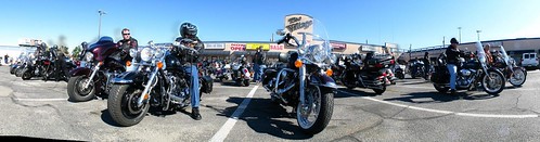
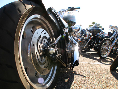
A whole contingency of bikers were grouped outside a motorcycle shop ready to leave on a rally. The would ride to select locations and receive playing cards, where they would then keep and make a hand out of. With rules similar to Poker, the winning team would take a way a prize at the end of the day.
It didn’t take long for the urban sprawl to give way to dry, dusty agricultural land as I made my way into a new state, New Mexico. Freshly plowed fields were easy game for the strong winds that swept across the flat land towards the Franklin Mountains.
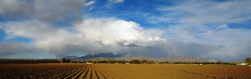
The land was flat, and where there wasn’t freshly plowed fields, there were pecan groves.
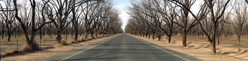
I’ve read other Trans-Am bike ride journals online, and have seen other photos like the one I took above, except that the trees were a beautiful green, plump with fresh spring leaves.
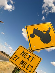
A few signs in New Mexico caught my eye. The tractor sign I was happy about, making me feel at ease at being on the road. A local I spoke to said that I should have no problems along the New Mexico state road 28, a smooth farmland road with decent enough shoulders. The local drivers are used to dodging tractors, so they would be aware of my presence on the road for sure, the local said.
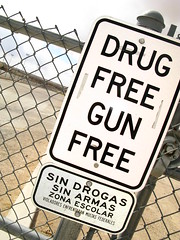
The second sign, outside a school, stood out as stating the obvious…at least from a New Zealand school point of view. Not so in the US, it appears.
On three separate occasions I had to shelter behind bushes and fences or in ditches to avoid brief, five minute dust storms. These decreased in frequency as the day wore on however, and I arrived in La Mesilla at about 6pm. I stopped at the WalMart Supercenter and bought what I needed for tonight’s dinner, tomorrow’s breakfast, and tomorrow’s lunch. I hope to be in Deming by nightfall at the latest.
I camped next to Burn Lake.
The road looks great. I noticed the nice shoulders. Were any of the pecans ready for picking? Probably not, as I think they ripen in autumn. I just say I prefer pecans to walnuts.
rob,
It was great meeting you at Paradise Bakery in Goodyear Az. I am wishing you the best in your journey and am hoping you discover what you want to do next.
I am sharing your story with our church this sunday. Keep going.
Trev
