Day 629 – USA (CALIFORNIA): Video Update!

Here’s the latest video update. Personally, my favourite so far. Shows some of the toughest terrain I’ve experienced so far on the board. Including of course the Guinness World Record breaking moment, and the moment I reached the Pacific Ocean. Enjoy. Those with weak stomachs beware: You will see me naked :-)

Guinness World Record 14degrees.org journey video update

(Click on the image above, and the video will begin in a new window in Youtube)

UPDATE: I just uploaded another copy of this video to Vimeo. Much better quality, and you can download the original video. See it here.

Day 614 – USA (ARIZONA and CALIFORNIA): From Somewhere near Glamis to Salton Sea

Today’s distance / ???????: 62 miles / 101km
Average speed / ????: 10.2mph / 16.4km/h
Time on skateboard / ????: 6h 07m
Total skateboarding distance to date / ????????????: 3881mi plus 280mi (?) / 6247km plus 450km (?)
Ascent / ??: n/a
Descent / ??: n/a
End-of-day GPS coordinates: N33.06.14.1, W115.48.47.5

Downhill, smooth surface, slight tailwind. It makes all the difference. My first century in the US. 101km. Stoked. And some fantastic scenery to boot.

The first half of the day was skating through the ups and downs again of the hilly rocky area between Palo Verde and Glamis.

Mars-like scenery on the way to Glamis, California

Somewhere in California

I passed through the incredible Glamis Sand Dune Wilderness area near Glamis.

Glamis Sand Dunes, Glamis, California

On the south side of the road, the dunes are naked. Any attempt at plants growing there are thwarted by thousands of petrol-head dune buggy enthusiasts.

Glamis Sand Dunes, Glamis, California

The north side is untouched dune wilderness with small bunches of wild flowers growing in the fragile valleys created by the sandy dunes.

Approaching Glamis is a desert tortoise area. Only authorised persons are allowed to harass the tortoises.

Sign near Glamis, California

I pushed on through to Blythe. 43 miles by lunchtime. It is such a nice feeling to know that you only have to do another 7 miles after lunch in order to meet the average daily mileage deadline.

I pushed on further than those 7 miles however. The more I do today, I figured, the less I have to do the next couple of days. You never know when you’ll get a tough headwind or tough roads. Best to make hay while the sun shines, so to speak.

I camped out just out of sight from the highway behind what looked like a stop bank.

Day 613 – USA (ARIZONA and CALIFORNIA): From Quartzsite to somewhere near Glamis

Darn it. Misplaced my mileage info for today…

Anyway, it was a bit of a lously start to the day. I had to get a ride for 15 miles from Quartzsite to Ehrenberg, on the Arizona side of the Colorado River; the border of California/Arizona. Gutted.

In Blythe in California, I visited the California Highway Patrol HQ to ask about frontage roads along the I-10 freeway between Blythe and Banning. “None” was the reply.

Righto then. A 250 mile detour it is. 250 miles in 5 days. I called Rosie, the organiser of the Lowe Syndrome Fundraiser in Hemet, to let her know that she may need to pick me up. I might not make it on time, I told her.

So…welcome to California. I was stoked.

Californian scenery near Colorado River, California

It appears that this was the only photo I took today. Brutally hot during the afternoon, it was tough going on the steep ups and downs along HWY78. Got about 3 miles past the Border Patrol Checkpoint and set up camp in a dry wash. Dumb idea to camp in a dry wash, but I was shattered. Just wanted to sleep.

Day 612 – USA (ARIZONA): From Hope to Quartzsite out of hope…

Today’s distance / ???????: 26 miles / 42km
Average speed / ????: 9.1mph / 15km/h
Time on skateboard / ????: 2h 54m
Total skateboarding distance to date / ????????????: 3766mi plus 280mi (?) / 6060km plus 450km (?)
Ascent / ??: n/a
Descent / ??: n/a
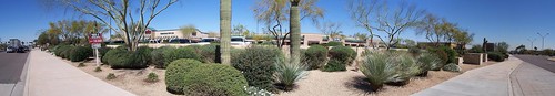
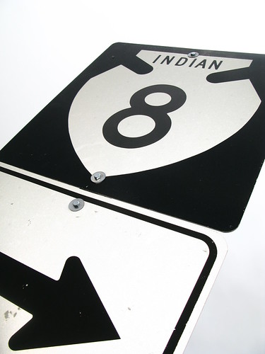
End-of-day GPS coordinates: N33° 39′ 54.04″, W114° 13′ 24.49″

Well, after 4,000 miles, bureaucracy has put an end to my hope of using solely human powered means to cross the North American continent.

No matter how much I reasoned with the Highway Patrol Officer, he would not budge. And this time, there were no alternatives.

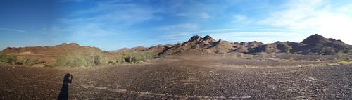
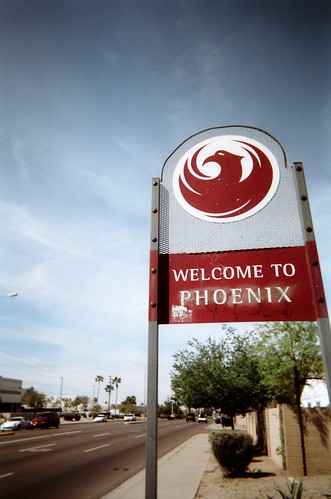
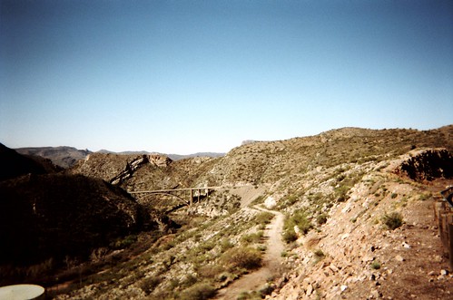
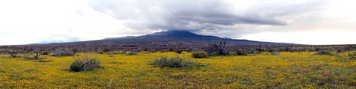
I left Hope in not much of a hurry this morning. Bill and Gerry invited me to stay with them again in Quartzsite, only 35 miles away. They had had a couple of big days on their bikes, and were going to make it a half day. Conisdering my two big days, I decided to make it a shorter day today too. Since they travel much faster than me on my skateboard, I told them I would call them once I arrived in Quartzsite.

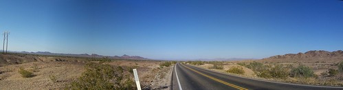
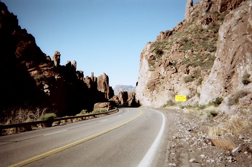
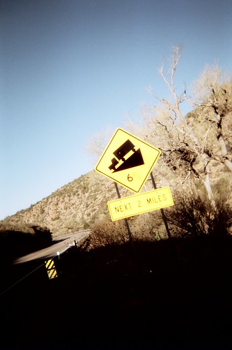
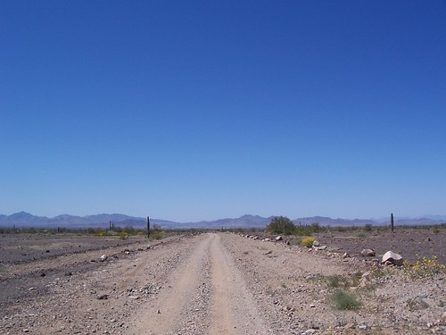
It was a nice downhill for five miles from Hope to the bottom of the wide valley, before US60 began a slow insidious climb. The road surface was rough, and a slight headwind was blowing. It felt like an age getting from Hope to where US60 joins with the I-10 freeway. I didn’t like the thought of going on the freeway again, but since there was genuinely no other alternative (well, apart from a remote 150 mile detour through scorching desert with no services compared with a ten mile downhill stretch to Quartzsite on I-10), I felt I was justified for using the freeway.

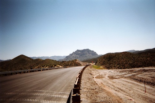
I was two miles into a nine mile wondrous downhill on the smooth, 10-foot shoulder on I-10, seven miles from Quartzsite, when I heard a short chirp of a police siren behind me. I pulled off the shoulder onto the gravel, and waited for the police officer to get out of his car.

We went through a similar dialog as I had with the other officer two days ago just out of Phoenix, except that I emphasised the fact that there were no alternatives, and that I was only going to be on the highway for another 7 miles, down to Quartzsite.

“I’m sorry, but this a controlled access highway…” the officer recited.

I reasoned with him that I was not just some young punk on a skateboard out for a joy ride. I reminded him that in order to skateboard to this point, I had spent a total of more than 600 miles on this very I-10 highway without either being kicked off by police or being run over, and that it was entirely ridiculous that I should be viewed any different from a bicycle (which is allowed on the freeway shoulder).

He was as firm as a rock. “I don’t mean to be a kill-joy,” he said as he continued to recite the law.

“You are being kill-joy,” I said. “Why is it that the dozen or so officers that I have spoken to over the last 3.5 months have allowed me to continue, seeing that I am conducting my travel in a safe way, and you are the only one that is creating a problem?” I said, all rather too emphatically, getting more and more worked up.

Another police officer, who had been attending to another matter a few hundred metres up the road, once finished, now arrived to see what was going on. I told him I was skateboarding across America. “That’s awesome!” he said. He was the good cop. Had it only been him, I’m sure he would have let me off. Bad cop was not budging.

“You cannot skate on the highway. I’m going to write you a warning.” Bad cop continued.

“This is ridiculous!” I repeated. “What is more dangerous, me rolling downhill for half an hour on a skateboard, or me walking two hours through the desert in the middle of the day? Actually, mate, I don’t care. I’ll take my chances with the rattle snakes. Oh yes, that will be much safer than the highway.”

Good cop went and got me a couple of bottles of water. Bad cop offered me a ride to Quartzsite. I declined, in a huff. I may as well have said “Screw you!”, such was my attitude at that point.

I wandered towards the barbed wire fence that marked the freeway boundary. Half way there, Good Cop called after me. Looking back, the two officers were consulting a thick book, laid out on the boot of one of the cars. I walked back, and Good Cop explained that he was trying to give me a break. Trying to make sure there wasn’t some clause that would allow me to be on the freeway shoulder.

“Ummmm. Ah, actually, sorry, Mr. Thomson,” he said. Then turning to the other officer, “The wheel diameter has to be 16 inches or more. His are only three inches at best.”

I turned away and scuffed my feet as I walked towards the fence. Climbed over it. Re-adjusted my pack, and began the long walk down to Quartzsite, the town infuriatingly visible in the distance.

About ten minutes into the walk, I was still fuming at the unreasonableness of the police officer. I had however realised that I may as well have taken a ride in the police car. From Quartzsite to Ehrenburg, on the Californian border, a distance of about 15 miles, there is another unavoidable stretch of the I-10 freeway. I guess I won’t be on that on my skateboard.

Looks like I screwed myself. It’s hot, dry, and these shoes were not designed for walking with a pack on one’s back. I’m getting blisters.

Desert road near Quartzite, Arizona

I was upset. Cried even. Things like road construction or snow or other conditions that would force me to walk would be OK. Bureaucracy is such an invisible, incredibly insurmountable barrier. So frustrating.

Desert road near Quartzite, Arizona

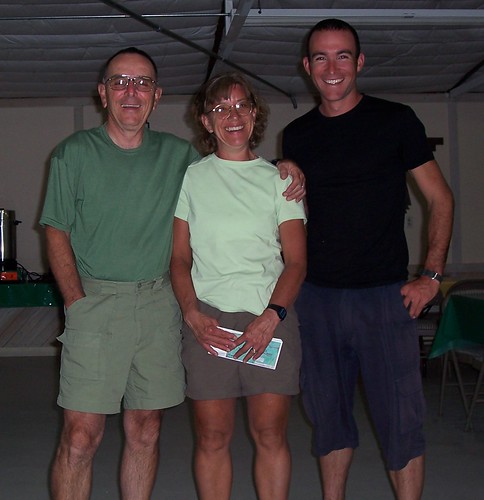
The pink shoes did get me to Quartzsite eventually however, and I met up with Bill and Gerry again at their campsite. Thanks guys. It was great to be with people when I was feeling down!

My biggest concern now is how to get across California. The plan was to travel on I-10. Other campers are of the opinion that if the Highway Patrol is strict here in Arizona, I’ll have no chance in California on the freeway.

What to do? I still need to make it to Hemet in….5 days. Along the freeway, this would be no worries.

With the help of Bill and Gerry, we looked at a map and calculated the distance on the only other feasible alternative route; south around the Salton Sea, via the Glamis sand dune wilderness area.

The alternative route worked out to be 250 miles. That’s 50 miles a day I would have to do in order to get to Hemet on time for the Lowe Syndrome Fundraiser. That’s a big ask.

Perhaps I should just hitch most of the way across California? Having to go 250 miles out of my way is a little too much to ask, surely.

I went to sleep undecided.

Day 611 – USA (ARIZONA): From Tonopah Valley to Hope

Today’s distance / ???????: 62 miles / 100km
Average speed / ????: 8.4mph / 13.5km/h
Time on skateboard / ????: 7h 22m
Total skateboarding distance to date / ????????????: 3740mi plus 280mi (?) / 6019km plus 450km (?)
Ascent / ??: n/a
Descent / ??: n/a
End-of-day GPS coordinates: N33° 43′ 18.07″, W113° 42′ 17.42″

Massive day today. Massive. Gnarly headwinds in the afternoon. Ugh.

So I got away from the Fire Department early at 7:30am. The morning was cool and crisp, belying the heat that always comes in the afternoon. The Salome highway took me through cotton plantations, up and down dips in the road, signs warning of flash floods one minute and dust storms the next.

Dips in the road near Wintersburg, Arizona More dusty desert near Salome, Arizona

I had made good time and was taking a break in the shade of a large tank at one end of a cotton field when I noticed two cyclists making their way towards me along the same road I had been on.

Bill and Gerry Myers started from Phoenix the day before, and were on their way on a circular tour of Arizona and California. From Phoenix to Phoenix via San Diego, up the coast, then via Death Valley back to Phoenix. The offered for me to stay with them in the campsite they were planning on staying in about 40 miles up the road. To do another 40 miles after already being on the road for 2.5 hours was a big ask, so I said that if I made it, I would give them a call.

The wind was at my back as I made my way over the I-10 highway and onto the 25 mile stretch of straight smooth road towards Salome. I was enjoying it so much I even had time to check out the smaller things in life. Strange little beetles all over the dry desert landscape.

Crazy beetles near Wintersburg, Arizona

I stopped for an early lunch at 11:30am. I figured I could have a few hours siesta before hitting the road for the afternoon.

By the time I was ready to hit the road again at 1pm, the wind had turned, and the nice tailwind was replaced with a vicious headwind. I shouldn’t have been surprised. The last few weeks have followed this pattern. No wind, or even a slight tailwind in the morning is always replaced by a strong headwind out of the west in the afternoon.

Desert road in Salome, Arizona

At my slow pace, I would have been happy to have come across a cow. Perhaps I could have lassoed one and trained it to pull me. Neither did I have to worry about screaming up to a cattle guard and not being able to stop.

Sign near Salome, Arizona

I was running out of water, and knew that I at least had to make it to Salome before dark. So I pushed on and arrived in the small town of Salome at around 5:30pm. In Salome, the Salome Highway (the road I had been following since the morning) hits US highway 60. Once on US60, the wind was on my right side, no longer blowing in my face. I had a bite to eat in Salome, and resolved to surprise Bill and Gerry by skating the remaining 8 miles to Hope.

From Salome to Hope, it is all downhill. Wondrous smooth gradual downhill. I was elated. After 6.5 hours of pushing, I could just coast for an hour. Very nice.

Bill and Gerry, as I had expected, were not expecting me. “When that headwind kicked up in the afternoon, we were thinking of you,” Gerry said. They had made it all the way to Hope, a total of 80-odd miles from where they started in the morning, by 3pm. Thanks to Bill and Gerry for letting me share their campsite tonight!

With fellow travelers in Hope, Arizona

Day 610 – USA (ARIZONA): From Phoenix to Tonopah Valley

Today’s distance / ???????: 57 miles / 92km
Average speed / ????: 9.5mph / 15km/h
Time on skateboard / ????: 6h 04m
Total skateboarding distance to date / ????????????: 3678mi plus 280mi (?) / 5920km plus 450km (?)
Ascent / ??: n/a
Descent / ??: n/a
End-of-day GPS coordinates: N33° 24′ 29.16″, W112° 50′ 9.97″

——————-

Thank you to C.R.I.S. Camera of Phoenix for going well beyond the call of duty and not only giving my camera repair utmost priority due to my ongoing travel arrangements, but also supplying me with a replacement camera to use while my camera is being fixed!

A special thanks to BJ Adams, the Sales and Marketing Director, for his help on this. He came into central Phoenix himself to hand me the replacement camera so that I would have it in time for leaving today.

When I first contacted C.R.I.S. Camera, I thought it was long shot. I had a feeling it would be one of those faceless high-walled corporations. But no, amazing customer support, with real people on the other end of the phone and computer screen. Thanks guys!

All the following photos for the next week or two of updates were taken on a dinky wee Kodak Digital Camera. I still missed my Canon G9, but it was great to at least be able to record the images from the road.

——————-

Cookie cutter city development. Ever heard of that term? Michael Grifka and his mother were wonderful hosts over the last few days as I recuperated from the week or so of tough skating from El Paso to Phoenix. It was Micheal who used this term to refer to the massive malls and all-the-same landscaping of the newer neighbourhoods of Phoenix.

Phoenix, Arizona

My image of Phoenix is wide footpaths, new shopping complexes, smooth roads, and beautiful desert inspired landscaping. All very nice, but I see what Micheal means. All stamped out of the same mold, so to speak.

Cactus near Phoenix, Arizona

It took the better part of half a day to get out of Phoenix, and I started skating on the shoulder of the I-10 freeway once I got to the outskirts. The freeway shoulder was open to bicycles, as it has been on major stretches in Texas and New Mexico where I had no option but to use the noisy character-less highway.

It wasn’t long however before a Highway Patrol Police Officer saw me and stopped to check things out.

He pulled up behind me. I stopped. He got out of the car and walked over to where I was standing off the shoulder of the road. I could tell he was wearing some sort of body armour under his shirt. Locals tell me that officers have been killed on this highway.

“So, ah, what are you doing?” the officer asks.

I give him the low-down. He looks at me sceptically, further acknowledging my feeling that the further on I get on this journey by skateboard, the less people believe that I have actually skateboarded all the way from Florida.

“You know, you’re not allowed to be on this freeway. This is a controlled access highway where only vehicles are allowed. A skateboard is not considered a vehicle” he replies.

I explain that to my knowledge, there is no other reasonable alternative if I am to skate to California. I also explain that Highway Patrol in other states have on numerous occasions allowed me skate on the shoulder of the freeway, acknowledging that I am doing it in a safe and controlled manner, especially considering my overall travel goals.

“I’m sorry, but to be on the highway on a skateboard is in violation of the law, and you’re going to have to find a different route,” the officer replied. “I’m not going to write you a ticket, but I am going to give you a warning.”

He writes out the warning and hands it to me. He then suggested an alternative route. A solid 40 miles or more out of my way, I have no option but to accept it. I need to get to Hemet in California, about 200 miles away, in 7 days. The Lowe Syndrome fundraiser where I am to be the Keynote speaker is on Saturday the 29th. With an extra 40 miles now to add to that distance, I can feel the pressure mounting.

By this time, it is the afternoon, and it is hot. Summer is coming, and I can feel it. Oppressive heat.

The wind and roads were kind today however, and by the end of the day, I had carved out 57 miles, and was still feeling good. I stopped in at the Tonopah Fire Department HQ to fill my water bottles at around 7pm, half an hour before sunset. Before I knew it, I was being given a tour of the facilities by the on duty fire personnel.

Fire truck at fire department near Wintersburg, Arizona

By the time we had finished, it was getting dark. “I don’t mean to put you guys on the spot, but I wonder if it would be OK if I camped on the fire department grounds tonight?” I asked them.

“That’s fine by me,” Captain Jerry said. “But you’re most welcome to crash inside the HQ if you want. We might have a callout during the night, and might end up waking you up, but you’re most welcome. We’re about to put a movie on if you want to watch. Relax in one of the recliners…”

So tonight I find myself clean (they let me use their shower), relaxed (they have some super comfy recliners there), and refreshed (got to watch a movie with the guys), and rested (they pulled out five or six blankets for me to sleep on in a quiet corner of the HQ). A massive thank you to the Tonopah Fire Department!

Fire truck at fire department near Wintersburg, Arizona

Day 608 – USA (ARIZONA): From Tempe to Phoenix

Today’s distance / ???????: 36 miles / 58km
Average speed / ????: 10.1mph / 16.3km/h
Time on skateboard / ????: 3h 36m
Total skateboarding distance to date / ????????????: 3621mi plus 280mi (?) / 5827km plus 450km (?)
Ascent / ??: not much
Descent / ??: lots
End-of-day GPS coordinates: n/a

Short blat into Phoenix today. Met up with Michael, a long time 14degrees Blog reader. Stoked. Staying with Michael and his mum. Jolly nice folk.

Phoenix, Arizona

Day 607 – USA (ARIZONA): From the Top of The World to Tempe

Today’s distance / ???????: 43 miles / 69km
Average speed / ????: 9.0mph / 14.5km/h
Time on skateboard / ????: 4h 46m
Total skateboarding distance to date / ????????????: 3584mi plus 280mi (?) / 5769km plus 450km (?)
Ascent / ??: not much
Descent / ??: lots
End-of-day GPS coordinates: N33.22.49.9, W111.35.51.2

Brrr. Woke up this morning to a hard frost. And my tent was pitched in the shade of a rock. The tent would not dry…wet tent in my pack all day.

If you want a nice vintage railcar, by the way, you need to visit The Top of The World. One for sale there…

Old railcar in The Top of The World, Arizona, USA Old railcar in The Top of The World, Arizona, USA

There was a big plus today however. All those vertical metres I climbed yesterday were to be descent metres today. If only there had been no traffic. Big loaded truck and trailers barreled down the narrow winding road all the way from the top of the pass between Globe and Superior, down to Superior.

Coming down from The Top of The World, Arizona, USA

I had to time my short downhill bursts well. Jump on the board once one line of traffic had passed, barrel down the hill for a few hundred meters, looking back to see if I would be caught up to by the trucks, before getting off the road again when I saw another line of vehicles coming.

Coming down from The Top of The World, Arizona, USA

The shoes held up well on the 6% grade long descent to Superior.

Coming down from The Top of The World, Arizona, USA

Once in Superior, it was a long climb back up Gonzales Pass. Bonus was that there was an under-construction road parallel to the old highway. Smooth and quiet it was. The workers cared not that I was using the new road. Happy times.

Brand new under construction roadway next to US60 after Gonzlaes Pass near Superior, Arizona, USA

The other side of Gonzales Pass was the same. A nice gentle gradient all the way down to Florence Junction on super smooth brand new blacktop.

Brand new under construction roadway next to US60 after Gonzlaes Pass near Superior, Arizona, USA

Once again, as soon as 1pm rolled around, the day heated up. By that time I was in Apache Junction, more or less at the beginning of the massive 70 mile wide urban sprawl that is the Phoenix area. I stopped in at a grocery store and bought chow mein noodles for lunch.

The rest of the day I spent pushing on towards the center of Phoenix. I got as far as Tempe before deciding to call it a day. From Apache Junction, I followed Baseline Road to Tempe. At the south of Tempe, this road is mostly rural/soon to be developed urban area. At the outskirts of Tempe is a large IMAX theatre with a large mall. It was still too light to set up camp in the large open area/field behind the mall, so I treated myself to a movie. Watched The Bank Job. Not as great as its hype promised, but still a good flick. The movie finished at 7pm. Dark enough to set up camp under a tree in the open field. Slept like a baby.

Day 606 – USA (ARIZONA): From somewhere on US70 heading towards Globe to The Top of The World

Today’s distance / ???????: 48 miles / 77km
Average speed / ????: 7.4mph / 11.9km/h
Time on skateboard / ????: 6h 26m
Total skateboarding distance to date / ????????????: 3541mi plus 280mi (?) / 5700km plus 450km (?)
Ascent / ??: 1120m
Descent / ??: 550m
End-of-day GPS coordinates: N33.21.15.8, W110.58.48.2

Don’t be fooled. In this part of the country, anything over 4,000 feet (1,200m) is really high. Like Top of The World high, as the community on the top of the pass between Globe and Superior call it.

So today I continued through the San Carlos Indian Reservation dodging hail storms. Chilly, t’was. The photo below was the last photo I took today on my Canon G9 camera:

Indian road in the San Carlos Indian Reservation near Peridot, Arizona, USA

Soon after, I dropped the jolly thing. Onto the road. Clunk. Turned it on. By its own accord, the lens zoomed waaaaay out to its full extension, stopped, beeped at me, and shut off, giving the error message Lens error, please restart camera. Hmmm. Lens error. You don’t say. I tried to restart the camera, but the lens just stayed zoomed out. Not pretty. Not a happy chappy, I wasn’t.

No matter what I did, the camera didn’t return to normal. I spent the goo part of 30 minutes trying different things. In the end I gave up, despondent. I really quite like taking photos, as you may have noticed. So I was gutted.

I began skating, and tried to think of what to do. It’s a jolly good camera. At least, it was. And I hope it will be again. I visited the public library in Superior to see if I could find a camera repair outfit in Phoenix that might be able to fix the camera for me. In the end, I ended up shipping the camera ahead of me to C.R.I.S. Camera in Chandler, a city that makes up part of the great seething metropolis that is the Phoenix area. C.R.I.S. Camera was confident they could give me an idea of what will need to be done to make the camera useable again.

So it’s all up in the air until I hear back from the repair place. Until then, I am taking photos on a disposable film camera. That should be a laugh.

By the way, today I skated uphill more than I ever have before. 1120m, or about 4,800 feet, for those who are still fond of overly complex systems of measurement. That’s only 500m or so off the most I ever climbed on the bicycle (Amasra, Turkey). Madness.

I camped at the top of the world, and hoped it wouldn’t get too cold way up there…

Day 605 – USA (ARIZONA): From Safford to somewhere on highway US70 heading towards Globe

Today’s distance / ???????: 48 miles / 77km
Average speed / ????: 7.5mph / 12.1km/h
Time on skateboard / ????: 6h 23m
Total skateboarding distance to date / ????????????: 3494mi plus 280mi (?) / 5623km plus 450km (?)
Ascent / ??: 215m
Descent / ??: 380m
End-of-day GPS coordinates: N33.12.42.2, W110.12.34.9

Right ‘o then! No more of this hanging about lounging in hot springs! Time to get on the road.

I was totally stoked when I woke up at 5:50am this morning. Bright and early. When I woke up, the wind was blowing from the east. Very nice. A tailwind.

As Murphy’s Law would have it, however, the moment I got everything packed up and ready to go, the wind had turned around to a gusty westerly – right in my face. The story of my life here in Arizona, I thought, and pushed out onto the highway.

I stopped in at the Safford Walmart for supplies, and saw my mug on the front page of the local news paper (The Eastern Arizona Courier). Employees at the WalMart recognised me from the paper, and asked for my signature on their copies of the paper. Nicolette Gonzales from the WalMart McDonalds Restaurant called me over and treated me to a free breakfast. Thanks Nicolette!

With the manager of McDonlads at the WalMart in Safford, Arizona, USA

The wind blew strong from the west all day. It wasn’t until 5pm that it died down. In between I passed through the San Carlos Indian Reservation town of Bylas. Litter and general social decay was the impression the town left on me.

Passed through the one-house large town of Geronimo too. Geronimoooooooooooo!

A spot of humour on US70 between Fort Thomas and Bylas, Arizona, USA

I set up camp as the light was fading in the west. In amongst nice daisy fields. Nicely nice.

Desert flowers in the San Carlos Indian Reservation near Bylas, Arizona, USA

Desert flowers in the San Carlos Indian Reservation near Bylas, Arizona, USA