Day 629 – USA (CALIFORNIA): Video Update!

Here’s the latest video update. Personally, my favourite so far. Shows some of the toughest terrain I’ve experienced so far on the board. Including of course the Guinness World Record breaking moment, and the moment I reached the Pacific Ocean. Enjoy. Those with weak stomachs beware: You will see me naked :-)

Guinness World Record 14degrees.org journey video update

(Click on the image above, and the video will begin in a new window in Youtube)

UPDATE: I just uploaded another copy of this video to Vimeo. Much better quality, and you can download the original video. See it here.

Day 602 – USA (NEW MEXICO and ARIZONA): From 15 miles out of Duncan to the US70 / US191 junction

Today’s distance / ???????: 49 miles / 79km
Average speed / ????: 8.2mph / 13.1km/h
Time on skateboard / ????: 6h 01m
Total skateboarding distance to date / ????????????: 3435mi plus 280mi (?) / 5528km plus 450km (?)
Ascent / ??: 345m
Descent / ??: 615m
End-of-day GPS coordinates: N32.47.16.0, W109.32.47.4

At the usual time, a few minutes before sun-up, I was up and getting ready to leave for another day of skating. For the first time in quite a while, I was feeling great. Anxious to get on the road, anxious to see what lay up ahead. The wind was still blowing when I retired to my tent last night, but like the last five days, it was calm in the morning. A slight tailwind even.

I was on the road by 8:05am, about an hour after sun-up. Breakfast was sultana bran with reconstituted powdered milk.

The funny desert trees stood proudly in the morning light.

Strange trees near Duncan, Arizona, USA

Leaves on tree near Duncan, Arizona, USA Tree near Duncan, Arizona, USA

Ten miles down the road, I entered Arizona, and my world changed forever. At last, smooth roads. Smooth, rolled, blacktop.

Entering Arizona, USA

The roads in New Mexico were acceptable. The roads here in Arizona are exemplary. Excellent. Smooth, quiet. Luverly.

The scenery has changed, also. Tighter valleys. The mountain tops are closer. The contours and lay of the land is more understandable. Clearer passes. Distinction between up and down.

Smooth highway US70 near Safford, Arizona, USA

Once again, as if by clockwork, the westerly wind arrived in force at 12 noon. I was feeling good however. Blow as hard as you may, you dastardly wind! I have a smooth road! Nothing can stop me! I would come to regret those words, as you will see in the next post…

It was a long hard climb out of Duncan, uphill and into the wind. The top of the ‘pass’ came around however, and I felt the gentle downward slope towards Safford. The wind prevented any easy coasting downhill however, and I had to push even though I was heading downhill.

Amazing hills and surrounds here…

Desert hill country on highway US70 in Arizona, USA near Safford

Like yesterday, I took shelter around 5pm and ate dinner, carrying on after a short rest for another two hours. Instead of using my hammock for shelter today, I sat in a large culvert under the road, out of the sun and wind.

I was still 10 miles away from Safford when it started growing dark. Time to stop and camp. I jumped a fence and found a spot just out of sight of the highway behind a not-so-grassy and very stony knoll.

Majestic sunset 10 miles east of Safford on highway US70 in Arizona, USA

Day 601 – USA (NEW MEXICO): From I-10 MM54 to 15 miles out of Lordsburg on US70

Today’s distance / ???????: 45 miles / 73km
Average speed / ????: 8.8mph / 14.2km/h
Time on skateboard / ????: 5h 08m
Total skateboarding distance to date / ????????????: 3386mi plus 280mi (?) / 5449km plus 450km (?)
Ascent / ??: 145m
Descent / ??: 195m
End-of-day GPS coordinates: N32.29.59.6, W108.51.36.1

I woke up at my normal time of 7am this morning; about 15 minutes before the sun itself starts to appear out of the horizon. At this time of the morning here in New Mexico, mirages are the most prominent. Hills that I could see in the distance at dusk last night are gone, only to slowly appear from the top down as the sun rises. They begin as brown dots hovering above the horizon, and as the sun rises, they drip a steady flow of colour down onto the horizon until they finally make contact with the brown line of the earth in the distance. They then slowly begin to take shape, the brown dot elongating horizontally, while slowly moving upwards, leaving a normal-looking hill in its wake. The elongated brown dot eventually disappears as the hill takes over prominence on the horizon again…trippy stuff…

Another dry, sunny day today, with no wind whatsoever in the morning.

Train near the Continental Divide, New Mexico, USA

Even more exciting was crossing the Continental Divide. Admittedly, it was probably the lowest crossing there is in the US, at only 4,500 feet / 1,300m. But what a psychological boost! All downhill from here! Well, in spirit, at least. There’s still a heck of a lot of flat country out here!

Continental Divide on I-10, New Mexico, USA

Continental Divide, New Mexico, USA

The headwind, as if on cue, started blowing at 12 noon. The same thing as the last few days. Calm, a little tailwind even, in the morning, and then the westerly picks up in the afternoon. It was a long slow push into Lordsburg, where I met with local reporter Helen from the Hidalgo County Herald. This interview comes hot on the heels after a report in the Deming Headlight paper in New Mexico (see article here). The interview with Helen over, I snuck into the local library and sheltered from the hot dry wind for an hour before rather begrudgingly set out again.

I left the big noisy I-10 interstate highway, and set off on the wide-shouldered highway US70 in the direction of Arizona. Again the surrounding landscape was bare and desolate.

Desert scenery in New Mexico, USA

I stopped for dinner on the roadside at about 6pm, 1.5 hours before sunset. I used my hammock/parachute as a windbreak and enjoyed tortilla wraps with tuna, blackeye peas, and Tabasco hot sauce, washed down with Gatorade (I buy the powdered drink mix).

Another hour and a half of skating saw me about 15 miles from the next town, so I found a spot next to a disused water tank to set up camp.

Campspot on US70 near Duncan, Arizona, USA

Day 600 – USA (NEW MEXICO): From Deming to a World Record

Today’s distance / ???????: 30 miles / 49km
Average speed / ????: 8.6mph / 13.8km/h
Time on skateboard / ????: 3h 30m
Total skateboarding distance to date / ????????????: 3340mi plus 280mi (?) / 5376km plus 450km (?)
Ascent / ??: 120m
Descent / ??: 50m
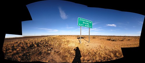
End-of-day GPS coordinates: N32.12.13.1, W108.14.43.4

I didn’t get away from Deming until about 1pm today. Keith and his wife are a great couple and a pleasure to stay with. “No one leaves our place early,” Keith said, referring to other travelers that have stayed.

Keith talking about his rocks in Deming, New Mexico, USA

Keith with wife Mary in Deming, New Mexico, USA

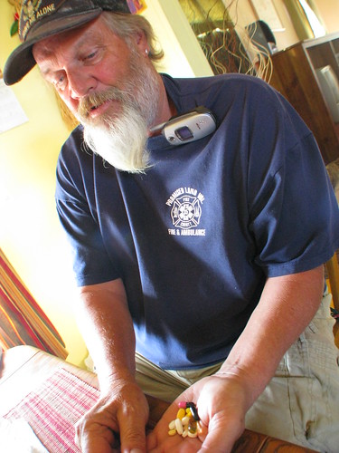
Keith is a Vietnam Vet, and still suffers from the effects of Agent Orange poisoning while on tour in Vietnam. He has extensive nerve end damage, including the soles of his feet, causing occasional falls. His hands shake uncontrollably when doing anything that requires a steady hand – writing, eating, drinking coffee. “Hey Rob, you want to see something?” Keith called out to me as I was working on his computer, uploading some photos.

I went to the kitchen, and he was holding a handful of pills out to show the amount of medication he was taking daily. He held his hands steady by gripping the unsteady hand with the other not-so-unsteady hand tightly.

Vietnam Vet Keith taking his daily medicine in Deming, New Mexico, USA

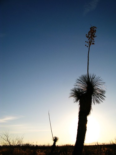
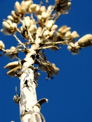
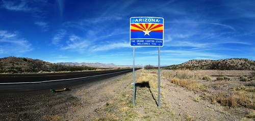
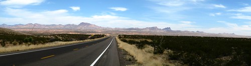
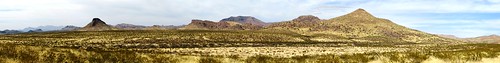
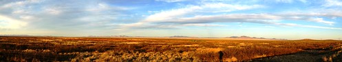
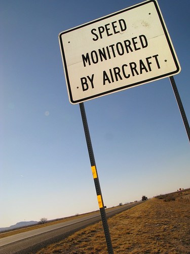
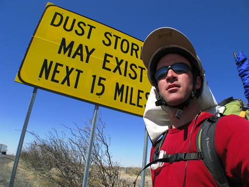
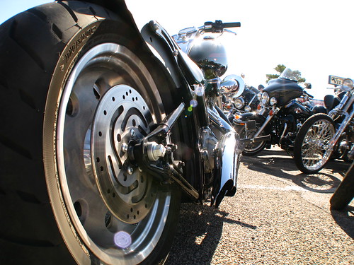
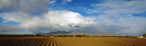
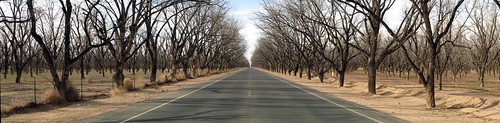
Keith dropped me off at the WalMart where his wife, Mary works. I loaded up with food and water for the 58 mile skate to Lordsburg across more desert. I was hoping to find some source of water along the way, as I only carried 4.5 litres with me from Deming. I was feeling the weight of the pack as I rolled out of Deming.

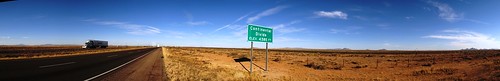
About 15 miles out of Deming, I noticed a vehicle stopped on the side of the highway, just off the shoulder.

Interested passers-by near Lordsburg, New Mexico, USA

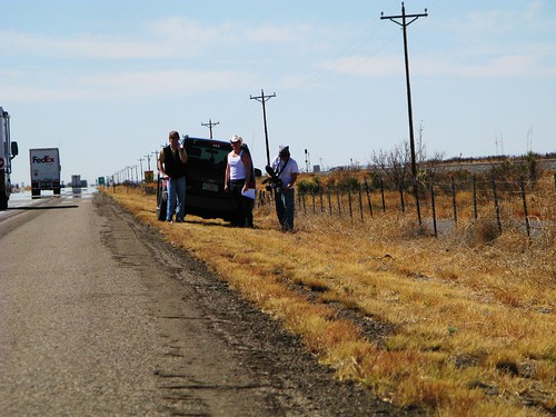
Three guys, one with a camera, one with a scooter, and one with a white piece of paper. As chance would have it, they were three students from Florida State University in Tallahassee, on a cross-US road trip, filming two separate documentaries, one serious, and one not so serious.

In any case, they were amazed to see me out on the highway in the middle of nowhere, and stopped to ask what I was doing. I gave them the usual run down, and suggested that they head to Mile Marker 54, about 15 miles away. I told them that I would be there in about two hours, and they could get some footage of someone breaking a world record. It didn’t take them long to accept, and I arranged to meet them up the road.

It took a little longer than two hours to get to Mile Marker 54. The slight tailwind that I had been enjoying turned on me again this afternoon and I pushed my way towards MM54 into a slight headwind.

As promised, the guys were there to see the event.

Guinness World Record breaking spot on I-10, NEw Mexico, USA

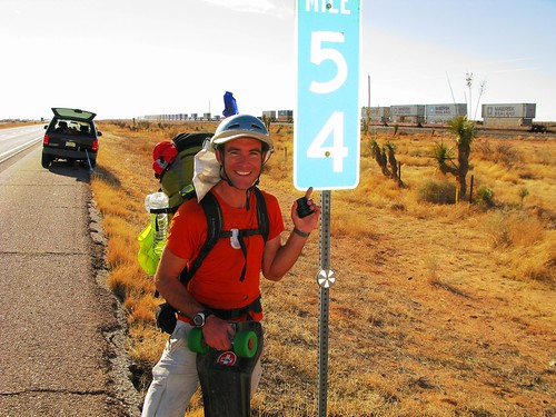
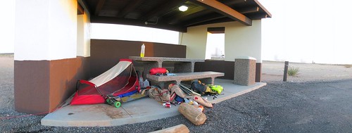
Just up the road was a rest area, where they had taken over a sheltered picnic shelter to interview me about my journey. Talk about good timing. We chatted about the journey, and they filmed the whole interview. They were amused that one of their documentaries was about one of the guys traveling across the US on his scooter (they were acting the whole thing, just riding the scooter occasionally), and here was a guy actually skateboarding across the US.

They left me with a gallon of water, and a few snack bars. Stoked. I was getting low on water, so the extra water would be essential for the remaining 30 miles to Lordsburg.

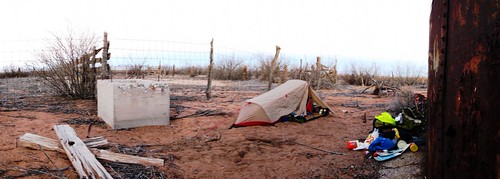
There would be no more skating today however, and I set up in the picnic area and took the rest of the afternoon off.

Campspot at picnic area on I-10 in New Mexico, USA

Thoughts on breaking the world record (Longest Journey by Skateboard – 3,615 miles):

There was no feeling of great relief or joy upon equaling the world record. No out of the ordinary emotion at all, really. Comparing this event with finally arriving at the North Sea coast in The Netherlands (Holland), I felt much more emotional at the North Sea coast.

I think this has something to do with the fact that this journey has never been about distances or records. Even though I may try to sell the world record aspect of the journey more heavily to media and potential sponsors (because it sounds good), this journey is still about traveling in unique, close-to-the-environment, human powered ways. No matter what form of human powered transport, crossing a continent by human power is a thrill that no intermediate record achieved in the interim can surpass.

As stoked as I am that I have this icing on the cake, a swim in the Pacific Ocean on the west coast of the US is something that I am looking forward to very much indeed.

Day 599 – USA (NEW MEXICO): From La Mesilla to Deming

Today’s distance / ???????: 55 miles / 89km
Average speed / ????: 8.6mph / 14km/h
Time on skateboard / ????: 6h 25m
Total skateboarding distance to date / ????????????: 3310mi plus 280mi (?) / 5327km plus 450km (?)
Ascent / ??: 295
Descent / ??: 195
End-of-day GPS coordinates: Deming WalMart (forgot to record the digits)

Nothing quite like a nice tailwind and a smooth shoulder to start the day. I ate the other half of the fresh French bread loaf from last night with a banana and a can of canned lasagna for breakfast, and hit the road at about 8am.

The I-10 expressway climbs out of Las Cruces for about three miles before leveling off to a flat plateau. Before the climb, the highway crosses the Rio Grande River. The Rio Grande heads north from El Paso, and ceases to be the border between the US and Mexico.

Rio Grande near Las Cruces, New Mexico, USA

I had emailed a few newspapers along my route from El Paso to Phoenix, and this morning got a call from the Las Cruces News Sun paper. The reporter did the interview over the phone, and this is the artcile – Las Cruces News Sun Article.

Before long, I had well and truly entered the desert country of New Mexico. Sweeping vistas of the surrounding plains and mountains in the distance. For once, I was able to enjoy the surroundings without having to spend 90% of the time with my head down, putting all my effort into just getting some speed out of the board (Texas had terribly coarse road surfaces).

Once again the road signs amused me. I asked a local about this one, and apparently yes, speed is monitored by aircraft. A small Cessna airplane is flown over the highway at 70mph, and if a vehicle moves faster than the aircraft, it is dobbed in to the police. I guess the economics must work out…if not, they wouldn’t do it, I guess.

Speed monitored by aircraft in Akeela, New Mexico, USA

I didn’t see any aircraft, or dust storms for that matter…

Windy New Mexico (near Las Cruces, New Mexico, USA)

The wind turned on me in the afternoon, and I spent the afternoon pushing into a light headwind. Akeela Flats with a rest stop and convenience store, complete with an amazing old-style mural was a refreshing stop.

Akeela Flats, New Mexico, USA

I arrived in Deming late, at about 7pm. I did some shopping, and considered pitching my tent in the WalMart parking lot. I had heard about other cyclists doing this, namely Dom and Meers from http://ridehardusa.blogspot.com/, so I thought I’d give it a go.

As I was about to leave the WalMart, a friendly guy by the name of Keith stopped me and asked the usual questions. He turned out to be a volunteer firefighter, and was an active member of the community. He called the police and asked them to come over to WalMart to make sure it would be OK for me to stay there in the car park. After a lengthy wait, the police arrived, congenial, and said they had no problem with it, but they suggested that I might want to head out of town and camp there instead, rather than right in the middle of town.

I was umming and ahhing, trying to decide, when Keith suddenly blurted out “Why don’t you stay at my place!? I should have thought of that sooner! My wife and I are Trail Angels for the Continental Divide trail. You’re welcome to stay if you want.”

Say no more, I thought, and promptly accepted. A comfy bed for the night…I can’t refuse.

Day 598 – USA (TEXAS and NEW MEXICO): From El Paso to La Mesilla

Today’s distance / ???????: 46 miles / 75km
Average speed / ????: 8.7mph / 14km/h
Time on skateboard / ????: 5h 19m
Total skateboarding distance to date / ????????????: 3255mi plus 280mi (?) / 5238km plus 450km (?)
Ascent / ??: 290
Descent / ??: 285
End-of-day GPS coordinates: N32.17.34.8, W106.47.46.4

Feeling great today. A slight cover of cloud kept the heat of the sun off, and despite some extremely strong headwinds with dust storms, I managed to push on for just over five hours to Las Cruces.

It was a hefty climb out of El Paso, but thankfully I was rewarded with a downhill soon after getting to the top of the climb, the road smooth and traffic light, since it was a Sunday morning.

West side of El Pas, Texas, USA

A whole contingency of bikers were grouped outside a motorcycle shop ready to leave on a rally. The would ride to select locations and receive playing cards, where they would then keep and make a hand out of. With rules similar to Poker, the winning team would take a way a prize at the end of the day.

Bikers ready to leave El Paso, Texas, USA

Motorbike in El Paso, Texas, USA

It didn’t take long for the urban sprawl to give way to dry, dusty agricultural land as I made my way into a new state, New Mexico. Freshly plowed fields were easy game for the strong winds that swept across the flat land towards the Franklin Mountains.

Fields near La Mesa, New Mexico, USA

The land was flat, and where there wasn’t freshly plowed fields, there were pecan groves.

Pecan groves near San Miguel, New Mexico, USA

I’ve read other Trans-Am bike ride journals online, and have seen other photos like the one I took above, except that the trees were a beautiful green, plump with fresh spring leaves.

A few signs in New Mexico caught my eye. The tractor sign I was happy about, making me feel at ease at being on the road. A local I spoke to said that I should have no problems along the New Mexico state road 28, a smooth farmland road with decent enough shoulders. The local drivers are used to dodging tractors, so they would be aware of my presence on the road for sure, the local said.

The second sign, outside a school, stood out as stating the obvious…at least from a New Zealand school point of view. Not so in the US, it appears.

Sign near Anthony, New Mexico, USA Sign outside school near La Mesilla, New Mexico, USA

On three separate occasions I had to shelter behind bushes and fences or in ditches to avoid brief, five minute dust storms. These decreased in frequency as the day wore on however, and I arrived in La Mesilla at about 6pm. I stopped at the WalMart Supercenter and bought what I needed for tonight’s dinner, tomorrow’s breakfast, and tomorrow’s lunch. I hope to be in Deming by nightfall at the latest.

I camped next to Burn Lake.