Lake Shikotsu to Chitose Cycling Road (Cycle Path) in Hokkaido


Length: 25km (100% smooth asphalt)
Start: Shikotsu-ko (Lake Shikotsu) Morappu Camping Ground (map)
End: Chitose City, Kasuga-machi, 2-chome (map)
Other names: Hokkaido Shikotsu-ko Park Cycle Road (Hokkaido Route 872) – 北海道道872号支笏湖公園自転車道線
Winter usage: This cycle route is not cleared in winter.
Japanese info: Wikipedia, personal webpage

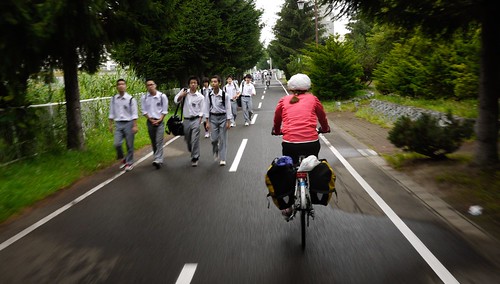
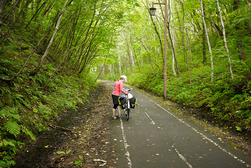
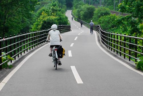
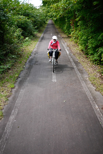
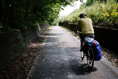
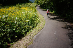
This hidden gem of a cycle road, the Shikotsu-ko to Chitose cycling road (or bike path, cycle path, whatever you call it in your country), is one of the most consistently forest-enveloped of any cycling road in Hokkaido. If you’ve ever cycled on the beautiful separated cycle paths in The Netherlands, you’ll think that you’ve done a spacial warp; this cycle path is entirely separate from the main road, and passes through very pleasant forest.

Shikotsu-Chitose Cycling Road, Hokkaido, Japan

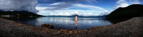
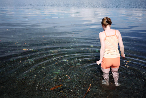
Most cyclists will probably start from the Chitose end, but it is possible to link this cycle road up with the Sapporo-Shikotsu-ko ‘cycle road’ (which is actually just a sidewalk next to the main road) to create a nice long day trip. An equally appealing option might be to make it a day trip from Chitose to the lake and back again, with a nice swim in the middle; Lake Shikotsu is undoubtedly one of the cleanest lakes in Japan. What you see floating on the surface of the lake is natural pumice; Lake Shikotsu is a volcanic lake.

Lake Shikotsu, Hokkaido, Japan

Swimming in Lake Shikotsu, Hokkaido, Japan

The cycle path is a classic ex-railway line, so gradients are gentle. There are also a couple of rest areas along the way with toilets.

Shikotsu-Chitose Cycling Road, Hokkaido, Japan

Shikotsu-Chitose Cycling Road, Hokkaido, Japan Shikotsu-Chitose Cycling Road, Hokkaido, Japan

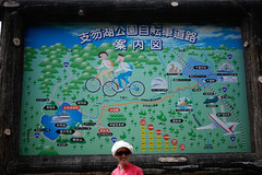
Shikotsu-ko to Chitose Cycle Road Route Map
(the cycle path runs more or less parallel to the road-route below)


View Larger Map

The Shiroishi Cycling Road (Path) in Hokkaido – Sapporo to Kitahiroshima


Length: 19.7km (100% smooth asphalt)
Start: Sapporo Communication Park (SORA) - Sapporo City, Shiroishi-ku, Higashi Sapporo 6-jo 1-chome
End: Kita-Hiroshima JR Train Station - Kitahiroshima City, Chuou 6-chome
Other names: Elfin Road (Kitahiroshima section),  Hinatadamari Road (Atsubetu-ku section), Sapporo-Eniwa Cycling Road (extension is planned).
Winter usage: The Sapporo City section (13.2km) is cleared of snow in winter, so can be cycled all year round. The Kitahiroshima section (6.5km) is not cleared in winter, and is only passable with nordic skis or snowshoes.
Japanese info: Link 1, Link 2.

This is one of my favourite cycling paths in the Sapporo area. It follows the route of the decommissioned (1973) Chitose Line of the Japan Public Railway, so has those classic gentle gradients one would expect from an old train line. The section from the beginning at the Sapporo Communication Park, to the border with Kitahiroshima can be quite busy, especially in the mornings, with middle and high school students using the path to walk to school.

Shiroishi Cycling Road, Sapporo, Hokkaido, Japan

 The path is, however, impressively wide at all points, and throughout the Sapporo City portion, there are only a few road crossings that are not furnished with tunnels or bridges. For the most part, the cycle road goes over or under roads.

Shiroishi Cycling Road, Sapporo, Hokkaido, Japan   A bridge on the Shiroishi Cycling Road, Sapporo, Hokkaido, Japan

For those cyclists who want to ‘get away from it all’, the Shiroishi Cycling Road will not truly impress until the Kitahiroshima City border, where the urban sprawl ends, and lush forest (in summer and autumn) begins. Here, the cycling road really shines.

Shiroishi Cycling Road, Kitahiroshima, Hokkaido, Japan

There is a toilet just after the Kitahiroshima border; a clean bio-toilet with solar panels. There are also toilets at the top of the climb. That is to say, coming from the Sapporo side, the cycling road is a gentle climb all the way to the top of a ‘pass’ on the Kitahiroshima side (here). That said, the Kitahiroshima section of the cycling road has to be seen to be believed. The road is wiiiiide. And smoooooth.

On the Shiroishi/Elfin Cycling Road between Kitahiroshima and Sapporo, Hokkaido, Japan

The cycle road ends at the Kitahiroshima JR Station, where you can either turn round and cycle back to Sapporo, or bundle bikes into bike bags and take the train back to Sapporo station.

Bicycles on the train in Sapporo, Japan Bicycles on the train in Sapporo, Japan

Bicycles on the train in Sapporo, Japan

There are plans afoot to extend the cycle road all the way to Eniwa. This would be fantastic, as it would make an almost perfect cycling road loop, connecting the Shikotsu-Chitose cycling road, Sapporo-Shikotsu cycling road, Toyohira River cycling road, and Shiroishi Cycling road. This would be an almost 150km circular route, easily done in two days with a nice camping stop at the scenic Lake Shikotsu.

Shiroishi Cycling Road Route Map


View Map on Google Maps