Monthly Archives: February 2018


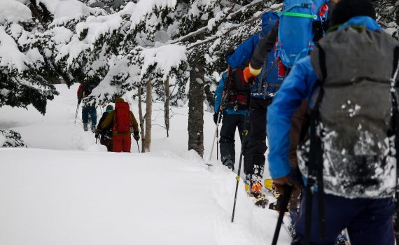
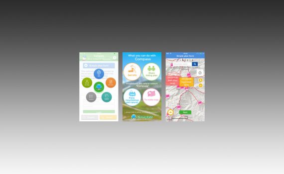
At last, there is a free, smartphone-friendly online service in Japan for easily sharing and submitting detailed backcountry plans via the web. MT-Compass is a free, Japan nation-wide service (https://www.mt-compass.com/) that allows backcountry travelers to submit their backcountry skiing, mountaineering, and hiking plans directly to regional police databases via the web. The English version of the MT-Compass site (https://www.mt-compass.com/) is a bit clunky, but using my instructions below, you'll get the gist of it quickly.

Notifying Police of Backcountry and Hiking Plans in Japan on ...


In 1928, Prince Chichibu (son of Japan Emperor Taisho) skied the hallowed slopes of Utopia Piste (ユートピアゲレンデ) in the hills just west of Sapporo City. Two yeas later the Okuteine Yama-no-Ie Hut (奥手稲山の家) was built at the foot of that ski run, and still stands today. We visited the hut on an overnight ski trip to the Utopia Piste via the Okuteine River (奥手稲山の沢川) route - the most direct route to the hut - for some untracked skiing. Along for the trip was Jasper, a keen mix-breed Hokkaido-dog.

Okuteine Hut and Utopia Piste ski tour (Okuteine Valley Route, ...


With an easy hack on your smartphone, it is possible to display official Japanese topographical maps in English, sort of - AlpineQuest GPS Hiking will allow you to overlay the Japanese topo map with English Google Maps. Below, I outline the features of three apps to display Japanese topographical maps: Geographica (free on Android and iPhone), AplineQuest GPS Hiking (US$7.99 on Android), and Locus Map (free on Android). If you are serious about knowing your surroundings while backcountry skiing in Hokkaido, then you’ll want to have access to the Geospatial Information Authority of Japan (GSI) topographical maps on the fly.

Android and iPhone Apps for displaying Japan Topographical Maps in ...


Mt. Maetokachi (前十勝岳, 1,790m) can be approached from a few different angles. The classic, easily navigable route heads up the Kabawara Ridge (route guide here), but that can sometimes be buffeted by high winds (as on this trip). If the weather is otherwise clear with good visibility, then it might be worth hopping from one sheltered rocky outcrop to another, and taking some time out of the wind at the very basic Tokachi Emergency Shelter Hut. From the shelter it is possible to access a nice downhill run in a bowl that runs all the way from the very active Taisho Crater (大正火口) fumeroles back to the hut.

Mt. Maetokachi Taisho Crater ski touring route and Tokachi-dake Hut ...


Mt. Furano (富良野岳 - 1,912m) is a formidable mountain, whose peak is only accessible in winter by mountaineers with extensive experience. The lower reaches on its northwest aspect, however, offer some great accessible skiing up to around the 1,500m mark. In particular, the broad northwest ridge - the "Giant Ridge" - offers access to some relatively safe ridge-line skiing. In this route guide, I outline a 4.5 hour return trip up to the 1,500m point and back on the Giant Ridge.

Backcountry skiing Mt. Furano’s Giant Ridge (Hokkaido, Japan)


The area north of Mt. Shokanbetsu's peak (署寒別岳, 1,491m), nestled deep in the Rumoi/Mashike Ranges on the Japan Sea coast in Hokkaido, offers a veritable feast of ski tour routes (the classic approach is here). In this route guide, I outline a short route up Mt. Shokanbetsu's Western Ridge (西尾根, nishi-one), just a short skin from the Shokanso Hut. This ridge offers easy access to good, sheltered steep skiing on well-spaced tree-runs. The valley floors on both sides consist of deep gullies though, so take extra care to test the stability of the slopes before you drop in.

Shokanso Hut’s Western Ridge Backcountry Ski Tour Route (Hokkaido, Japan)


Bankei-sanso Hut (万計山荘, 917m) is a beautiful two-story mountain hut, built on the edge of a gorgeous mountain tarn in the hills about 20km south southwest from central Sapporo. Management of the hut was transferred to the volunteer Bankei-sanso Friendship Society (万計山荘友の会) in May 1995. One of the bigger jobs that needs to be done each year is the back-breaking task of removing, by hand, the 5 tons or so of snow that accumulates on the roof of the hut, half way through winter. This was my first time taking part, and I would discover a community of people passionate about the outdoors, sharing knowledge, and protecting this valuable resource.

Bankei-sanso Hut Annual Volunteer Snow-Clearing (Mt. Soranuma, Hokkaido, Japan)