Teine-Neopara by Snowshoe

手稲ネオパラ

Posted on Nov 23, 2017
35 0

Posted on Nov 23, 2017

35 0

7.6km

Distance

4hrs

Time

660m

Ascent

838m

Highest point

5/10

Difficulty

Best season icon (Hokkaido Wilds)
Jan-Mar

Best season

The peak to the east of Mt. Teine has no name on the map, but it is known as Neopara (ネオパラ), or the "2nd Teine". On the flanks of Mt. Teine is the Paradise Hut, with its close by Paradise Ski Slope. From that name comes Neopara: the "new" "paradise" slopes. This is the closest, easily accessed backcountry ski route from central Sapporo. Even during the weekdays, it is a popular destination. (Translated from Hokkaido Yukiyama Guide, 2015, p. 102.)

Last updated Jul 20, 2019

Route Map

Need to know details

Location

This showshoeing route is on the eastern flanks of Mt. Teine in Sapporo City. As such, the summit of Neopara is actually an old annex to the Mt. Teine ski field that is no longer used. It starts in the hamlet of Nishino (here).

General notes

This route is a popular one with backcountry skiiers from January till March, but the route is also well-suited to snowshoes. This is particularly so earlier in the season when the snow hasn’t formed a decent base for skiing. The disused ski field building/hut at the summit is a nice spot to take shelter from the wind at the top before heading back down. The route marked in this post’s GPS file goes back the way you came up. However, it is also possible to keep walking across to the Teine ski area, and catch a taxi or bus back to JR Teine station from the main ski field buildings (route here).

Route Timing
Up | 3hrs
Down | 1hrs

About 3 hours from trailhead to summit, and just over an hour back to the trailhead (if on snowshoes).

Route

There are no route markers.

Transport

Public transport:

This route is accessible by public transport. Take one of the following JR buses headed for Nakasubashi (中州橋行), from either the Miya-no-zawa, Hassamu-minami, or Kotoni subway stations on the Tozai line. You’ll get off at the Nishino 8-jo 8-chome (西野8条8丁目) bus stop (here). From there, it is a 800m walk to the trailhead.

> Miya43 (宮43)
> Hatsu43 (発43)
> Koto43 (琴43)

By car: 

There is a limited amount of space along the road, just before the end of the snow clearing, for car parking (around here).

Hut(s)

None

Physical maps
GSI Topo Map: Teineyama (手稲山) – map no. NK-54-14-14-2

NOTE: The GSI 1/25000 topo map(s) above can be purchased for 350yen each from Kinokuniya bookstore next to Sapporo Station or online (in Japanese).

route safety

Watch out for glide-cracks in the snow around the 650m mark later in the season. At around 420m in the gully, watch out for weak snow bridges over the stream.

  • Notify the police of your backcountry plans online using Compass – instructions here.

Weather forecast

Windy.com weather forecast for Teine-Neopara

Onsen nearby

There is a small super-local public bath near Kotoni Station here, or a larger public baths even nearer the station here.

Extra Resources
  • See the write-up (in Japanese) in the Yuki-yama Guide (ISBN: 978-4894538047) from page 102-105.

Guide Options

If you’d like to hike this route and/or explore other hikes in the central Hokkaido area together with a local certified guide, get in touch with Yasuko Kikuchi. Born and raised in Hokkaido, she’s a JMGA-certified guide now based in Sapporo. Her outdoor experience is broad and worldwide, having worked as a Canadian Ski Patrol member, and has sumitted a number of 6,000m+ peaks around the world. She speaks good English. In addition to Yasuko, also see a full list of English-speaking Hokkaido Mountain Guides Association (HMGA) guides on the HMGA website here

Support us

Like this content? Buy the HokkaidoWilds.org team a coffee. 50% of tips go to the Hokkaido Wilds Foundation.

Show Full Route Notes Close Route Notes

Route Trip Notes


Neopara snowshoe trip (Sapporo City, Hokkaido, Japan)

Neopara snowshoe trip (Sapporo City, Hokkaido, Japan)

From there the mostly unmarked route loosely runs parallel to an old unused forestry road before cutting directly up the Nanako-kawa stream (中の川) valley, across a couple of zig and zags in the forestry road.

Photo by Szilvia Nagy

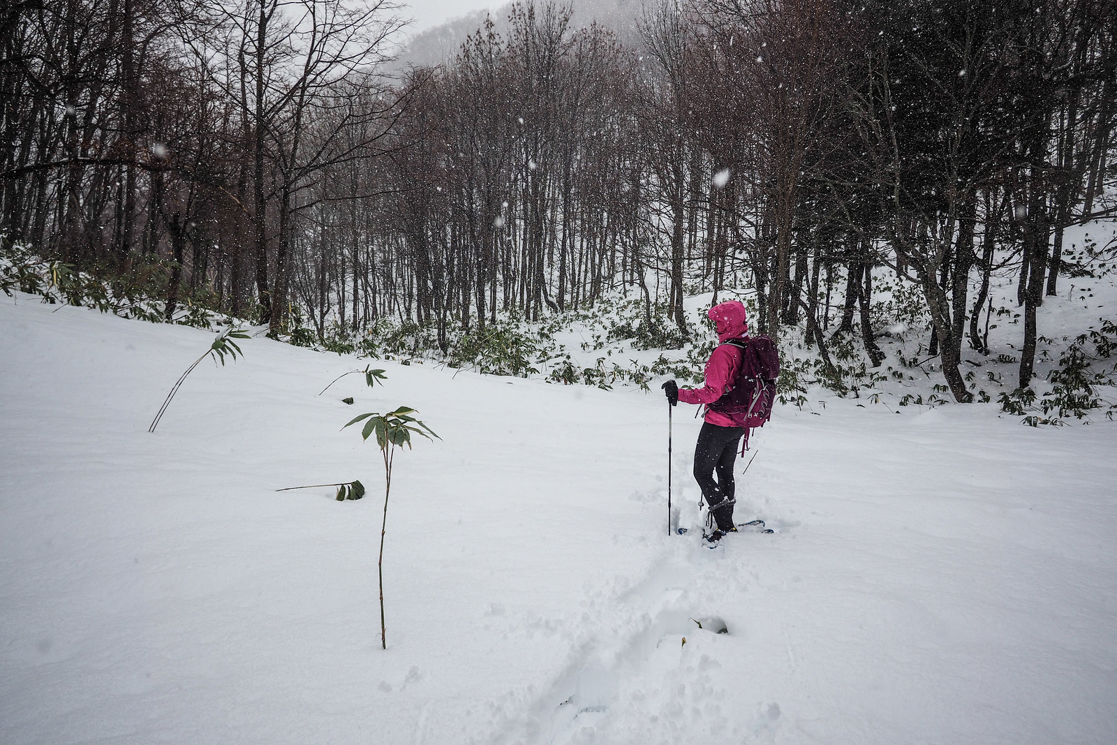
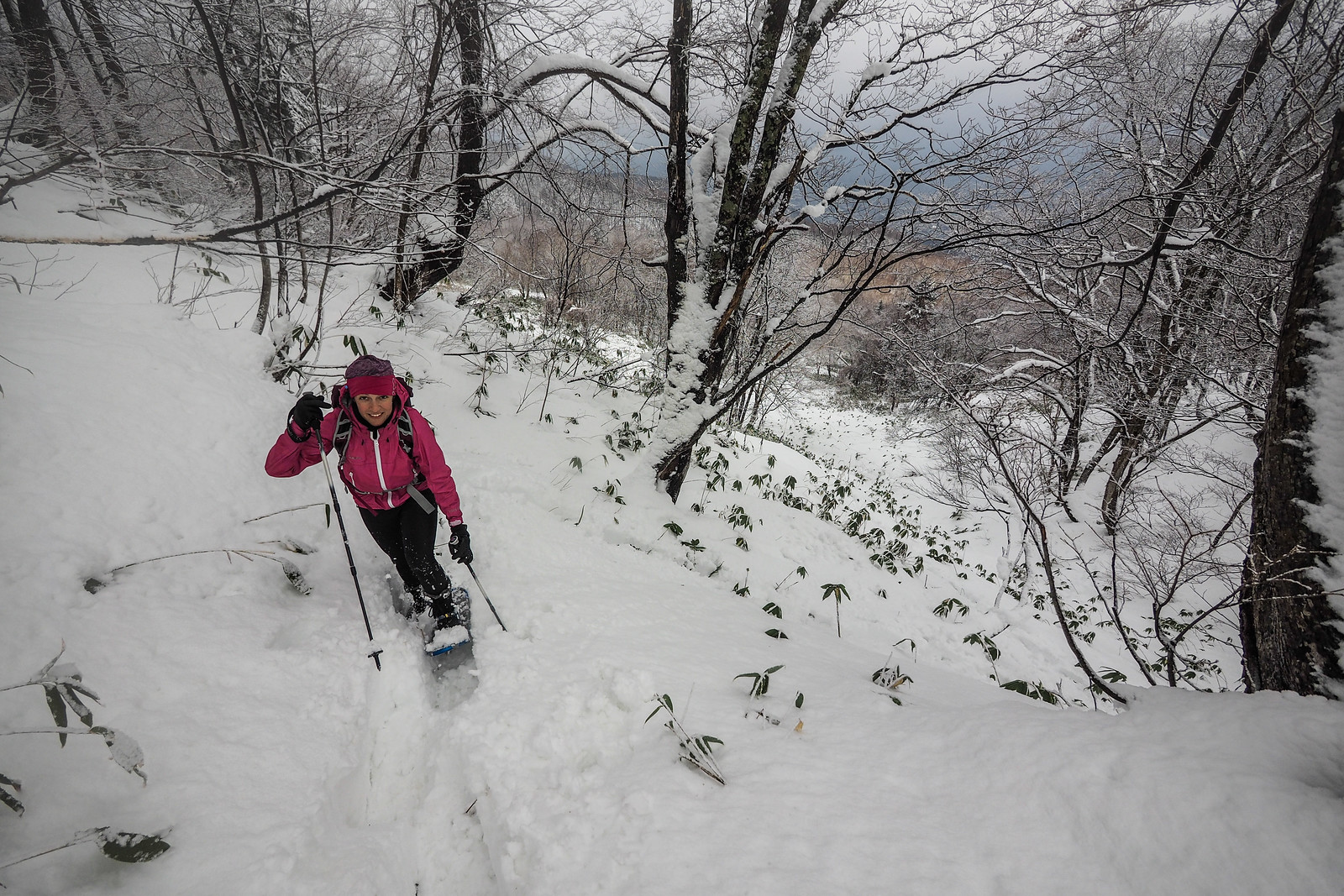
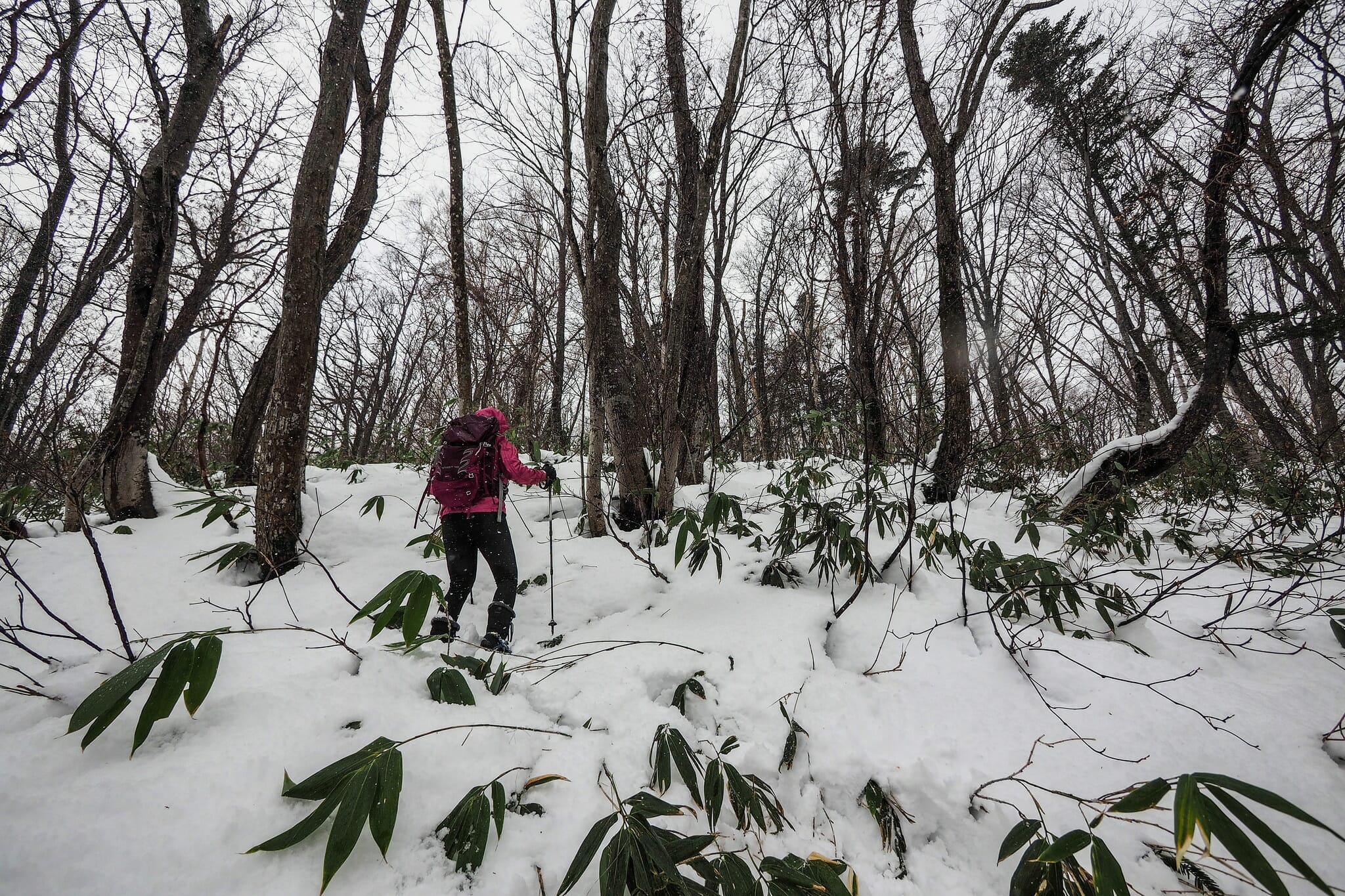
This early on in the season, the snow condition was just deep enough to warrant the use of snowshoes down below, but almost shallow enough not to bother about snowshoes.

Neopara snowshoe trip (Sapporo City, Hokkaido, Japan)

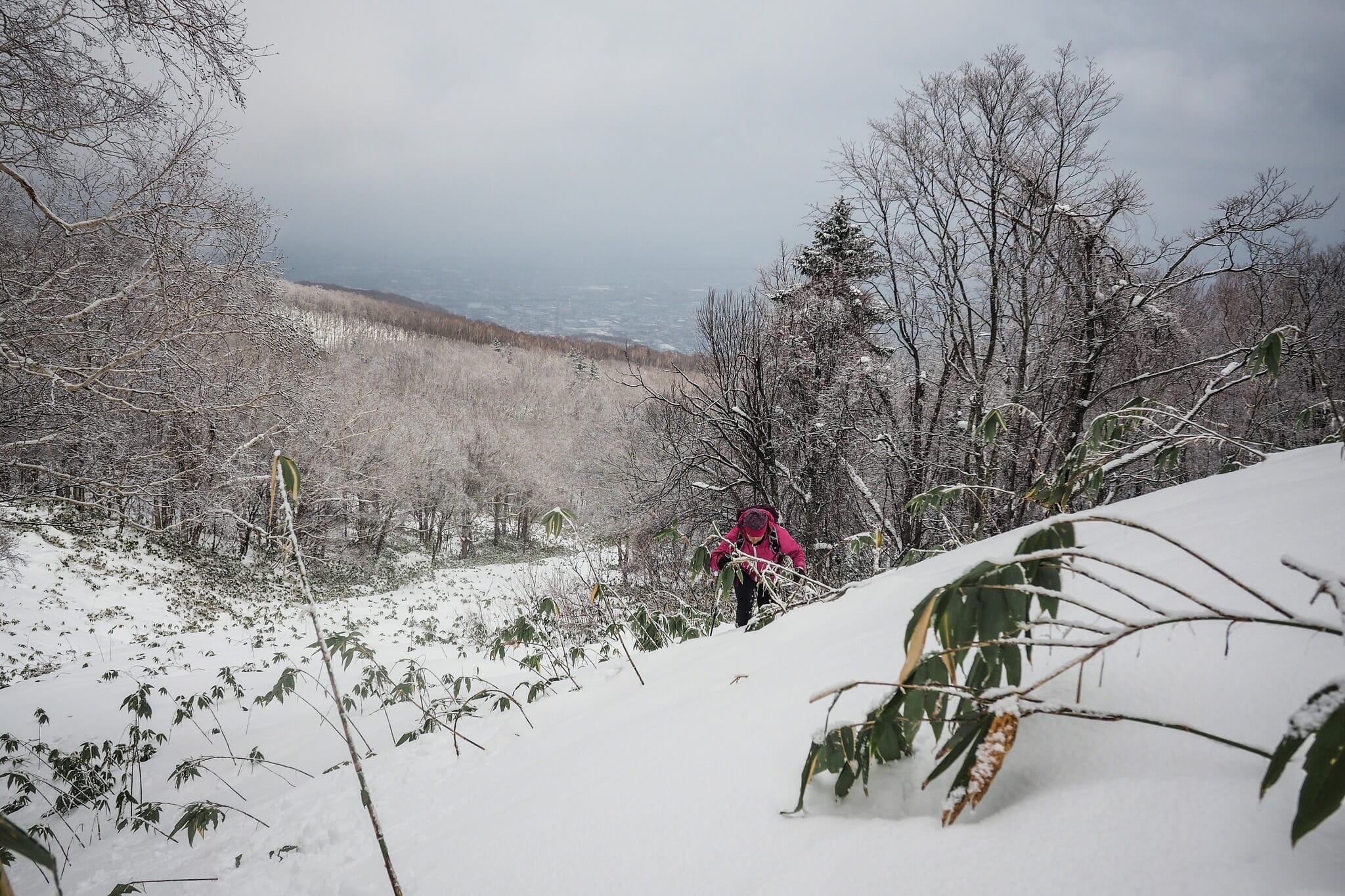
For the first 45 minutes or so, we trudged along under light showers of sleet and rain. Mercifully, this slowly turned to snow as we ascended. At the small clearing above, we both noticed a flurry of wings on the snow, and were treated to an owl hurriedly flying up into a tree. The beautiful creature gazed down at us with its deep black eyes – a master of its domain. Szilvia got a photo of it on her smartphone…can you see it?

Photo by Szilvia Nagy

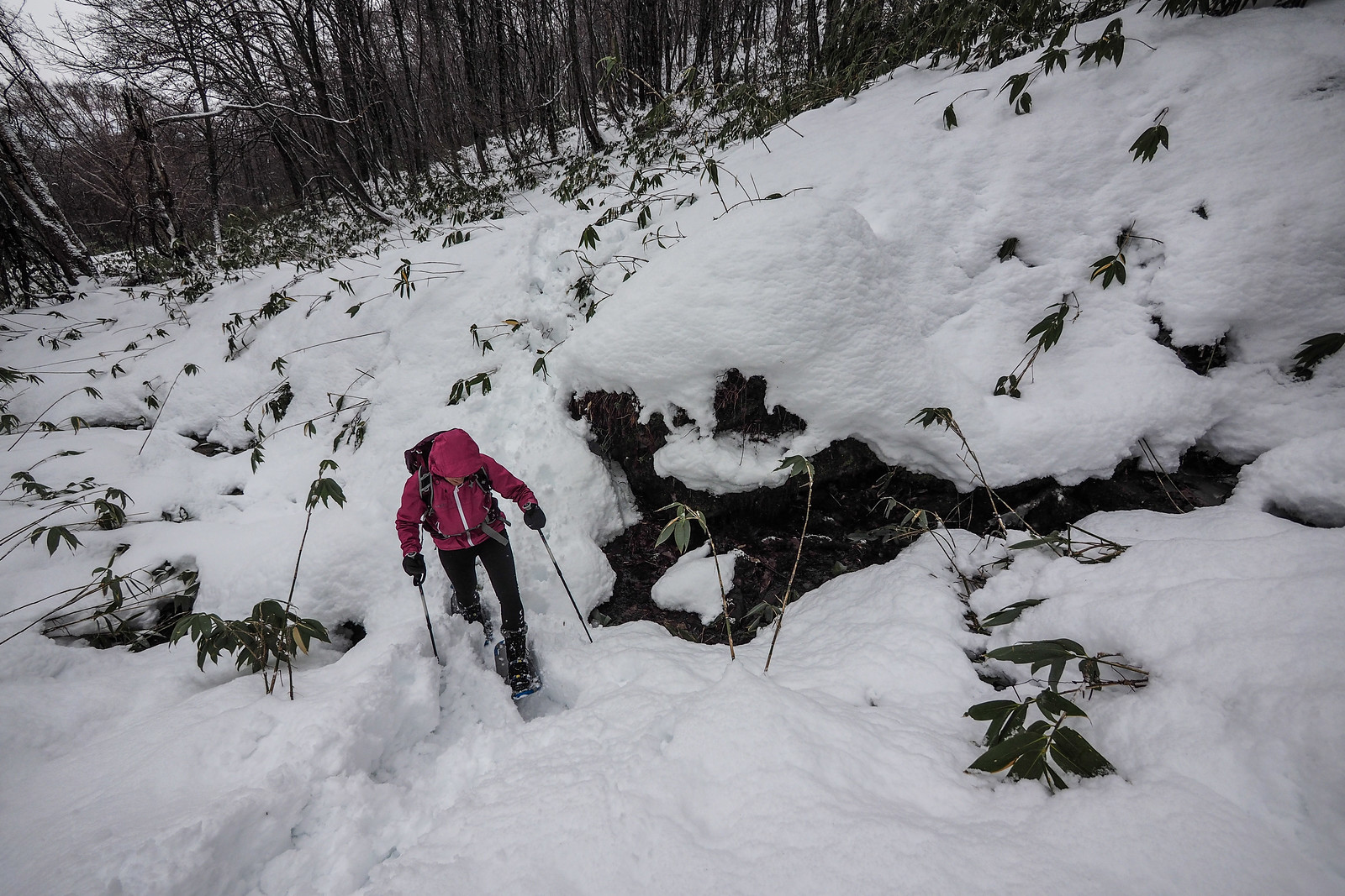
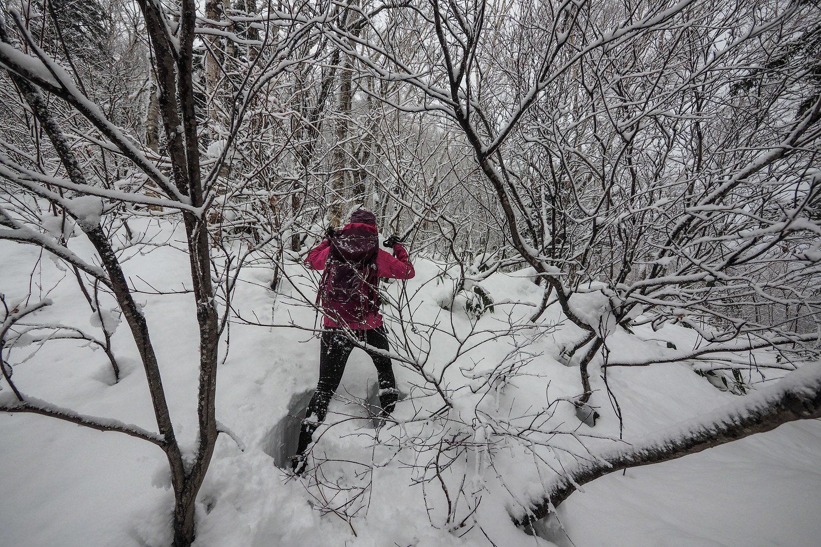
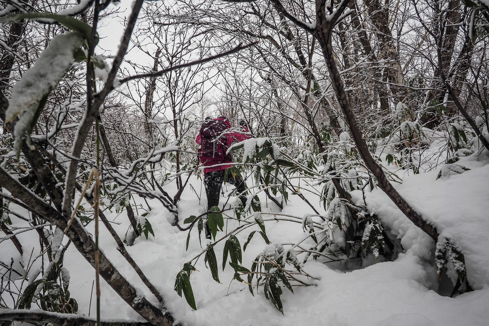
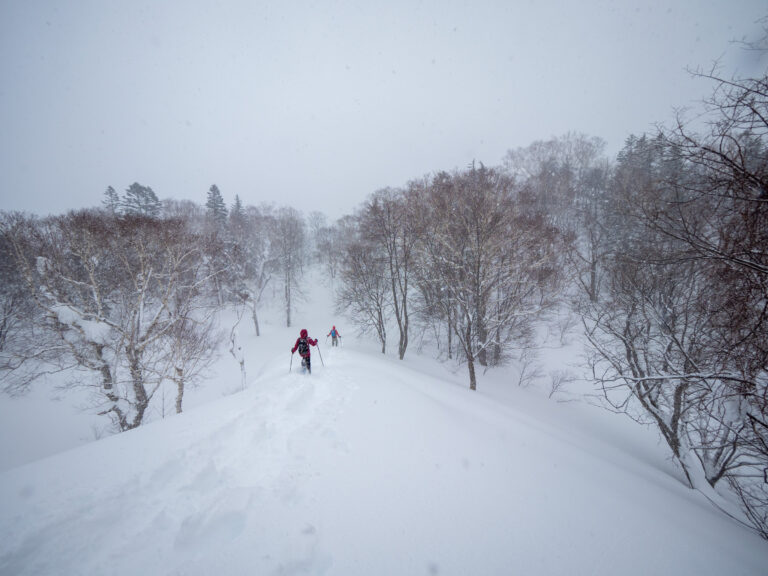
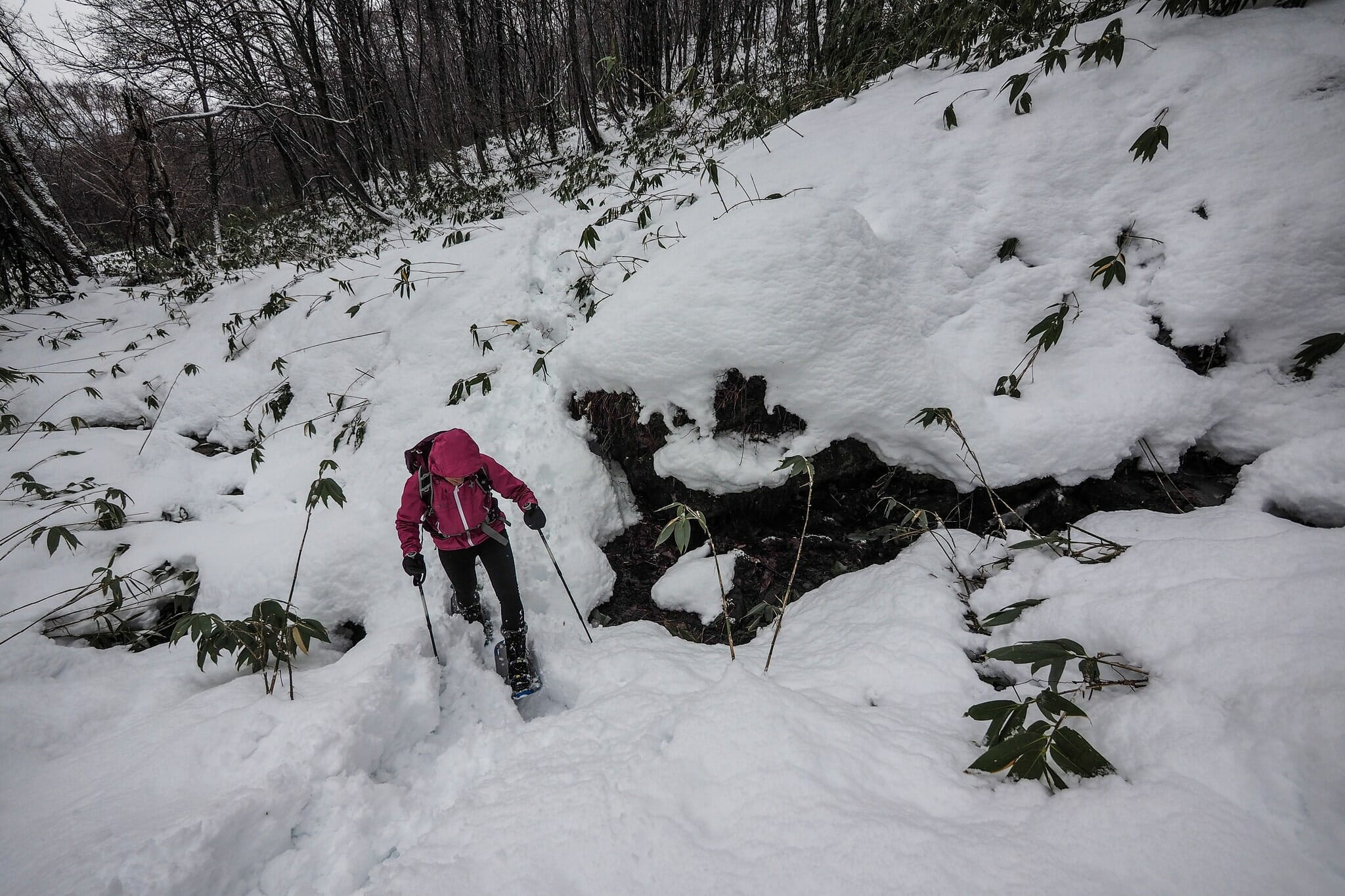
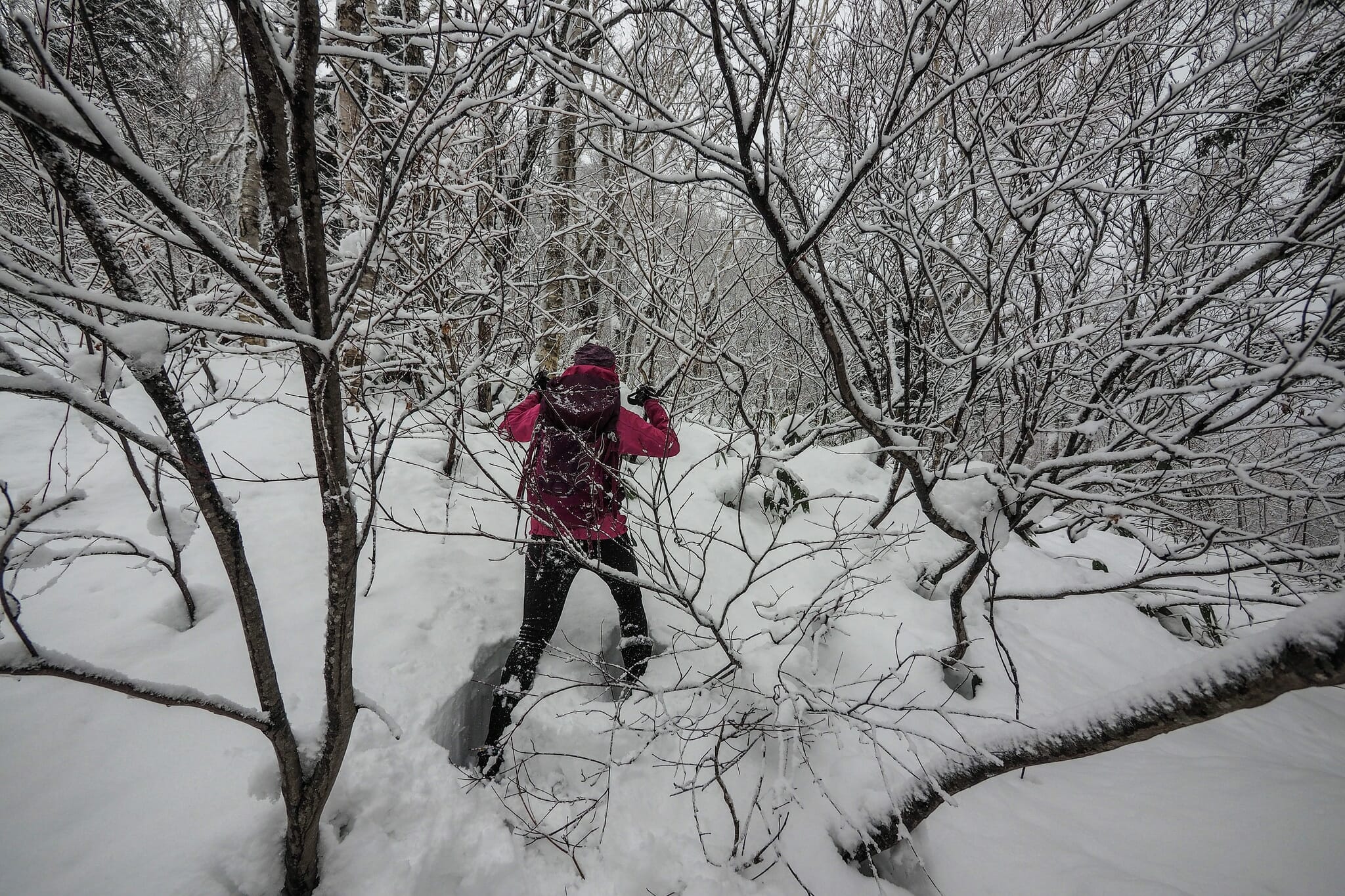
As we ascended higher, the base-less snow got deeper, and the challenge was trying to find a route which avoided the sasa bamboo as much as possible. Later on in the season, the sasa would be completely covered, with a relatively sold base of snow under the soft top layer of snow. In the latter half of our trip this time, we spent a lot of time sinking up to our knees or deeper in snow and sasa.

Neopara snowshoe trip (Sapporo City, Hokkaido, Japan)

Neopara snowshoe trip (Sapporo City, Hokkaido, Japan)

Neopara snowshoe trip (Sapporo City, Hokkaido, Japan)

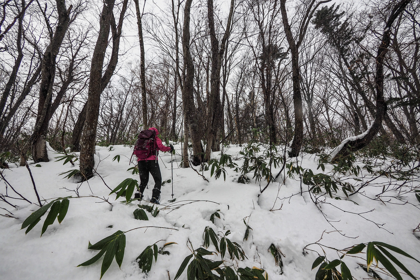
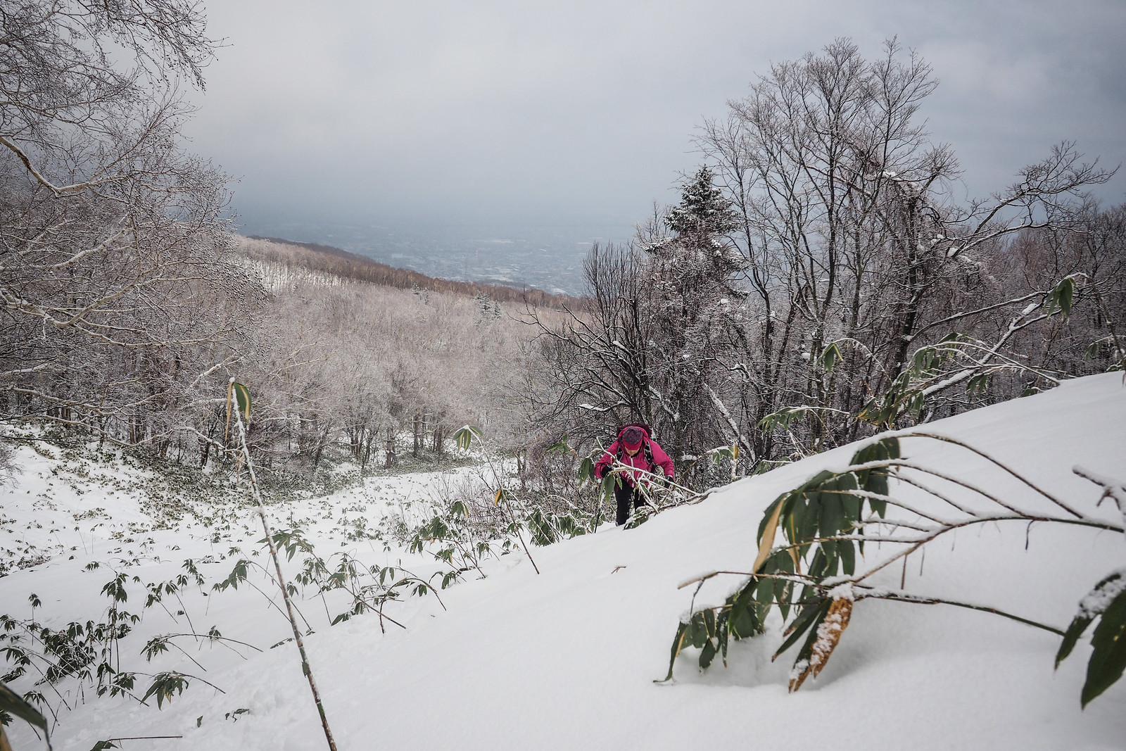
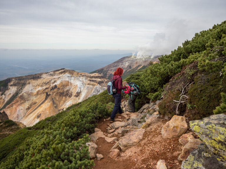
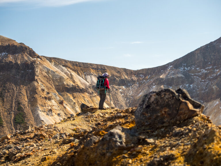
At times, the clouds would lift just enough to remind us that we were in fact snowshoeing in glorious nature, right next to a city of almost 2 million people. Another reminder of why I love this place so much.

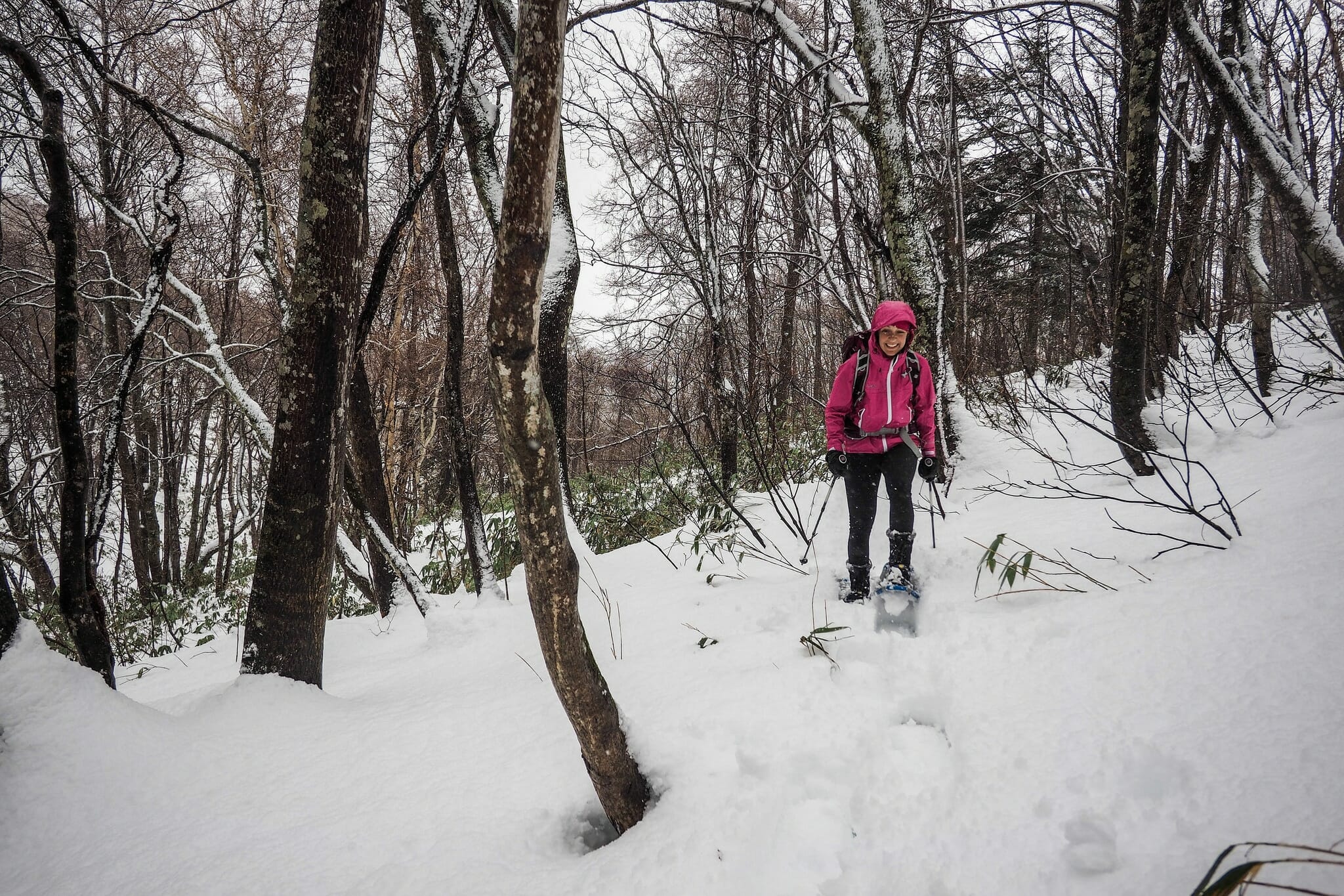
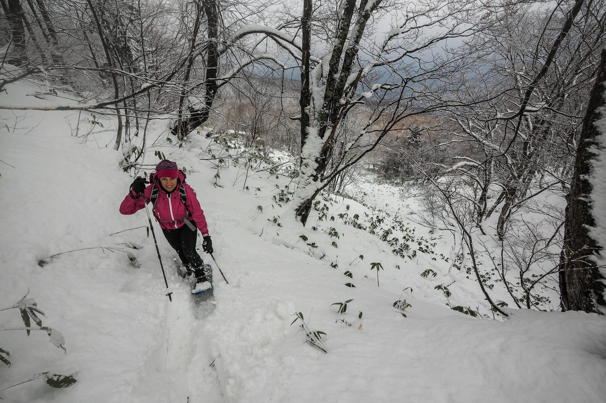
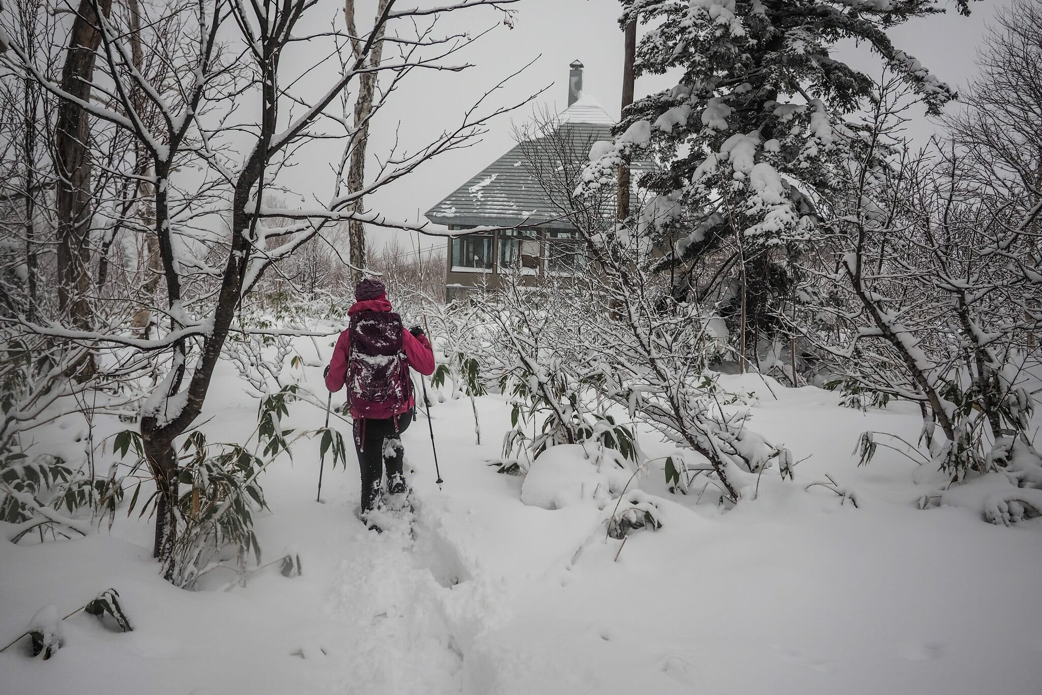
As we neared the nondescript, rather flat summit of Neopara, we spent a vigorous 20 minutes or so bush-bashing through twiggy brush, weaving a route on the final approach. I reminded Szilvia that this is not the typical way most people experience snowshoeing for the first time!

Neopara snowshoe trip (Sapporo City, Hokkaido, Japan)

Neopara snowshoe trip (Sapporo City, Hokkaido, Japan)

Neopara snowshoe trip (Sapporo City, Hokkaido, Japan)

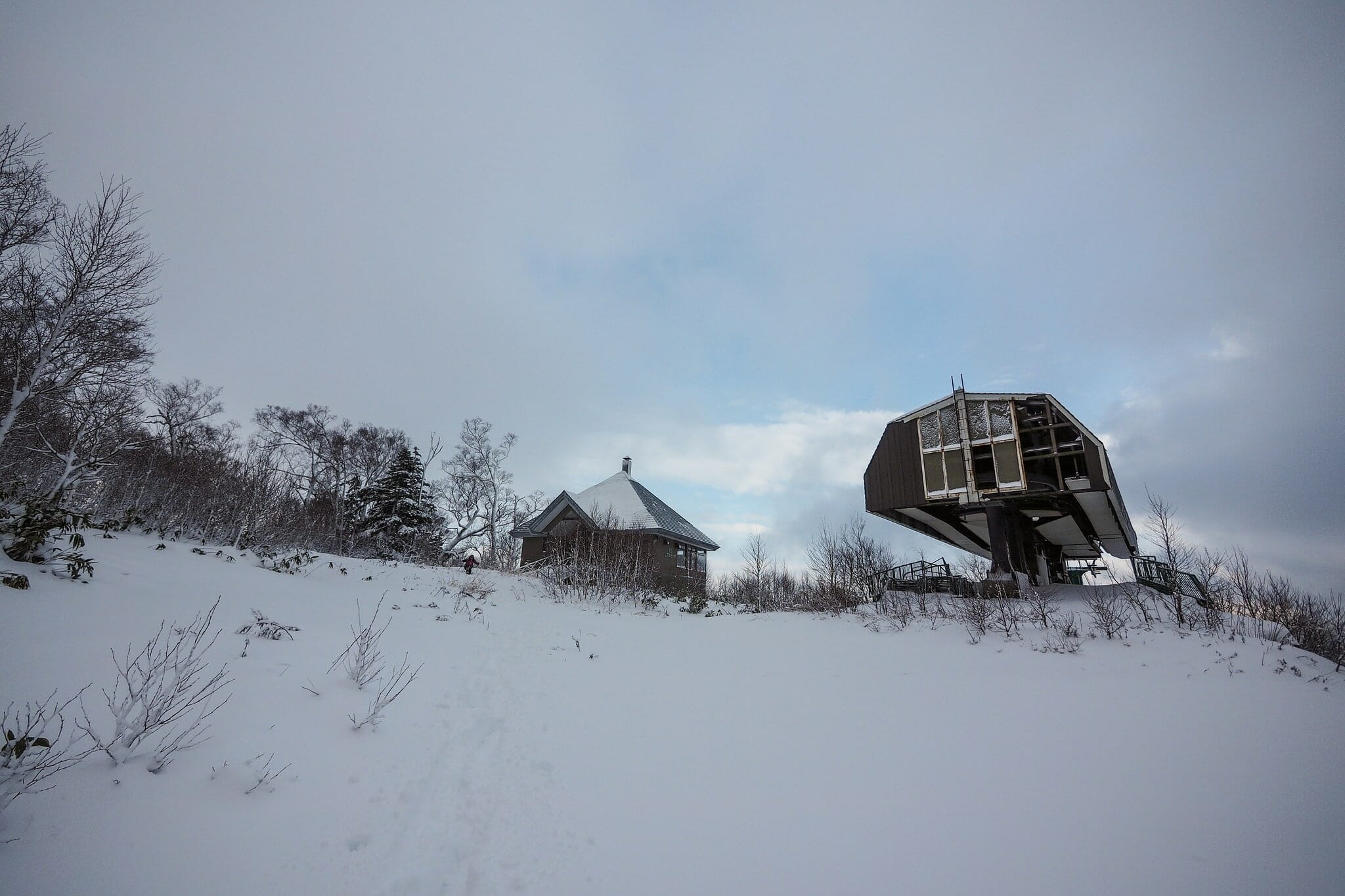
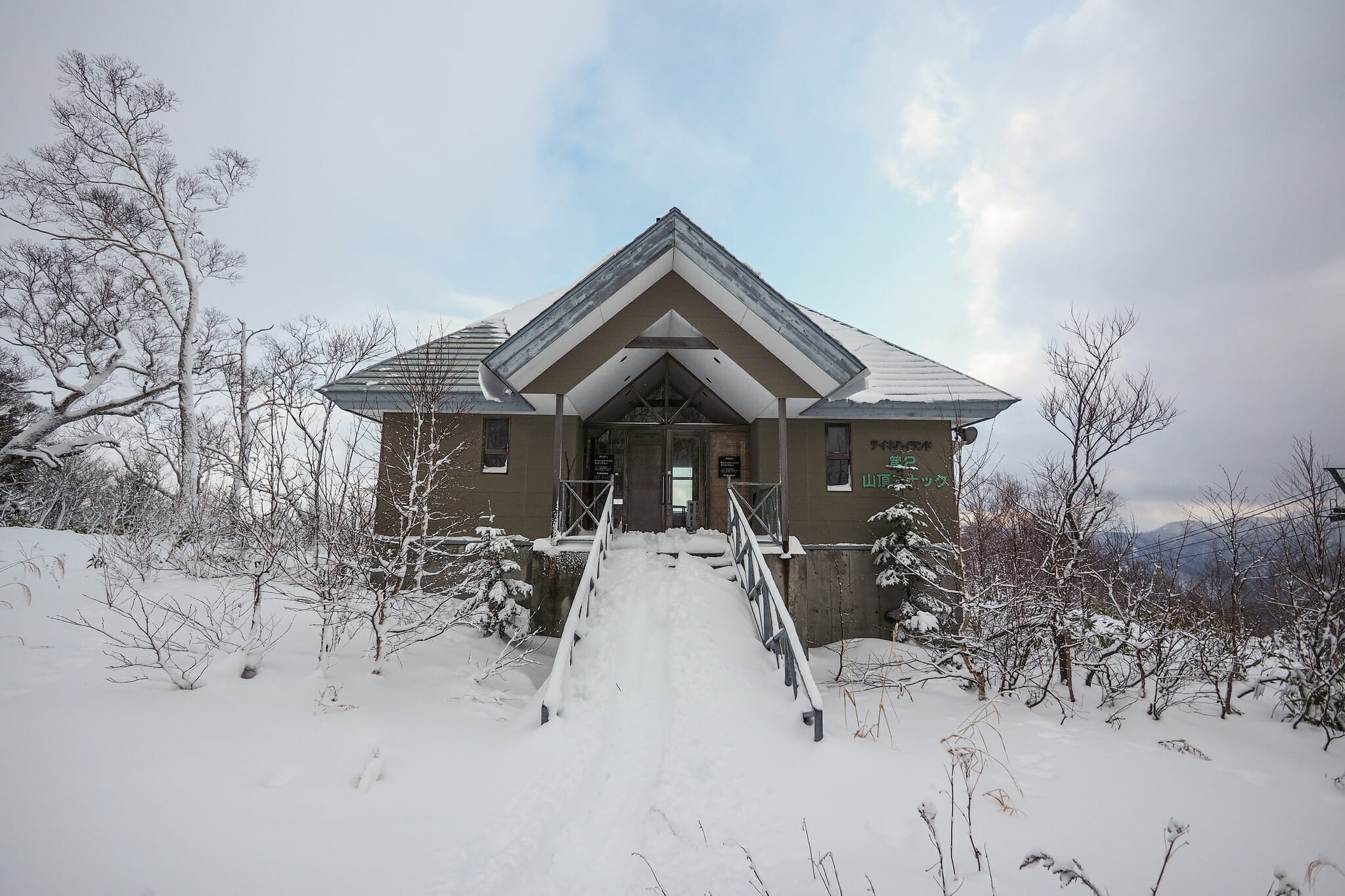
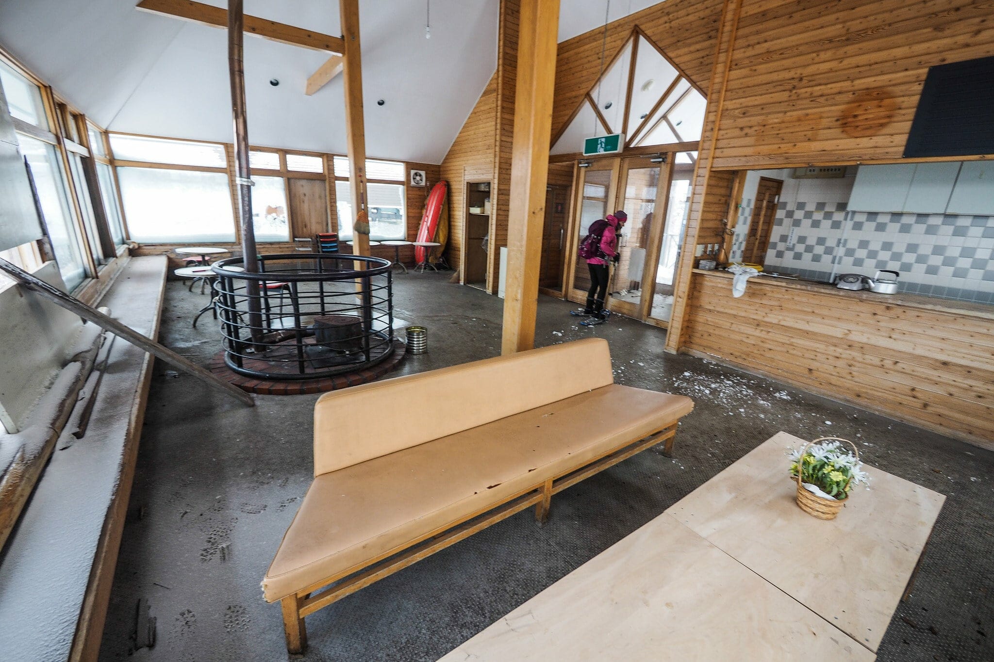
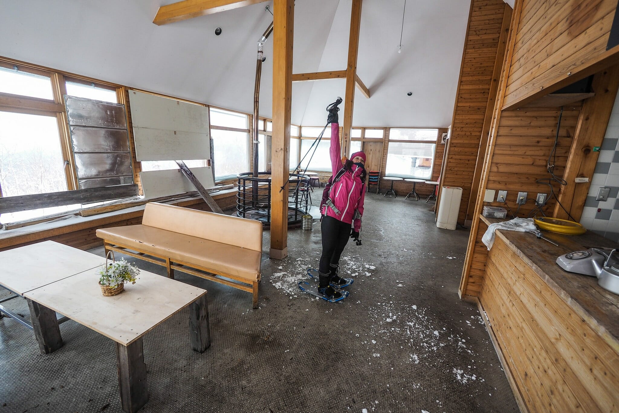
As I was doing some research about this route on the web, I had seen some mention of an abandoned restaurant at the summit, next to a defunct ski lift. Once part of Teine Ski field, there were conflicting reports as to whether the building was left unlocked during the winter months for hikers and skiers. I was quietly hopeful that it would be open, as it would be a nice place to get some shelter as we scoffed down some lunch. Soon after breaking our way through the brush near the summit of Neopara, we found the building.

Neopara snowshoe trip (Sapporo City, Hokkaido, Japan)

Neopara snowshoe trip (Sapporo City, Hokkaido, Japan)

Neopara snowshoe trip (Sapporo City, Hokkaido, Japan)

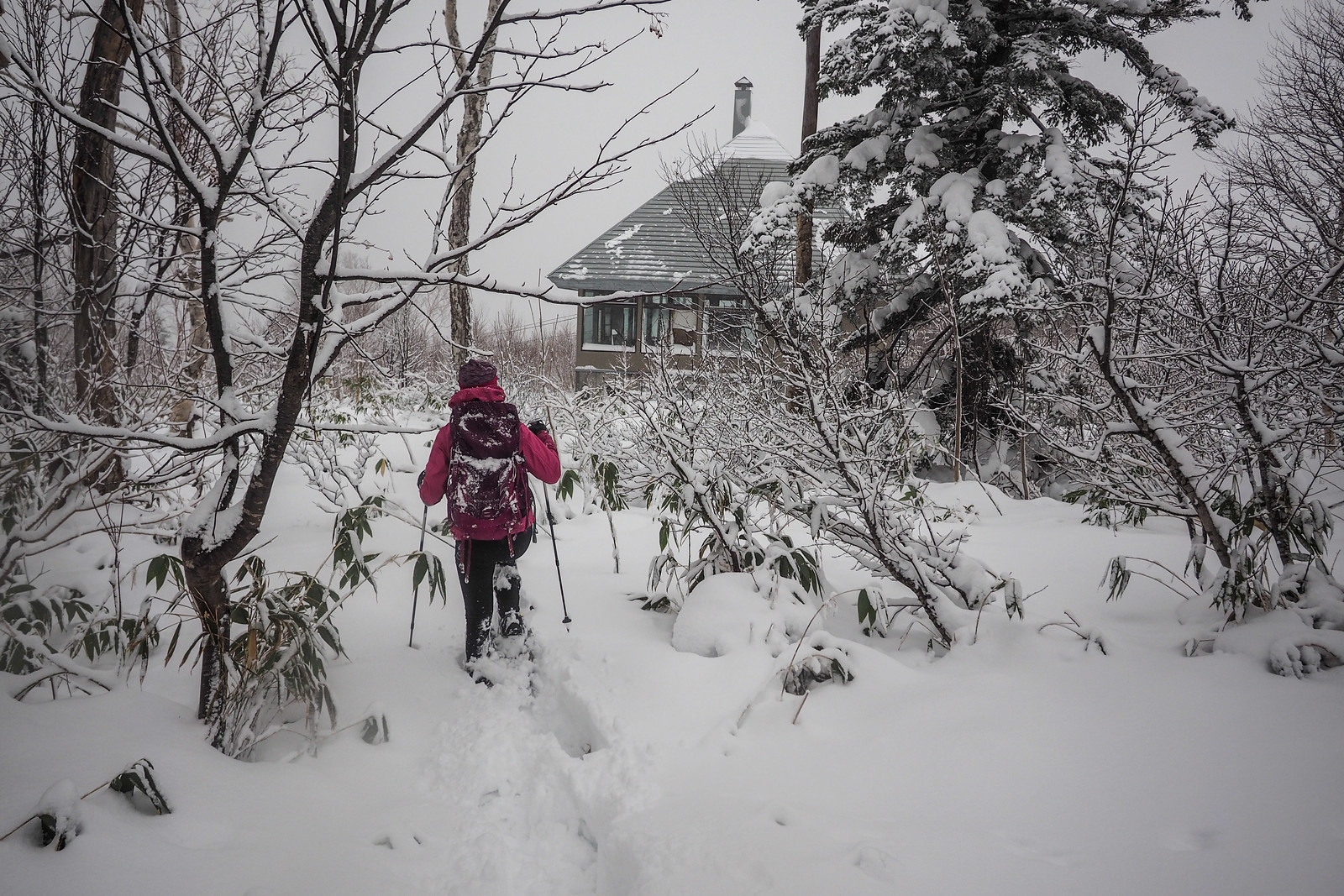
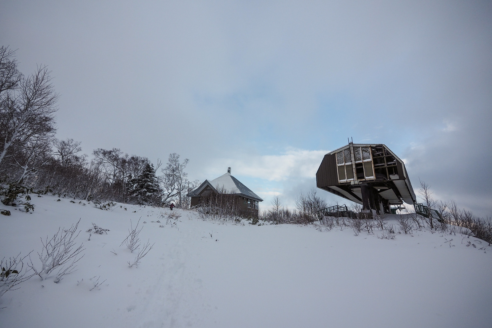
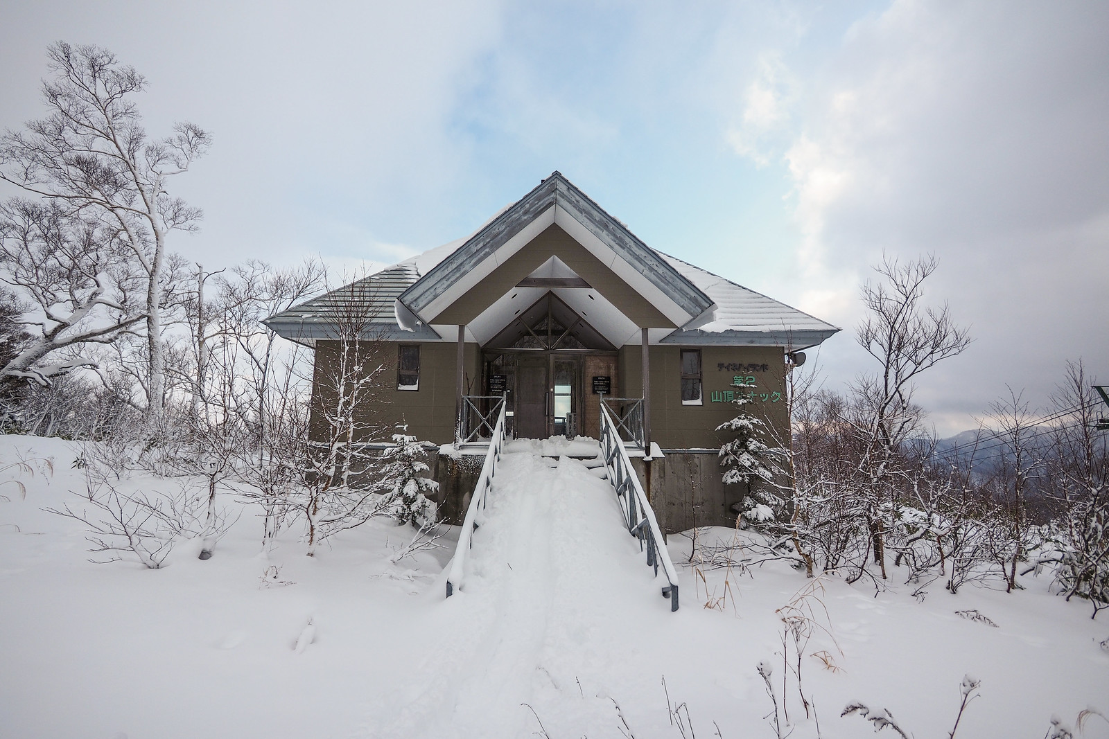
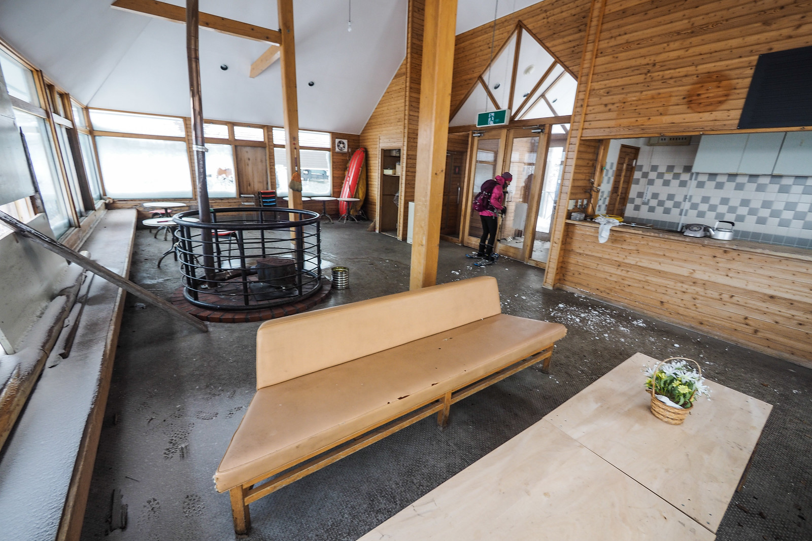
Mercifully, the doors were unlocked, and we were able to spend a precious 15 minutes or so eating our packed lunches. It goes without saying that this building is well and truly abandoned, with multiple windows missing.

Neopara snowshoe trip (Sapporo City, Hokkaido, Japan)

Neopara snowshoe trip (Sapporo City, Hokkaido, Japan)

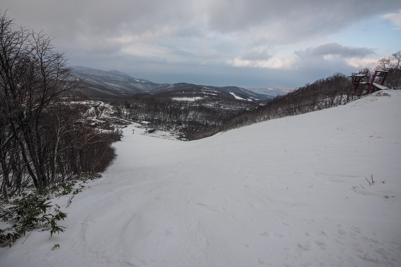
In the route map above, and in the Hokkaido Yukiyama Guide, the idea is to return the way you came up. However, due to the slow going on the way up, we’d already taken just over four hours to get to the summit. It was now 1:30pm, and I was wary about our prospects for a quick descent. Later in the season, a decent base of snow would allow for run snowshoe-running down the slope. Today, however, we’d be contending with sasa and brush that would happily snag our snowshoes with every lunge down the hillside.

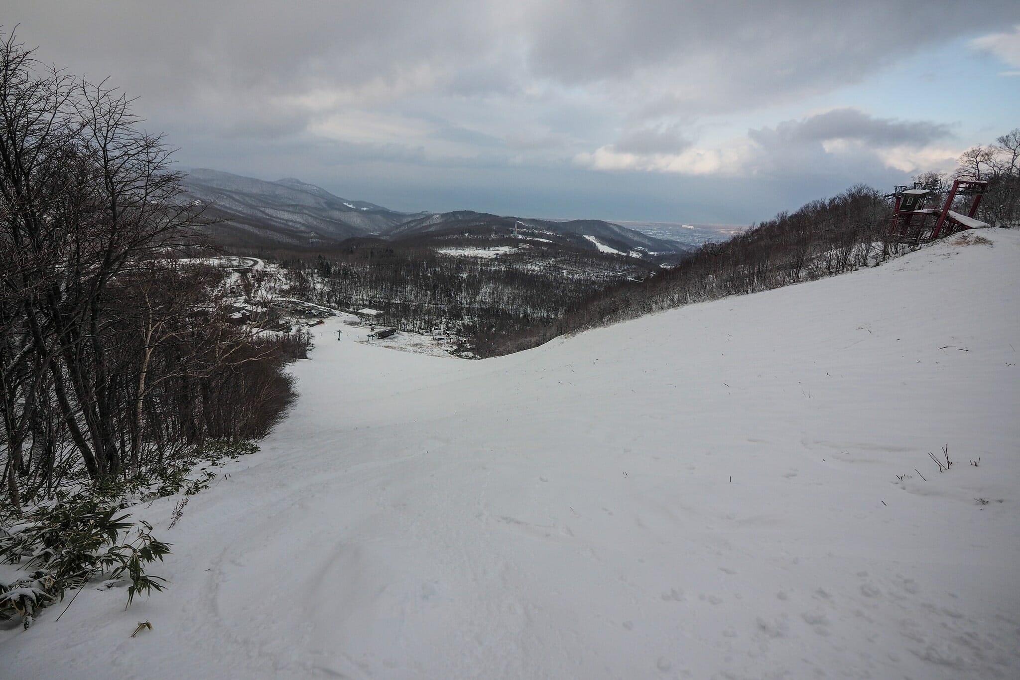
So we decided to carry on over to the Teine Ski field and get a bus back down to the train station from the ski area buildings. The legality of doing so is probably a bit of a grey area, and I certainly felt conspicuous trudging down the ski runs on snowshoes. But it certainly saved us a lot of time.

So here is the actual route we took this time around.

Photo by Szilvia Nagy

Neopara snowshoe trip (Sapporo City, Hokkaido, Japan)

As it turned out, however, the grand plan to get a bus down from the ski area buildings was thwarted – it was still too early in the season for the regular buses to be running.

Hitch-hiking seemed the only reasonable alternative. No sooner had we stuck our thumbs out for a lift, however, we got picked up by an enthusiastic ski school mini-bus, full of wide-eyed school kids. Even better, it was a ski school located over the road from the very subway station we needed to go to.

A thoroughly satisfying end to an adventurous day out.

Photo by Szilvia Nagy

Comments | Queries | Reports

Done this Teine-Neopara route? Thinking of doing it? Please post any feedback or queries here. Thanks!

Leave a Reply

Your email address will not be published. Required fields are marked *

This site uses Akismet to reduce spam. Learn how your comment data is processed.

See More Like this

Printable Teine-Neopara Topomap

TOPO DOWNLOAD (PDF, 24.6MB)

Download may take some time

Hokkaido Wilds Foundation

We’ve got affiliate links on HokkaidoWilds.org to help fund the Hokkaido Wilds foundation.

The Foundation gets a small commission on sales from affiliate links, but we only link to stuff we think is worth checking out for people keen on the outdoors in Hokkaido and Japan.

The Hokkaido Wilds Foundation is a fund where 100% of funds are donated to Hokkaido volunteer groups involved in sustainable, safe, and responsible access to the Hokkaido outdoors.

Learn more here

ADVANCED FILTERS

Filter by location

About Filters

REGION: The general mountain/geographical region the route is in.

BEST MONTH(S): Time of year a route is suited to visiting. Some pop all season, some are more limited.

DIFFICULTY: How strenuous a route is, and how technical it is. Full details here.

FREERIDE/SKITOUR: Very subjective, but is a route more-of-a-walk-than-a-ski or the other way around? Some routes are all about the screaming downhill (freeride), some are more about the hunt for a peak or nice forest (ski-tour). Some are in between. 

MAIN ASPECT: Which cardinal direction the primary consequential slope is facing, that you might encounter on the route. More details here.

ROUTE TAGS: An eclectic picking of other categories that routes might belong to.

SEARCH BY LOCATION: You can find routes near your current location – just click on the crosshairs (). You may need to give permission to HokkaidoWilds.org to know your GPS location (don’t worry, we won’t track you). Or, type in a destination, such as Niseko or Sapporo or Asahikawa etc.

Please let us know how we can make it easier to narrow down your search. Contact Rob at rob@hokkaidowilds.org with your suggestions.

Teine-Neopara by Snowshoe Difficulty Rating

Category

Grade

Points

Strenuousness

Vertical Gain

B

35

Time ascending

C

3

Technicality

Altitude

C

3

Hazards

D

Navigation

D

Totals

41/100

GRADES range from A (very difficult) to D (easy). Hazards include exposure to avalanche and fall risk. More details here. Rating rubric adapted from Hokkaido Yukiyama Guidebook 北海道雪山ガイド.