


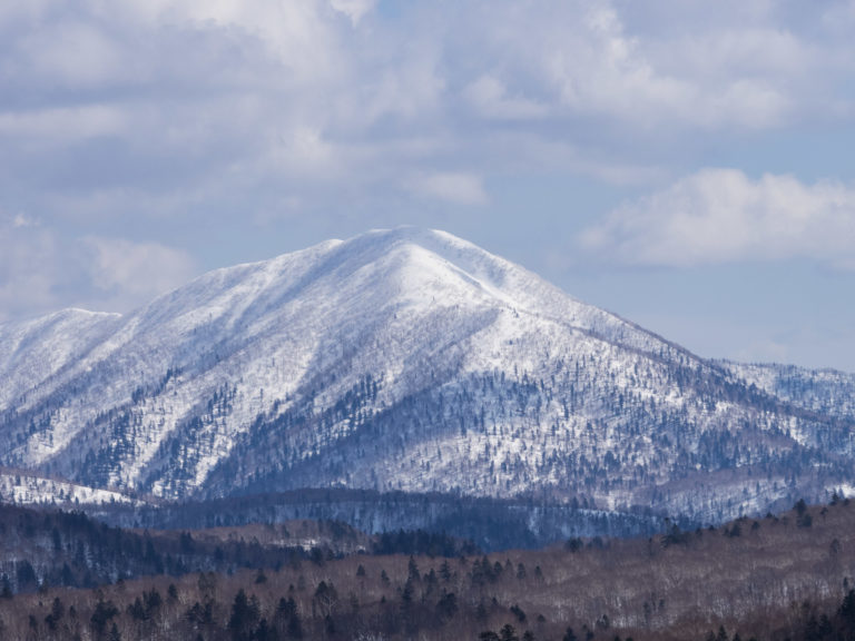
On an overnight backcountry hut trip last year (to Mt. Okuteine Hut), an old Japanese guy told me about a hut on the way up Mt. Shokanbetsu, near the historic town of Mashike. In his experience, he rated the Shokanso Hut as the best in Hokkadio. “Not only is the hut amazing, but the skiing is fantastic,” he beamed. I was immediately intrigued. Mountain huts are an obsession for me, and so Shokanso Hut was duly filed away in my memory for another time. Fast-forward to last week, and I finally stamped out some time to make the 250km trek from Sapporo to the small Japan Sea coast town of Mashike. I intentionally chose not to heed the Yukiyama Guide‘s recommendation to do the tour after the road to the hut was cleared. I love to feel isolated in a mountain hut, so I committed to making the 1.5 to 2 hour skin up the snow-buried road, making the trip a two-night, three-day trip. Around the same time as I was planning to do the trip with or without companions (my usual ski-touring mates were not available that weekend), I got an email from a German couple – Hendrik and Leni – who were in Hokkaido for some split-board backcountry boarding. They had stumbled on my Hokkaido Ski Touring Resources page, and asked if I happen to have any trips planned in the next couple of weeks. If so, could they tag along? They seemed up to it, so I invited them to tag along with me to Mt. Shokanbetsu – to be co-explorers of a place I’d never been myself.
Day 1 – To the Hut
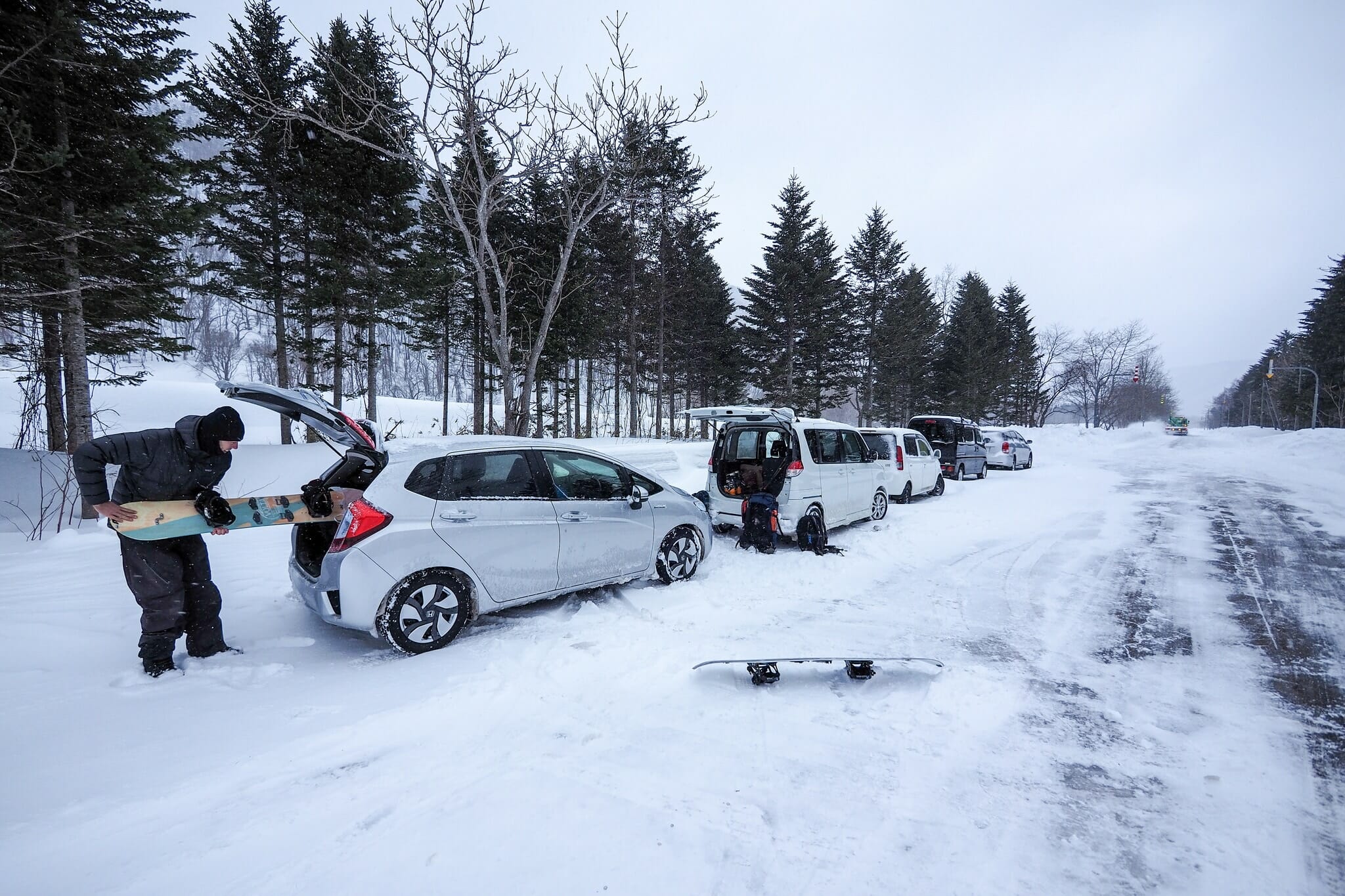
In the end, their Couchsurfing host in Sapporo, Hiro, also came along, and early on Friday the 24th of February, we found ourselves driving very carefully north from Sapporo along the Japan Sea coast towards Mashike. I say carefully because the very weekend I chose to do the trip, the entire island of Hokkaido was caught up in a massive storm. So massive in fact, that the high winds had cause waves to breach the road along the coast, closing the coastal road to Mashike. We had to make a 2.5 hour detour back inland via Takikawa and Rumoi in order to get to our destination. Even then, we were slowed at times to a crawl as great gusts of wind blew drifting snow across the road so thick that visibility was reduced to zero.
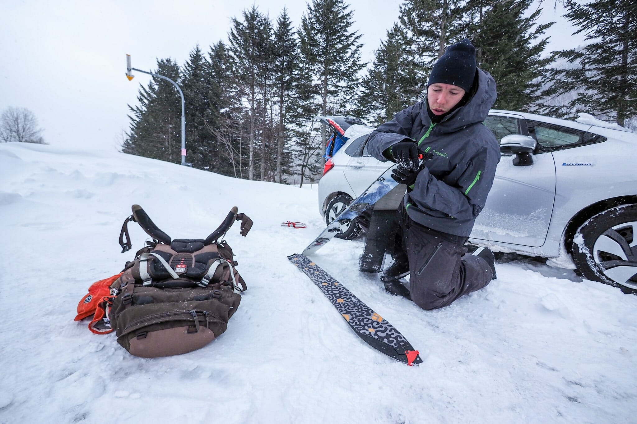
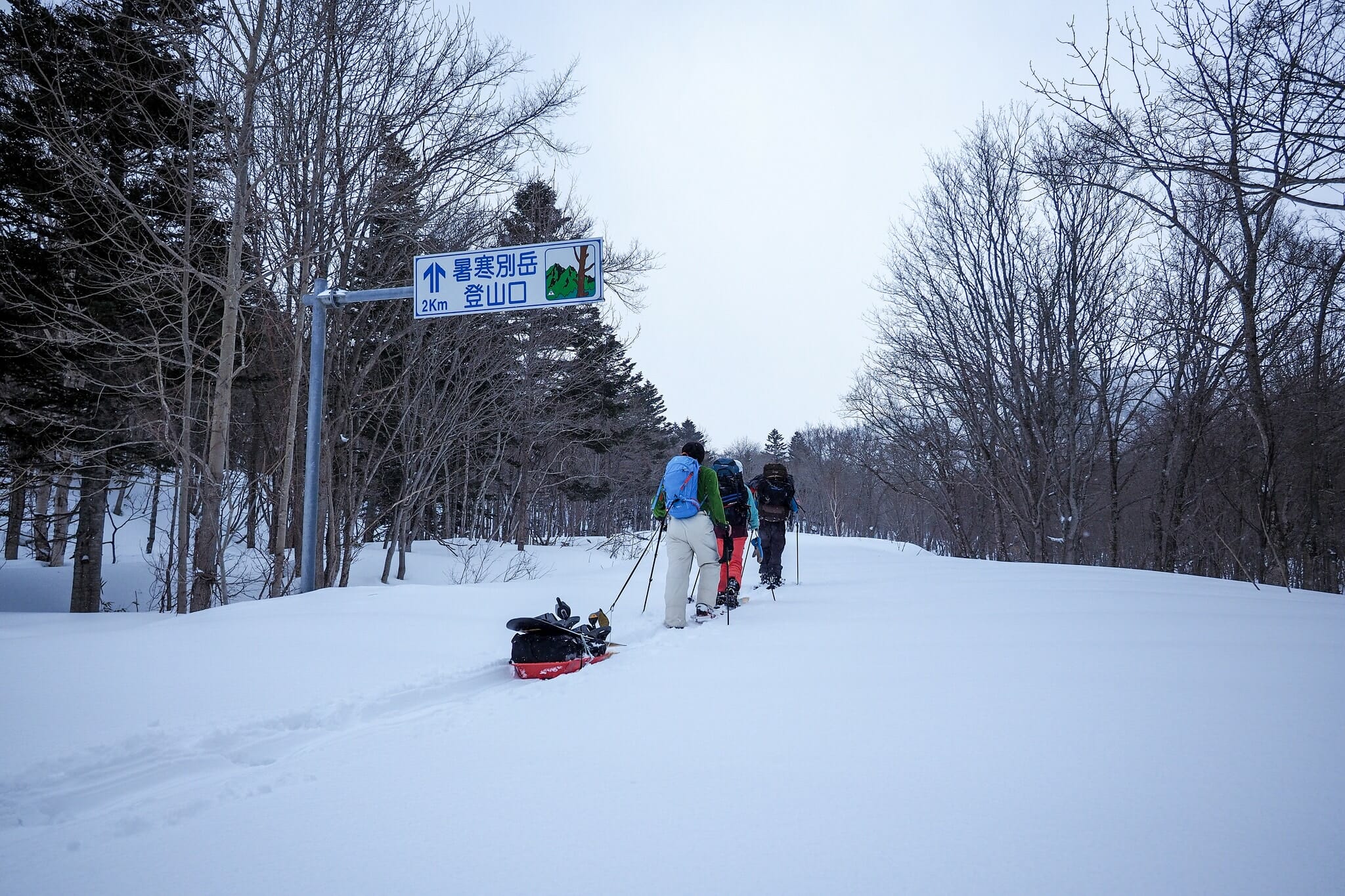
After finally arriving in Mashike, picking up the hut key from Cafe Polku, and getting to the end of the snow-cleared section of access road, we were running about 3 hours behind schedule. It was already around 1pm, so we’d likely be arriving at the hut around 3pm. We quickly suited up, and were amazed at how the Shokanbetsu River valley seemed to be nicely isolated from the raging storm elsewhere. There was hardly a breath of wind.
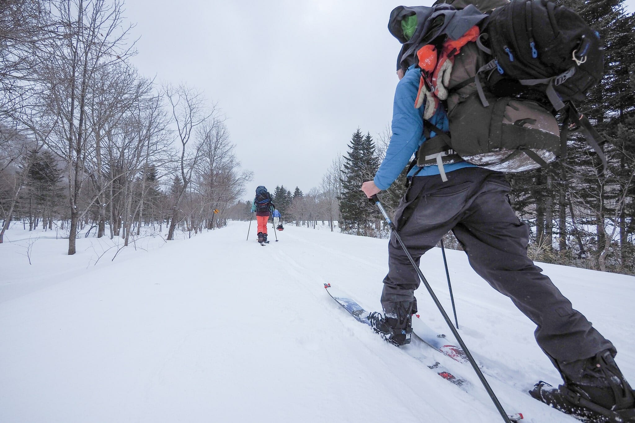
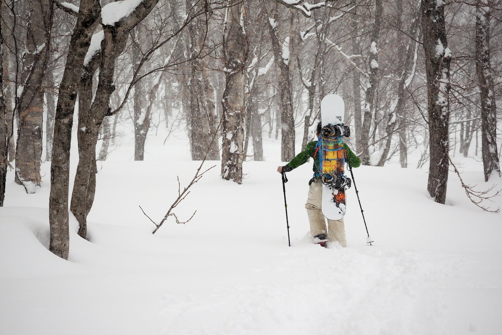
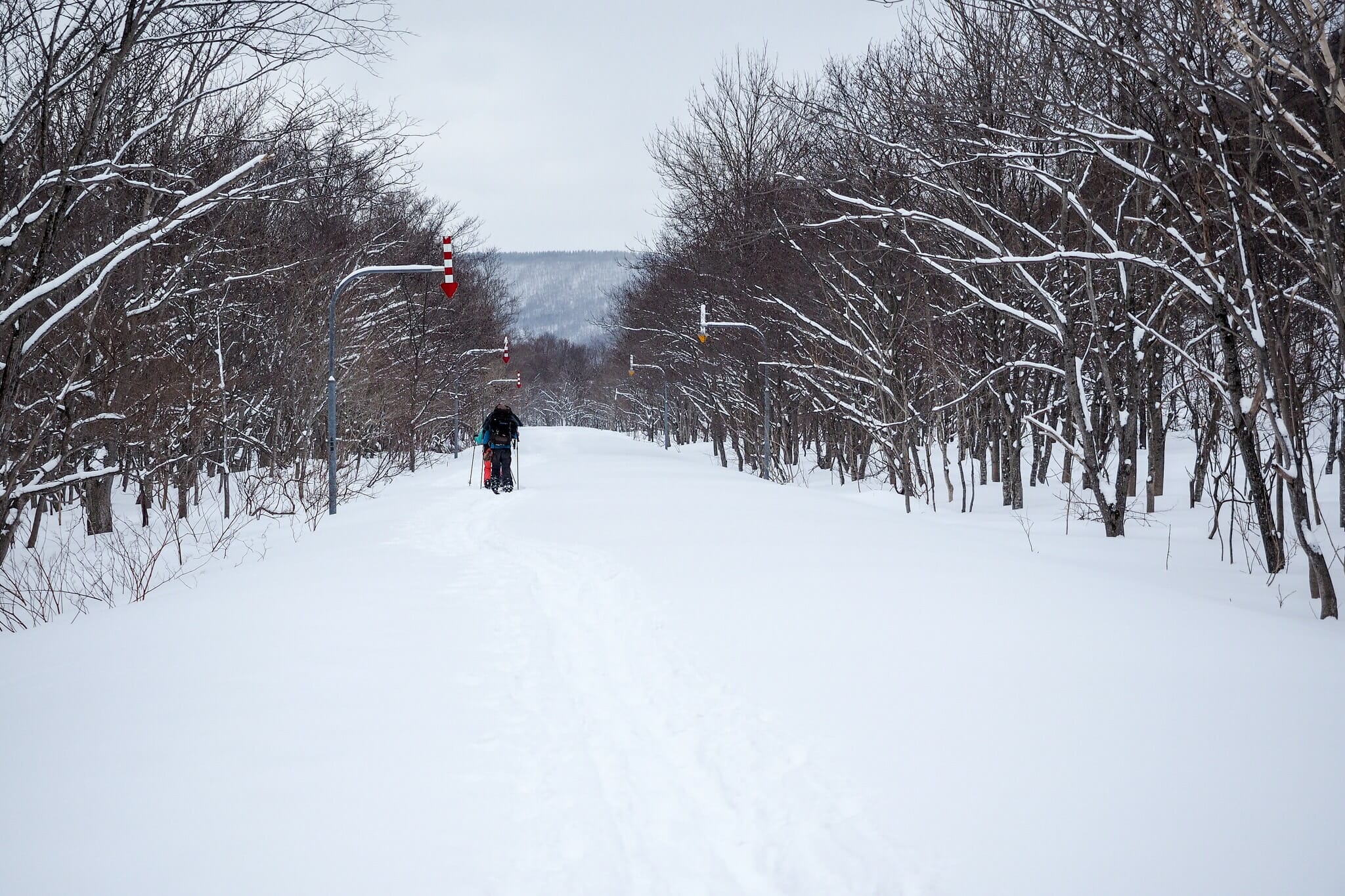
The 5km skin to the hut was a chance to re-acquaint ourselves with heavy packs on a ski tour. Inspired by prolific Hokkaido wilderness guide Leon Roode, I now like to make meals at mountain huts an event, rather than simply a necessity. This meant heavy packs for all of us. But I was determined to make it worth it.
Hiro seemed to have the right idea – a cheap 700yen plastic sled turned out to be the more popular way of lugging gear and food to this particular hut. We would discover other people at the hut that night, who had also used sleds to transport drinks, food, and home comforts to the hut with them. The relatively flat approach was definitely suited to this mode of moving luggage.
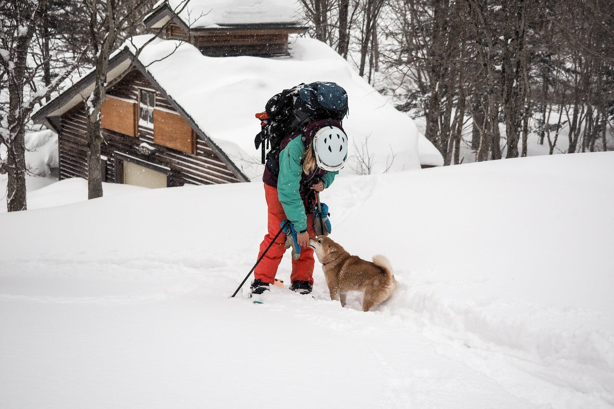
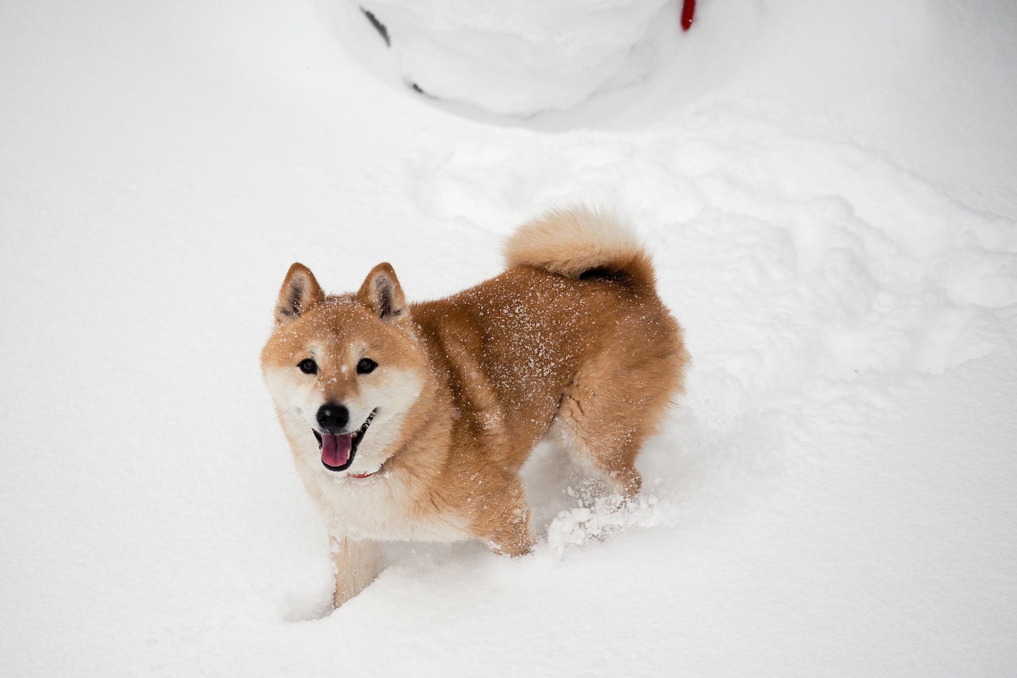
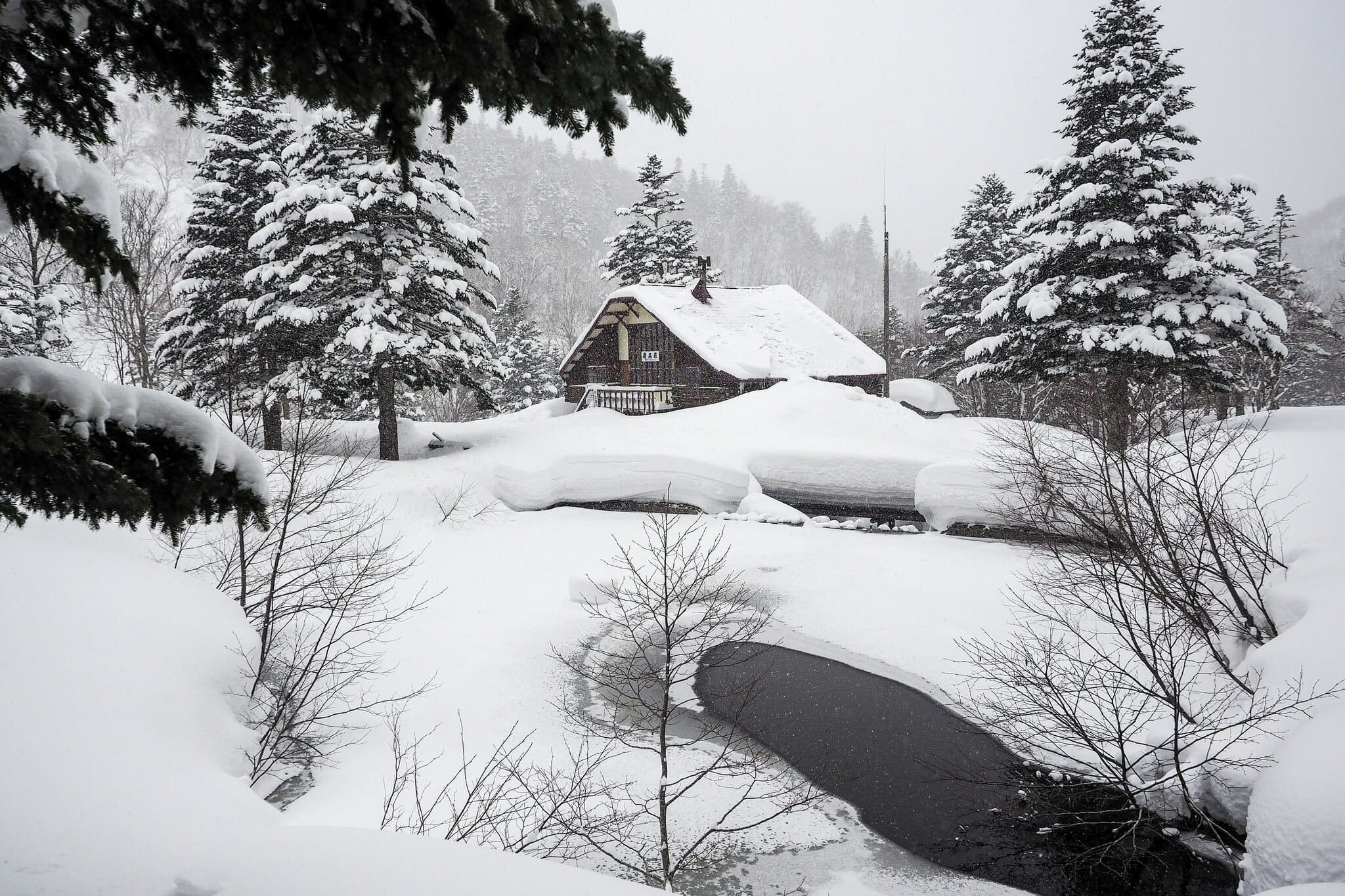
Just as Shokanso Hut came into view, we noticed interesting animal prints in the snow. They seemed to be from a fox-like animal, running around and around in circles. They had us scratching our heads until the pint-sized culprits came bounding towards us. There was another party already at the hut (they had been there three nights), and they’d brought along their hopelessly adorable shiba-ken Japanese dogs with them. They really looked like they were in their element – completely happy.
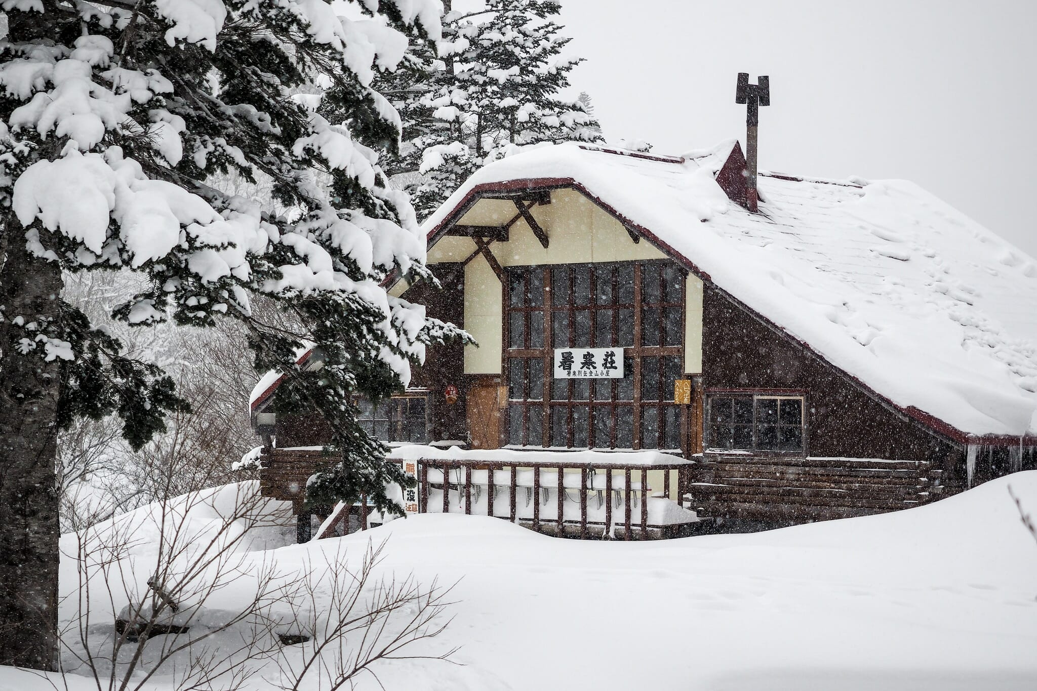
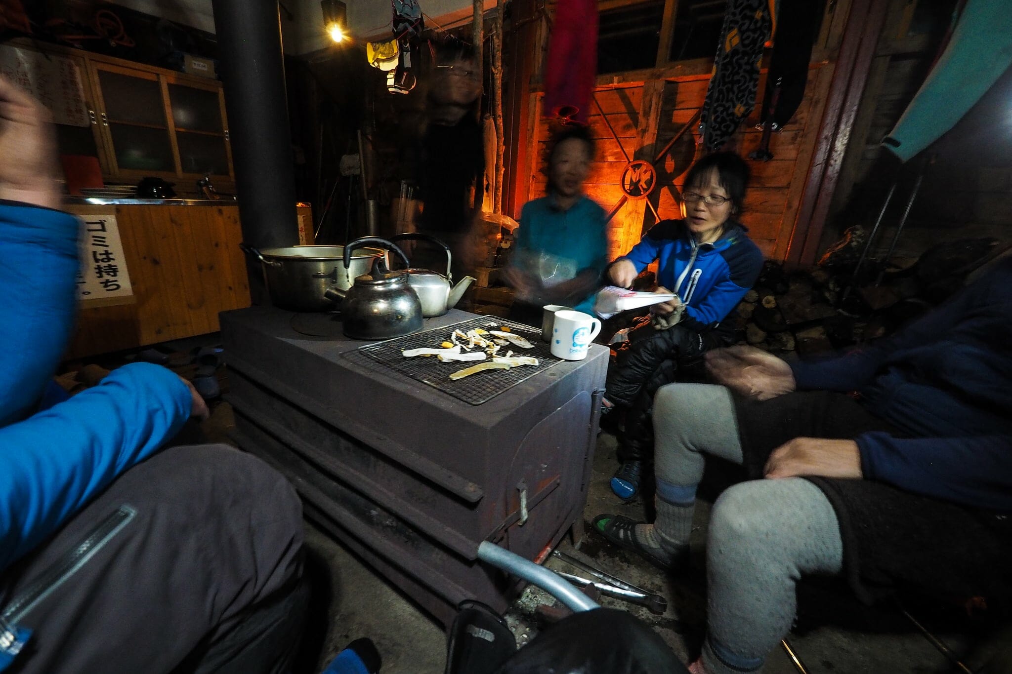
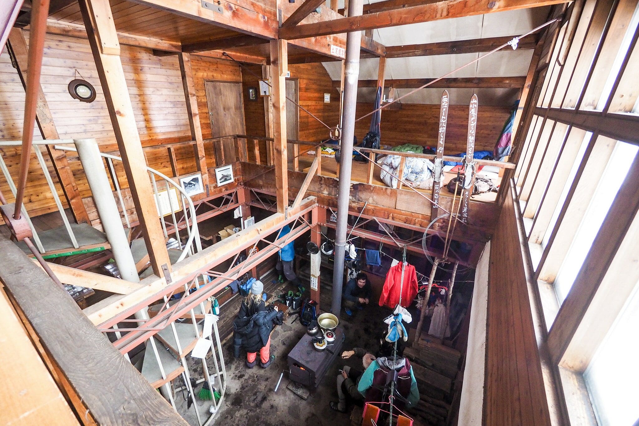
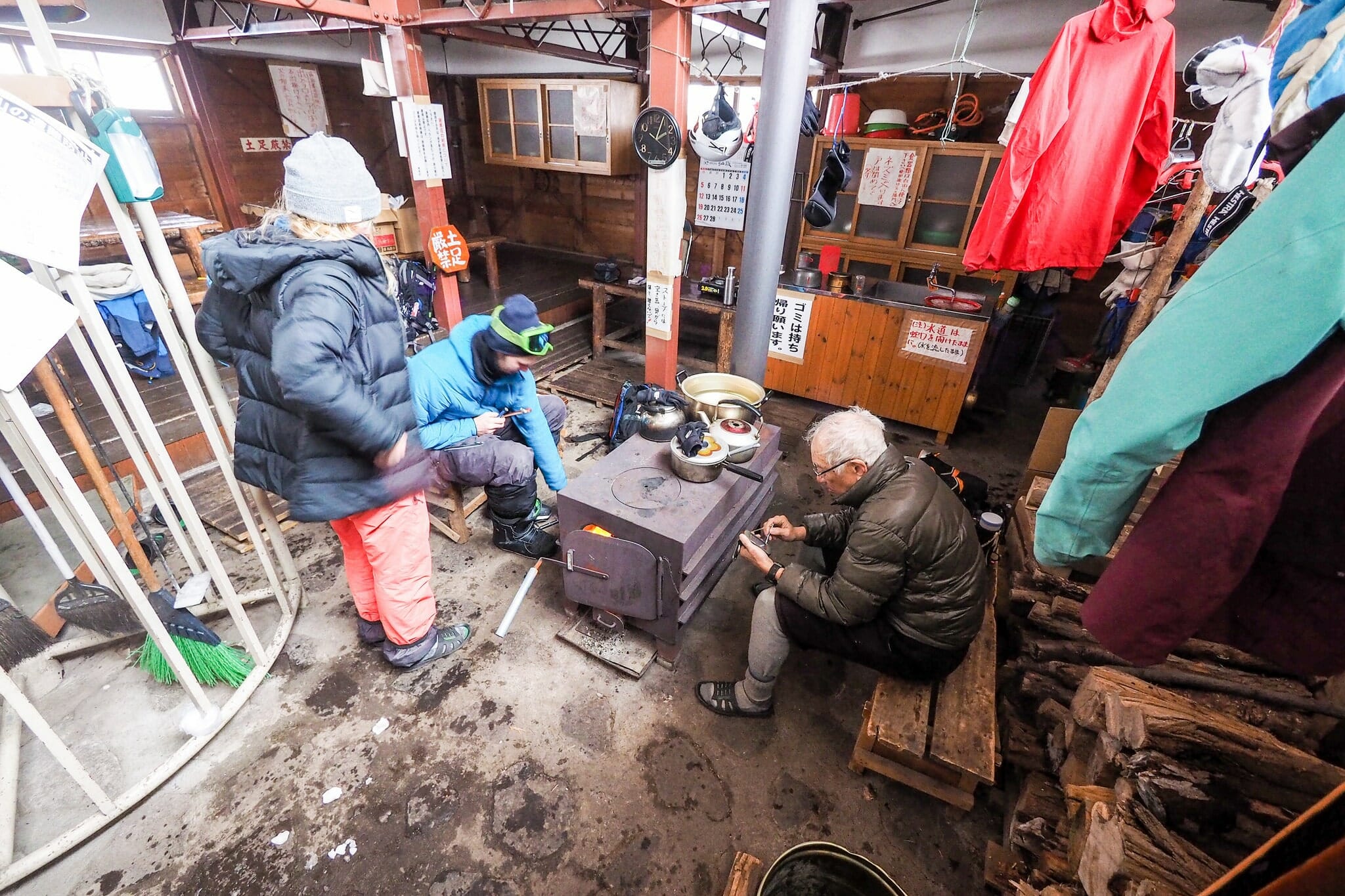
The occupants of the hut were also surprised and excited to see us. There were four of them (three sisters and a older gentleman), and they’d been coming to Shokanso Hut for many years. They said that it was extremely rare that anyone else would stay at the hut during the season where the road was not cleared. It was lucky for us that they were there, as we were treated to the luxury of walking straight into a nice warm hut, the large wood stove already pumping out the heat.
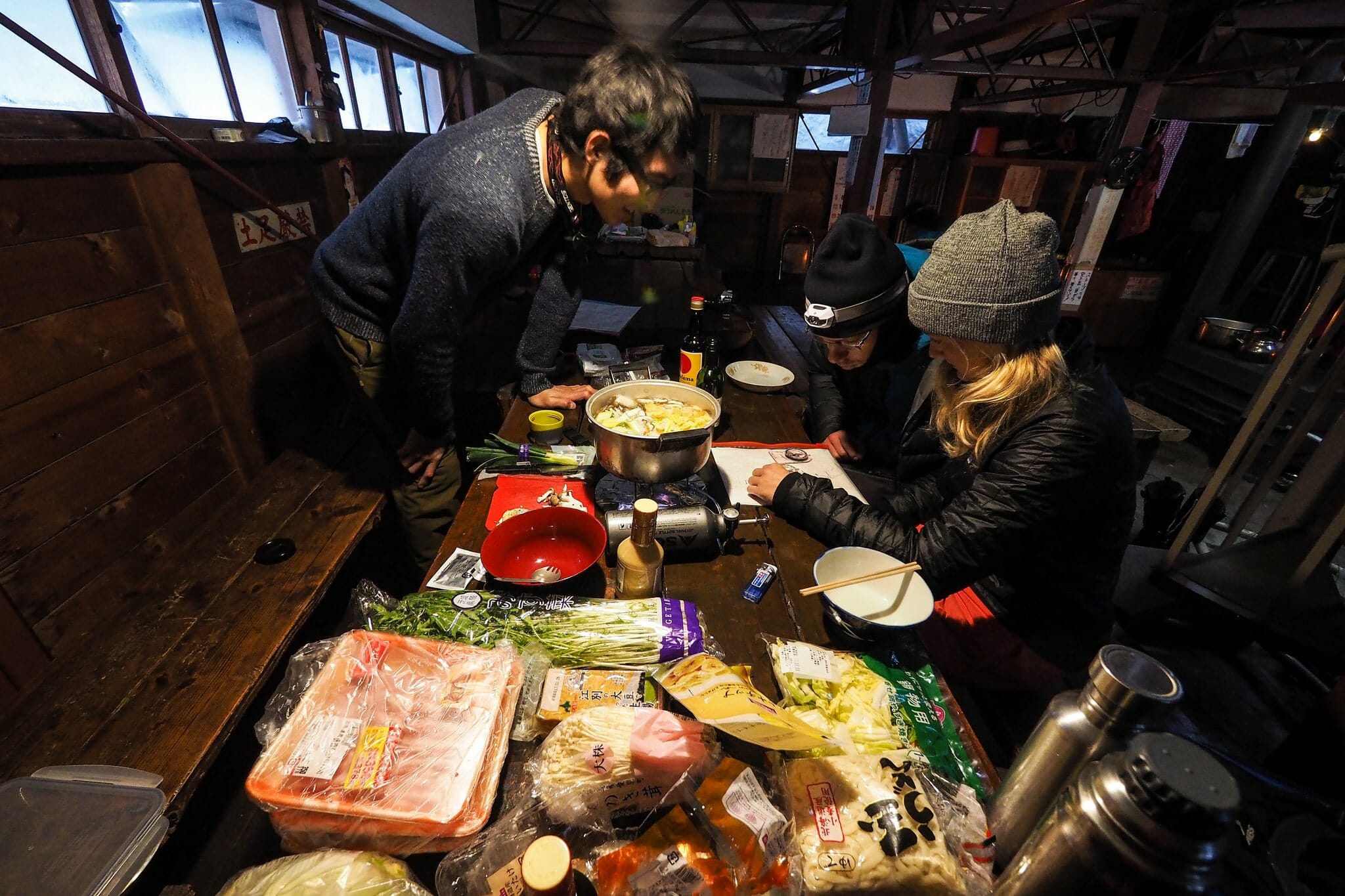
On our menu for the first night was what I call ‘shabu-nabe‘. It is a fusion of two very similar communal meals in Japan – shabu-shabu and nabe. I tried to insist to the Japanese there that they are essentially the same thing – a large communal pot of very light soup into which pork, tofu, and vegetables are put in rounds, until a thick hearty soup remains. Into this goes udon noodles to finish. The time taken to eat this meal makes it a very social event. There is time to check maps for the next day’s route, and there’s time to show off one’s nifty gadgets – such as Hiro’s new (and very powerful) alcohol stove.
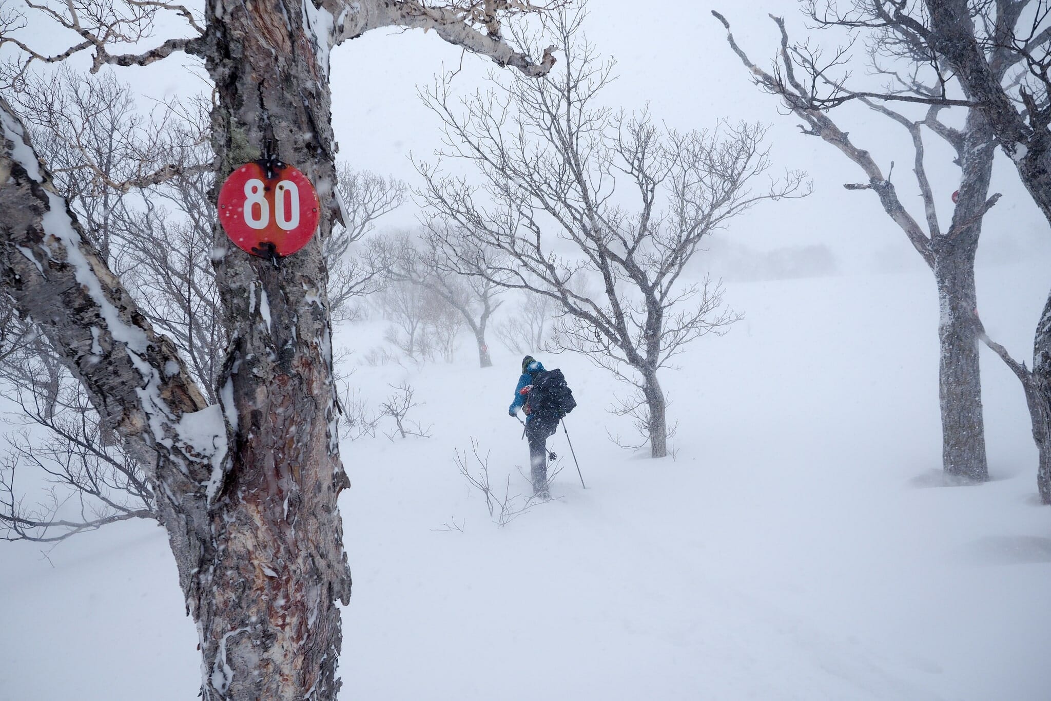
Day 2 – If we can make it to marker #100 we’ve done well
It was an early night to bed the night before, so that we could make a very early start up the mountain. A quick breakfast of oats and coffee, and we were outside setting up by 7am. Before we had even set off, we collectively decided that we’d try to make it to the #100 marker, and assess the situation. Despite the very calm and kind conditions down at the hut, we all knew that the forecast was for very high winds at the higher altitudes, so we wanted to manage our expectations.
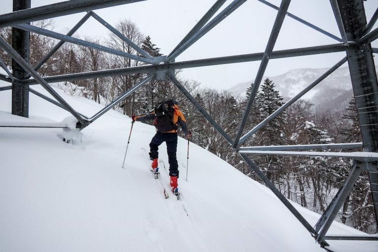
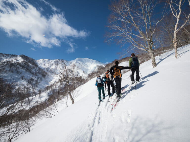
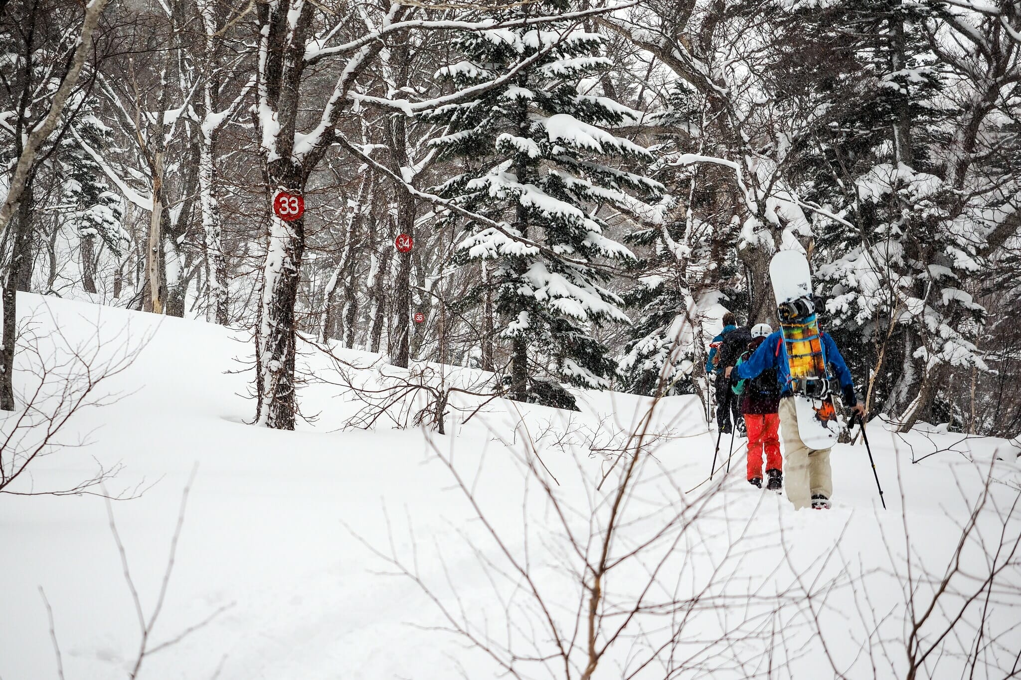
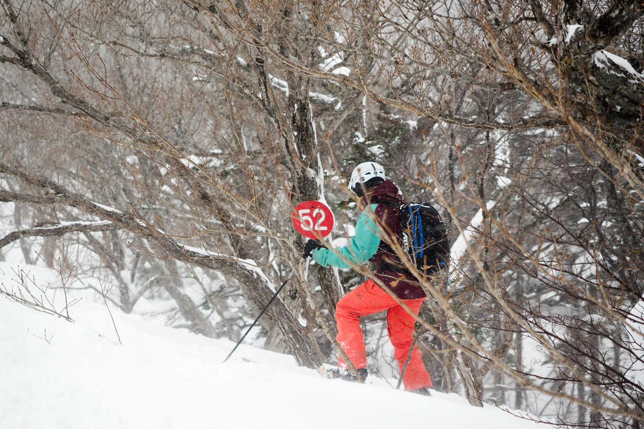
As we were setting off, a light snow started to fall, but there was certainly plenty of visibility to “join the dots”. The numbers on the trees below, 33-34-35 were an example of very closely spaced route markers. In other places, there were larger distances between markers, but not so far that even in quite heavy snow we were always able to find the next one to head towards.
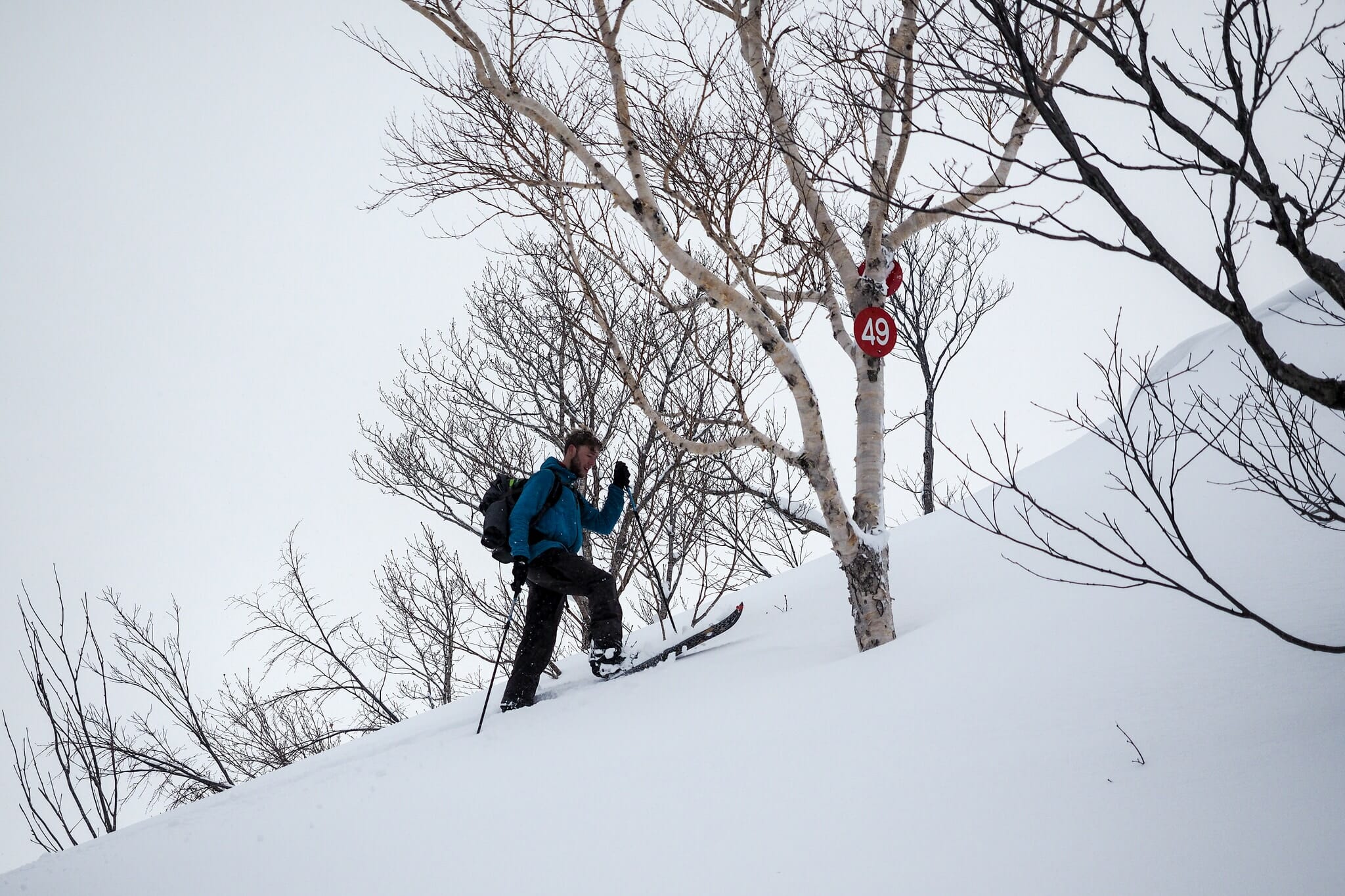
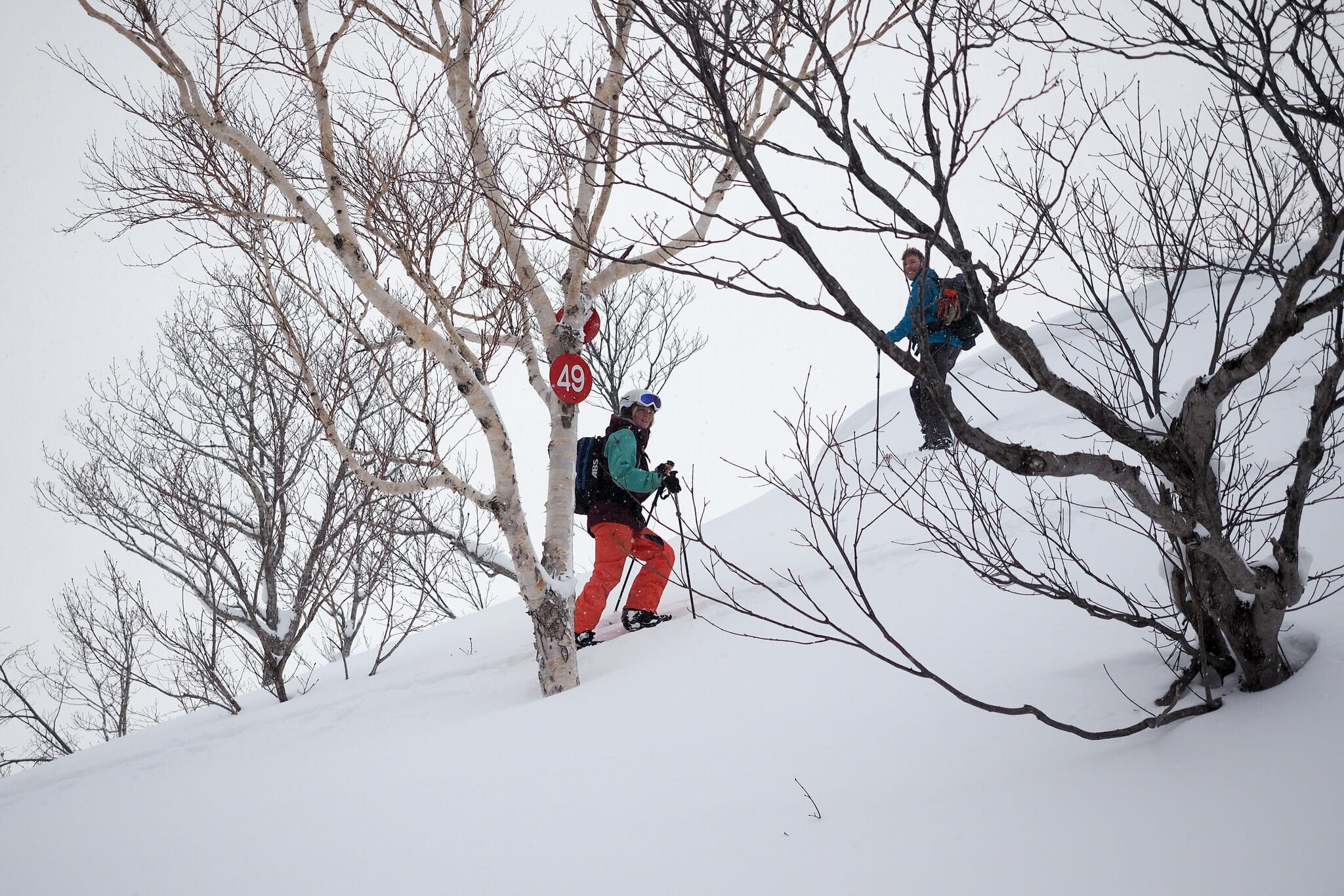
It was not until marker #50 that we were on top of the northern ridge. It was here that we became increasingly acquainted with the strong winds that everyone told us about – including the other party at the hut the night before.
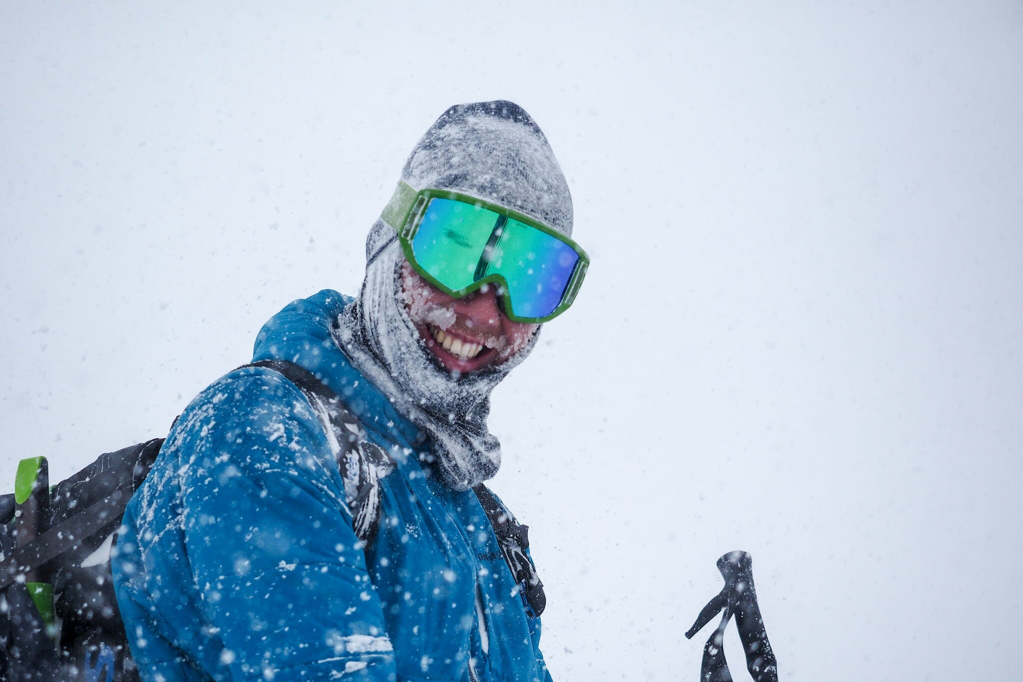
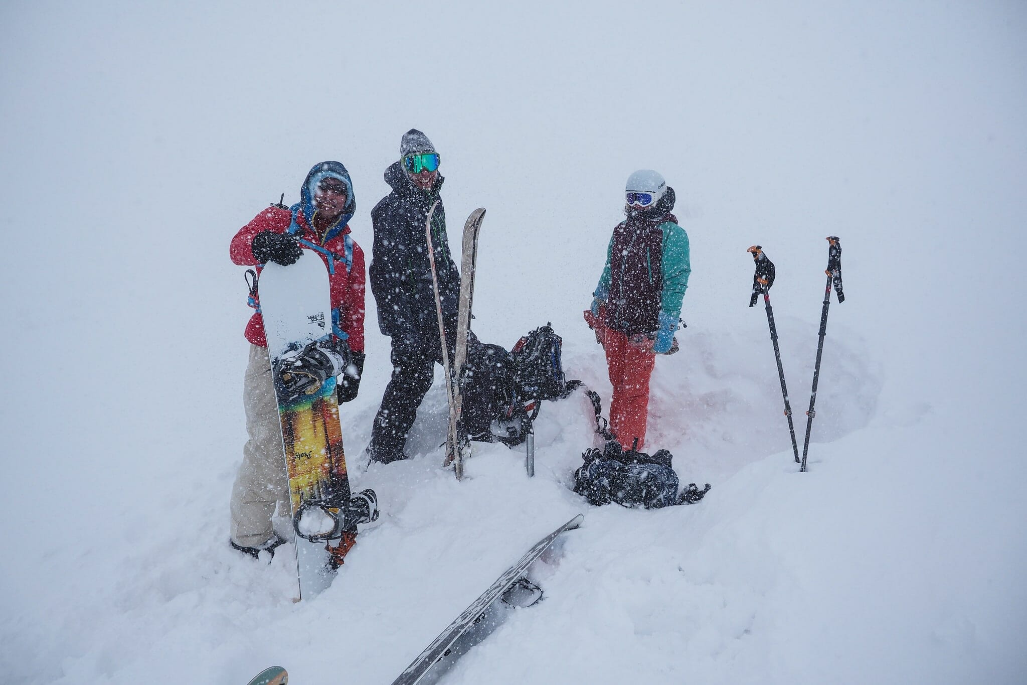
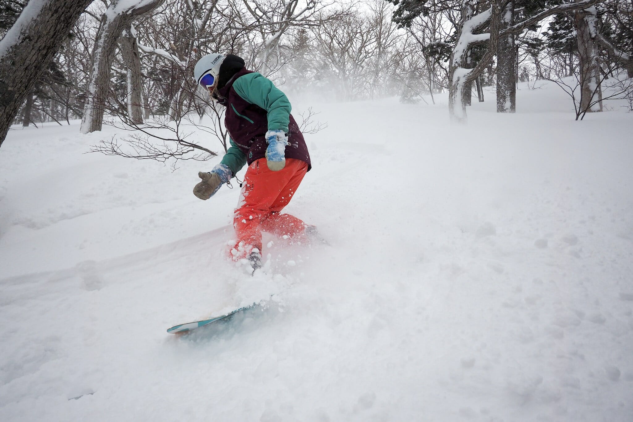
By marker #90, it was clear that we wouldn’t be making it far above 1,000m today. It became increasingly clear that the exposed slope at around marker #100 was no place to be, and we needed to head down as soon as possible. We threw on our down parkas, I filled my Nalgene bottle with boiling water from my thermos so that Hiro could warm up his cold, stiff hands, and the wind just kept hurling chunks of snow at us – even after I’d carved a large half-shelter in the snow for us to shelter for just a moment (whoever invented folding shovels with a ‘hoe’ function deserves a medal). We were mostly smiles.
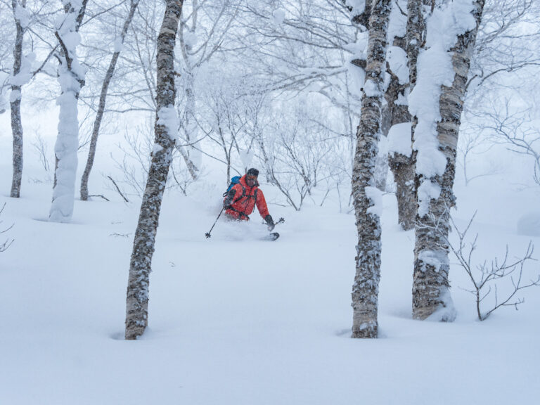
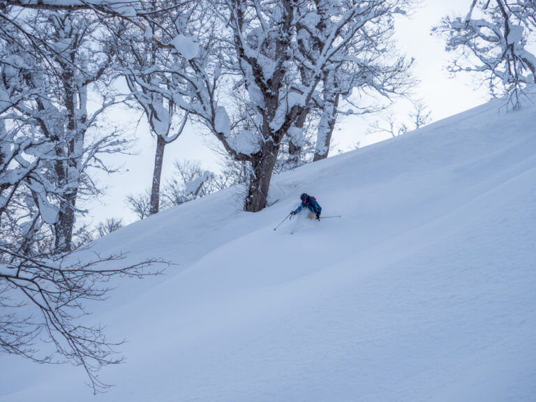
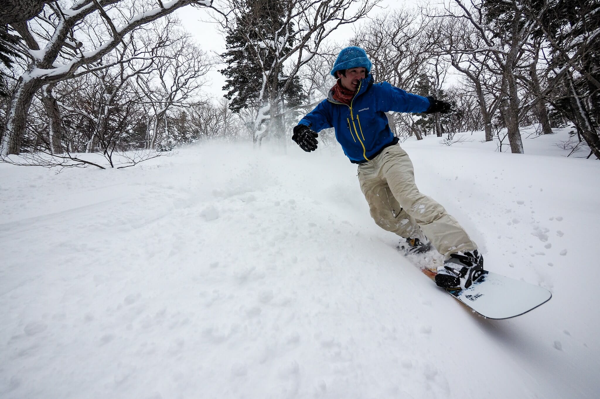
Due to the abysmal visibility and conditions, we were not in a position to consider other options for getting back to the hut other than back the way we had come. This was not a problem for me on my skis, and for the most part the boarders were fine also, but there were some flatter spots that required them removing their boards and hiking for a few meters. To avoid one extra up at around 600m, we decided to drop down the western side of the main ridge at around 650m. This dropped us into more sheltered territory, but it was steep enough that we decided to stop to dig a pit and see how the snow pack looked like. Compression tests showed a very small weak layer under a harder melt-refreeze layer. Nothing catastrophically shifty however. The top layer, at least, was perfect for some very nice turns.
We were back in the warmth of the hut by just before 2pm. Grinning. Bubbling inside from the pure beauty of this valley. We were massively grateful to Mr. Kawai, the gentleman from the night before who had taken it easy today, and therefore had kept the fire stoked and warm.
Of all the huts I’ve been to in Hokkaido, I think this is the one I was most happy to take a nap in that afternoon. The warmth of the fire, the snow falling softly outside the windows…pure luxury.
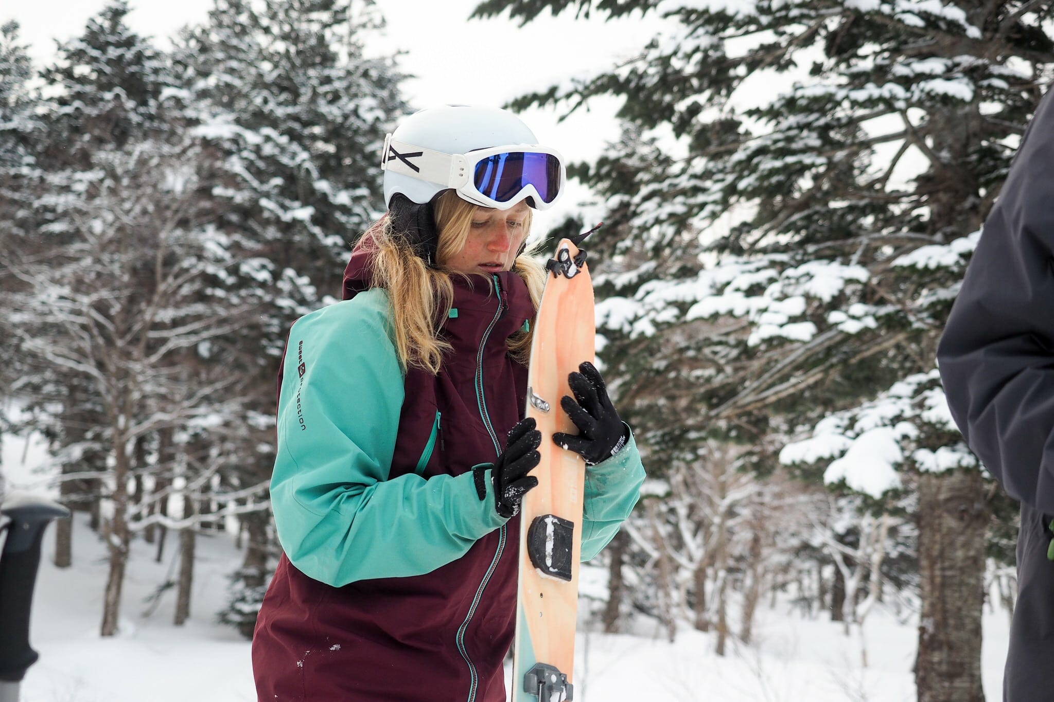
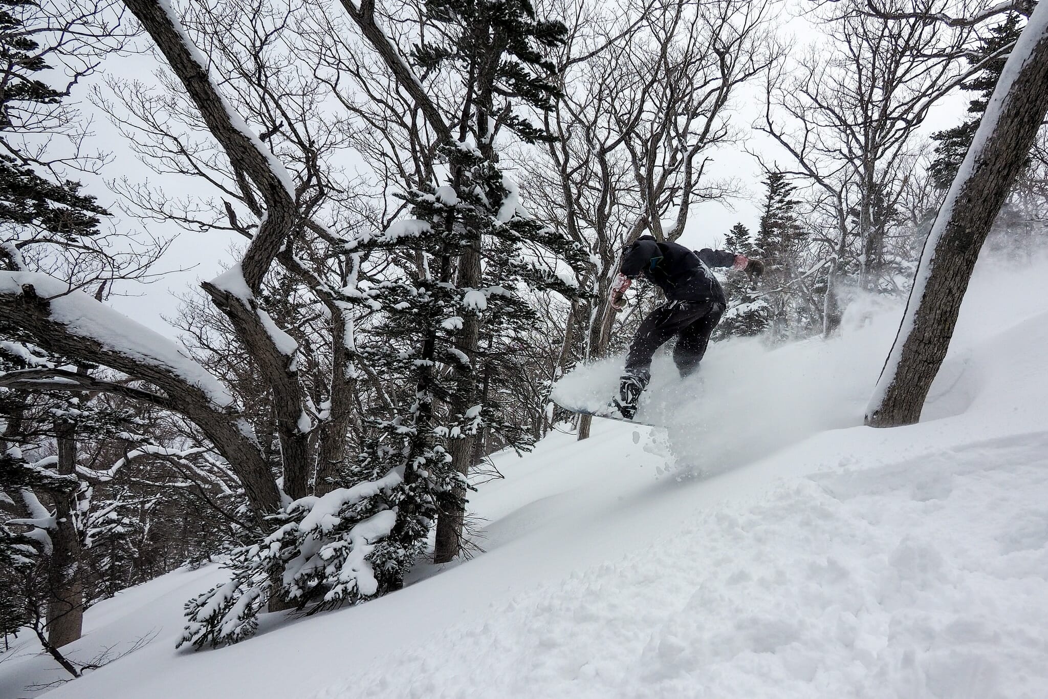
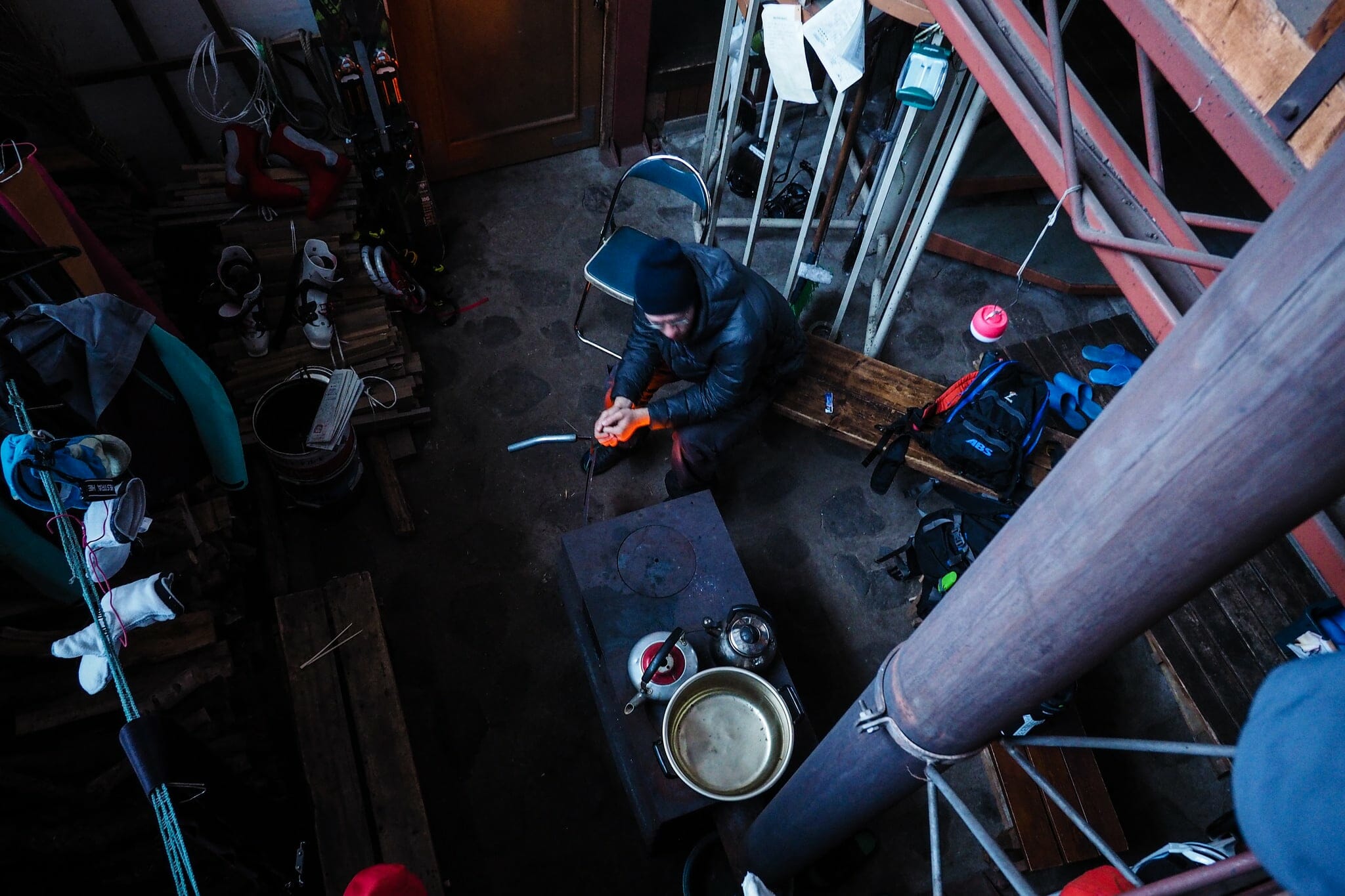
I slept lightly from 3:30pm till 4:30pm, as did Hiro. Leni spent her down time writing her diary, and Hendrik went out for some more turns, this time climbing up the west side of the valley directly across from the hut. “It was super steep,” he beamed, as he arrived back just in time for his curry and rice dinner.
Day 3 – Onsen, sightseeing, and back home
While the Shokanso Hut fireplace is great at warming up the hut, it doesn’t take long for the fire to burn out completely without any extra fuel. I stoked it once during the night, adding a couple of large pieces of wood. Despite this, I noticed in the morning Hendrik needed to use some newspaper to get the fire lit again.
After a breakfast of scrambled eggs and bacon, we reluctantly bade our farewells to the hut. We washed up the dishes and returned them to the cupboards. We closed the ground floor window shutters. These all felt like ending rituals, drawing to a close a very peaceful and relaxing two nights at the hut.
There isn’t much to say about the return from the hut to the cars. The route is long and flat. You’ll want your skins on right from the start.
Epilogue
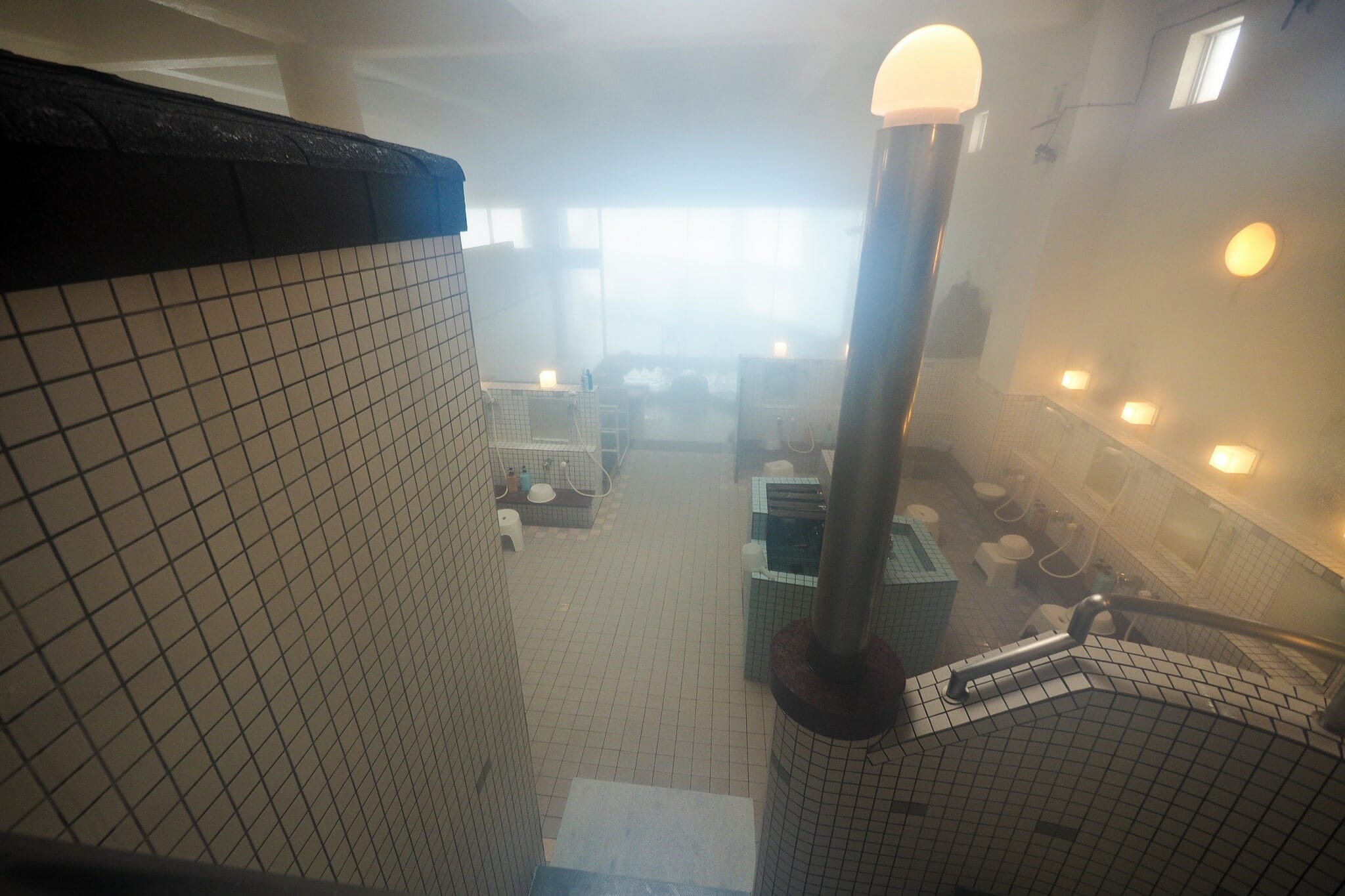
No trip anywhere near Mashike should be without a little bit of sightseeing. We first got warmed up and washed at the Auberge Mashike hotel, which has an artificial onsen (550yen per person).
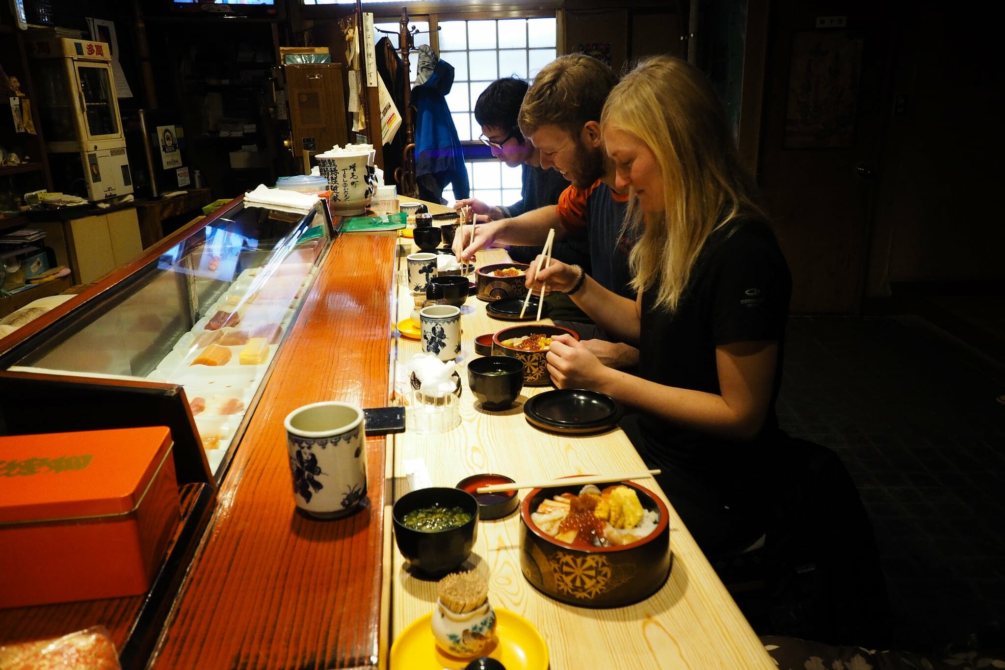
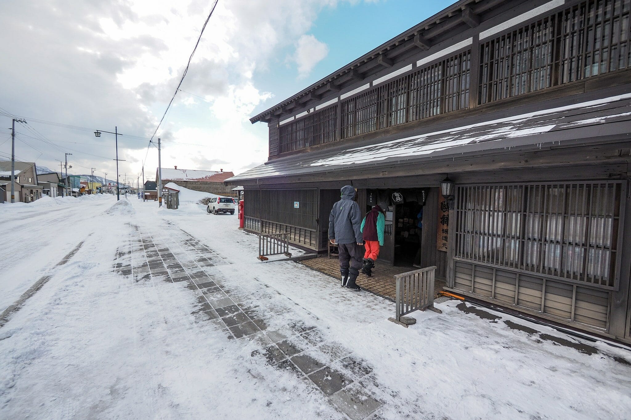
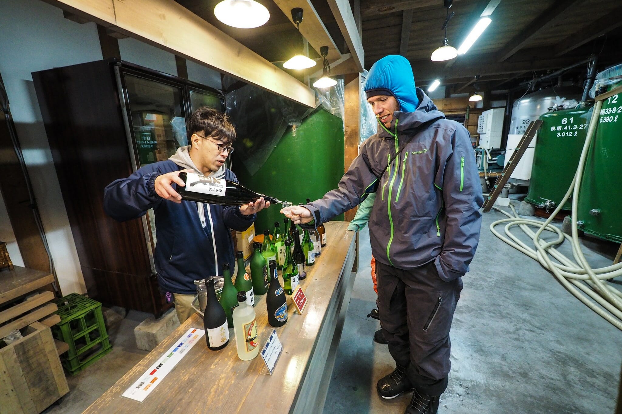
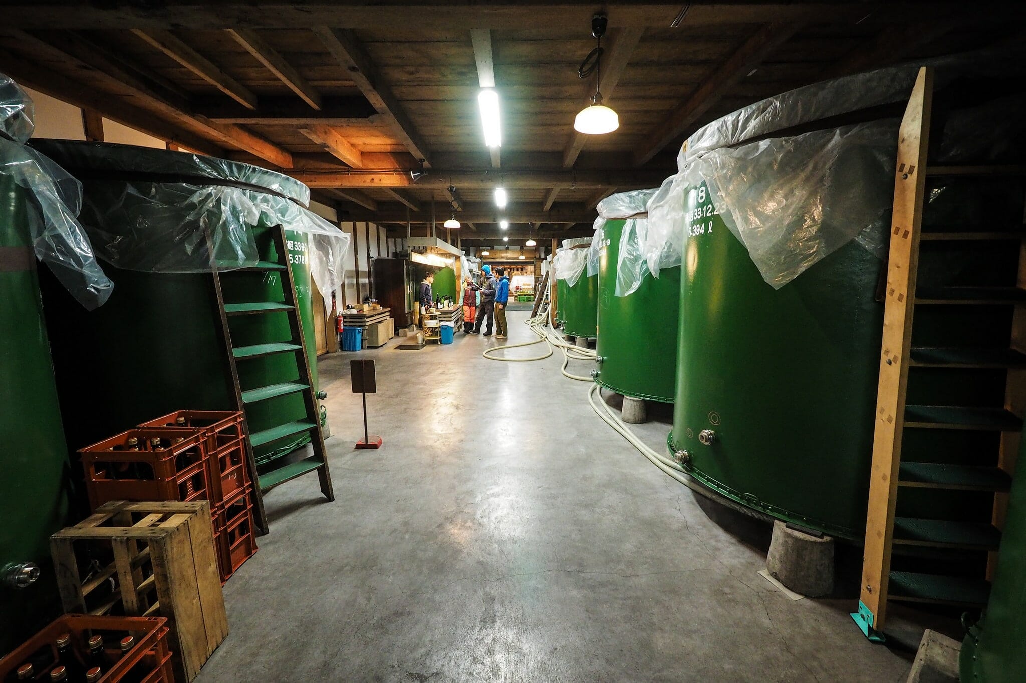
Afterwards, we had lunch at an amazing old-school sushi restaurant… And Hiro and I got terribly jealous of Hendrik and Leni as they tried a number of local sake, during our tour of Japan’s northernmost sake brewery. A massive thanks to Hendrik, Leni, and Hiro for making this such a fun trip despite (or probably because of) the blustery weather.


