Posted on May 14, 2017
74 0
N
Posted on May 14, 2017
74 0
N
8.6km

Distance

3.5 hours

Time

540m

Ascent

1153m

Highest point

5/10
Difficulty
Snow Icon | Hokkaido Wilds
Dec-Mar

Best season

This classic close-to-Sapporo route provides a unique view of the Jozankei topography. On a clear day, you'll be treated to a full-frontal view of Mt. Yotei to the northwest. We did the route in mid-May, and there was just enough snow left to make it a bit of bush-bashing fun.

Last updated Apr 2, 2021

Route Map

Need to know details

Location

This backcountry ski touring route up to the Senjaku Plateau starts and finishes in the Toyoha Mine area (here) above Jozankei Village in the western outskirts of Sapporo City.

General notes

The destination for this route is the Senjaku Plateau, but in essence it is a wide saddle between Mt. Nagao and Mt. Onuma. In any case, this is essentially the first half of the popular ski touring route up Mt. Muine that starts from the Toyoha Mine (see the alternative Muine Hut route here). It still gives excellent views of Mt. Yotei on a good day. It is one of the last areas around Sapporo that can be skied before summer kicks in. If you’re lucky you can still have some fun here up till mid-May.

Hut
None
Route details

This route it not marked.

Route Timing
Up | 2.5hrs
Down | 1hrs

Expect around 2.5 hours from trailhead to the saddle, then about 1 hour back down. If doing this route in late spring, timing will depend somewhat on how much snow is still around. In May, it is best to assume some time will be lost to removing skis to stomp through sasa.

Transport

Public transport:

There are no public transport options for this route, although note that there are buses that run to Jozankei. From there, it would be about a 30 minute taxi trip (14km).

By car:

The mine road is usually cleared in winter up to the start of the summer route up Mt. Muine, here: https://goo.gl/maps/qpFb8Z1hoBK2

Physical maps
Official Topo Map: Muineyama (無意根山) – map no. NK-54-14-15-3

NOTE: The official 1/25000 topo map(s) above can be purchased for 350yen from Kinokuniya bookstore next to Sapporo Station or online (in Japanese).

Aspect
The main aspect skiers are exposed to on the descent and/or ascent is North. Therefore, keep an eye on the weather forecast a few days ahead of your trip to monitor wind, snow, and temperature. Also, since this route is in the general vicinity of the Shiribeshi area, consider looking at the Japan Avalanche Network avalanche bulletins (updated Tuesdays, Thursdays, Saturdays at 8am) or the daily Niseko Avalanche Information website. These may give extra insight into avalanche conditions in the greater area around the route.

Snow and
route safety

Note that the route time indicated above is only to the Senjaku Plateau. Add another 3 hours if you intend to go all the way to the Mt. Muine summit.

  • Mt. Muine boasts the largest number of avalanche fatalities of any mountain in the Sapporo region (see the Hokkaido Institute of Avalanche Research and Education database map here). This is primarily due to its popularity, but also due to the steep eastward slopes and overall tight, deep run-out gullies. Make conservative decisions on high-risk days.
  • Notify the police of your backcountry plans online using Compass – instructions here.

Senjaku Plateau in Late Spring Difficulty Rating

Category

Grade

Points

Strenuousness

Vertical Gain

C

30

Time ascending

C

3

Technicality

Altitude

B

6

Hazards

C

6

Navigation

C

6

Totals

51/100

GRADES range from A (very difficult) to D (easy).  More details here. Rating rubric adapted from Hokkaido Yukiyama Guidebook 北海道雪山ガイド.

Weather forecast

Windy.com weather forecast for Senjaku Plateau
Onsen nearby

To get to the trailhead, you’ll pass through the Jozankei Onsen area. Out of the numerous onsen in this area, I’ve been to Hoheikyo Onsen (massive outdoor bath, but can be busy on weekends) and Keiryuso Hotel (smaller outdoor bath area, but not as crowded).

Extra Resources

See the write-up (in Japanese) from p. 140-141 of the Yuki-yama Guide (ISBN: 978-4894538047).

Guide Options

If you’d like to ski this route and/or explore other hills around Sapporo together with a local certified guide, get in touch with either Wataru Nara or Yasuko Kikuchi. They’re both Hokkaido born-and-bred Sapporo-based JMGA-certified guides. They both cut their teeth on peaks including those around Sapporo City and have taken part in major international expeditions. In addition, see a full list of English-speaking Hokkaido Mountain Guides Association (HMGA) guides on the HMGA website here

Support us

Like this content? Buy the HokkaidoWilds.org team a coffee. 50% of tips go to the Hokkaido Wilds Foundation.

Show Full Route Notes Close Route Notes

Route Trip Notes

Route blurb from the Hokkaido Yukiyama Guide (2015), p. 140 (translated by Hokkaido Wilds)

Mt. Muine is a platform-shaped mountain that can be seen southwest from Sapporo City’s Ishiyama suburbs. It is Sapporo City’s second-highest mountain after Mt. Yoichi. From Senjaku Plateau to the summit of Mt. Muine is a long, flat, easy-to-lose-one’s way ridge. During unstable weather in mid-winter, that part of the route demands some serious mountaineering skills. The Senjaku Plateau, however, can be accessed even in bad weather and can be very satisfying, so this part of the route is worthy of its own route guide.


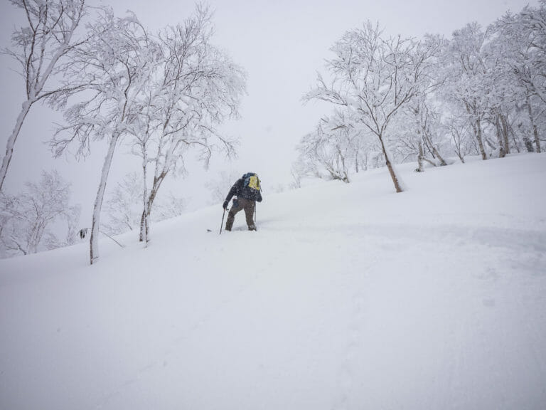
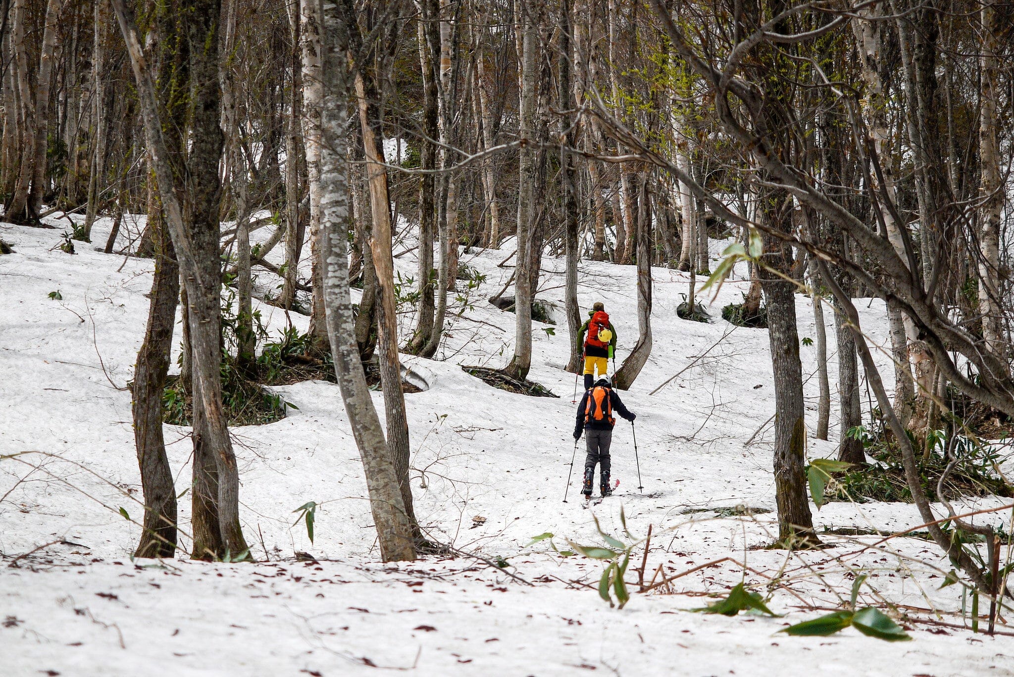
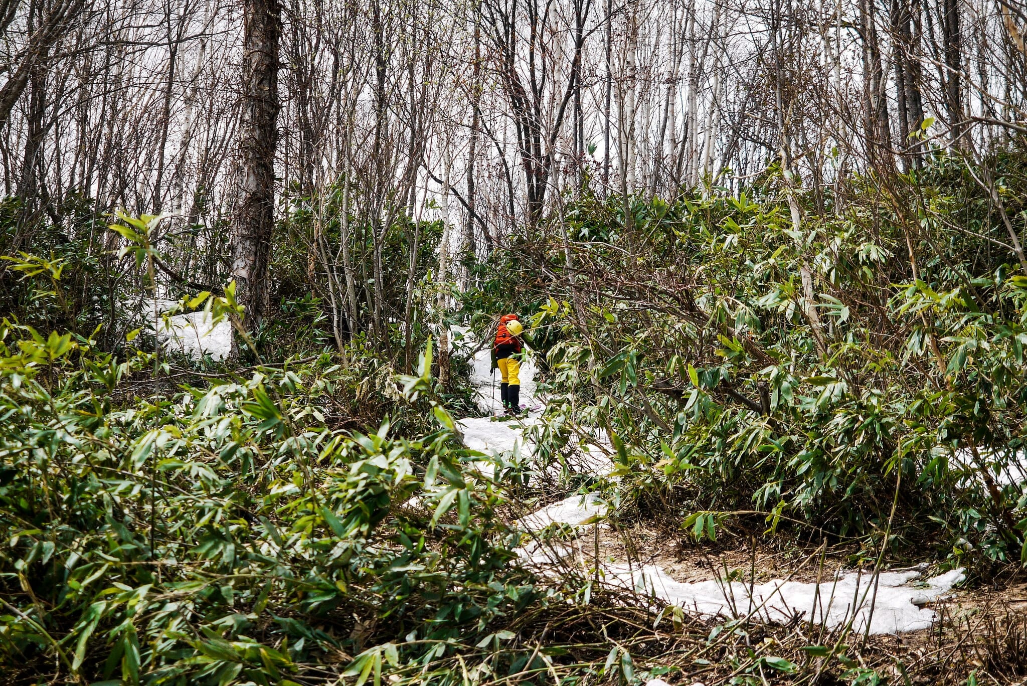
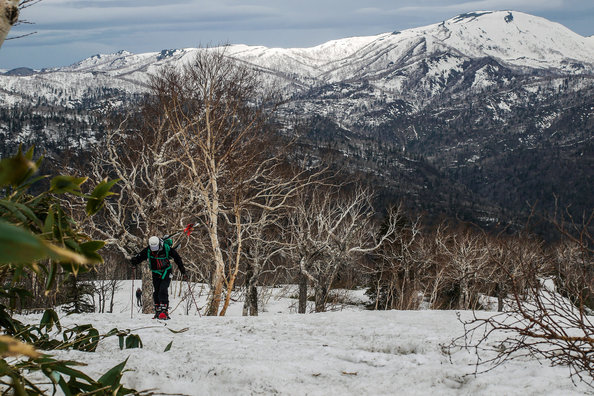
A back-country ski trip in mid-May, 30 minutes drive from central Sapporo. I didn’t really consider it possible until a guy from my workplace outdoor club suggested we check Mt. Muine out. A week later, we were skinning from the trailhead on the last wisps of snow left on the forestry-road approach, and threading our way along labyrinth-puzzle tracts of snow that weaved through towering sasa bamboo.

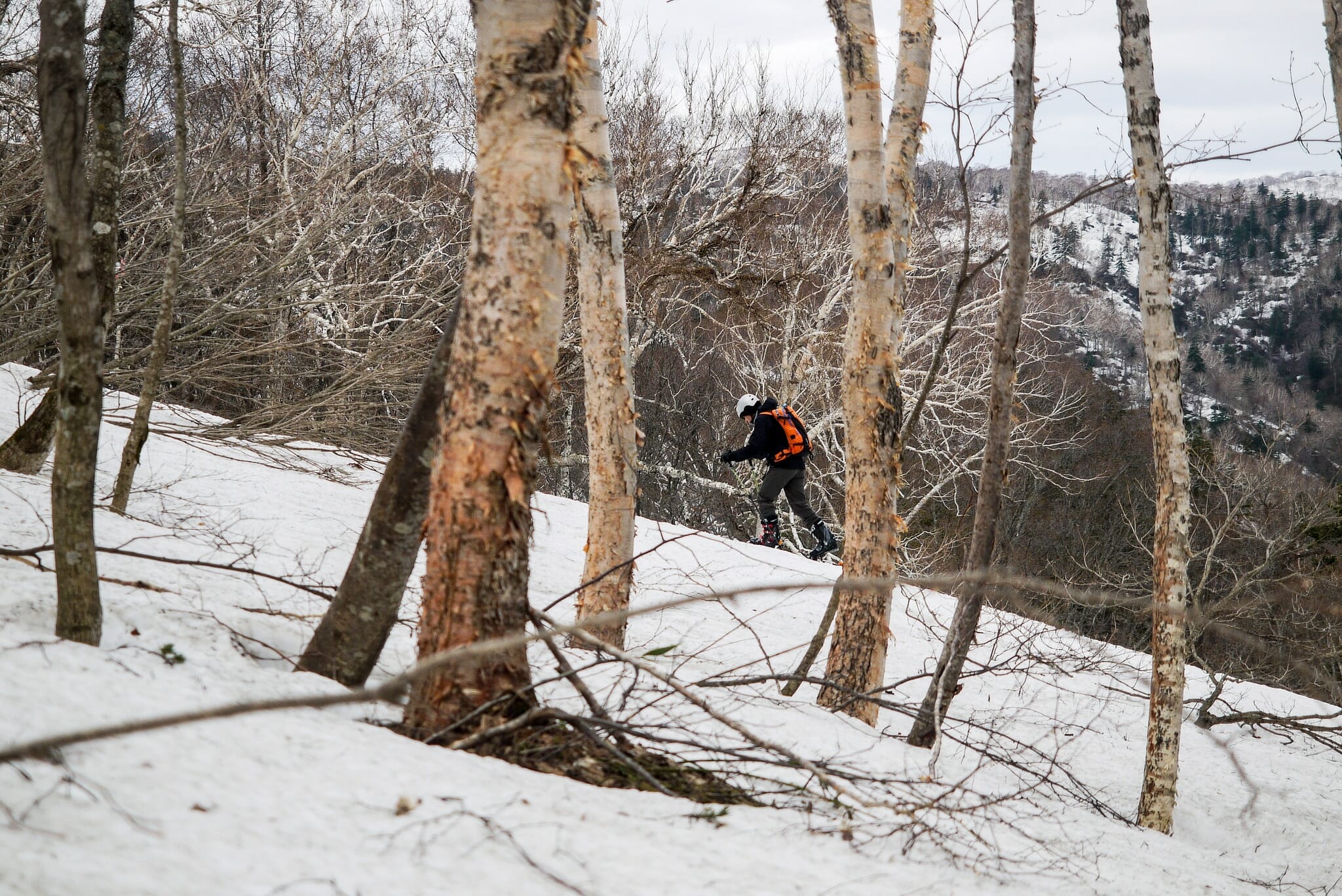
Before long, the snow was thick enough to cover most of the sasa bamboo, and it was relatively easy going. Flaky-barked trees dot the hillside as the route climbs out of the gullies. Before making the final half-hour push to the plateau, we stopped at around 920m for lunch. We dug seats and a table in the snow, and the ultra-prepared Prof. Tsunoda got his jetboils cranking. Boiled sausages were quite the treat, as were toasted marshmallows.

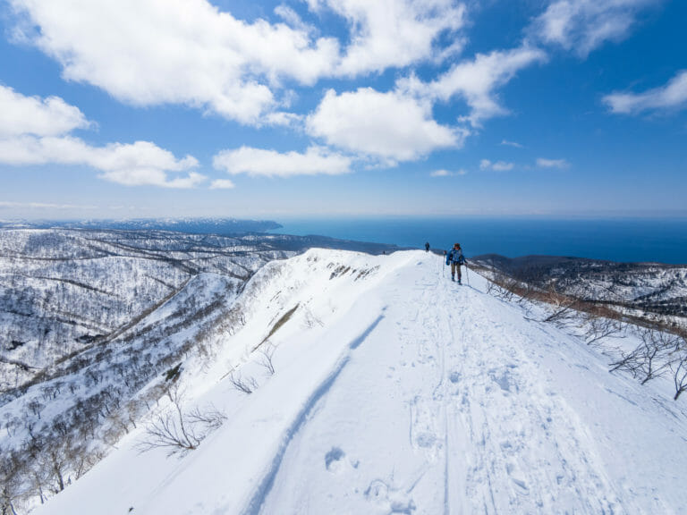
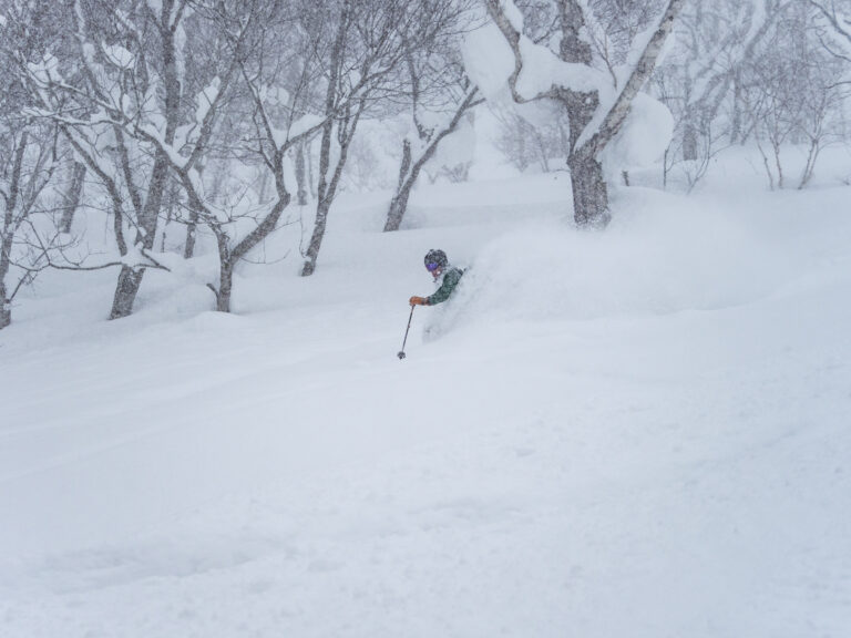
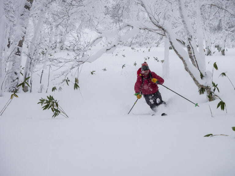
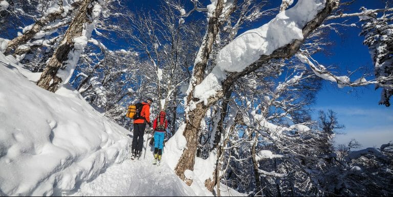
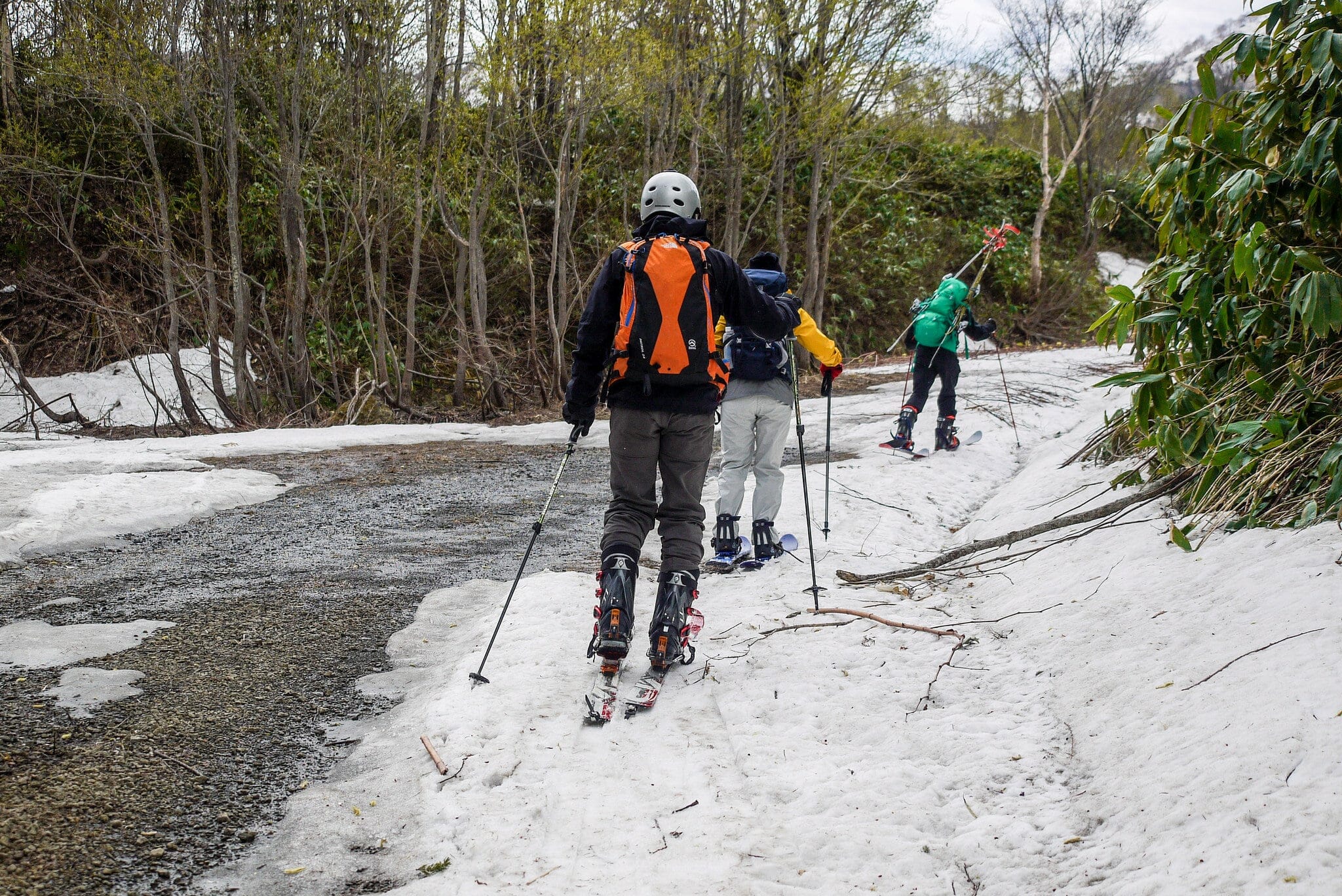
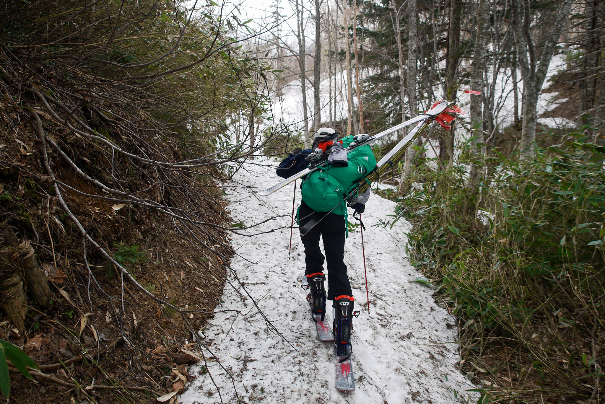
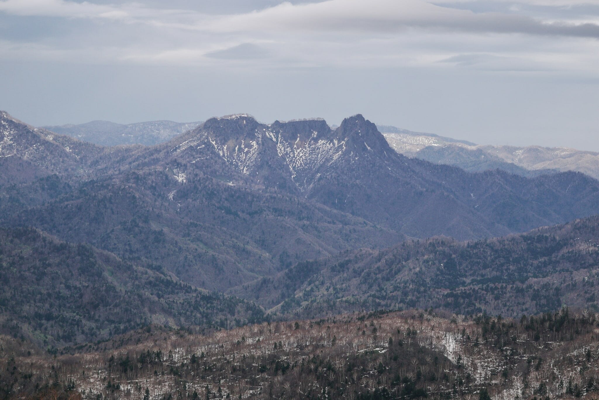
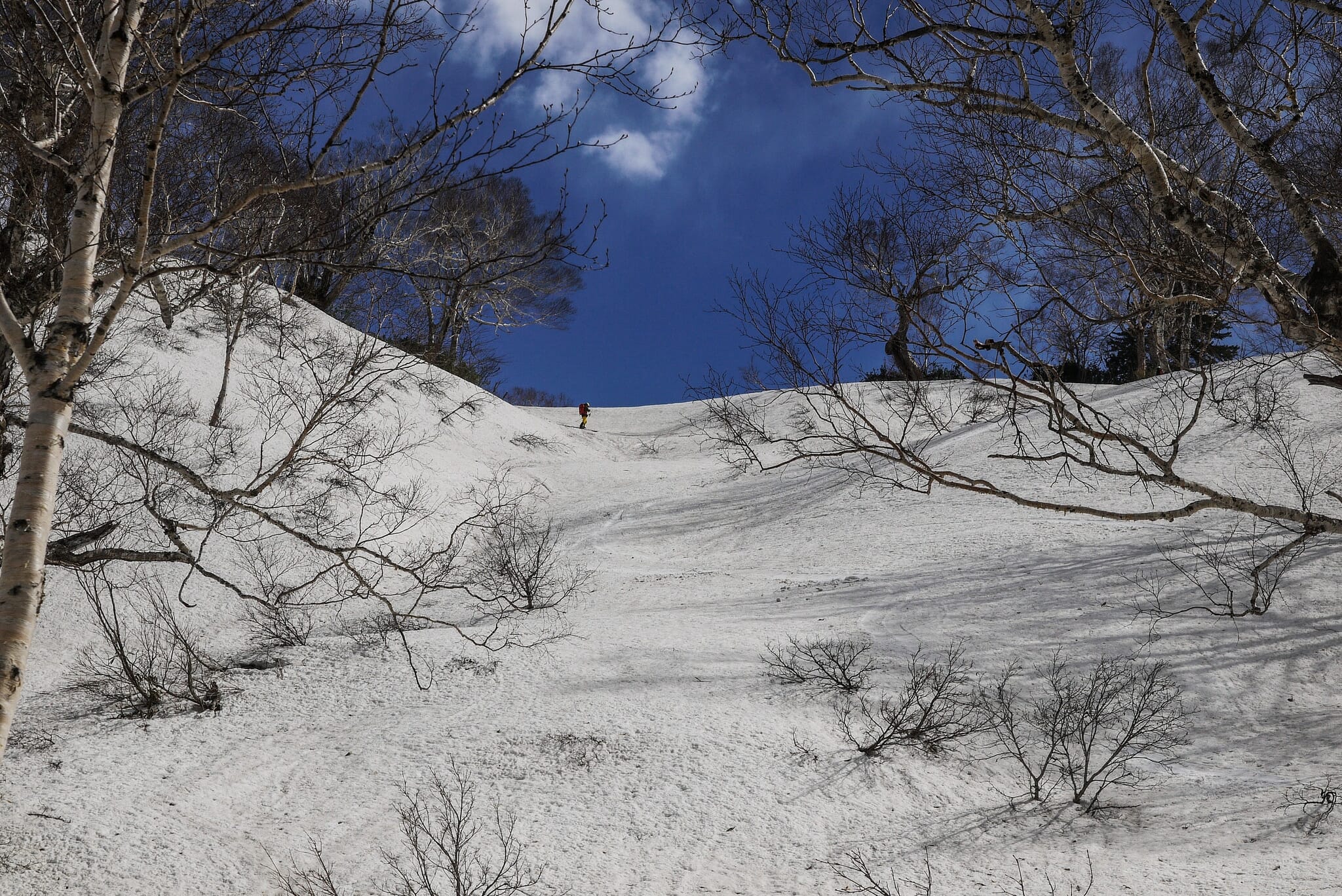
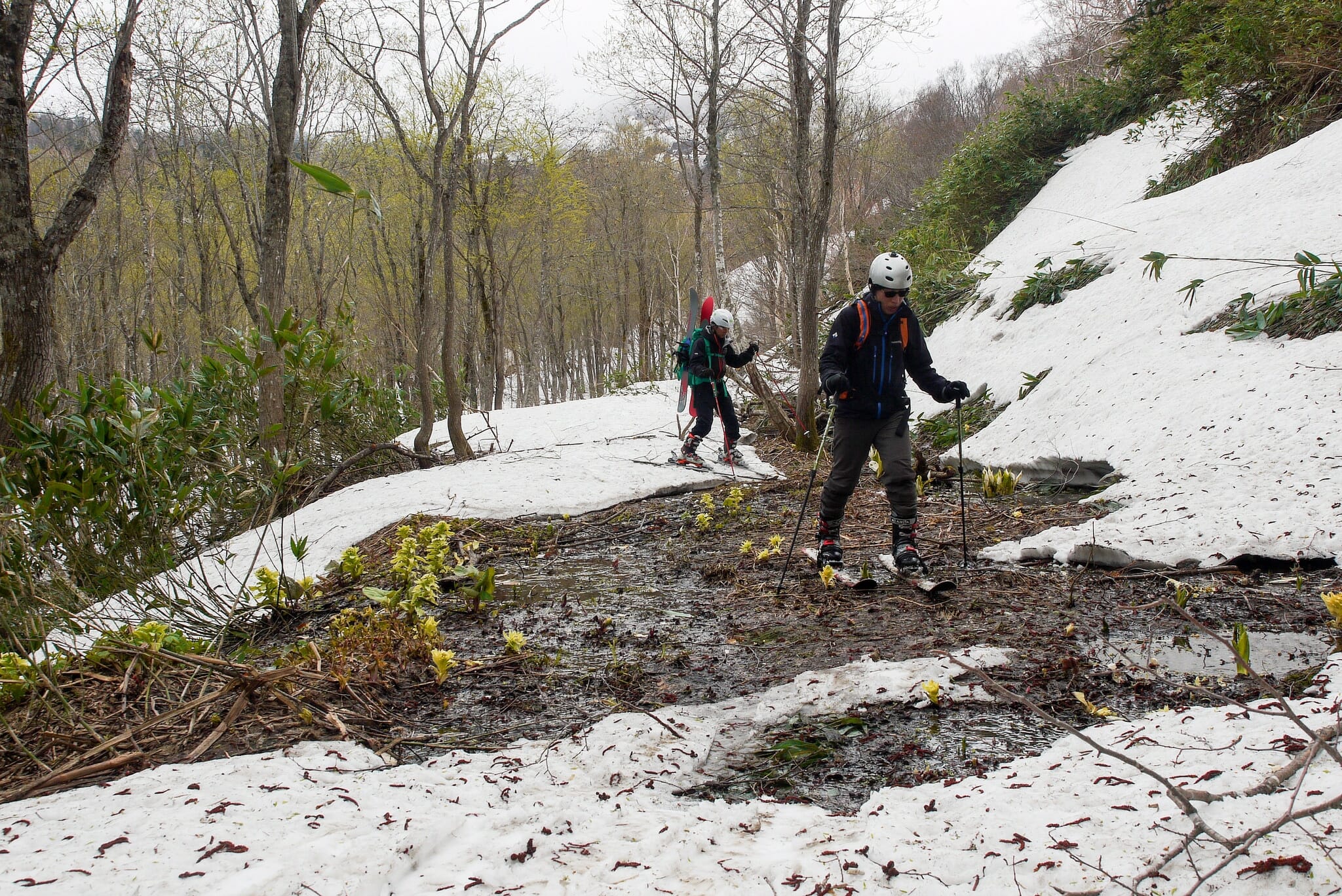
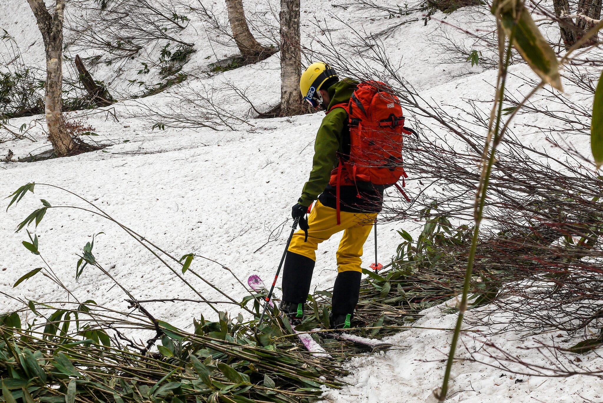
The final push up to the plateau is punctuated by a steep “step” up, which requires some patient kick-turn-traversing. After that, it is plain sailing, along a wide ridge to the top. Expansive 360 degree views await. Strong winds for us on this day too. From the plateau we took a different ridge back down, slightly to the south of the ridge we were on on the way up. A large bowl at the upper reaches allowed some well-earned turns before we started picking our way across undergrowth. Considering how late we were in the season, we were quite happy with only having to walk about 20 minutes from the last bits of snow to the cars. A thoroughly enjoyable last hurrah of the season.

Comments | Queries | Reports

Done this route to Senjaku Plateau, or others nearby? Thinking of doing it? Please post any feedback, reports, or queries here. Thanks!

Leave a Reply

Your email address will not be published. Required fields are marked *

This site uses Akismet to reduce spam. Learn how your comment data is processed.

See More Like this

Printable Senjaku Plateau Topomap

TOPO DOWNLOAD (PDF, 20.2MB)

Download may take some time

Hokkaido Wilds Foundation

We’ve got affiliate links on HokkaidoWilds.org to help fund the Hokkaido Wilds foundation.

The Foundation gets a small commission on sales from affiliate links, but we only link to stuff we think is worth checking out for people keen on the outdoors in Hokkaido and Japan.

The Hokkaido Wilds Foundation is a fund where 100% of funds are donated to Hokkaido volunteer groups involved in sustainable, safe, and responsible access to the Hokkaido outdoors.

Learn more here

ADVANCED FILTERS

Filter by location

About Filters

REGION: The general mountain/geographical region the route is in.

BEST MONTH(S): Time of year a route is suited to visiting. Some pop all season, some are more limited.

DIFFICULTY: How strenuous a route is, and how technical it is. Full details here.

FREERIDE/SKITOUR: Very subjective, but is a route more-of-a-walk-than-a-ski or the other way around? Some routes are all about the screaming downhill (freeride), some are more about the hunt for a peak or nice forest (ski-tour). Some are in between. 

MAIN ASPECT: Which cardinal direction the primary consequential slope is facing, that you might encounter on the route. More details here.

ROUTE TAGS: An eclectic picking of other categories that routes might belong to.

SEARCH BY LOCATION: You can find routes near your current location – just click on the crosshairs (). You may need to give permission to HokkaidoWilds.org to know your GPS location (don’t worry, we won’t track you). Or, type in a destination, such as Niseko or Sapporo or Asahikawa etc.

Please let us know how we can make it easier to narrow down your search. Contact Rob at rob@hokkaidowilds.org with your suggestions.

Senjaku Plateau in Late Spring Difficulty Rating

Category

Grade

Points

Strenuousness

Vertical Gain

C

30

Time ascending

C

3

Technicality

Altitude

B

6

Hazards

C

6

Navigation

C

6

Totals

51/100

GRADES range from A (very difficult) to D (easy). Hazards include exposure to avalanche and fall risk. More details here. Rating rubric adapted from Hokkaido Yukiyama Guidebook 北海道雪山ガイド.