


When I was flicking through one of the early issues of the Stuben Magazine recently, I came across an entire article devoted to the chain of huts the dot the hills west of Sapporo City. Akihito Tachimoto writes:
“Did you know that around 90 years ago, 20 mountain huts were constructed in and around Sapporo City? Ten of them still remain. Almost all of these huts are still in use, still accessible to the general public when going through the right channels…It was around the time of the dawn of skiing culture within Japan, when a number of individuals conceived the idea to construct a hütten kette (chain of huts) in the Jozankei area. They wanted to facilitate social interaction, broaden awareness of ski touring and encourage mountain hut use among students and Sapporo citizens. They were Hokkaido University’s Prof. Seishichi Oono and Prof. Haruo Yamazaki, German instructor Dr. Arnold Gubler, and Swiss architect Max Hinder, among others. Together with Hokkaido University students, they made the idea a reality.” Stuben: Our Snow Culture, p. 35 (translated from the original Japanese).
Doing some more digging, I came across a 2006 publication by Hokkaido University, detailing the history of mountain huts the university had been involved in setting up. Called “The Mountain Huts of Hokkaido University” (in Japanese, download the official PDF version here or here), this 90-odd page book goes into fascinating detail about historical ski routes and the huts west of Sapporo. Case in point is the 1930’s era ski route map below.
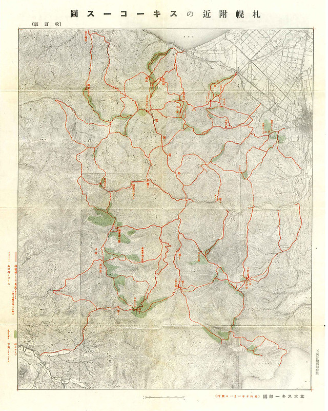
Looking at the map above, there are any number of options for ski tours west of Sapporo. The green-shaded areas are ‘good slopes’ for skiing. The solid red lines are main ski routes. The dashed lines are secondary routes. Well before I came across this 1930’s map, I had wanted to join up the common Okuteine Hut and Ginreiso Hut routes. They are both huts that sit at the bottom of some short but magnificently fun ski runs, so a leisurely three-day tour, allowing time to do a few laps of the ski runs behind the huts, was very appealing.
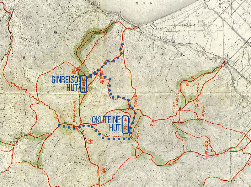
In the end, we would end up essentially following the route in blue below, starting at the west end at Sapporo Kokusai Ski Area, and ending on the coast at Zenibako JR station (see the route in GPS-track form here – slightly different to the route below, but close enough).
Looking at the map above, there are any number of options for ski tours west of Sapporo. The green-shaded areas are ‘good slopes’ for skiing. The solid red lines are main ski routes. The dashed lines are secondary routes. Well before I came across this 1930’s map, I had wanted to join up the common Okuteine Hut and Ginreiso Hut routes. They are both huts that sit at the bottom of some short but magnificently fun ski runs, so a leisurely three-day tour, allowing time to do a few laps of the ski runs behind the huts, was very appealing.
In the end, we would end up essentially following the route in blue, starting at the west end at Sapporo Kokusai Ski Area, and ending on the coast at Zenibako JR station (see the route in GPS-track form here – slightly different to the route in the old maps, but close enough).
Day 1 – Sapporo Kokusai Ski Area to Okuteine Hut (Yama-no-Ie) (11km)
Our actual Day 1 route/tracklog: https://ridewithgps.com/trips/13373833
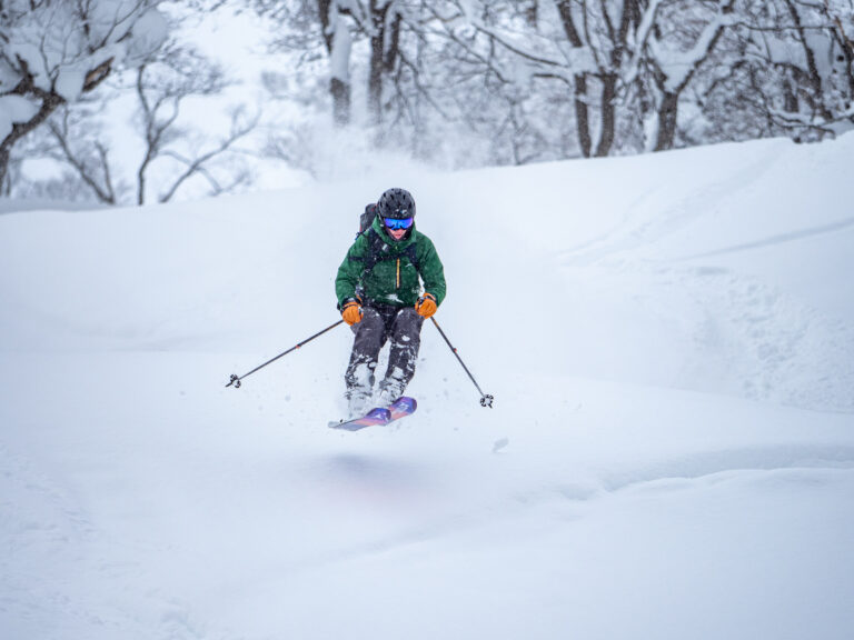
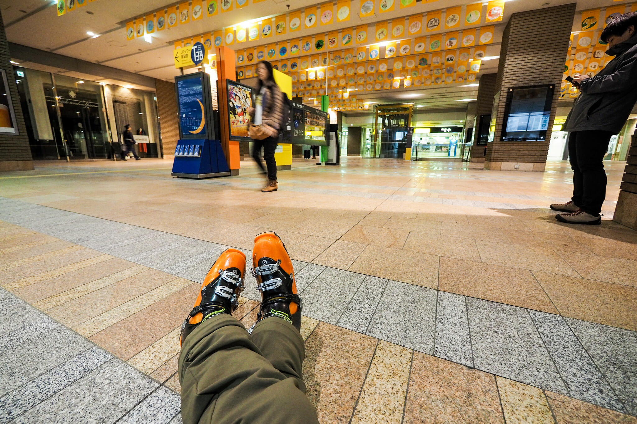
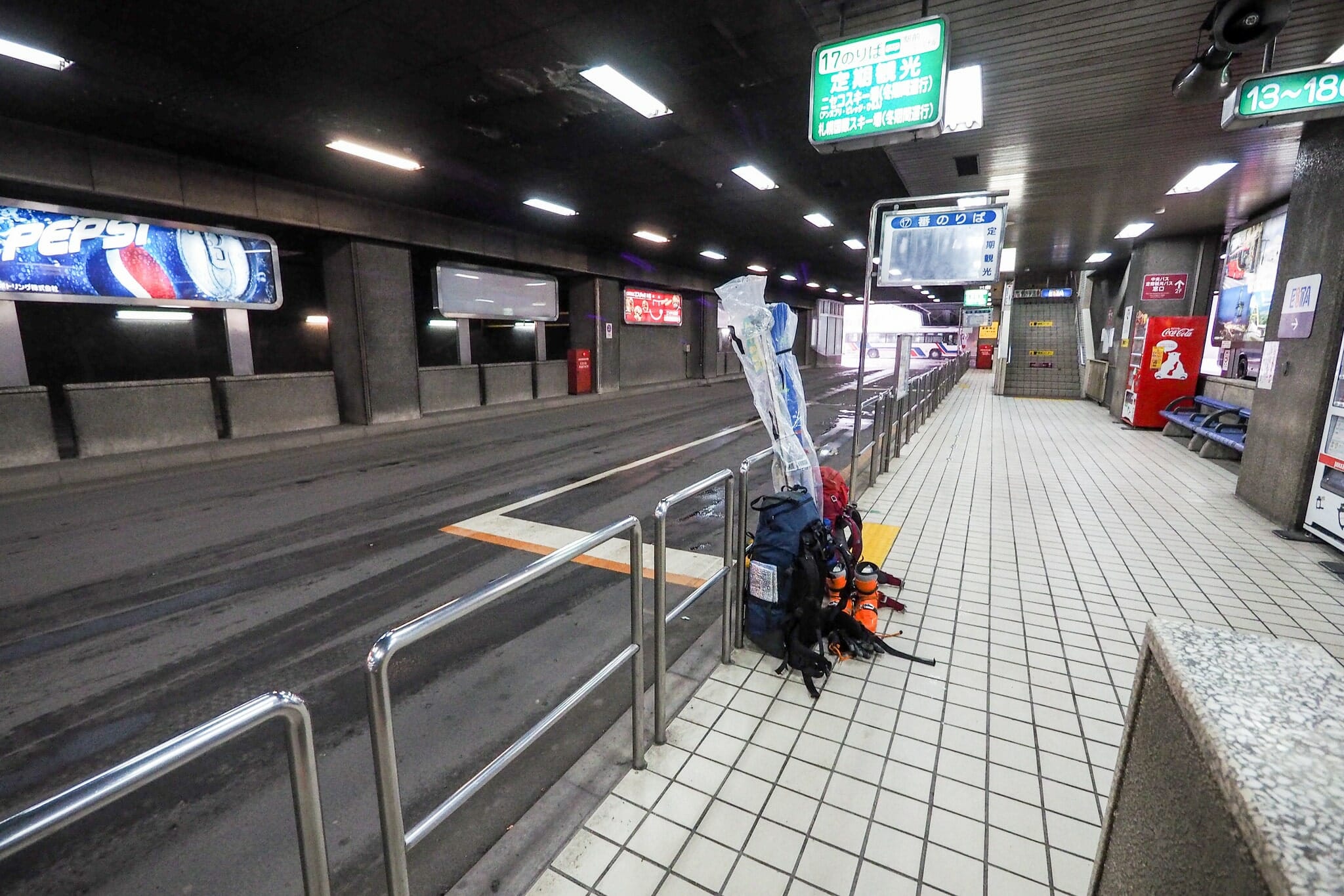
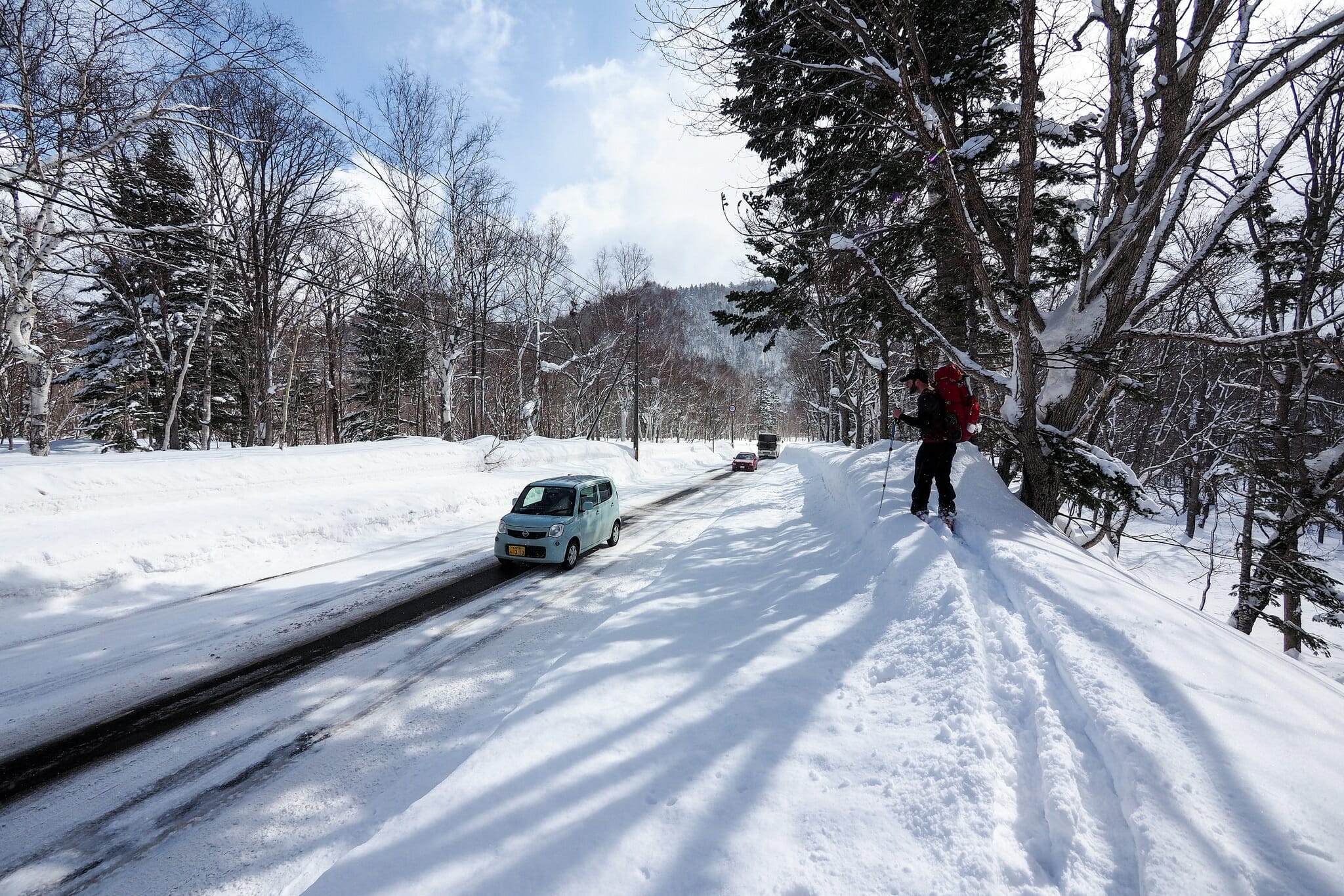
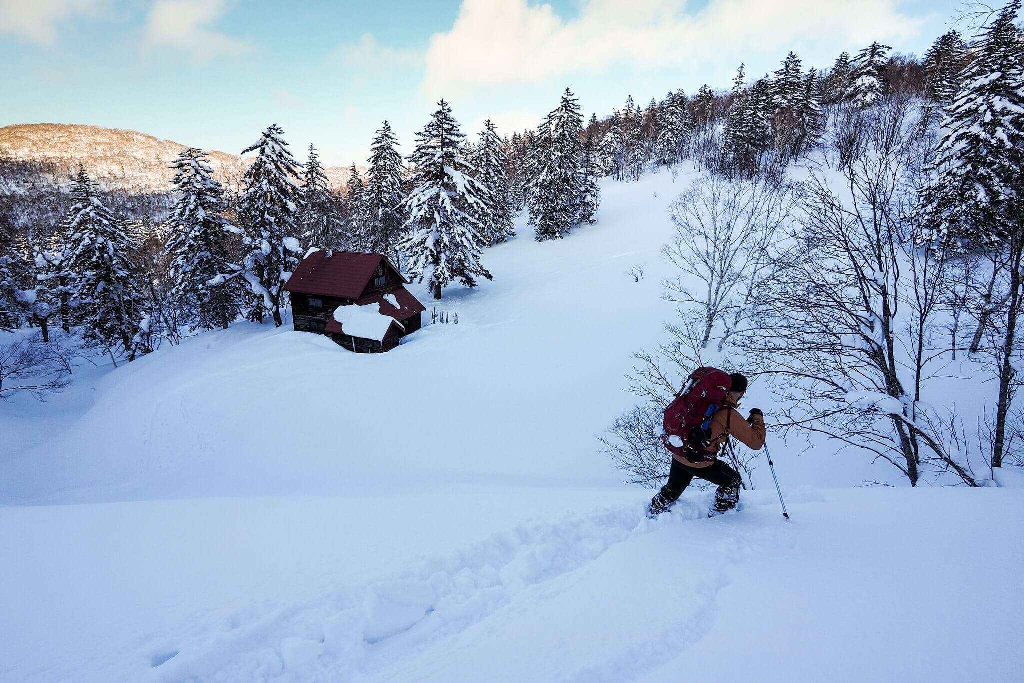
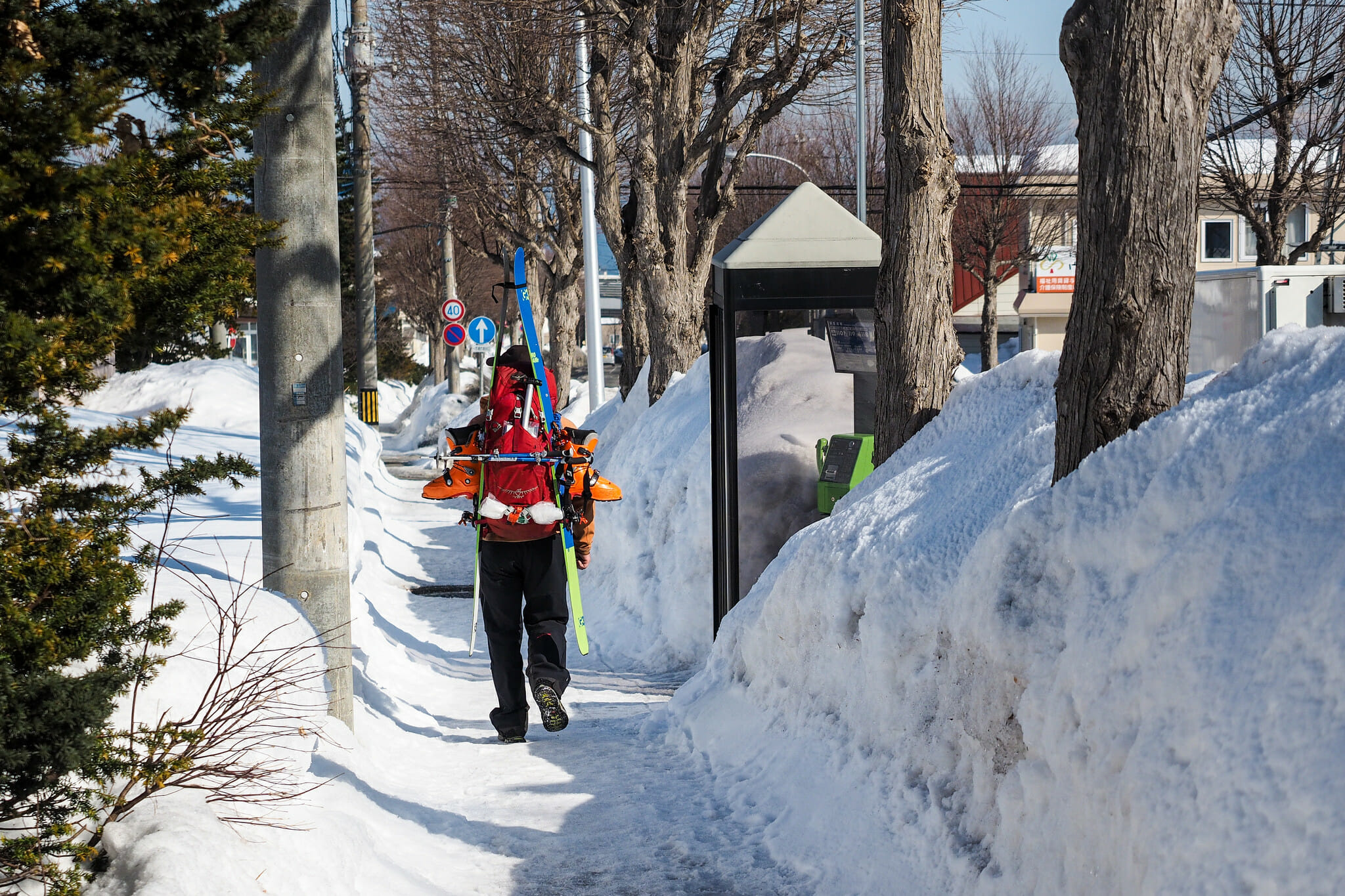
Andy and I met up at Sapporo Station at 6:50am on Saturday morning, keen to be first in line for the bus to Sapporo Kokusai Ski Area. The bus was advertised as leaving at 7:10am, and would take over an hour to get to the ski area. This all went smoothly, apart from one small catch – I opted to wear my ski boots rather than taking spare shoes, and found out upon boarding the bus that you’re not allowed on the bus wearing ski boots. “You may slip over,” was the reasoning. This was not a major issue, as I could remove my inner boots and wear those on the bus.
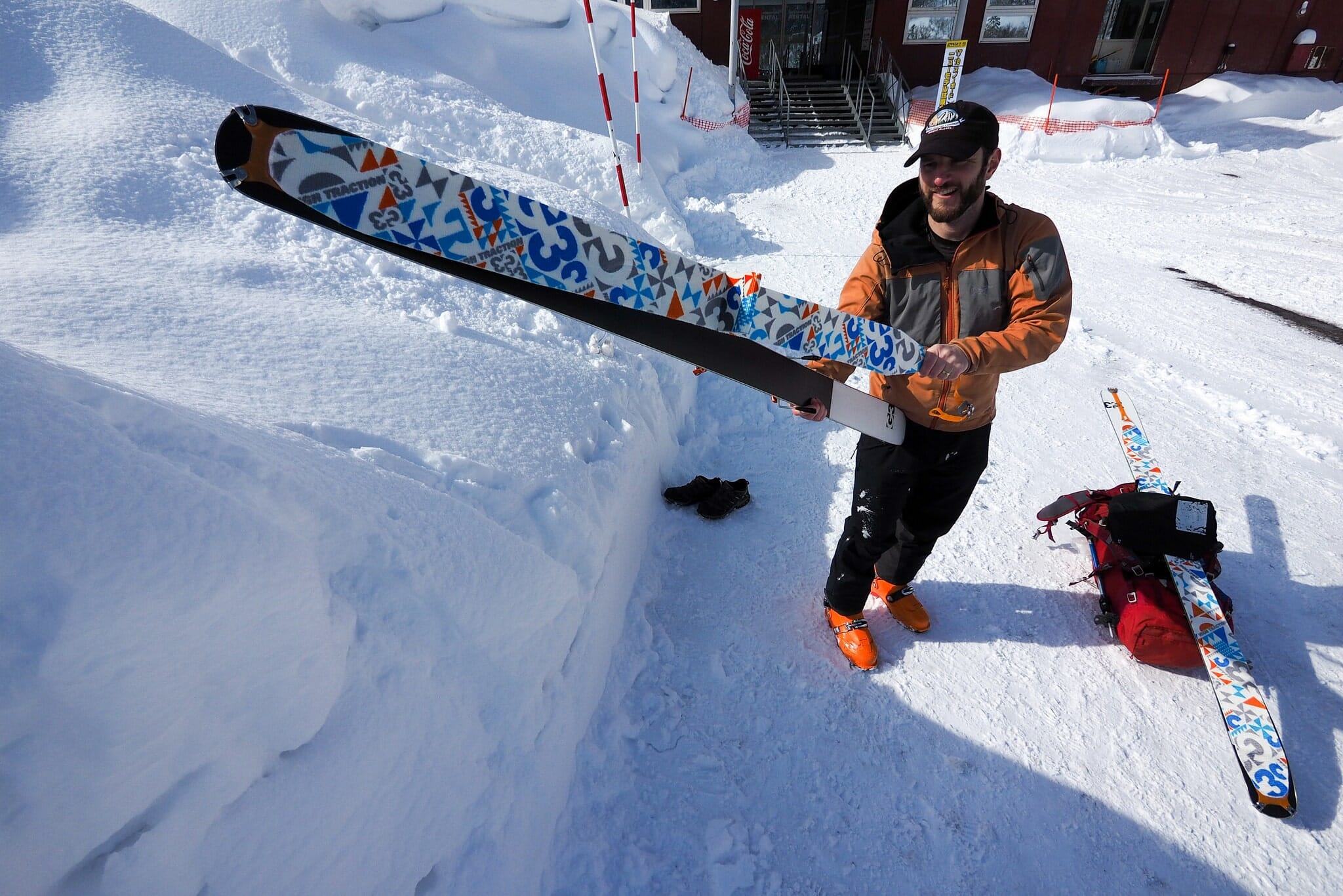
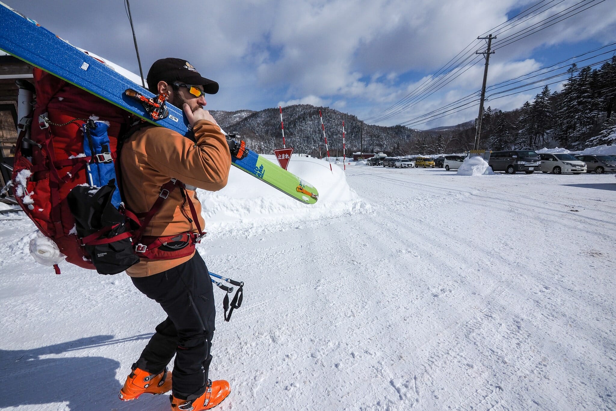
It was a relatively uneventful bus ride, and by around 9:00am we were gearing up in the ski area parking lot, with skins on right at the bus stop we’d been dropped off at.
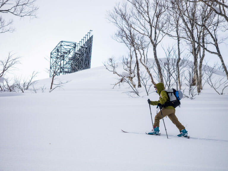
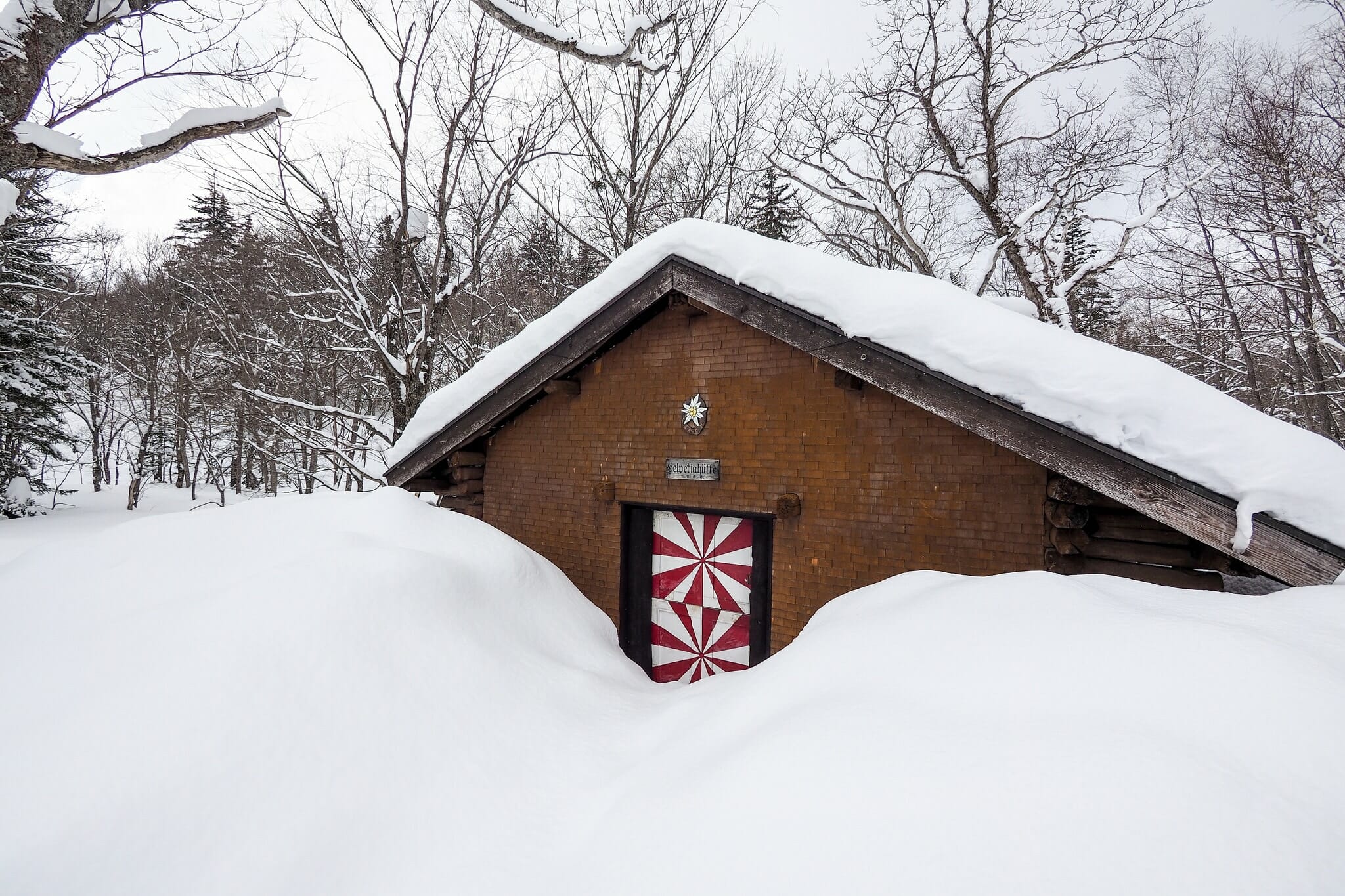
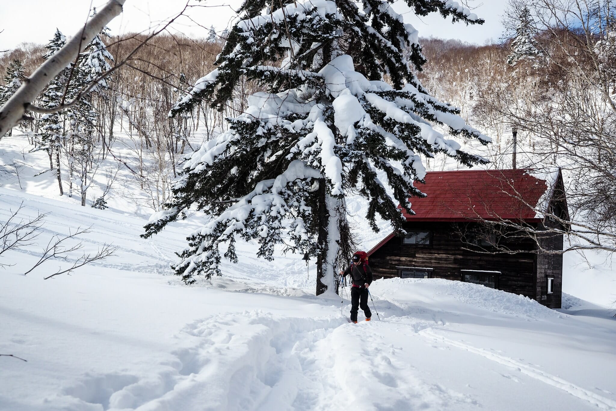
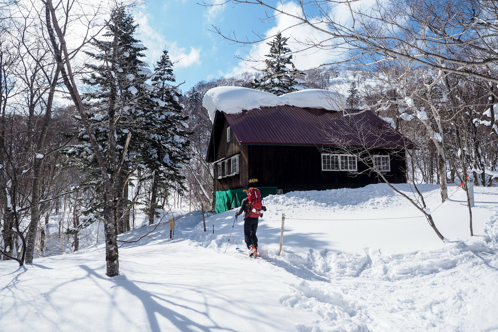
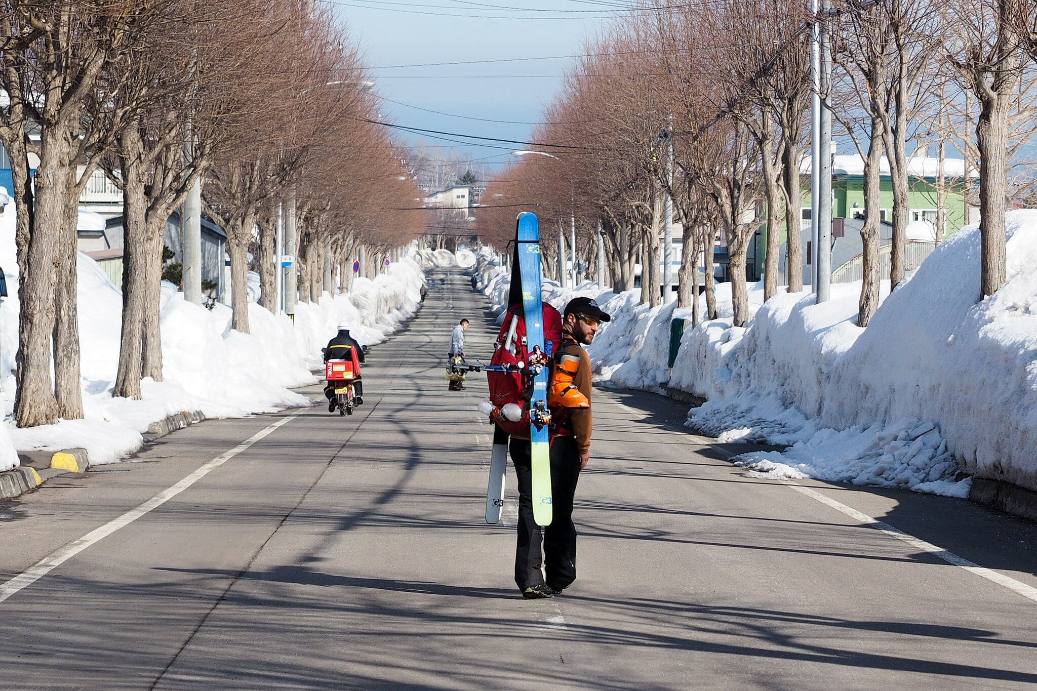
From the ski area carpark, it is a 2.7km flat-ish skin to the Okuteine trail. On the way, you’ll pass the historic Helvetia Hutte, still owned and maintained by Hokkaido University. It was one of the first mountain huts built by Hokkaido University. Designed by Swiss architect Max Hinder this hut was built on the 13th of September 1927 – or, at least the original hut was. The old hut was demolished, with the current hut, an exact replica, built in 1985. The hut is locked, so to use it you’ll need to talk to Hokkaido University (see the Okuteine Hut info for contact details). You’ll also likely get some strange looks from passing cars along the way.
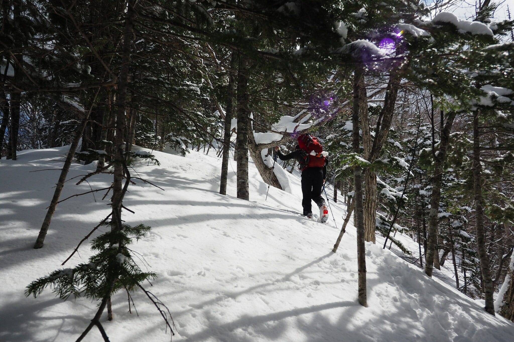
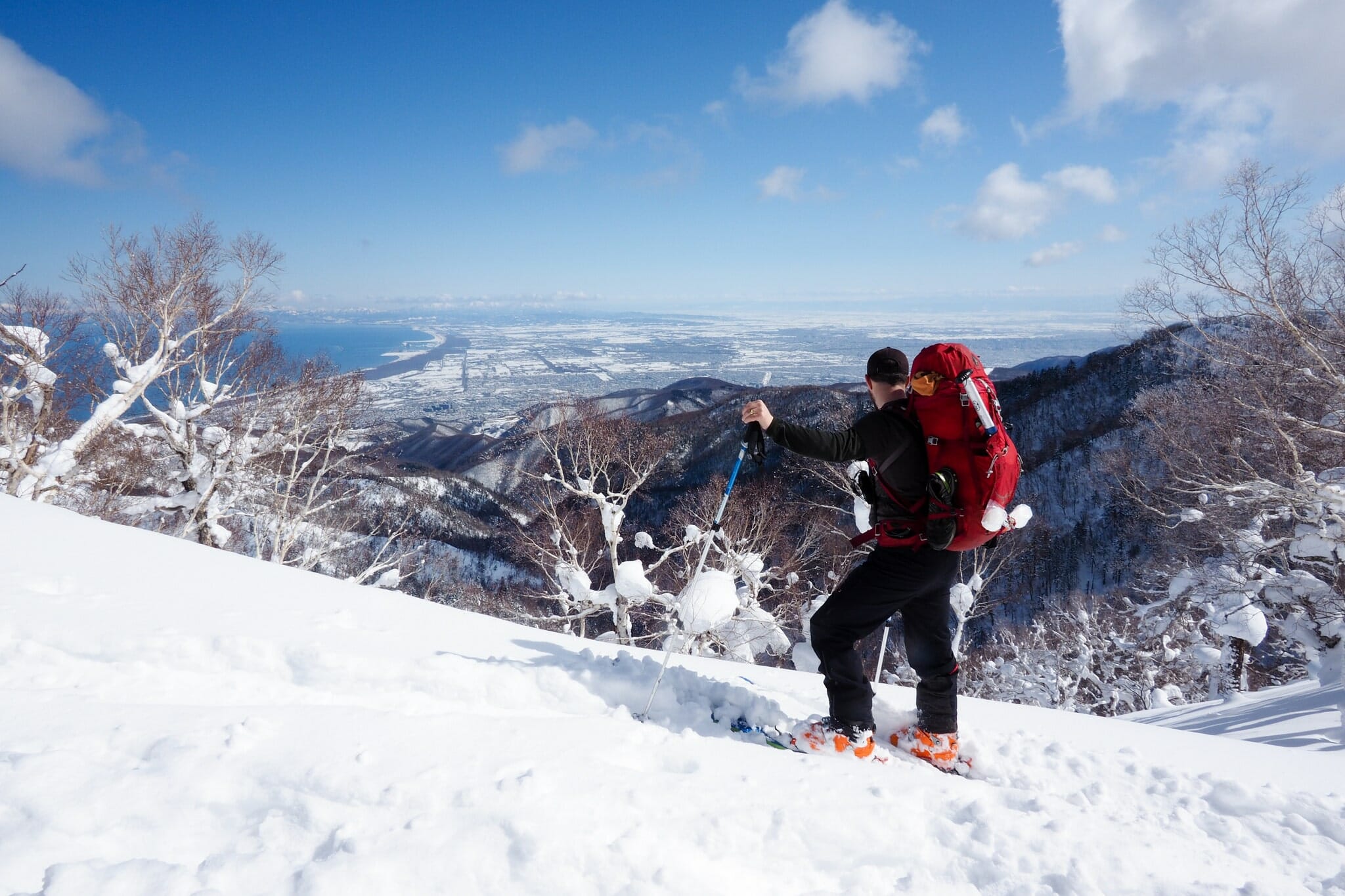
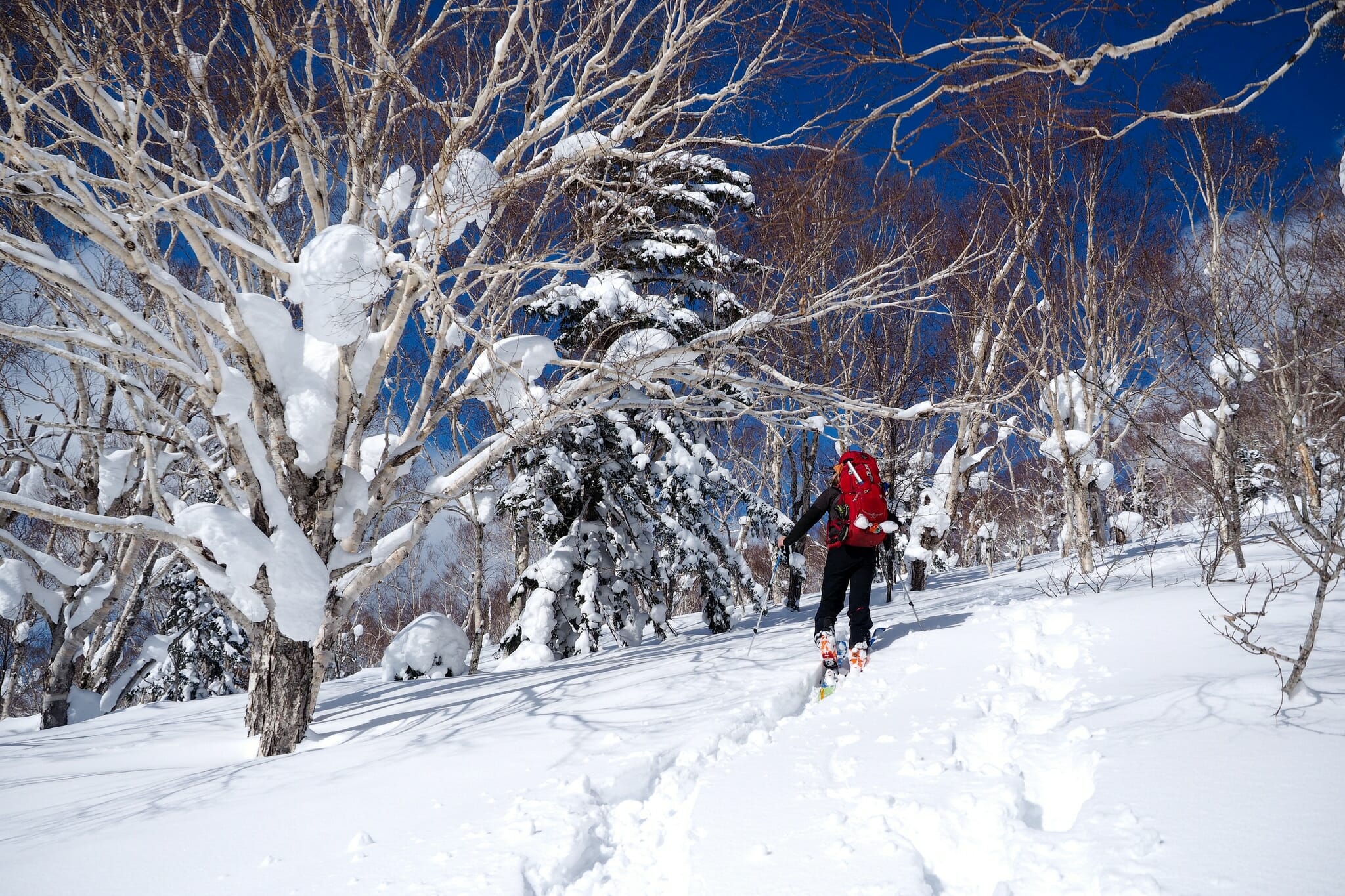
Once on the Okuteine Route proper, you’ll want to either follow the summer route along the valley floor all the way to the hut, or if the weather is good, head up to Mt. Tsuge and approach the hut from the top ridge. The Mt. Tsuge ridge has jaw-droppingly good views across the mountains of Jozankei, so this is by far the recommended route. After the 730m mark on the way up Mt. Tsuge the ridge gets very compact and you’ll be picking a cramped line through closely-spaced trees.
This keeps things interesting, however, and makes the broad summit ridge all the more pleasant. The view looks to the west towards the majestic, fortress-like Mt. Tengu (1,144m). The route meanders up and down a few times before finally arriving at the top of the “Utopia Piste” – a clearcut section of forest that descends sharply down to the hut. Enjoy this run – Prince Chichibu did in 1928, according to the official record.
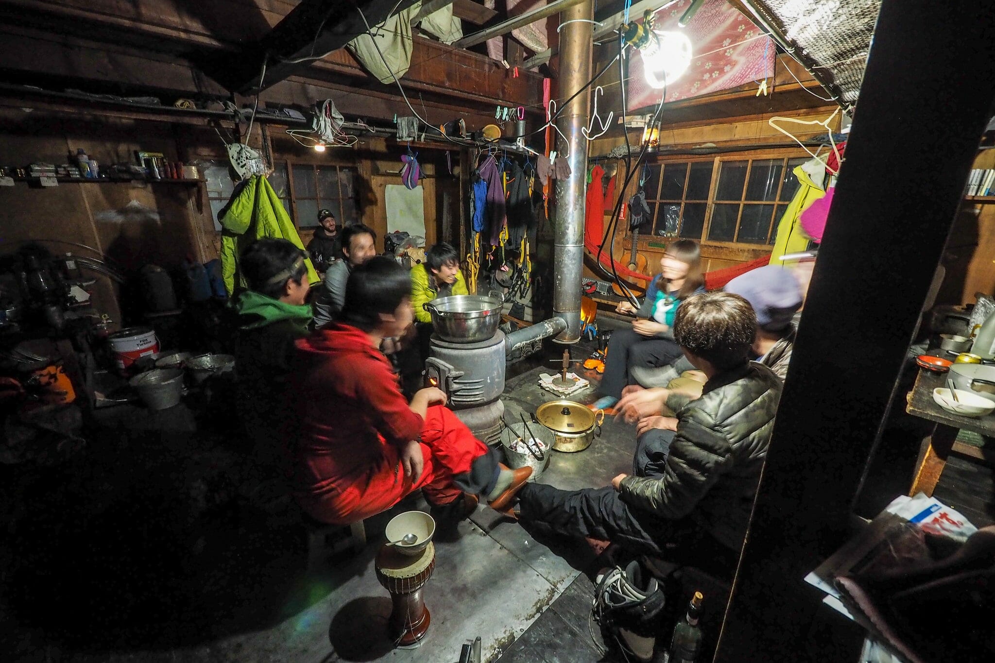
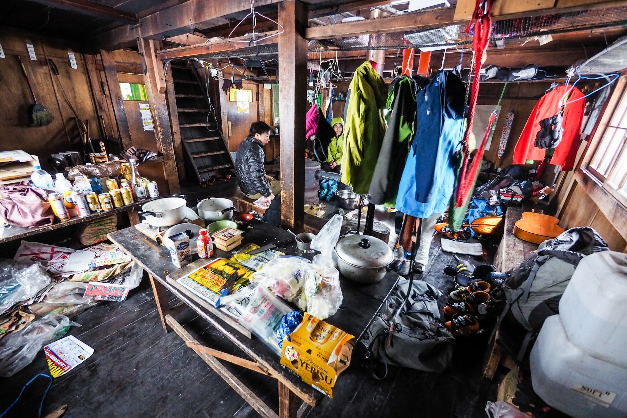
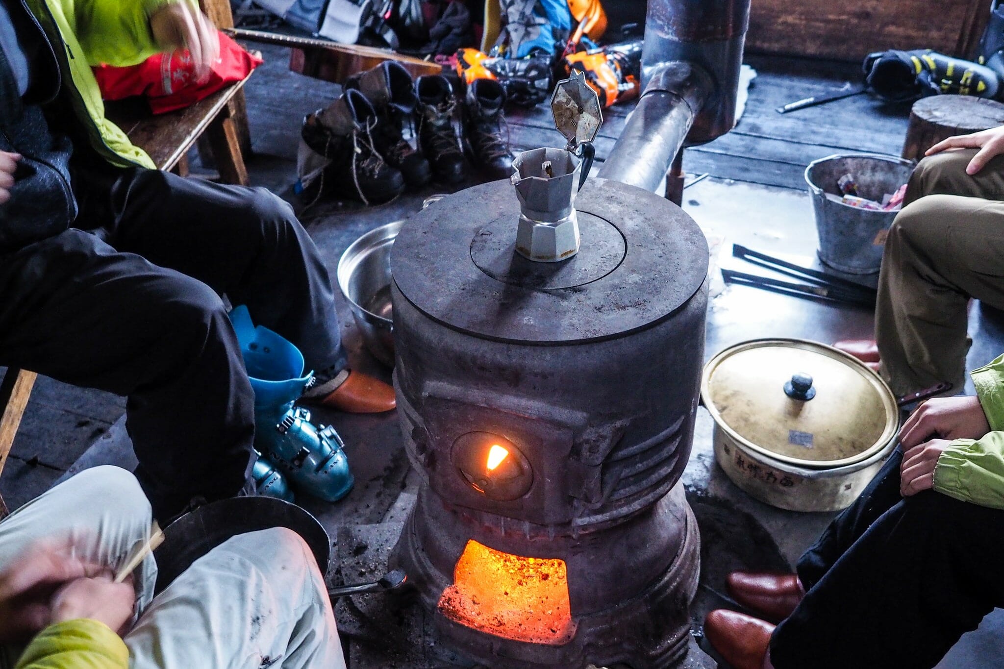
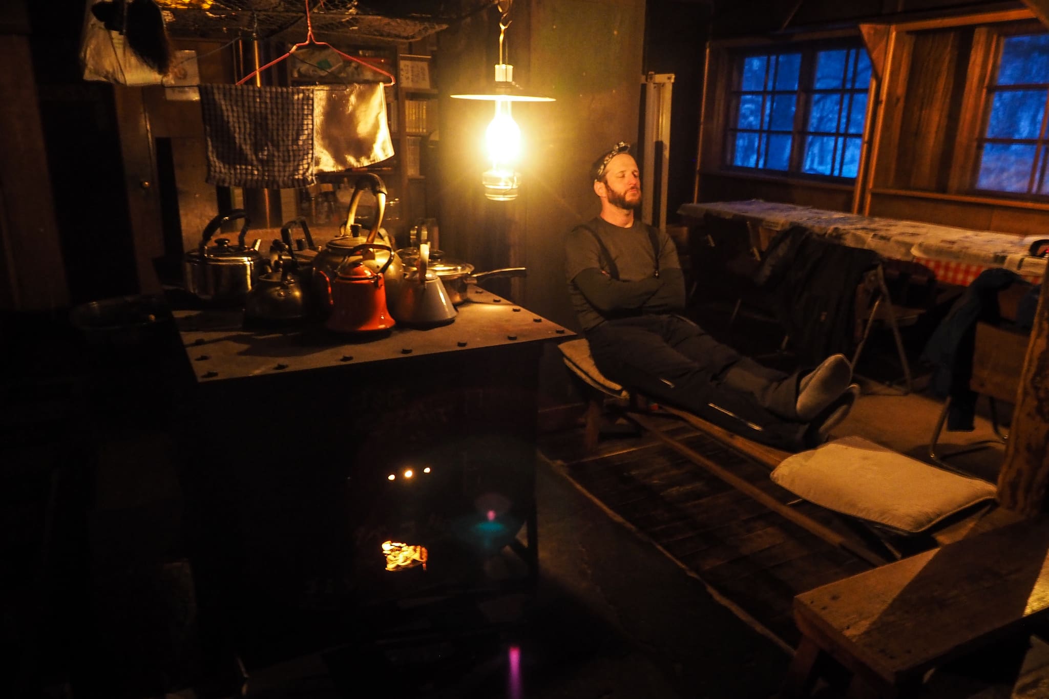
When we arrived at the hut, there was a group of Hokkaido University students from the Wandervogel Club – a university club that manages the hut. They’d already got the coal stove fired up, so the hut was already warm (see my Okuteine Hut page for hints on how to light the coal stove). The hut was as I remembered from last time I stayed there: a mess. The interior of the hut – parts of kerosene lantern and pots and cookers strewn over the tables – instantly tells you the hut is managed by a rag-tag club made up of undergraduates. But not only does this give the hut a homely feel, it speaks to the deep history the hut has with Hokkaido university students.
According to the 2006 booklet produced by Hokkaido University, the hut was built in 1930 partly in response to the mass popularity of skiing in pre-war Japan, and partly due to the Sapporo Railway Department wanting to boost profits.
“In January 1930, the Sapporo branch of the then Japan Railway Department was seeking ways to increase income revenues. One of the ideas was to build facilities for ski tourists, somewhere close enough to a railway such that they’d use the railway to get to the ski facility and away. On the 27th of January, the Railway Department held a get-together for skiers in the region, in order to gather opinions on what they might do. It was here that the president of the Hokkaido University Ski Club, Prof. Seichichi Oono suggested a hut at either Utopia or Zenibako Pass. He was keen to see one more hut be constructed so that the Paradise Hut (next to Mt. Teine) and Helvetia Hut might be more practically linked. If this idea was realized, then it would be likely that many hut users would get off the train at Zenibako Station, and this would add to the coffers of the Sapporo Railway Department. Since Utopia was known then as one of the larger ski slopes in Hokkaido andhad the marked distinction of having had Prince Chichibu ski there in 1928, this area was chosen for the hut.” Paraphrased from Mountain Huts of Hokkaido University (PDF), p. 39-43.
Day 2 – Okuteine Hut to Ginreiso Hut (11km)
Our actual Day 2 route/tracklog: https://ridewithgps.com/trips/13373834
The students staying in the hut with us last night were actually graduated members of the club, staying in the hut one last time before they went their separate ways to graduate school and new jobs. This was their farewell from a hut they’d grown to love over their 4 years as undergrads. What better way to celebrate this farewell than to sing acapella karaoke until 2am in the morning. Thankfully I had earplugs, and was sleeping on the third floor – just far enough away to reduce the frivolities to a loud murmur.
They were rather more subdued in the morning, but once again had the stove roaring by the time Andy and I roused ourselves downstairs for some morning coffee.
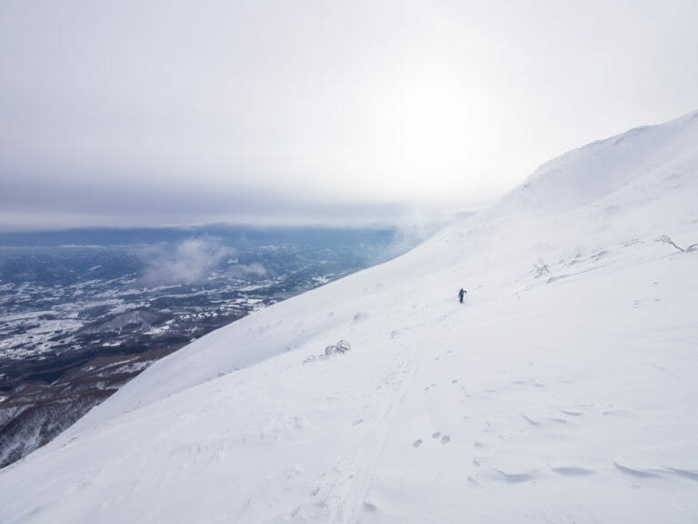
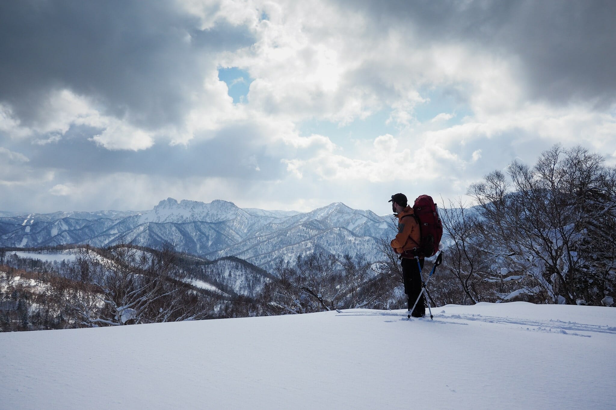
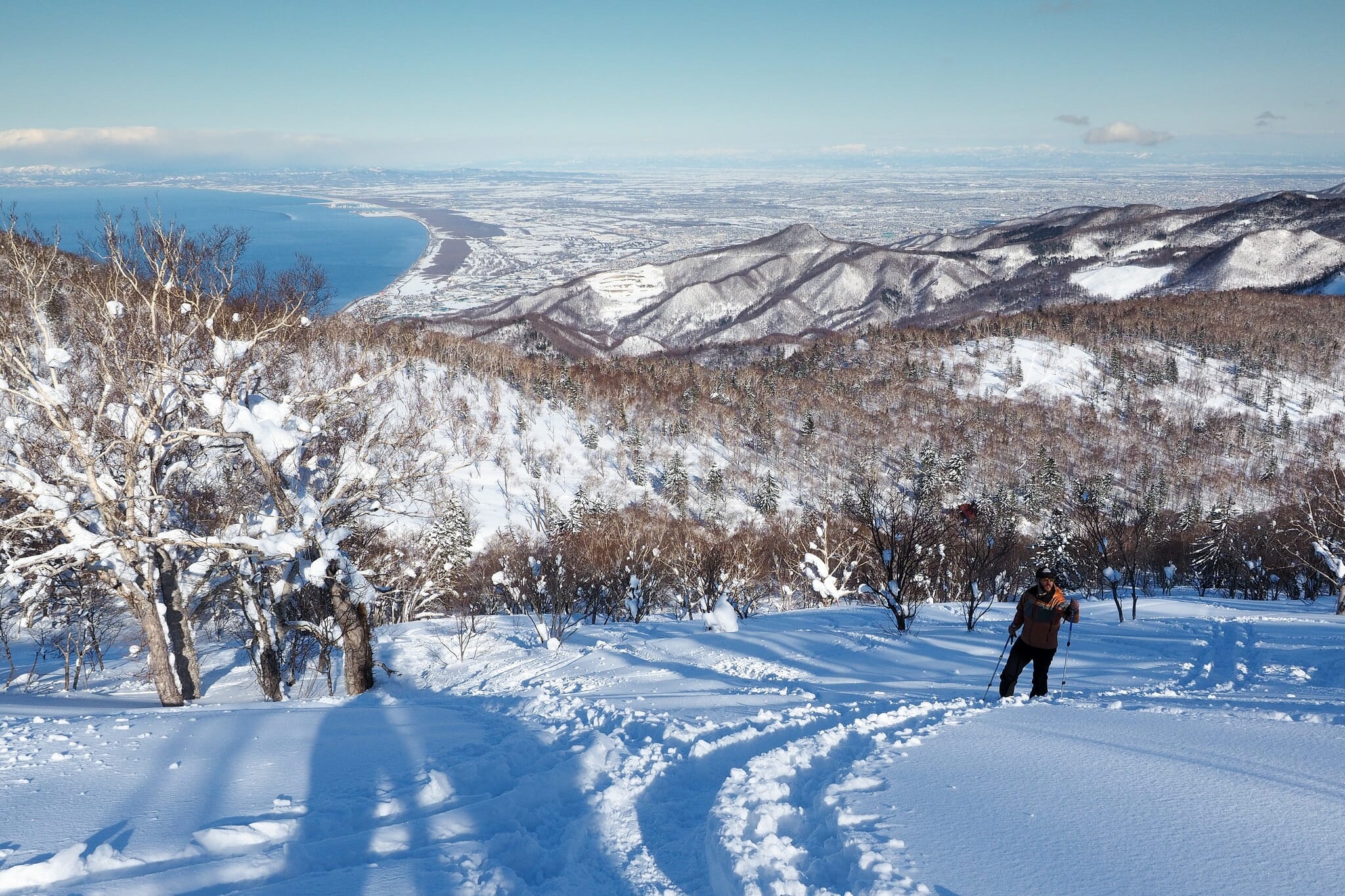
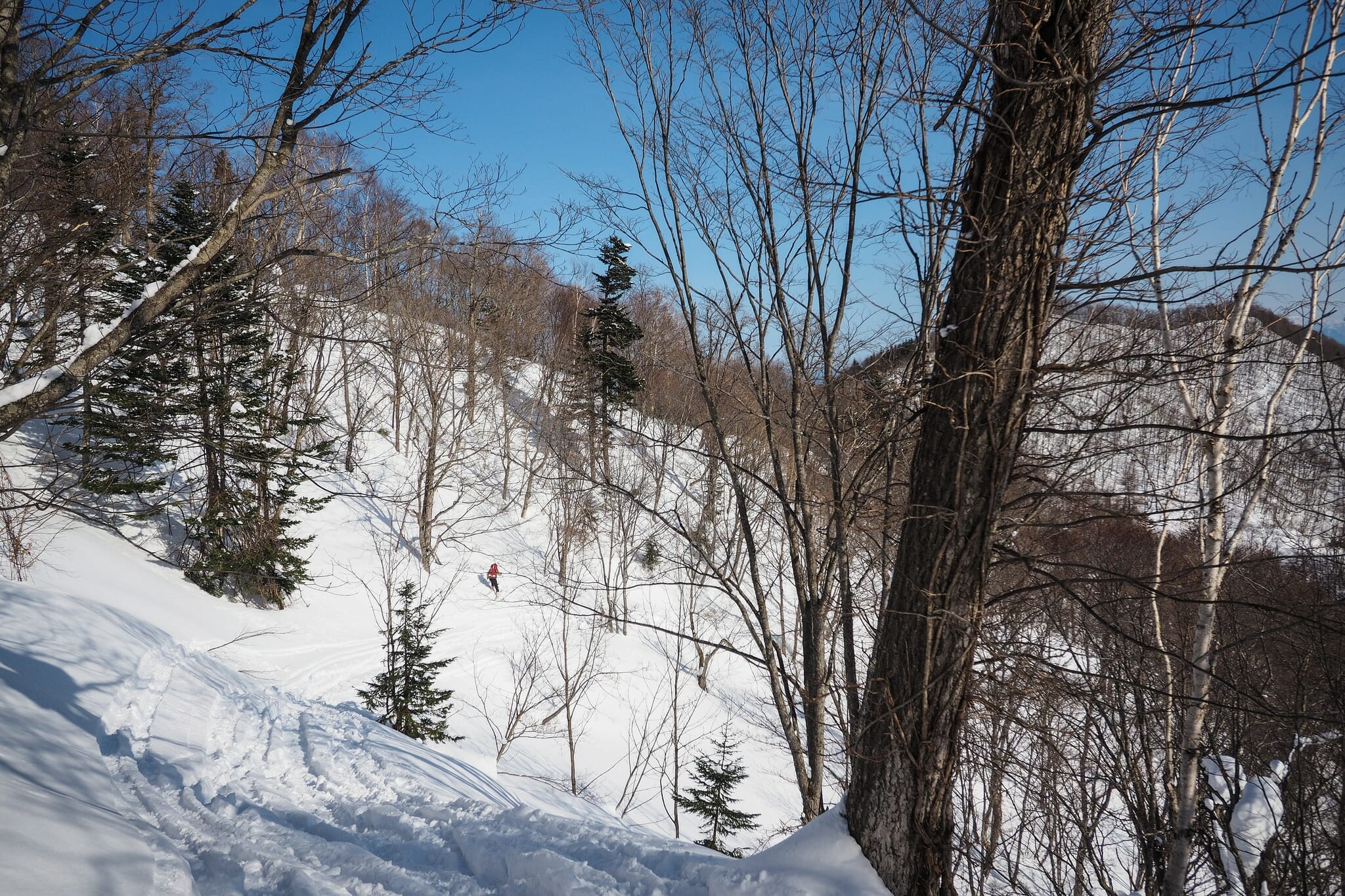
The route from Okuteine Hut to Ginreiso hut is not marked, but with good weather, it is a fairly easy route. Once you’re up on top of Mt. Okuteine, just follow the ridge around to Zenibako Pass, and then on to Ginreiso Hut. In anything other than perfectly clear conditions, or in changeable conditions, however, you’d have to have your wits about you. There are ups and downs and very steep drop offs towards the eastern side of the route. We left the hut at around 9am with blue skies overhead.
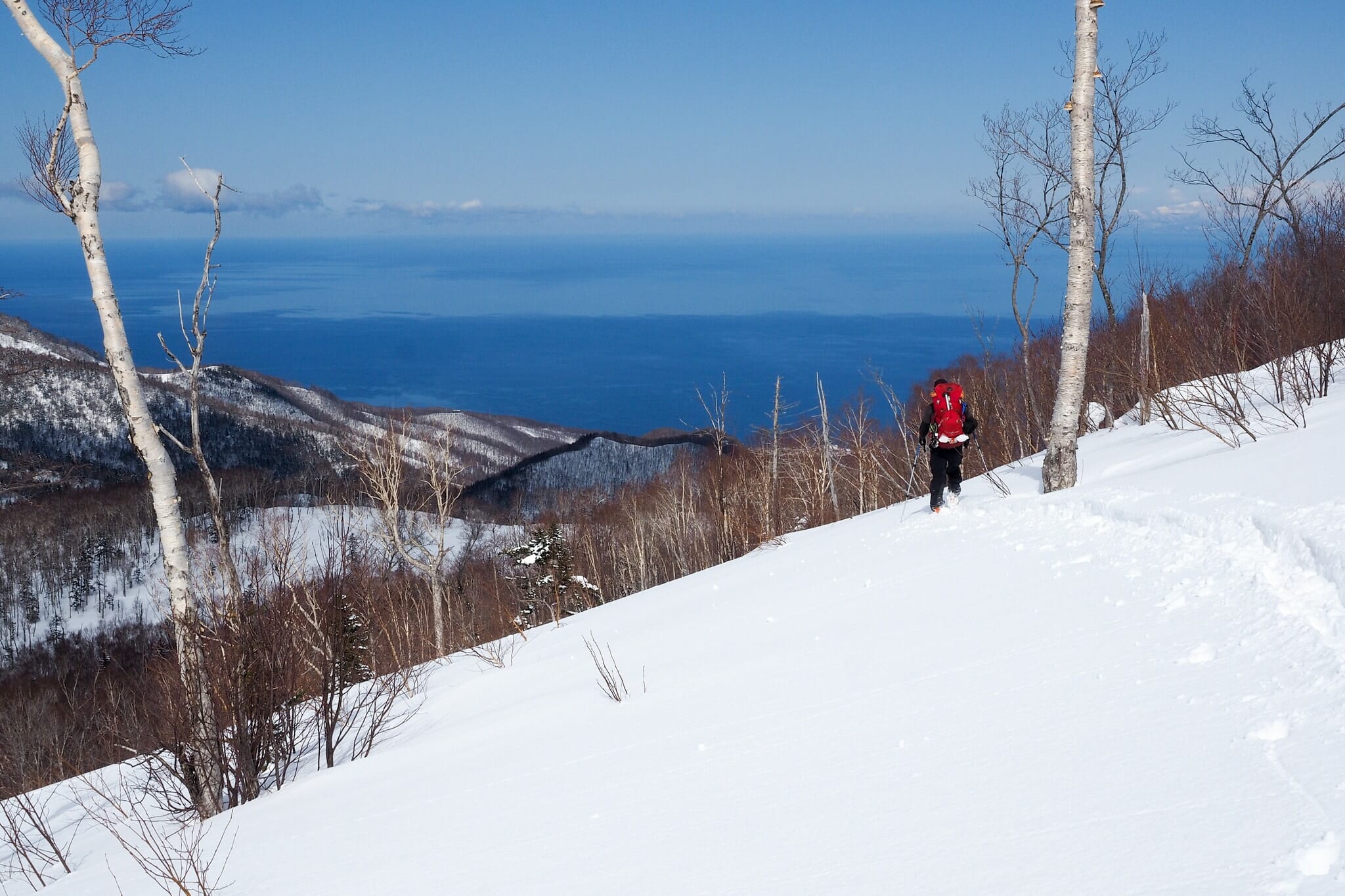
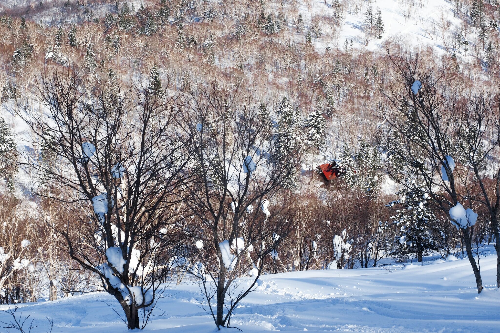
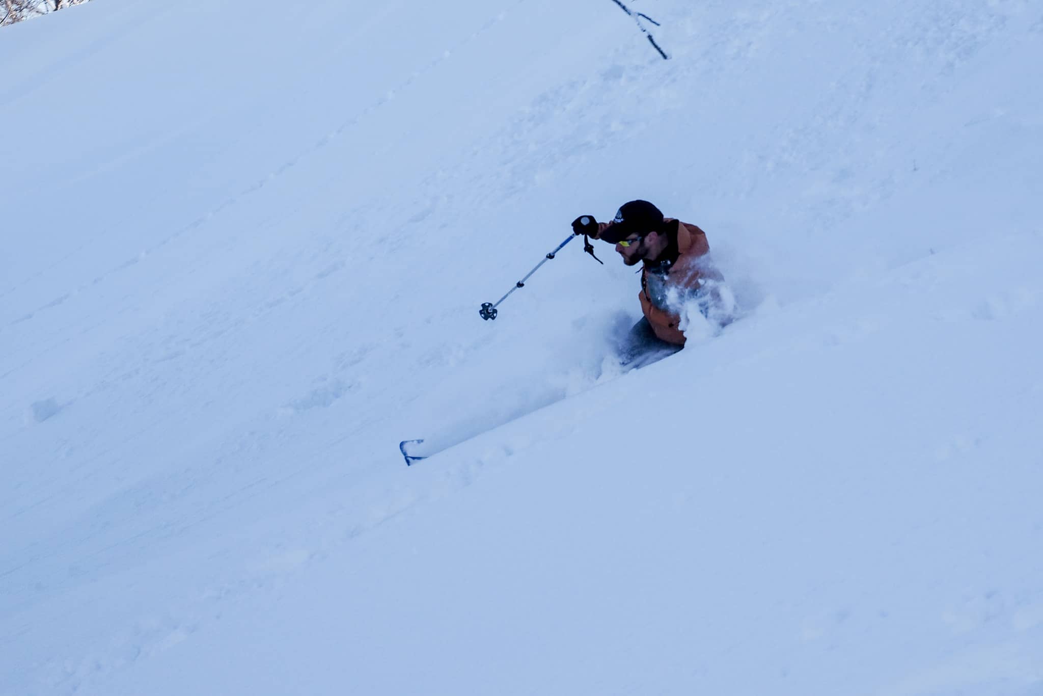
These conditions would follow us the entire day, for some truly inspiring views over the terrain, including Ishikari bay and the Japan Sea. I’d never seen this area from this vantage point before, and it was clear why it has such a deep skiing history here. Mellow plateaus dotted with some great terrain features for downhill skiing. We only took the skins off for one downhill run – a beautiful mellow run on the western flanks of the 838m peak just before Zenibako Pass (location). It was well worth the extra time taken to put the skins back on again afterwards for the final 30 minutes or so of skinning to Ginreiso Hut.
While we had been breaking trail for the 4 hours or so it took us to get here, the final 20 minutes approaching the hut were on a very well-trodden trail. Mt. Haruka is a very popular location in the weekends, particularly for day visitors. We had obviously caught the tail end of the weekend rush, however, as we were the only people staying over on that Sunday night.
As always, the live-in caretaker fastidiously ushered us in, making sure we had everything in the right place. We sat down for a coffee and a bite to eat, before heading out unburdened by heavy packs for a couple of runs on Mt. Haruka. I’d only ever been here in relatively snowy conditions, and had never seen the hut from the slope before. Today, it was clear that whoever had chosen the location of the hut had done well. It really is at the foot of some great skiing.
Ginreso Hut quick-facts: First built in 1934 by Hokkaido University with funds from Hokkaido Newspaper. Was demolished before the Second World War. A new hut was rebuilt on the site in 1960 again with funds from Hokkaido Newspaper, and since 1974 is owned and maintained by Tokai University Sapporo Campus.
The slope was relatively tracked up, being the end of the weekend. But upon getting back to the hut, the hutkeeper reminded us that we must have been having fun – he could hear our whoops and hollers from down in the hut below.
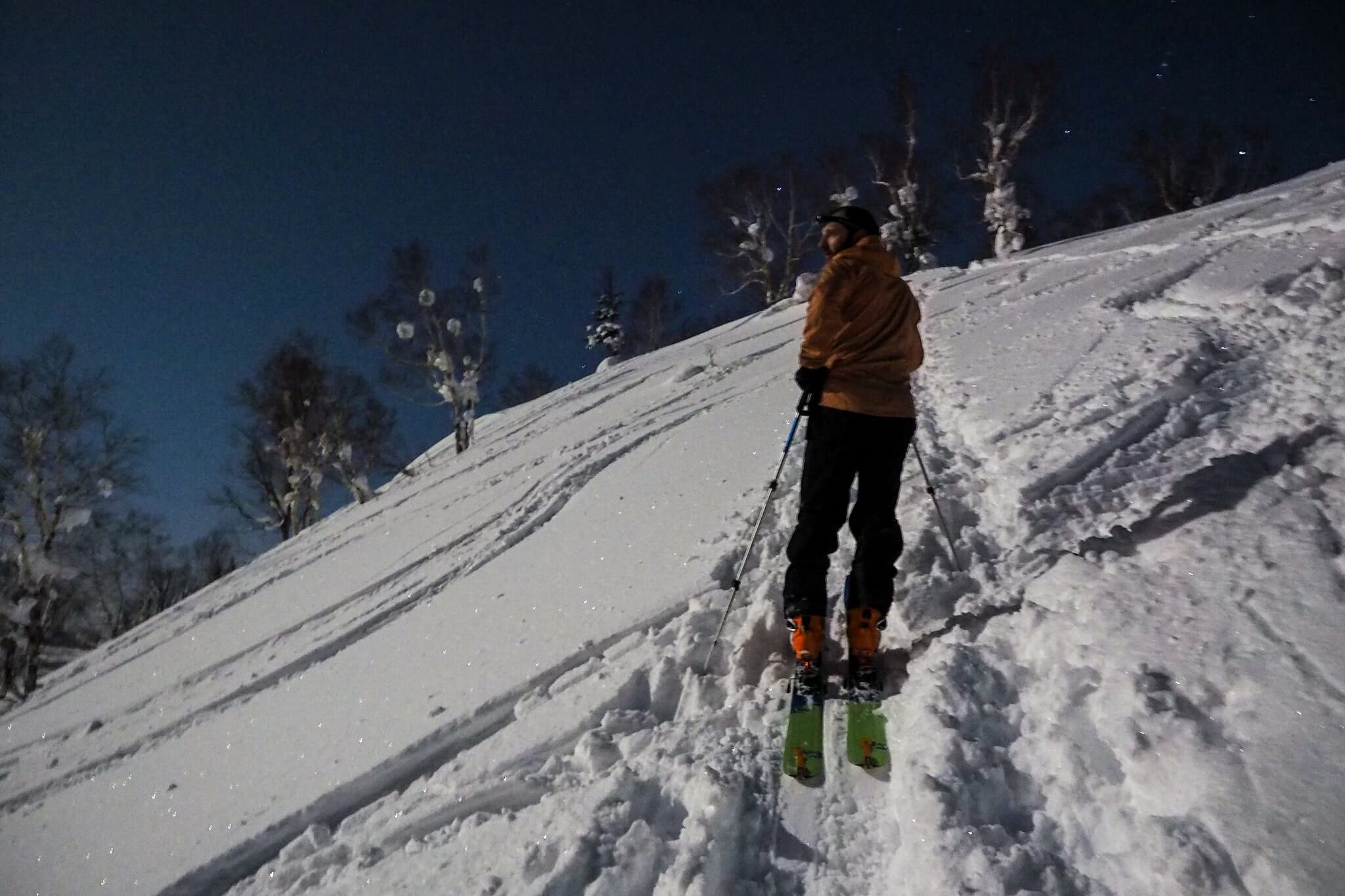
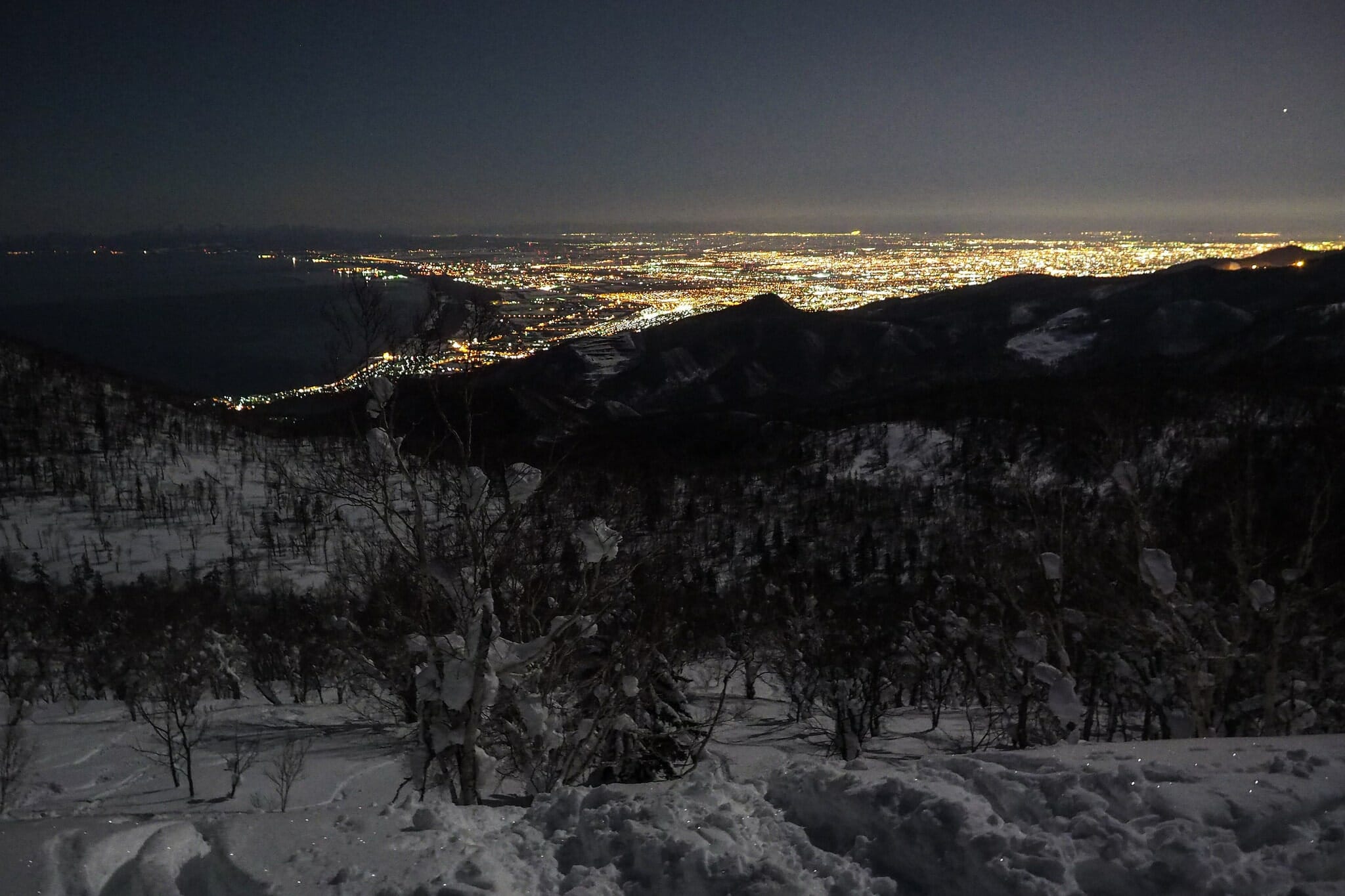
After making dinner with the last of our heavy ingredients, we settled in for a quiet evening of reading and browsing through photos from the day. And then I noticed it was almost as bright as day outside – the moon was full, and it was lighting up the area perfectly. How could we not go for one moonlight ski run. At the very least we’d get to see the city lights of Sapporo
Day 3 – Ginreiso Hut to Zenibako JR Station (8km)
Our actual Day 3 route/tracklog: https://ridewithgps.com/trips/13374114
The plan for Day 3 – a Monday – was to get away from the hut early, in time to be back at work by mid-morning. Being 100% downhill, this was completely doable…but not before a decent celebratory breakfast of bacon, eggs, slightly stale baguette, and coffee. We were almost finished following the footsteps of those hardy Japanese skiers of the 1930’s.
The ski down from Ginreiso Hut to the trailhead can be taxing, especially after a weekend of skiers, snowshoers, and snow-mobiles. The walking track to the west of the forestry road can be narrow and tracked up, and the forestry road can be concrete-like corrugated snow-mobile tracks. That said, there were a couple of spots of un-tracked bliss that had us thinking that there could certainly be worse Monday morning commutes.
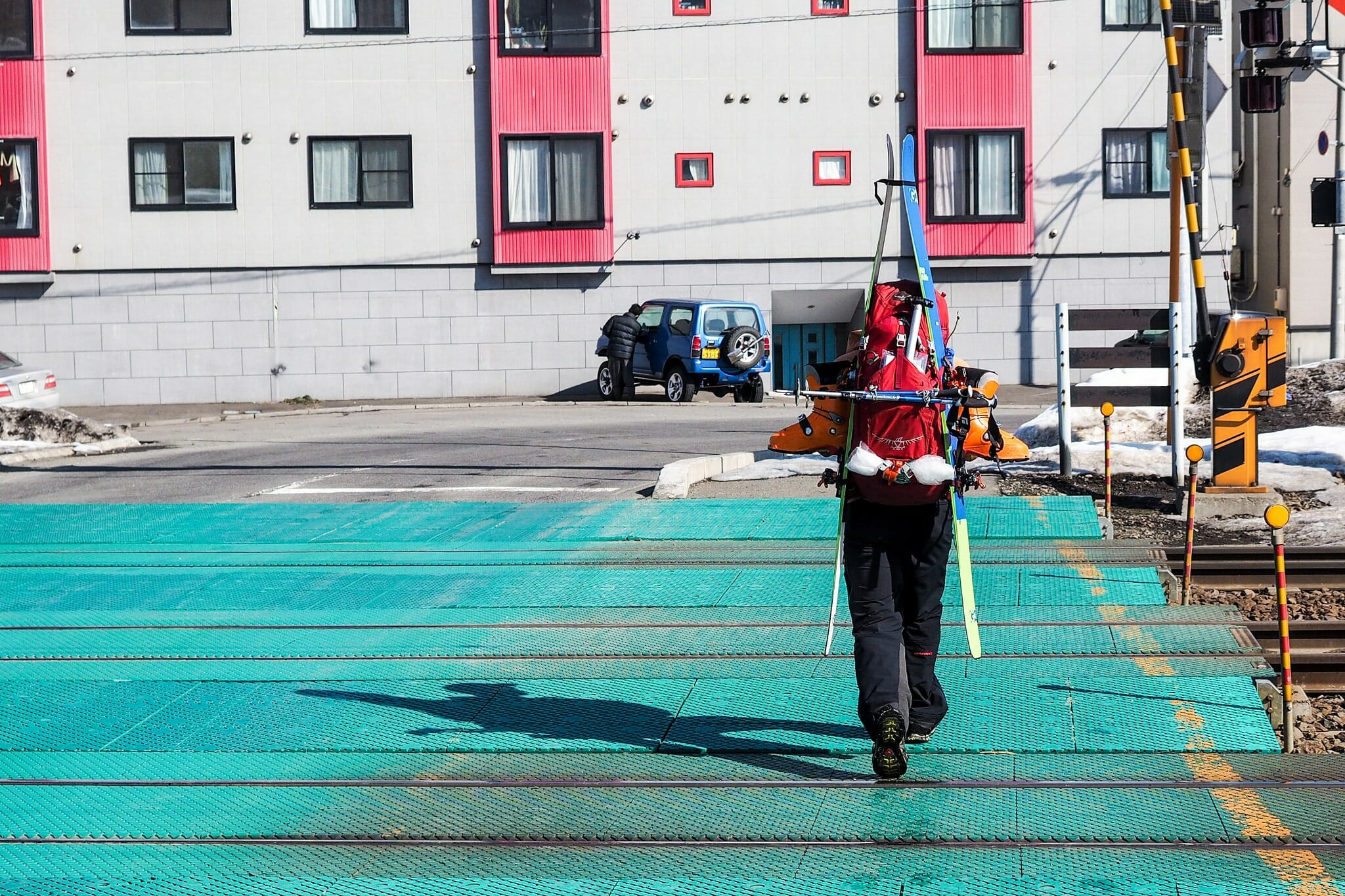
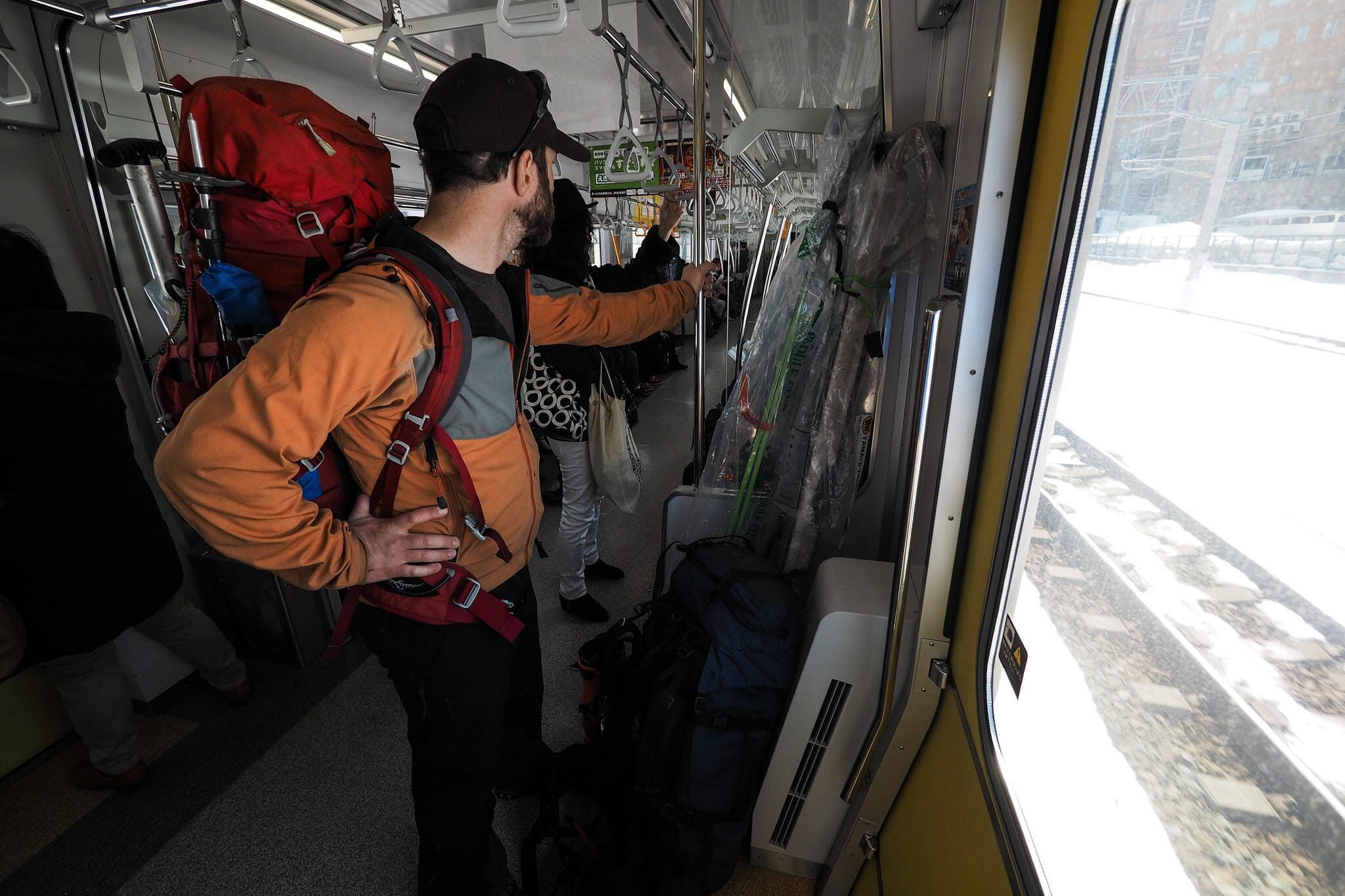
Once at the trailhead, we opted to walk the 2.5km from the zenibako-josui-jo bus stop to Zenibako JR Station. We’d missed one of the earlier buses, and with only two per hour going to the station, we’d get there quicker walking. With me in my ski boots (the relatively articulate Scarpa Maestrale), this was bearable. Just. Perhaps Andy had been right in carrying his trainers across the hills.


2 thoughts on “The Kokusai-Zenibako 3-day Traverse”
What is the Helvetia hut you have labeled on the map? I can’t seem to find any info about it on the site.
Hey Connor, the Helvetia Hut is one I haven’t stayed in yet (it is on the list for this season). So there’s no write-up about it. But here’s a quick bit of info to get things started. I hope this helps.
Capacity: 12 people
Management: Hokkaido University (see https://www.hokudai.ac.jp/gakusei/campus-life/facility/hut/#lodge3)
Contact: Hokkaido University Student Support Department (Extracurricular Activities Officer) (学務部学生支援課課外活動担当)
TEL: 011-706-7456
Booking: Book and pay for use prior to use of the hut at Hokkaido University (exactly same process as the Okuteine Hut: https://hokkaidowilds.org/hut/okuteine-yama-no-ie-hut). The hut is locked, so a key (or combination code?) will need to be picked up from the university. The university site mentions that the hut is only available for use on Sat/Sun. It is available for use year-round.
Fee: Not sure, but won’t be much more than about 200yen per night.
Facilities: Wood stove (with wood provided). No toilets, water, or bedding.
Hope this helps.