Posted on Mar 18, 2017
107 7
SSE
Posted on Mar 18, 2017
107 7
SSE
8.2km

Distance

5 hours

Time

690m

Ascent

1220m

Highest point

5.5/10
Difficulty
Snow Icon | Hokkaido Wilds
Feb-Apr

Best season

I hadn’t expected such a grandiose summit at the top of Mt. Mekunnai (目国内岳 – 1,220m). The summit looks pointy from a distance, but we were not prepared for the great frozen mountain of boulders, encrusted in a winter’s worth of wind-blown snow and frost, that greeted us almost out of nowhere. On a good day you'll get grand views along the compact but impressive Niseko Range.

Last updated Nov 25, 2022

Route Map

Need to know details

Location

This route up Mt. Mekunnai is on the more western reaches of the Niseko Range that can be accessed practically via road. Any further east from here (such as Mt. Raiden), and you’ll start climbing close to sea level. The route starts at the old Niimi Onsen road-end (here).

General notes

IMPORTANT: As of March 2021 Route 268 from the Route 268/Route 66 intersection (around here) is still officially no longer cleared of snow to the now mothballed Niimi Onsen (a distance of 4km – however, see John’s comment below).

As mentioned above, Mt. Mekunnai is the last peak on the Niseko Range, heading east, that can be accessed via a trailhead that starts relatively high up the mountain. Peaks such as Mt. Raiden further west require an approach either from sea level or via the Iwanai Ski Area on the northern side of the range. It is also popular because it starts and finishes from Niimi Onsen – an historic onsen that is currently closed, but opens every now and then as new owners take cracks at making it work.

Hut
None
Route details

There may be sporadic tape tied to tree branches to indicate a route, but it is best to assume there are no route markers.

Route Timing
Up | 3.5hrs
Down | 1.5hrs

About 3.5 hours from trailhead to summit, another 1.5 hours on the way back down.

Transport

Public transport:

There are no public transport options for this route.

By car:

When approaching by car, just drive towards Niimi Onsen until the snow-clearing runs out. There is a small snow-cleared area for parking just across the road from the old Niimi Onsen buildings (here).

Physical maps
Print: HokkaidoWilds.org 1:25,000 TOPOMAP+
Niseko Backcountry map: Buy on Amazon.co.jp | See companion site for more purchase options
Official Topo Map: Chisenupuri (チセヌプリ) – map no. NK-54-20-7-4

NOTE: The official 1/25000 topo map(s) above can be purchased for 350yen from Kinokuniya bookstore next to Sapporo Station or online (in Japanese).

Aspect
The main aspect skiers are exposed to on the descent and/or ascent is South. Other aspects that may also be encountered while following the route outlined on this page include: Southeast. Therefore, keep an eye on the weather forecast a few days ahead of your trip to monitor wind, snow, and temperature. Also, since this route is in the general vicinity of the Shiribeshi area, consider looking at the Japan Avalanche Network avalanche bulletins (updated Tuesdays, Thursdays, Saturdays at 8am) or the daily Niseko Avalanche Information website. These may give extra insight into avalanche conditions in the greater area around the route.

Snow and
route safety

From the 862m point, you’ll be above the tree-line, so this is probably a trip to avoid in low visibility and bad weather conditions. The Yuki-yama Guide (ISBN: 978-4894538047) also notes that in heavy snowfall conditions, the broad ridge that runs from the creek-crossing to the 862m mark is avalanche-prone, so take a more southerly route (as marked on the route map below) in fresh heavy snow.

  • Notify the police of your backcountry plans online using Compass – instructions here.

Mekunnai-dake Backcountry Difficulty Rating

Category

Grade

Points

Strenuousness

Vertical Gain

B

35

Time ascending

C

3

Technicality

Altitude

B

6

Hazards

C

6

Navigation

C

6

Totals

56/100

GRADES range from A (very difficult) to D (easy).  More details here. Rating rubric adapted from Hokkaido Yukiyama Guidebook 北海道雪山ガイド.

Weather forecast

Windy.com weather forecast for Mekunnai-dake
Onsen nearby

UPDATE: As of June 2017, Niimi Onsen is closed. Try somewhere such as Yuki-Chichibu up towards Mt. Chisenupuri (location).

You’ll have your car parked just next to Niimi Onsen, which is worth a soak. Note that the entrance to the onsen is not via the old buildings just across from the car-park area at the end of the snow-clearing. It is in the red buildings, accessed by the car-park entrance about 30m down the road (location). Niimi Onsen was re-opened in December 2016 after a long period of closure.

Extra Resources
  • See the write-up (in Japanese) from p. 242 of the Yuki-yama Guide (ISBN: 978-4894538047).

Guide Options

If you’d like to ski this route and/or explore other Niseko areas together with a local certified guide, get in touch with Yasuko Kikuchi. Born and raised in Hokkaido, she’s a JMGA-certified guide now based in Sapporo. Her outdoor experience is broad and worldwide, having worked as a Canadian Ski Patrol member, and has sumitted a number of 6,000m+ peaks around the world. She speaks good English. In addition to Yasuko, also see a full list of English-speaking Hokkaido Mountain Guides Association (HMGA) guides on the HMGA website here

Support us

Like this content? Buy the HokkaidoWilds.org team a coffee. 50% of tips go to the Hokkaido Wilds Foundation.

Show Full Route Notes Close Route Notes

Route Trip Notes

“Mt. Mekunnai-dake’s attractive feature is the large south-facing slope for skiing. Mt. Mekunnai is a less-traveled mountain, far away from the busy central areas of Niseko range. And unobstructed large slope descending from the summit, as well as the 300m vertical of powder skiing among the trees is a big attraction. There’s no public transport, but the road is cleared until Niimi Onsen, so you can enjoy a quiet ski tour and then a soak in the onsen.” Hokkaido Yuki-yama Guide, 2015, p. 242

Word of a multi-day ski tour along the Niseko range to the Japan sea (article and video here) got me keen to check out the western reaches of this majestic range, extending some 20km west from the bustling Niskeo ski area. A super-clear forecast was going to be icing on the cake. So Andy, Hiro and I made the 3-hour early-morning trek to Niskeo from Sapporo, already catching glimpses of what we could expect up on the mountain. It was shaping up to be a classic – and relatively rare – clear-sky day.

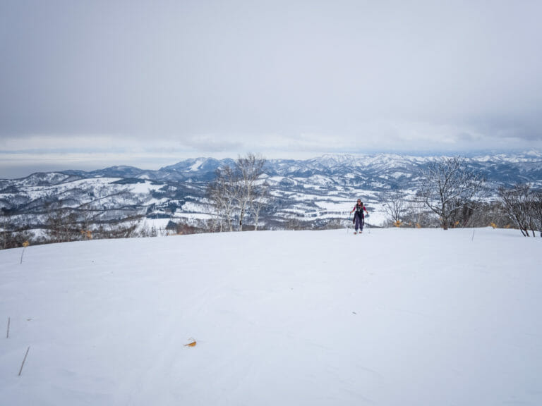
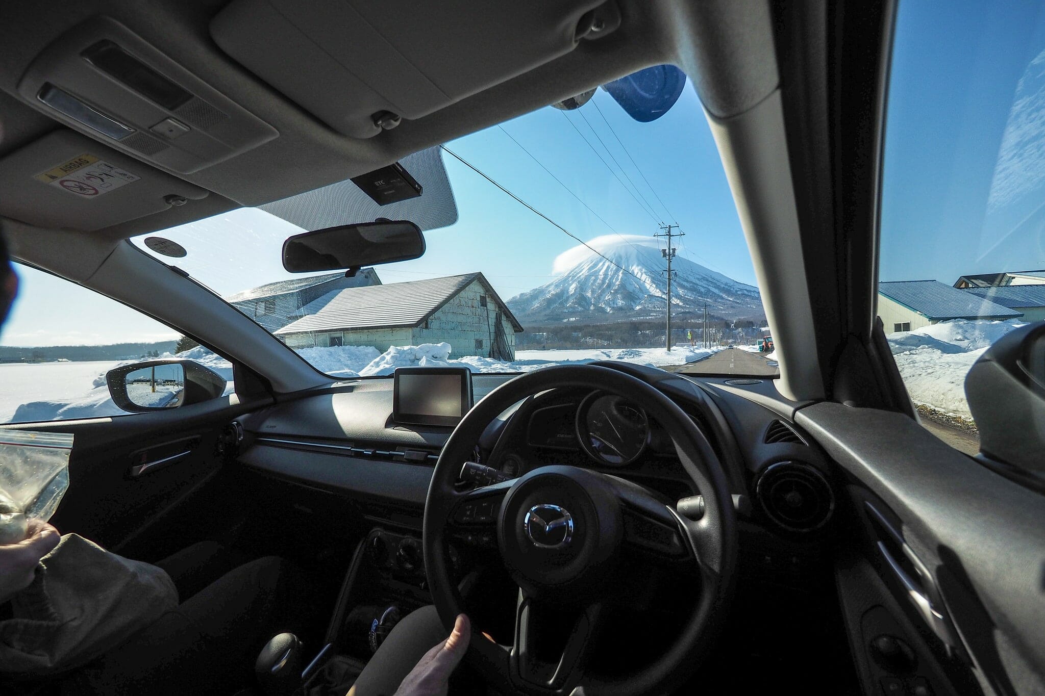
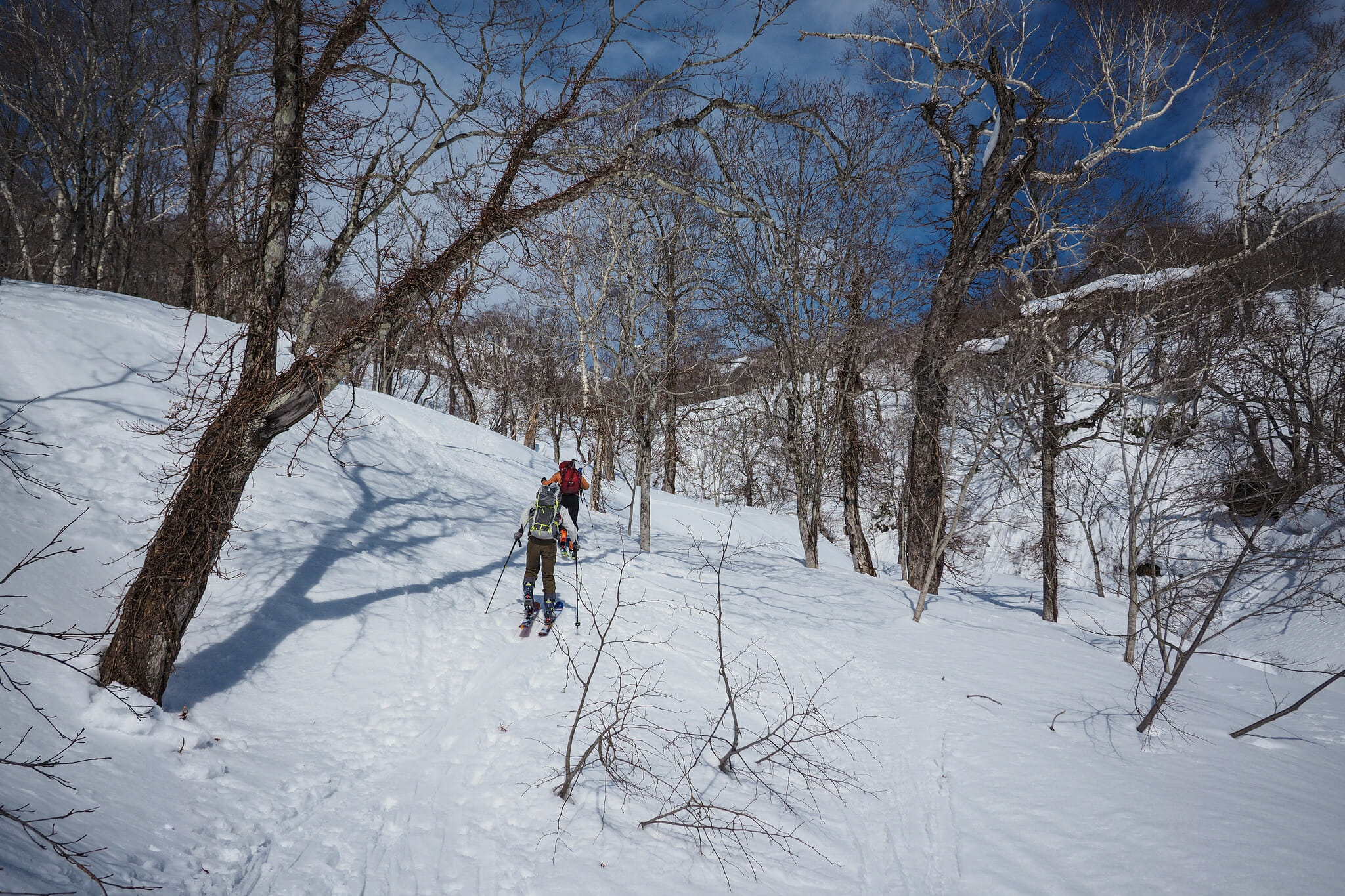
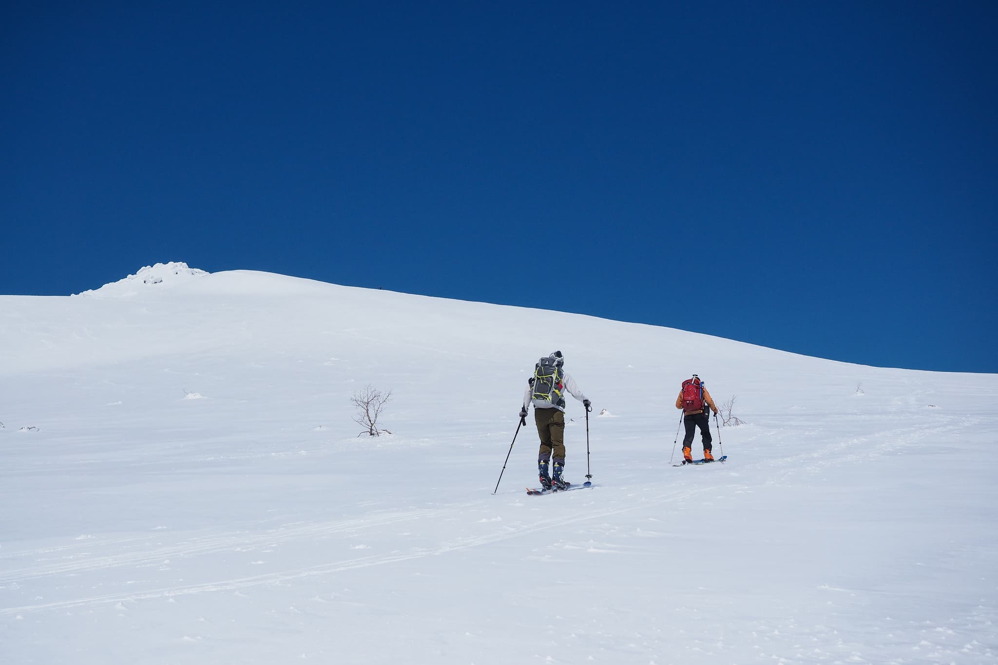
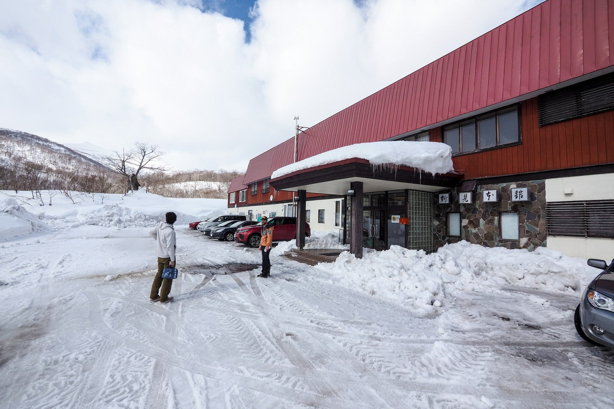
We arrived at Niimi Onsen at around 9am, after a few detours due to Google instructing us to take some roads that were closed in winter. As the guidebook promised, however, the road was cleared to Niimi Onsen. The route starts out on the closed portion of the road, so is relatively flat until just before the first hairpin turn. Already from here, the pointy summit of Mt. Mekunnai-dake is visible in the distance.

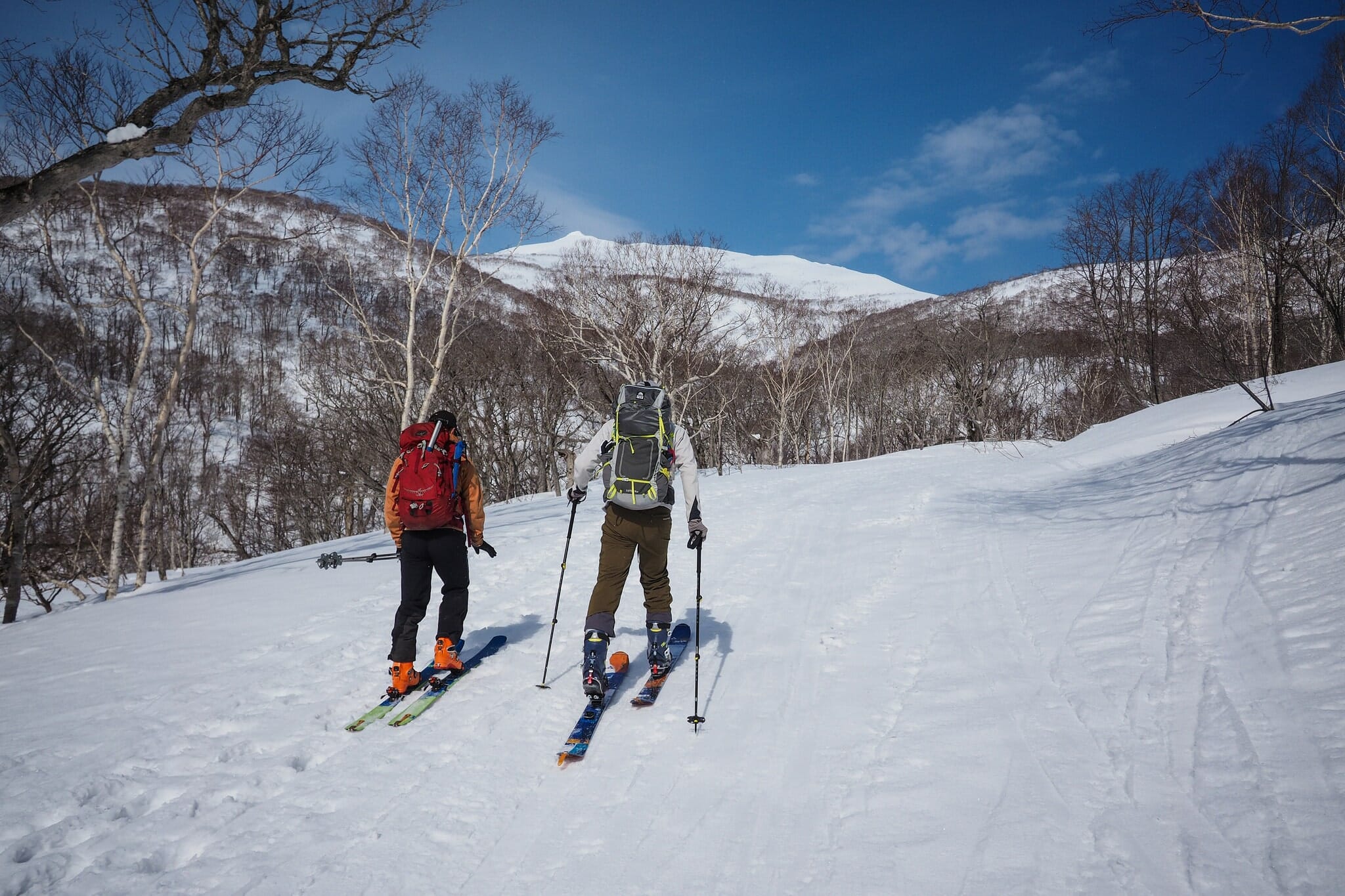
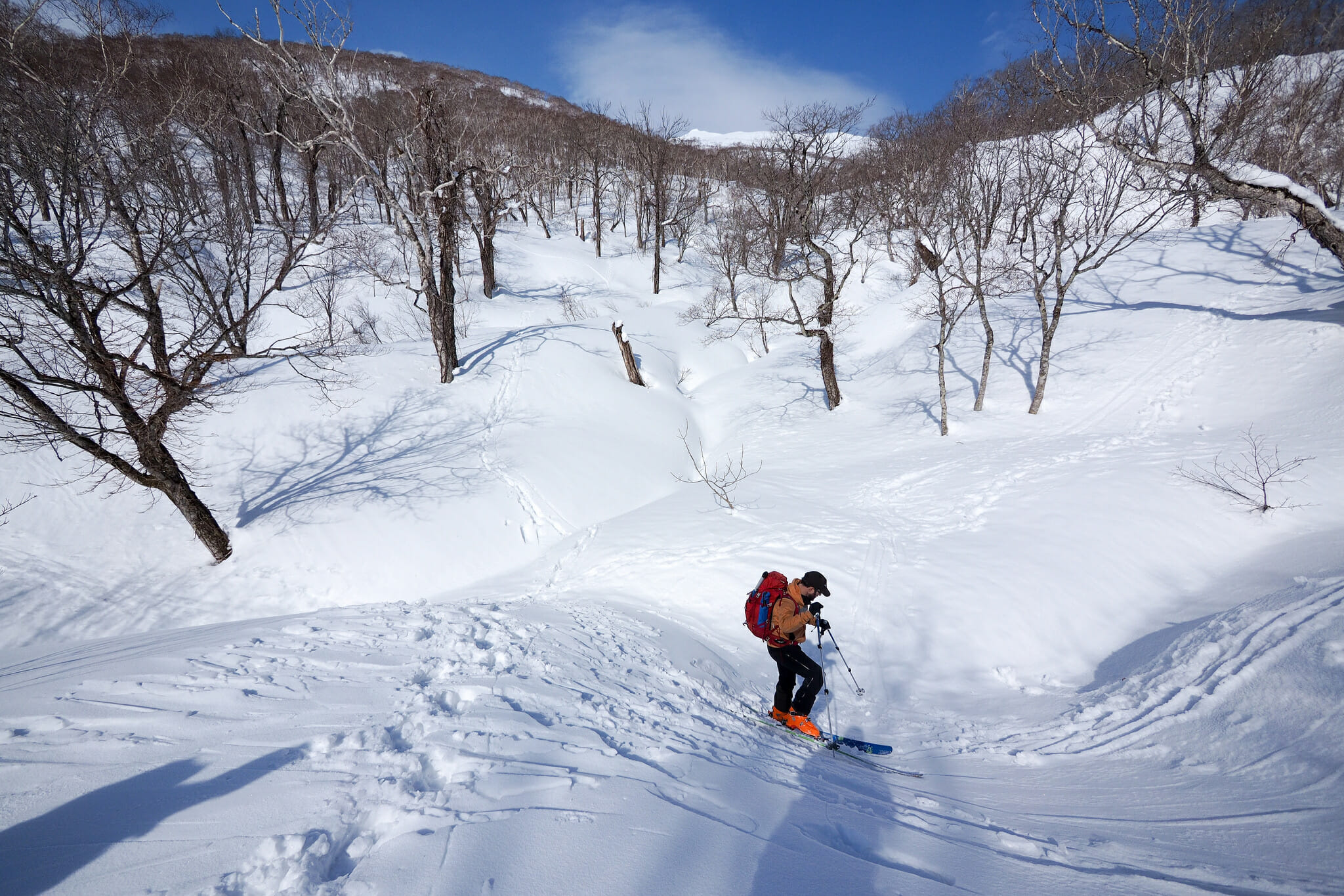
You’ll need to find a suitable snow-bridge to cross the creek before heading up the wide ridge towards the 862m plateau. From this point, it is just a matter of weaving one’s way through the trees. The Yuki-yama guide warns of avalanche danger in heavy snow conditions on the broad ridge that runs up to the 862m plateau. Take the narrower ridge on the southern side of the small gully to avoid this area when conditions are avalanche-prone.

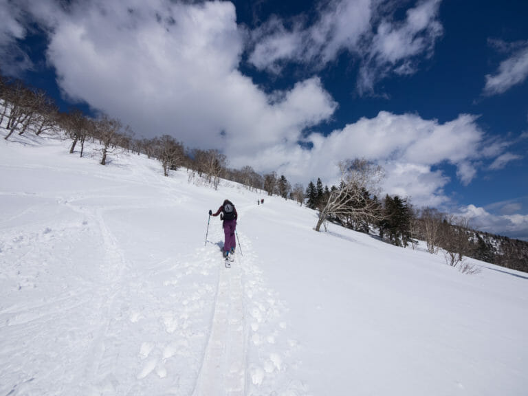
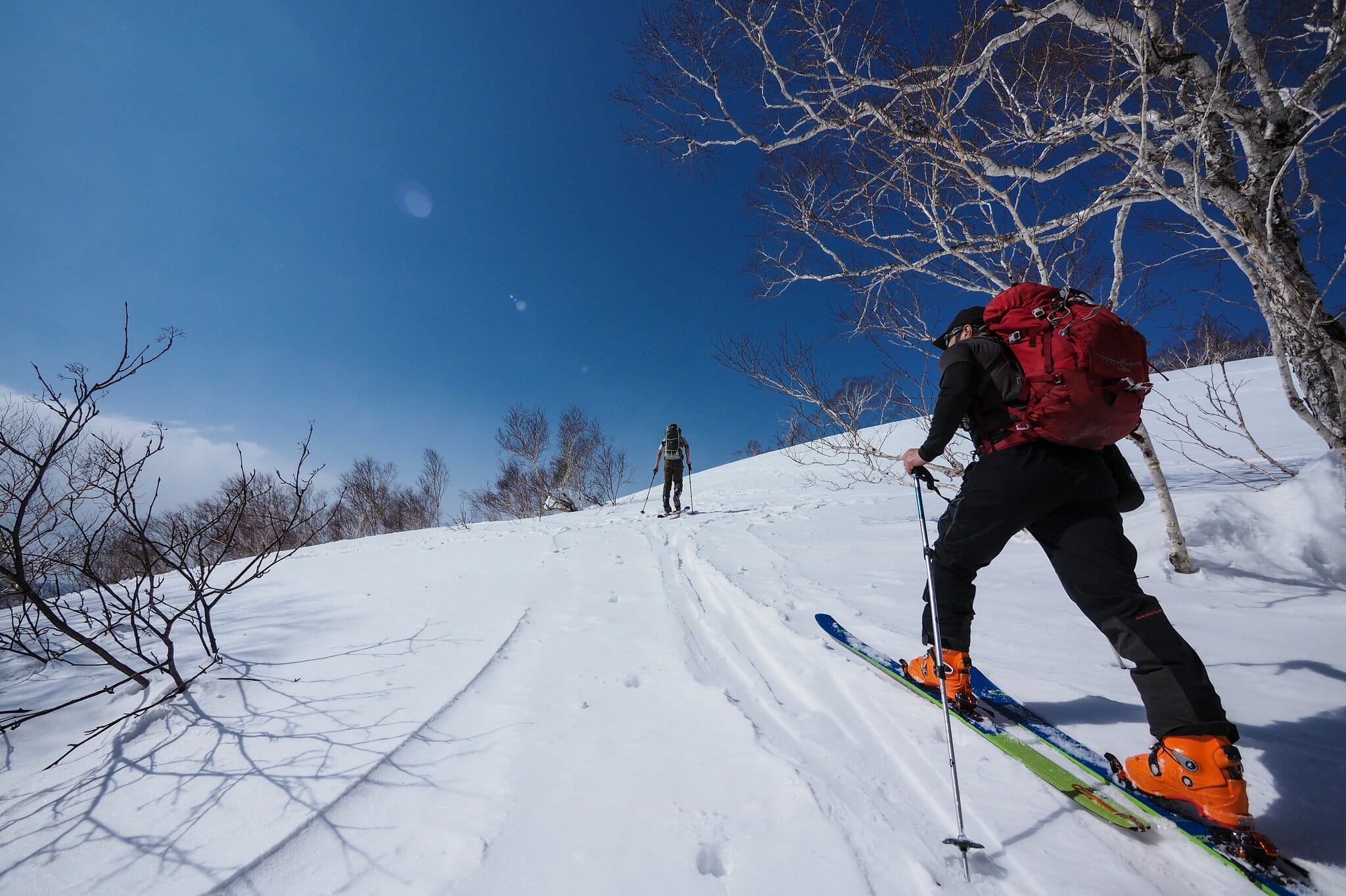
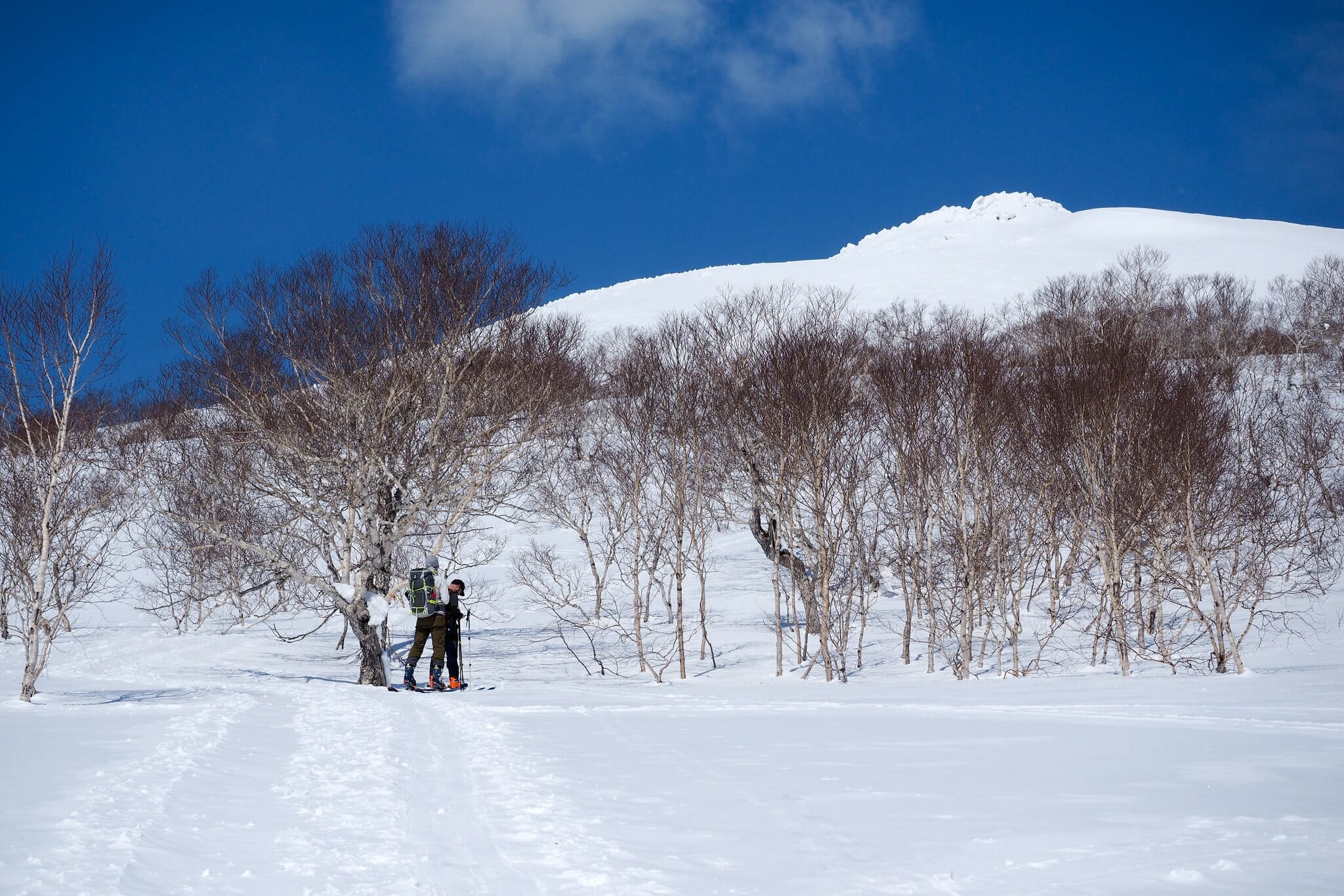
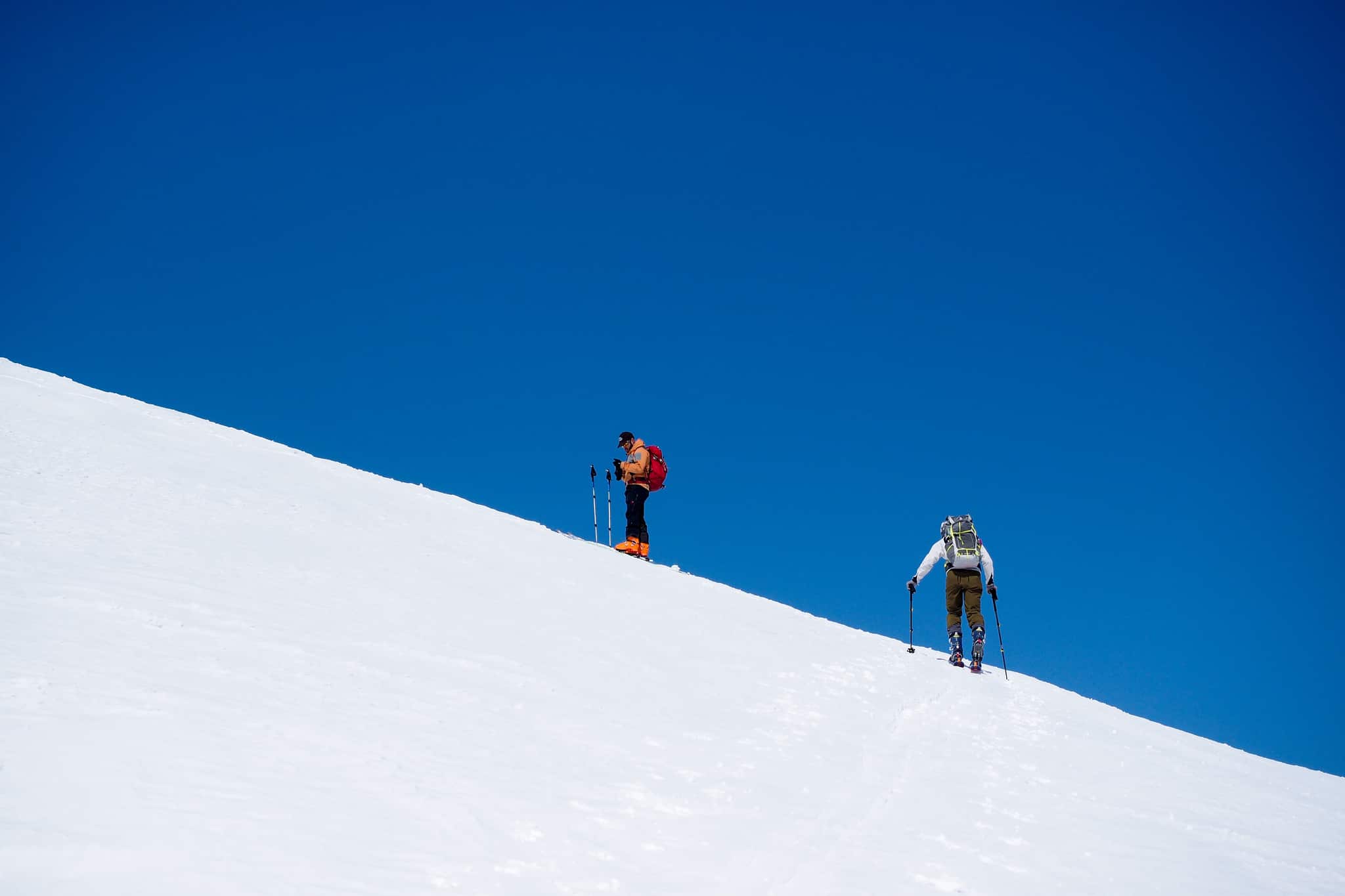
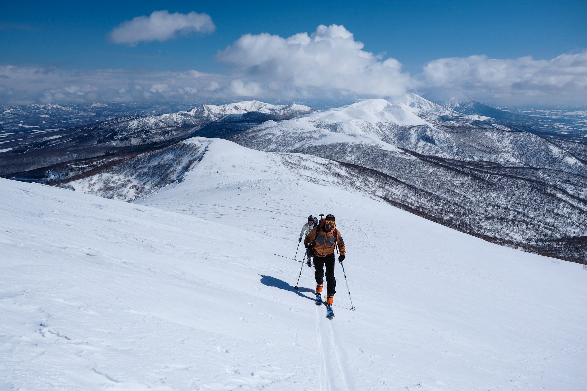
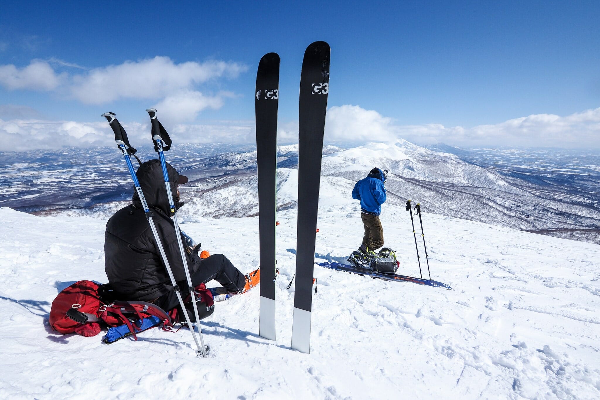
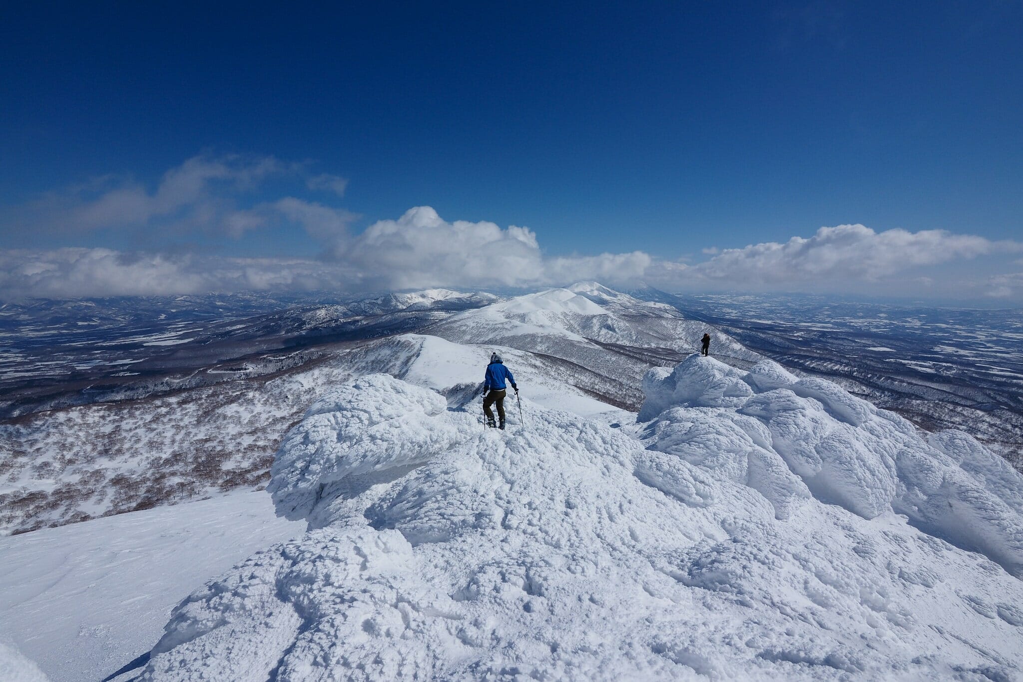
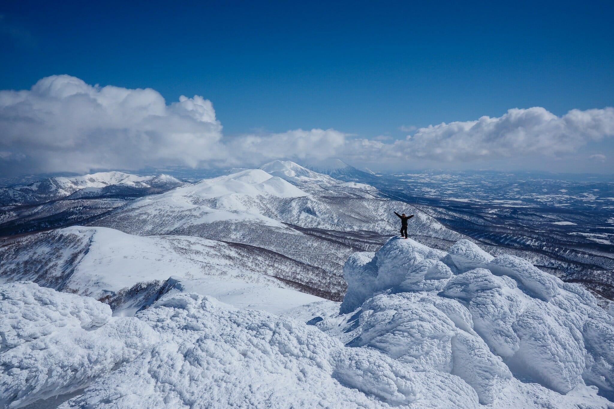
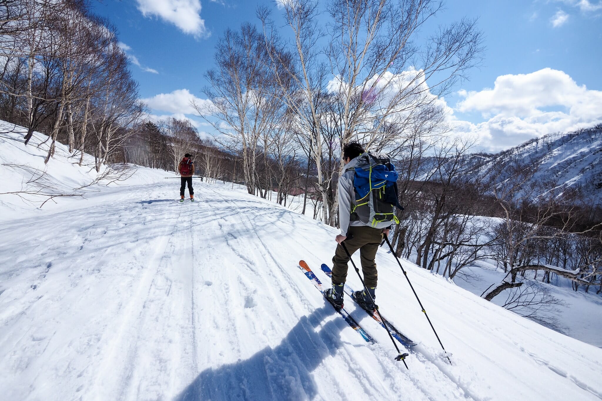
Before long, the trees will thin out, revealing a flat plateau before climbing up to the main ridge. Once on the main ridge, you’ll want to turn around and take a look at what your effort has rewarded you with. Hold onto something though, because the view can be breathtaking. We had a view along the Niseko range all the way to Mt. Yotei.

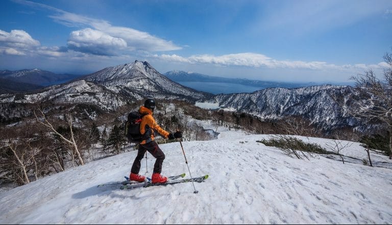
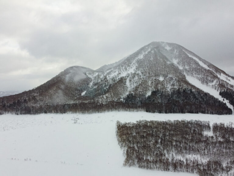
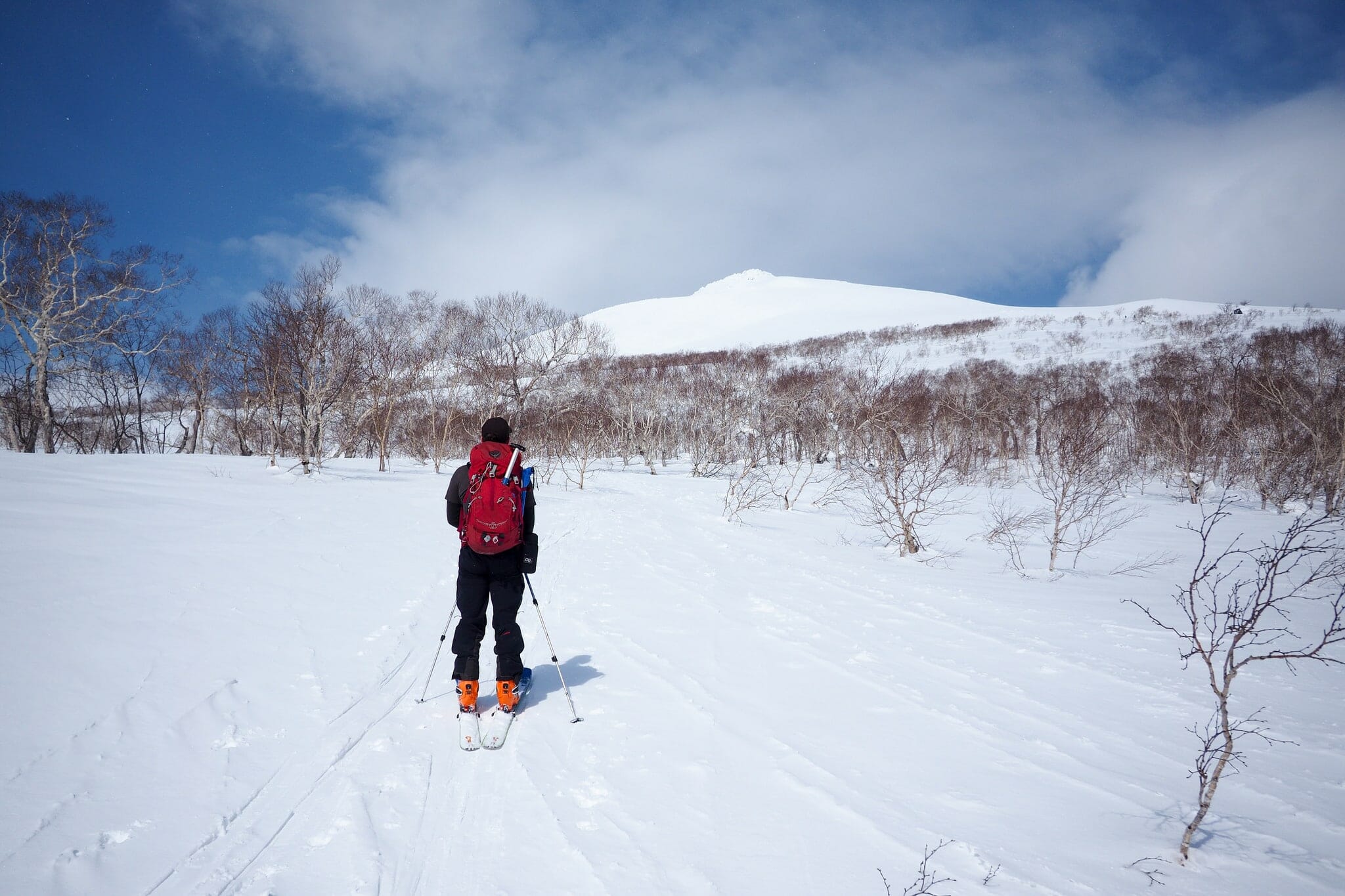
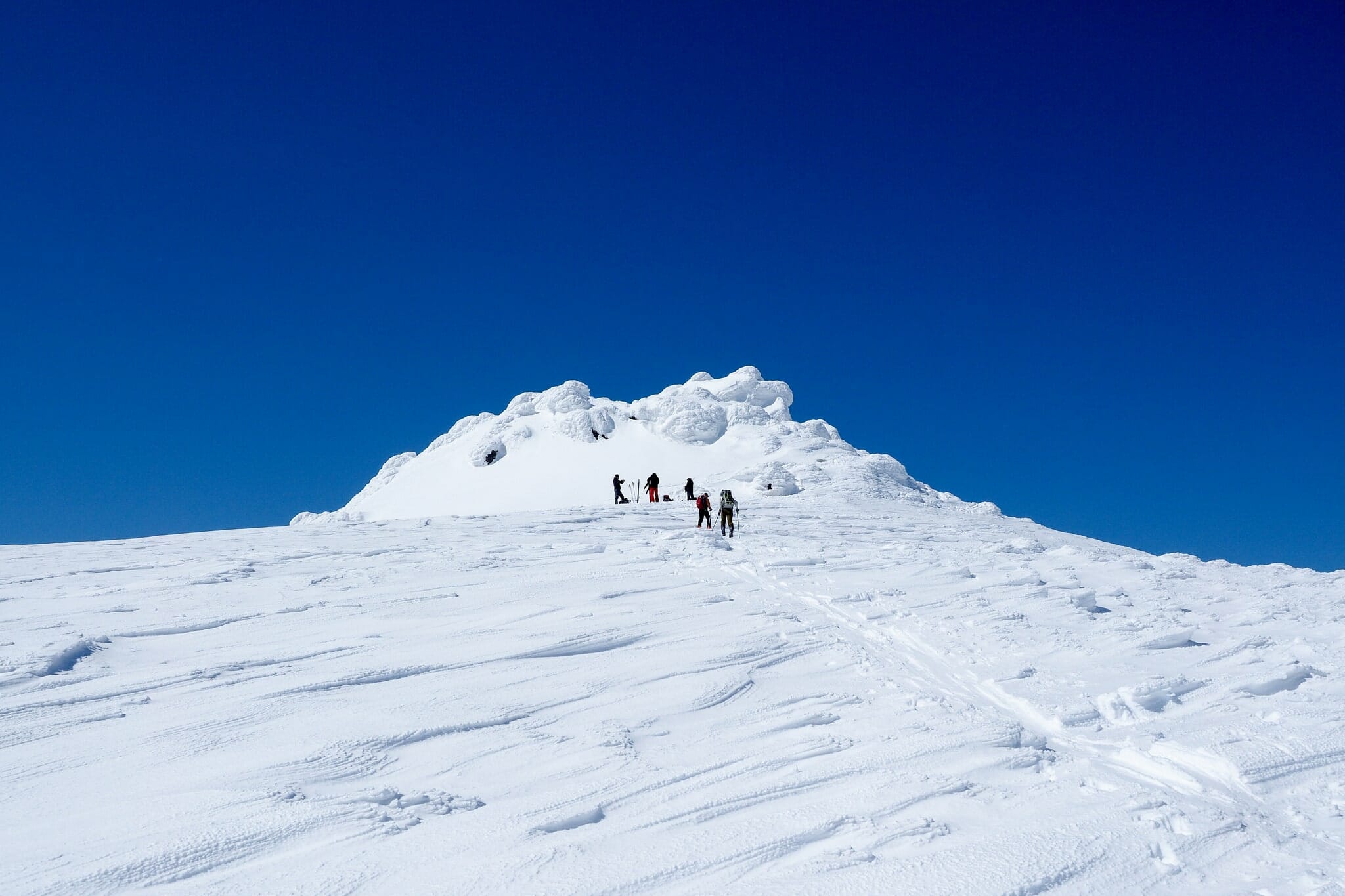
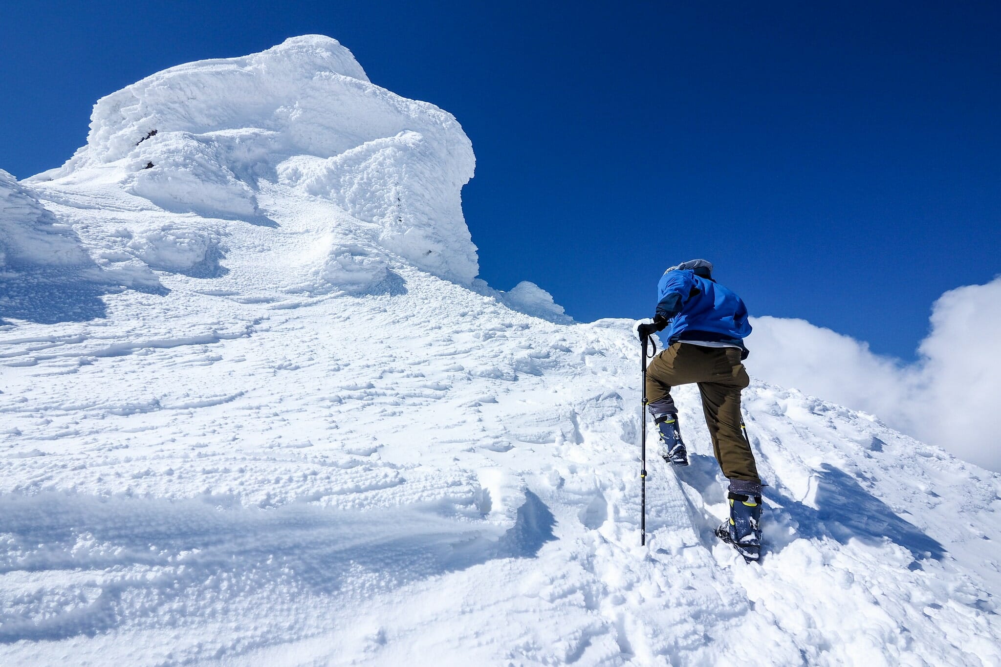
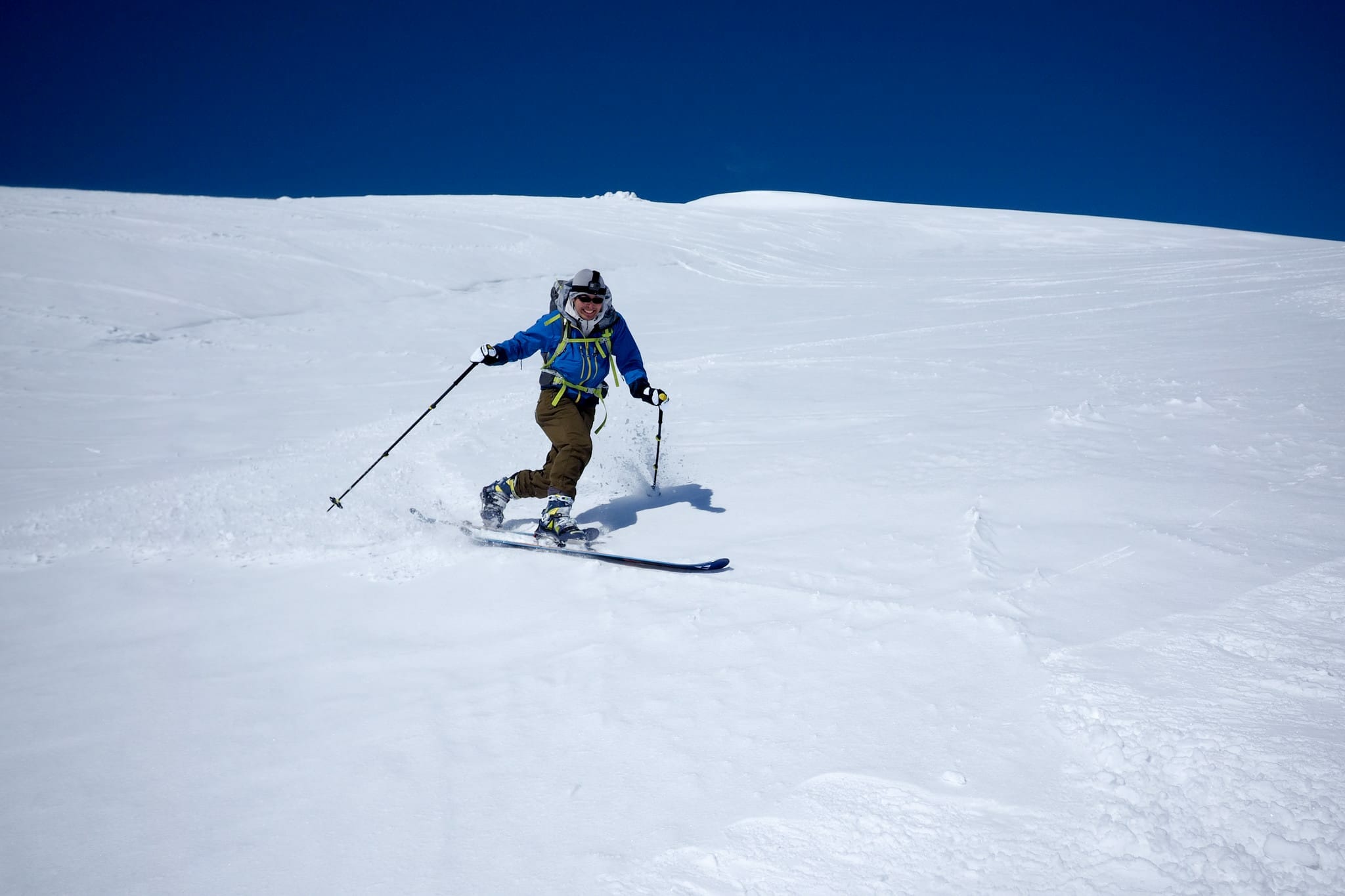
The view up ahead is something to behind also – Mt. Mekunnai’s curious rocky summit, encrusted in a winter’s worth of frost and wind-blown snow. Your skis won’t be much use from the base of the rocky outcrop to the actual summit. So drop the skis and boot-pack the remaining 20m or so to the 1,220m summit.

The way down is a more direct line from were you left your skis, down to the starting point of the stream, at around 900m. When we were there, the surface was just crusty enough to make the skis grab and wander – not ideal, but we could see how in better snow conditions, this would be pure bliss.

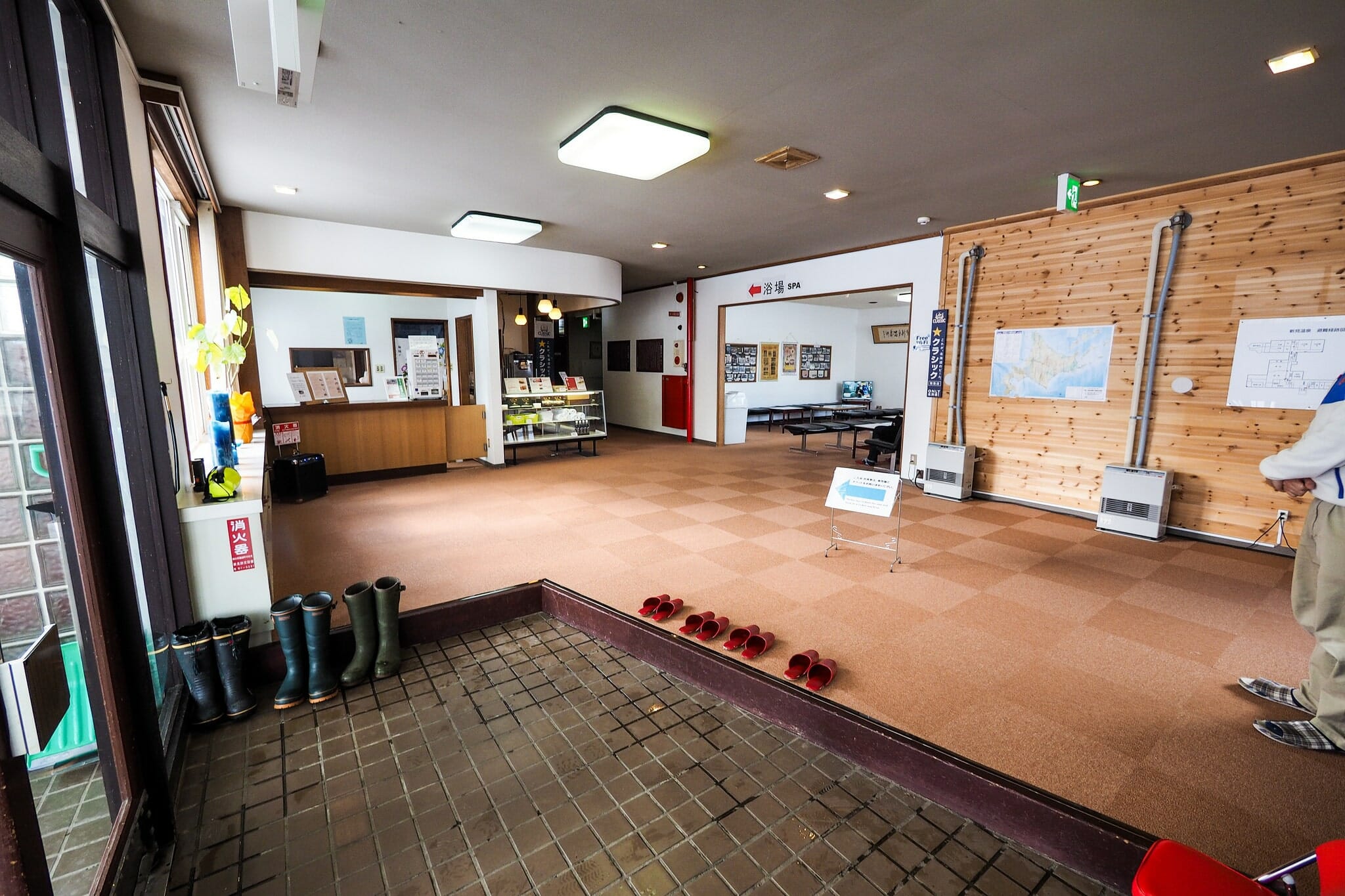
Enjoy the 300m or so of vertical drop down to the snowbridge, because there will be a very short boot-pack back up to the road after crossing the stream. From there, fly down the road, and make the decision as to whether you’ve done enough work to warrant a long soak in the recently re-opened (December, 2016) Niimi Onsen (EDIT: Niimi Onsen is closed again as of August 2017).

Comments | Queries | Reports

Done this route to Mekunnai-dake, or others nearby? Thinking of doing it? Please post any feedback, reports, or queries here. Thanks!

7 thoughts on “Mekunnai-dake Backcountry”

  1. John Llywelyn

    Can confirm that as of March 2021, the end of snow clearing on the road is the same as indicated on the GPX map. Same as Feb 2019.

    1. Hey John, was the gate open? I just called the road management people, and they confirmed that they’re still not clearing from the gate to Niimi Onsen during the winter. Perhaps they opened things up a bit earlier for spring?

  2. Hi team. So unfortunately Niimi Onsen is closed and as a result the road is not cleared up there any more. Probably more slog that it’s worth to hit this until spring comes. We did see sled trails over there today so that is another option…. guess I need a sled….

    1. Thank you so much for the important intel Chris! What a pity. I called the Rankoshi Council today to ask about the situation, and they mentioned that there are tentative plans to develop the Niimi Onsen, but that if anything does happen, it won’t be till 2020. Till then, no snow-clearing, apparently. Once again, many thanks. I have updated the post.

  3. Another great post Robert. Thanks for taking the time to write up your trip reports; they are a constant source of inspiration for my friends and I as we engage in our own adventures across Hokkaido. Safe travels mate.

    1. Hey Scott, thanks for the feedback and encouragement. I hope the spring conditions are treating you well!

Leave a Reply to Anonymous Cancel reply

Your email address will not be published. Required fields are marked *

This site uses Akismet to reduce spam. Learn how your comment data is processed.

See More Like this

Printable Mekunnai-dake Topomap

TOPO DOWNLOAD (PDF, 0.9MB)

Download may take some time

Hokkaido Wilds Foundation

We’ve got affiliate links on HokkaidoWilds.org to help fund the Hokkaido Wilds foundation.

The Foundation gets a small commission on sales from affiliate links, but we only link to stuff we think is worth checking out for people keen on the outdoors in Hokkaido and Japan.

The Hokkaido Wilds Foundation is a fund where 100% of funds are donated to Hokkaido volunteer groups involved in sustainable, safe, and responsible access to the Hokkaido outdoors.

Learn more here

ADVANCED FILTERS

Filter by location

About Filters

REGION: The general mountain/geographical region the route is in.

BEST MONTH(S): Time of year a route is suited to visiting. Some pop all season, some are more limited.

DIFFICULTY: How strenuous a route is, and how technical it is. Full details here.

FREERIDE/SKITOUR: Very subjective, but is a route more-of-a-walk-than-a-ski or the other way around? Some routes are all about the screaming downhill (freeride), some are more about the hunt for a peak or nice forest (ski-tour). Some are in between. 

MAIN ASPECT: Which cardinal direction the primary consequential slope is facing, that you might encounter on the route. More details here.

ROUTE TAGS: An eclectic picking of other categories that routes might belong to.

SEARCH BY LOCATION: You can find routes near your current location – just click on the crosshairs (). You may need to give permission to HokkaidoWilds.org to know your GPS location (don’t worry, we won’t track you). Or, type in a destination, such as Niseko or Sapporo or Asahikawa etc.

Please let us know how we can make it easier to narrow down your search. Contact Rob at rob@hokkaidowilds.org with your suggestions.

Mekunnai-dake Backcountry Difficulty Rating

Category

Grade

Points

Strenuousness

Vertical Gain

B

35

Time ascending

C

3

Technicality

Altitude

B

6

Hazards

C

6

Navigation

C

6

Totals

56/100

GRADES range from A (very difficult) to D (easy). Hazards include exposure to avalanche and fall risk. More details here. Rating rubric adapted from Hokkaido Yukiyama Guidebook 北海道雪山ガイド.