Yoichi-dake Backcountry Skiing

余市岳 | Yu-ot-i

Posted on Apr 4, 2015
18 4
NW
Posted on Apr 4, 2015
18 4
NW
13.5km

Distance

6 hours

Time

950m

Ascent

1488m

Highest point

8/10
Difficulty
Snow Icon | Hokkaido Wilds
Dec-May

Best season

GPX

KML

TOPO

GSI

Yoichi-dake (余市岳, 1,488m) is the highest peak within the Sapporo City limits. Despite this, it is extremely accessible – it overlooks Kiroro Ski Resort, so take the ski lift to the resorts upper reaches, and you’re more or less there. But to truly experience Yoichi-dake’s enchanting snowy wilderness, the only way to go is on foot (or ski) all the way from the resort buildings. The 6-hour return journey is long and steep in parts, but the rewards are worth it in views, vertical descent, and snow.

Last updated Feb 9, 2022

Topomap

Route Map

Need to know details

Location

Yoichi-dake is the high peak directly south of the Kiroro Snow World ski area in southern Hokkaido. This Yoichi-dake ski touring route starts from the Kiroro Ski area lower lifts (location), about 70km northwest of Sapporo City.

General notes

This route is the longest possible route to access Yoichi-dake from the Kiroro side; you’ll be starting from the base of the ski resort.

  • Rules regarding accessing the backcountry from Kiroro ski area seem to be developing from season to season. At the very least, those planning to enter the backcountry from any of the resort gates must submit a backcountry plan at the resort base. See details on the Kiroro Mountain Club page. For this route, you’ll be skirting around the southwest boundary of the ski resort to start, so you’ll leave the resort via the bottom gate (indicated on this map).
Hut
None
Route details

There are no route markers for this route. Start from the bottom-most resort buildings, and after submitting your backcountry plan to the front desk, exit the resort from the lower-most gate (around here). Follow along near the road marked on the topomap, and join up with the summer hiking trail (not visible in winter) marked on the map after about 3.5km. At around the 4km point, at 950m in elevation, you’ll start veering right, away from the resort, still following the summer trail marked on the map. At just after 1000m in elevation, it’s possible to start a long, climbing traverse to the climber’s right, all the way up to the main ridge, through gorgeous well-spaced trees. Once at the ridge, you’ll be well into the alpine. This would be a good time to reassess whether the weather and conditions are suitable for the final steep 1km, often icy, push to the summit along the summit ridge. The best skiing is usually from lower down than the summit anyway, so you’ll not be losing much in the face-shot category if descending from the summit ridge at around 1300m. On the return, there is the option to ski the large north-facing bowl from around 1350m, but do pay attention to snowpack conditions and err on the side of caution if your compression test indicates any instability. The wilderness experience ends at around 950m altitude, as you’re spat back into the gaudy, noisy, mass-of-humanity that is the Kiroro Snow World. Ski the resort pistes back to the base of the resort (depending on your re-entry point, you may need to hike a little).

Route Timing
Up | 4hrs
Down | 2hrs

Starting the hike up to Yoichi-dake from the bottom lift stations means a very long day on the mountain. The timing above (6hrs return) assumes you’re doing this route in spring, with firm snow under foot. In deep winter (Dec-Feb), don’t expect anything less than 7-8 hours, which would require a very early start.

Transport

Public transport:

Buses from Otaru Station to Kiroro Ski Resort (a 50 minute train ride from Sapporo Station) leave a few times a day; check with tourist info before you leave to get correct seasonal timetable information.

By car:

Plenty of parking at the Kiroro Ski Resort, here. Or, if you’re unlucky, here at the lower parking area.

Physical maps
Official Topo Map: Yoichi-dake (余市岳) – map no. NK-54-14-14-4

NOTE: The official 1/25000 topo map(s) above can be purchased for 350yen from Kinokuniya bookstore next to Sapporo Station or online (in Japanese).

Aspect
The main aspect skiers are exposed to on the descent and/or ascent is Northwest. Therefore, keep an eye on the weather forecast a few days ahead of your trip to monitor wind, snow, and temperature. Also, since this route is in the general vicinity of the Shiribeshi area, consider looking at the Japan Avalanche Network avalanche bulletins (updated Tuesdays, Thursdays, Saturdays at 8am) or the daily Niseko Avalanche Information website. These may give extra insight into avalanche conditions in the greater area around the route.

Snow and
route safety

The upper ridge approaching Yoichi-dake is broad, exposed, and well in the alpine. Getting to the summit of Yoichi-dake requires a clear forecast (rare in deep winter). Keep expectations in check, and rest assured that the most consistently good snow conditions are not necessarily found at the summit.

Yoichi-dake Backcountry Skiing Difficulty Rating

Category

Grade

Points

Strenuousness

Vertical Gain

A

40

Time ascending

B

6

Technicality

Altitude

A

10

Hazards

B

12

Navigation

B

12

Totals

80/100

GRADES range from A (very difficult) to D (easy).  More details here. Rating rubric adapted from Hokkaido Yukiyama Guidebook 北海道雪山ガイド.

Weather forecast

Windy.com weather forecast for Yoichi-dake
Onsen nearby

The beauty of back country skiing in Japan is the abundance of onsen (hot springs) available on the drive home; perfect to sooth tired muscles from a full day. At the Kiroro Resort is the Mori-no-yu Onsen (森の湯温泉, location), 1,200yen per person. If you’re keen for something a little more down-market, then Asarigawa Onsen on the way back to Sapporo has a couple of really good value onsen: Musashitei Hotel (600yen per person) or Classe Hotel (800yen per person) are great.

Extra Resources
  • See the write-up (in Japanese) for the upper portion of the route, accessed via the top lifts, in the Yuki-yama Guide (ISBN: 978-4894538047) from page 122-125.

Guide Options

If you’d like to ski this route and/or explore other hills around Sapporo together with a local certified guide, get in touch with either Wataru Nara or Yasuko Kikuchi. They’re both Hokkaido born-and-bred Sapporo-based JMGA-certified guides. They both cut their teeth on peaks including those around Sapporo City and have taken part in major international expeditions. In addition, see a full list of English-speaking Hokkaido Mountain Guides Association (HMGA) guides on the HMGA website here

Support us

Like this content? Buy the HokkaidoWilds.org team a coffee. 50% of tips go to the Hokkaido Wilds Foundation.

Show Full Route Notes Close Route Notes

Route Trip Notes

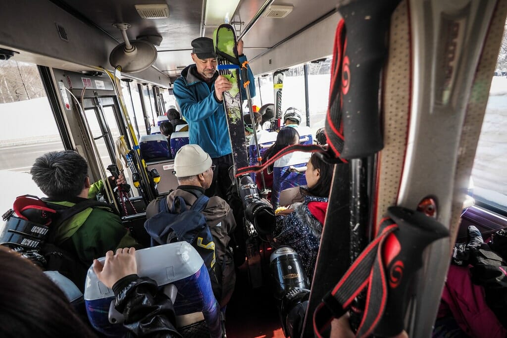
With NicoNico Rental cars, I’ve found that most franchises don’t open until 8am. This means that realistically with a 12-hour rental, we’re not onto the mountain until around 10am, depending on how far we have to travel. Today was no exception; the drive from central Sapporo to Kiroro Ski Resort takes between an hour and an hour and a half. Also, being a weekend, the resort was already very busy by the time we got there; we had to park in a lower parking lot and take the free shuttle bus up to the main building.

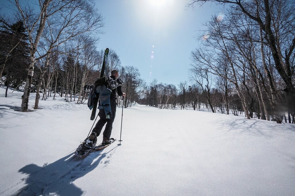
But there’s something secretly satisfying about shunning the lines at the lifts, walking past the throngs of people milling about the lower slopes, and heaving on a heavy backpack with skis and survival gear. Perhaps it is a feeling of freedom. Mixed, I must say, with a hint of ‘holier than thou’. I’m taking the hard route, people!

That feeling usually lasts only a few minutes until the reality of trudging along a deserted snowy road kicks in, the sun gleaming down, trying its best to sweat us off the mountain.

Still, it is nice to be away from the madding crowds. And taking this Akai-kawa route around the south-western perimeter of the ski slopes is perfect for that. I spent a great deal of the first hour or so of climbing wondering where on earth the downhillers were…this would be a perfect spot to get away from it all.

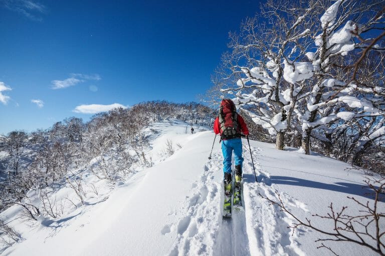
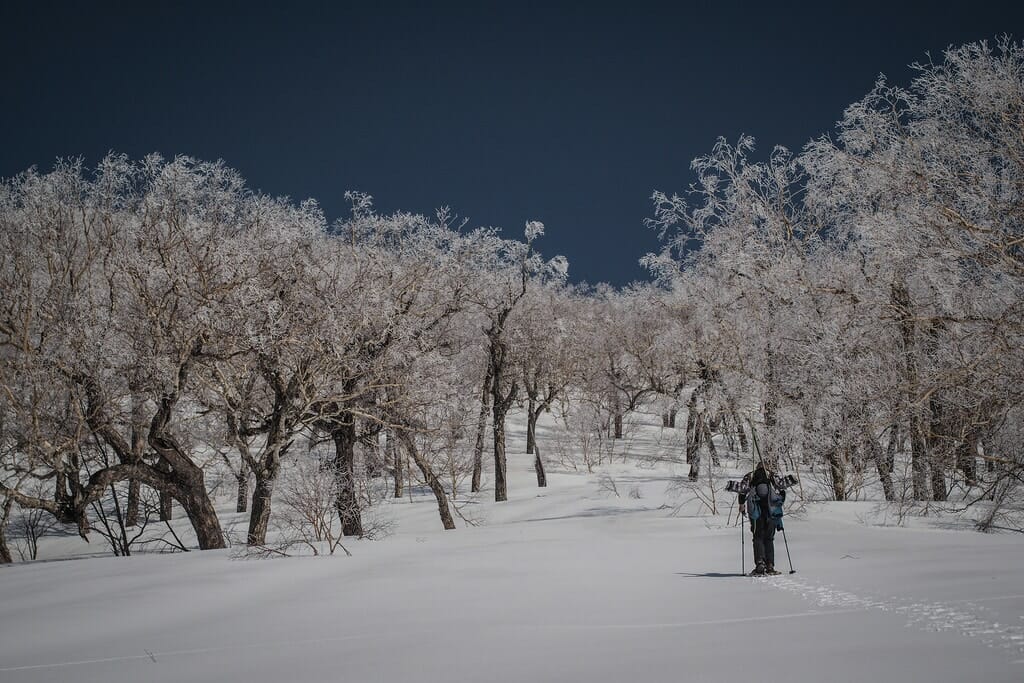
Soon enough we made it to the start of the Mt. Yotei track proper; just above the bottom station of one of the smaller chairlifts. It was here that the real fun – and spectacularly enchanting scenery – began.

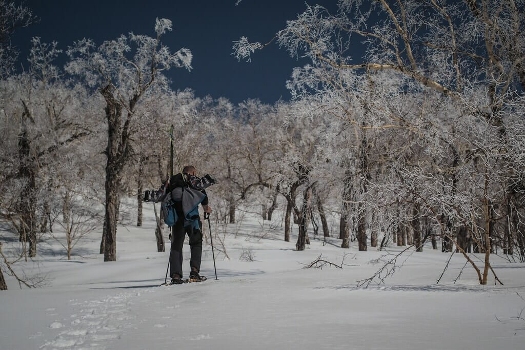
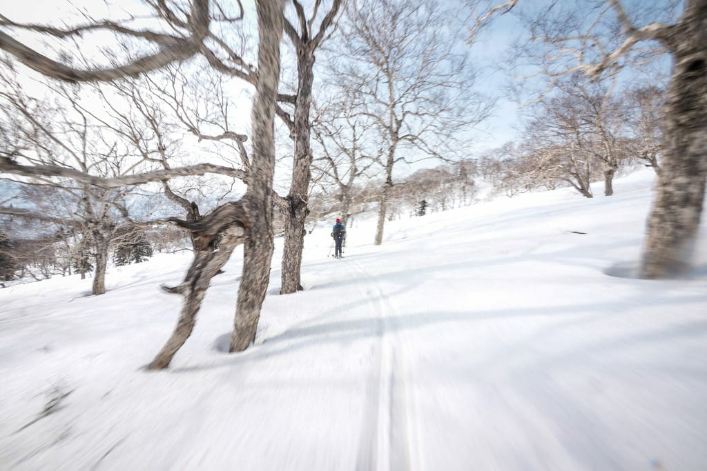
The previous couple of days had seen some very high winds and late season wet snow up on Mt. Yoichi. This had coated the bare tree branches with a thick snowy ice. In the heat of the day the ice was melting fast, but we managed to overtake the melt and found us entering a mysterious world of white forest.

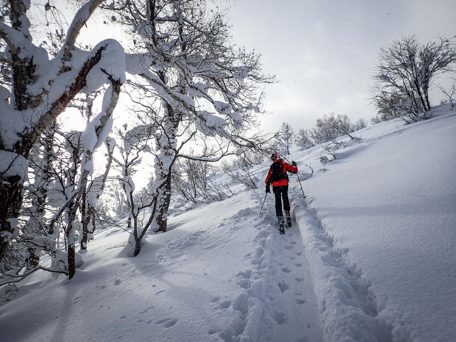
The way was steep in parts. Steep enough to make zig-zagging up the wide ridge/face the more energy efficient option. Curiously, there was a very thin, hard crusty layer of ice over a softer snow; ice dislodged from trees and from snowshoes above would come clattering down the fragile-layered slope.

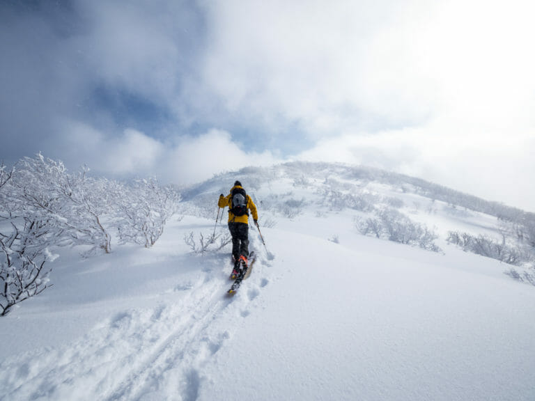
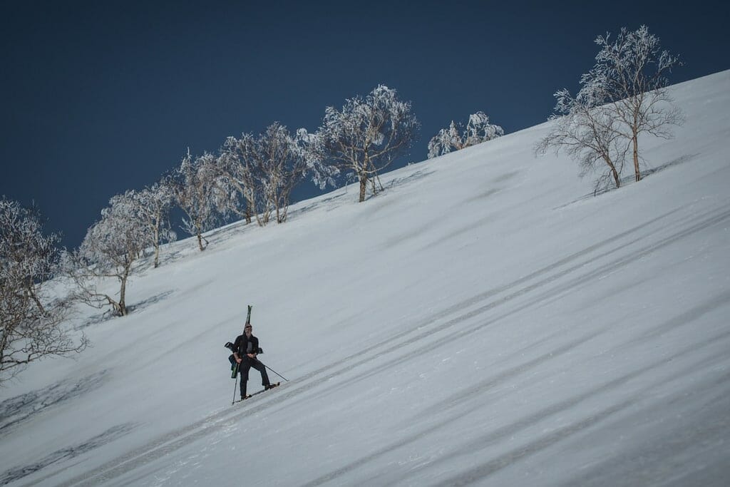
Once on the main ridge connecting Mt. Asari and Mt. Yoichi, we were well above the melting zone. What had been a thin, fragile crusty layer of ice was now a solid, gale-blown mess of mini-sastrugi. We were never in want of crampons, but had the ice been smoother, we would have struggled with only the soft aluminium protrusions on our snowshoes to grip the icy layer.

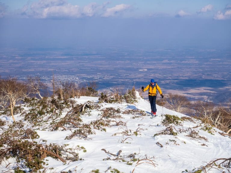
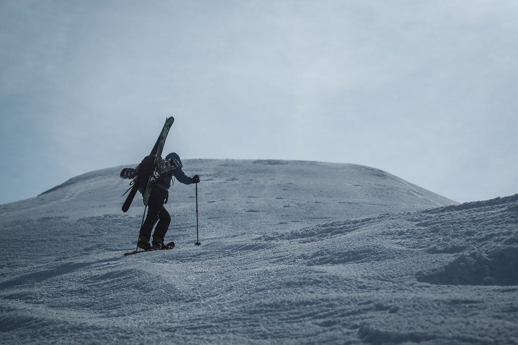
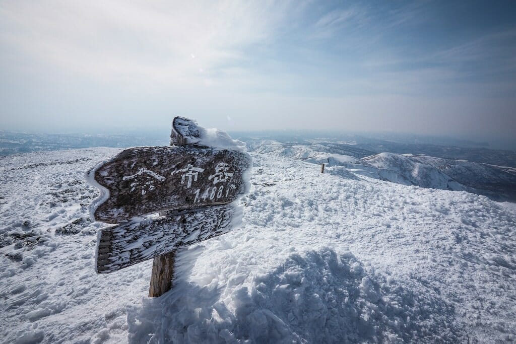
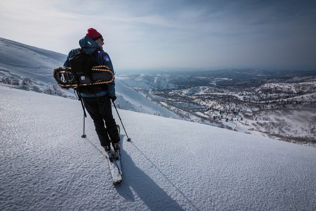
The final ascent up to the mini-plateau like peak of Mt. Yoichi was over sooner than I had expected it. We were greeted with more micro-sastrugi, evidence of the preceding days’ storm. The view from the top was expansive; towards Niseko in the south-west, and the sea to the north. If the air had been less hazy, we would have been able to see further.

Last week’s trip up Mt. Fuppushi was my first ski trip for the season. That made today my second ski trip for the season. My brain and legs were starting to get into chorus with each other on the way down from Mt. Yoichi, but not quite in coordination enough to have the camera out for the ski down.

Dirk, on the other hand, a German wrought from iron direct from the European Alps, was in his element. He hardly hesitated to take the first positive-looking line down the way we had climbed up. I threw caution to the wind and jumped in after him, great chunks of flaky ice chattering down the steep gradient as I braked heavily down the slope. It was pure terror mixed with an inescapable joy of ‘knocking the bastard off” (in the words of Sir Edmund Hillary) and now having the downhill ski slope entirely to ourselves.

The lower reaches were pleasantly wooded with plenty of room between trees to cut a comfortable line between them. Classic Hokkaido back country skiing.

Mt. Yoichi spat us out onto the Kiroro ski area, and we nonchalantly glided up to one of the ski lifts, hoping we’d be able to catch a ride up, in order to avoid a 15 minute climb; doing so would allow us to ski along the groomers back down to the resort buildings. The lift security was having nothing of it, however, and after ascertaining that we were out for a free ride, he sent us on our way.

At the resort buildings we boarded the 4pm shuttle bus down to the car park, packed up, and headed straight to central Otaru, to the Otaru Beer Hall. Being the designated driver of the two of us, I had a few of Otaru Beer’s take on zero alcohol beer. After a long, sometimes very hot, day on the mountain, the sweet, fizzy, and wet substance was a perfect antidote to a parched body, and the perfect end to an awesome day.

Comments | Queries | Reports

Done this route to Yoichi-dake, or others nearby? Thinking of doing it? Please post any feedback, reports, or queries here. Thanks!

4 thoughts on “Yoichi-dake Backcountry Skiing”

  1. I am in Niseko now I am interested finding a guide to climb Mount Yotei and ski down. Does this Wednesday look like a possible day to make the climb and ski. I have climbing experience and a advanced skier. Please replay ASAP so if I can find a guide reserved if the conditions look good for this Wednesday March 21.

    Thanks Sean Gilbert
    I don’t have a Japanese sim card in my iPhone so please email with your contact info.

  2. ive seen this snowshoe skiing nonsense before only in japan.
    blows my mind why japan is so far behind in the ski touring game.

Leave a Reply

Your email address will not be published. Required fields are marked *

This site uses Akismet to reduce spam. Learn how your comment data is processed.

See More Like this

Printable Yoichi-dake Topomap

TOPO DOWNLOAD (PDF, 11.4MB)

Download may take some time

Hokkaido Wilds Foundation

We’ve got affiliate links on HokkaidoWilds.org to help fund the Hokkaido Wilds foundation.

The Foundation gets a small commission on sales from affiliate links, but we only link to stuff we think is worth checking out for people keen on the outdoors in Hokkaido and Japan.

The Hokkaido Wilds Foundation is a fund where 100% of funds are donated to Hokkaido volunteer groups involved in sustainable, safe, and responsible access to the Hokkaido outdoors.

Learn more here

ADVANCED FILTERS

Filter by location

About Filters

REGION: The general mountain/geographical region the route is in.

BEST MONTH(S): Time of year a route is suited to visiting. Some pop all season, some are more limited.

DIFFICULTY: How strenuous a route is, and how technical it is. Full details here.

FREERIDE/SKITOUR: Very subjective, but is a route more-of-a-walk-than-a-ski or the other way around? Some routes are all about the screaming downhill (freeride), some are more about the hunt for a peak or nice forest (ski-tour). Some are in between. 

MAIN ASPECT: Which cardinal direction the primary consequential slope is facing, that you might encounter on the route. More details here.

ROUTE TAGS: An eclectic picking of other categories that routes might belong to.

SEARCH BY LOCATION: You can find routes near your current location – just click on the crosshairs (). You may need to give permission to HokkaidoWilds.org to know your GPS location (don’t worry, we won’t track you). Or, type in a destination, such as Niseko or Sapporo or Asahikawa etc.

Please let us know how we can make it easier to narrow down your search. Contact Rob at rob@hokkaidowilds.org with your suggestions.

Yoichi-dake Backcountry Skiing Difficulty Rating

Category

Grade

Points

Strenuousness

Vertical Gain

A

40

Time ascending

B

6

Technicality

Altitude

A

10

Hazards

B

12

Navigation

B

12

Totals

80/100

GRADES range from A (very difficult) to D (easy). Hazards include exposure to avalanche and fall risk. More details here. Rating rubric adapted from Hokkaido Yukiyama Guidebook 北海道雪山ガイド.