
August 4th, 2012 | categorizilation: all categories,Hokkaido (Japan),Japan,Post-2008,Shiretoko Tour (2012)
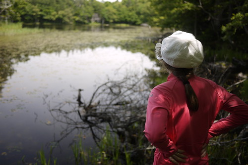
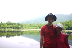
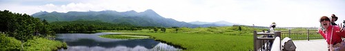
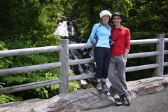
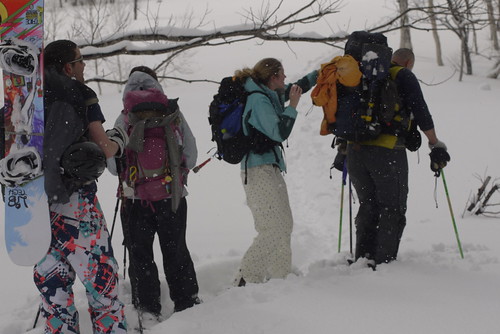
Today was supposed to be a ‘rest’ day. Instead we cycled a 30km round-trip to see the famous Five Lakes, right in the heart of Shiretoko National Park. The climb up to the lakes was truly stunning. Wild flowers, and ancient-looking forest. All with the excitement that you might be attacked and torn to pieces by a bear at any moment.
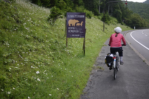
Just to do the 1.5 hour walk, visitors have to take part in a 10 minute lecture on what to do to avoid encounters with grizzly bears, and what to do if you manage to encounter one. The advice taken most to heart, apparently, was to avoid encounters by making noise, such as clapping. For the first five minutes or so of the walk, therefore, you’d hardly know whether you were in a peaceful national forest, or a pentecostal church worship service. Luckily for us, the group quickly dispersed along the track, with us taking up the rear. We were mostly content with Haidee’s dinging bear-bell. This allowed us to enjoy the lakes more or less in peace and quiet.
Route Map
Distance: about 30km | Time on bikes: | Average speed: | Bears: 0
Financials: Food:┬Ā4,623yen | Accommodation:┬Ā800yen | Onsen (hotspring):┬Ā1000yen
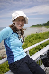
August 3rd, 2012 | categorizilation: all categories,Hokkaido (Japan),Japan,Post-2008,Shiretoko Tour (2012)
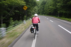
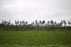
The day began today also on nice quiet farming roads. Fields of potatoes, mainly. With some daikon (large white Japanese radish).
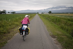
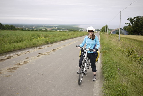
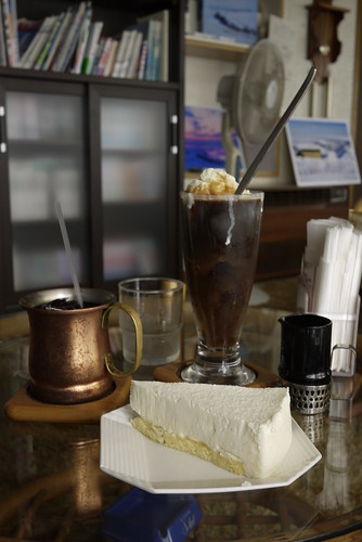
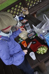
We did manage to avoid the narrow bit of Route 334, but at the cost of some steep hills. Good for the soul. Like chicken soup, only less comforting. And despite the cold start in the morning, it was getting very hot later in the day. Perfect excuse to drop into a cafe (read: smokey old-style Japanese coffee bar) for some iced coffee and cake. The cake is ‘rare cheese cake’.
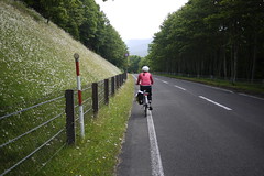
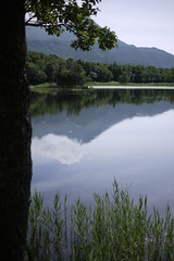
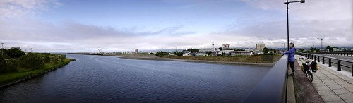
Quite unlike much of the Japanese coastline, the coast of Shiretoko Peninsula seems relatively untouched. Nice sweeping vistas and unrestrained waterfalls. It is worth noting that today was one of the few days on this trip we had blue skies.
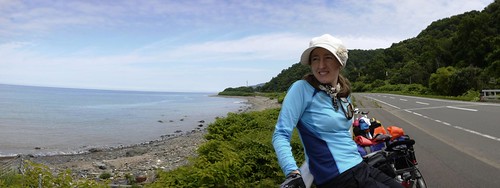
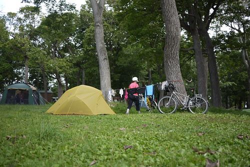
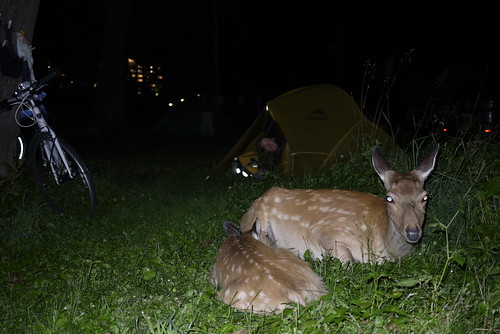
Our campsite for tonight was at the Shiretoko Campground in Utoro. It comes complete with wild deer who wander freely through the campground. We apparently set up our tent right next to where a family of deer bunk down for the night; even so, with all the warnings about storing food away from one’s tent during the night (to avoid encounters with bears), it was quite disconcerting to hear the dear pacing about outside at night.
Route Map
Distance: 40.1km | Time on bikes:┬Ā2h 56m | Average speed: 13.6km/h | Bears: 0
Financials: Food:┬Ā3,723yen | Accommodation:┬Ā800yen | Onsen (hotspring):┬Ā1500yen
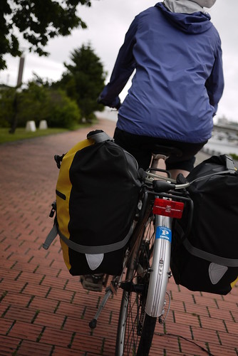
August 2nd, 2012 | categorizilation: all categories,Japan,Post-2008,Shiretoko Tour (2012)
With the rain of yesterday gone, we were now keen to get on the road. The bear hunt began.
Abashiri is a nice enough town. It has that feel of being sort of outpost-ish. Like it is right on the outskirts of Hokkaido. It is a quiet town, but apparently is more popular in winter, where you can see sea-ice floes. Haidee and I made a note to come back in winter.
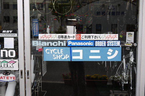
It is probably worth noting also that there is a fairly well stocked cycle store in Abashiri on Route 244 through the city (location here:┬Āgoo.gl/maps/0qUJX). We had to pop in to get an extra headset spacer.
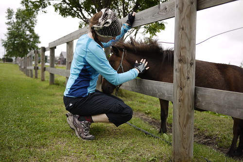
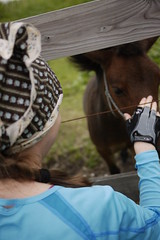
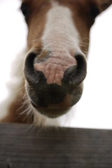
Not far out of Abashiri, along the coast, we stopped in at the White Swan Center on Lake Tofutsu. The distinct lack of white swans (there are more in winter) led us to the friendly miniature horses nearby.
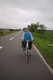
Where ever possible, we tried to get off the main roads, and onto adjacent farming roads. The area is criss-crossed with them, so a good map is really handy; it is amazing how much birdsong gets drowned out by automobile noise.
Our destination for today was the town of Shari. The gateway to Shiretoko National Park. Or so they like to think. In any case, it was a nice enough town. It sort of reminded me of Taupo in New Zealand without the lake. Nice big houses and carefully┬Āmanicured┬Ālawns and gardens.
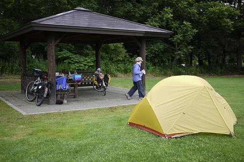
The Shari Campground was fantastic. It too was carefully manicured, with nice facilities. Even better, the caretaker let us stay for free; we were the only campers that night!
Route Map
View Larger Map – http://goo.gl/maps/Zt96h
Distance: 43.5km | Time on bikes: 3h 01m | Average speed: 14.4km/h | Bears: 0
Financials: Food: 5,209yen | Accommodation: 0yen | Onsen (hotspring): 0yen | Laundry: 0yen
August 1st, 2012 | categorizilation: all categories,Hokkaido (Japan),Japan,Post-2008,Shiretoko Tour (2012)
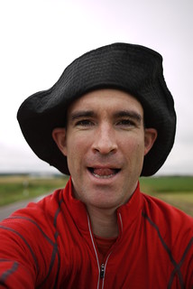
The Shiretoko region in eastern Hokkaido is home to more grizzly bears per square kilometer than anywhere in Japan. It therefore seemed like the sensible thing to go there and cycle around for a couple of weeks, camping along the way. It was summer vacation here, after all.
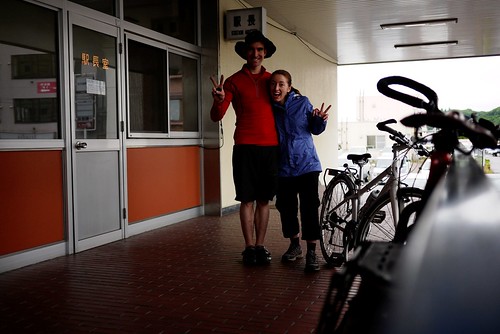
So Haidee and I bundled up our bicycles onto the train in Sapporo, and got on an early train bound for Abashiri. About 400km east of Sapporo, on the northern sea coast. It was about 30 degrees┬ĀCelsius┬Āwhen we left Sapporo. It was about 15 degrees in Abashiri when we arrived 5 hours later at noon. Our expectations of a hot and sweaty two week tour suddenly seemed extremely silly. Haidee was kicking herself for not bringing that extra merino wool longsleeve top.
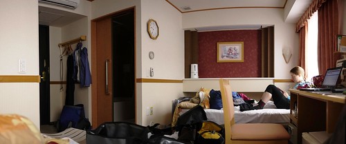
It was also raining. The idea for this trip was to relax. So we checked into a swanky hotel right in front of the train station (for a very┬Āreasonable┬Ā3,500yen each), and spent the first night in comfort.
Route Map (by train)
July 22nd, 2012 | categorizilation: all categories,equipment,Post-2008
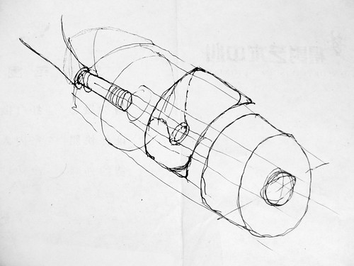
This is an idea that I had while skating across China in 2008 for fenders which would attach to longboard trucks/wheels to stop water and road grime from flicking up onto the board. My concept was that the fenders would be made from plastic, and attach on the inside of the wheel. I did this sketch on the 23rd of August 2008.
To my joy, it looks like someone (Chase Kaczmarek) had a similar idea and has taken it from an idea to a prototype product:┬Āhttp://longboardism.com/2012/07/wheel-shields-avoid-wheel-bites-and-skate-in-the-rain.html.┬ĀBrilliant. He calls them ‘Wheel Shields‘ and it looks as though the main design intention was a device to shield against wheel-bite (the wheels touching the board when in motion and turning, causing the rider to be thrown from the board), with ‘fender’ functionality as an added bonus. The device is patented.
A huge thanks to Longboardism.com for the scoop on this one! Head over to the Longboardism.com post (http://longboardism.com/2012/07/wheel-shields-avoid-wheel-bites-and-skate-in-the-rain.html) and fill out a quick survey regarding the devices, and let Chase know what you think. I have already, and I told him that it is a brilliant idea.


(The two Wheel Shield images above via Longboardism.com)
May 1st, 2012 | categorizilation: all categories,Japan,Post-2008,vids
At the moment, being a Masters student, much of my time is involved in the somewhat dry world of academia (www.robthomo.com). Playing with video editing helps keep me sane and the creative juices flowing. The following is an example of that; a short 1.5 minute ‘study’ using slow motion and some motion design. Footage is from a back country ski trip from a few weeks back. Direct┬Āvideo link┬Āto the video is here: http://www.youtube.com/watch?v=uaCIqAN7tqY&.
April 26th, 2012 | categorizilation: all categories,China,Post-2008,Trip Ideas
I happen to be in Vancouver, Canada, right now. I’m off back home to Japan tomorrow on a flight at the ungodly hour of 6am, but in my short time here I managed to meet none other than Mr.┬ĀAaron Enevoldsen. Aaron is well known as a┬Āprotagonist┬Āin the www.longtreksonskatedeks.com sagas.
In any case, we got chatting about the www.longtreksonskatedecks.com trips (through South America in 2009, and across Morocco in 2010). As we talked, I found that I feel kind of sorry for Aaron. Happy that he got two awesome trips, but sorry that both were on such awful surfaces. Bad surfaces can be good in a bad way, and bad in a good way. Good in that they cleanse the soul by the ravaging fire of mental and physical exhaustion. Bad in that ┬Āthey punish the soul by the ravaging fire of mental and physical exhaustion. But when I told him that China was essentially 5,000km of the smoothest black-top in the world, he looked surprised. And it got me thinking again of the one skate trip which, if the cards were all lining up right, I would jump at the chance to do.
That trip is, to me, the holy grail of distance skateboarding: A Crossing of the Tibetan Plateau (map below).
The route from Lhasa to Xining, via China National Highway 109, is 1,922km, according to Google Maps. Anywhere else in the world, one could expect to cover this distance on a longboard in around 6-8 weeks max. The following points, however, would make things very challenging.
For all the challenges, the smooth roads (some short sections of unpaved road have been reported), amazing views, and the sheer sense of accomplishment, would surely make it worth while.
Here are some recent cyclists’ accounts of the route (both traveled Xining – Lhasa):
April 16th, 2012 | categorizilation: all categories,Japan,Post-2008,vids
Let it be known that Sapporo City, a city of around 1.3 million people in Hokkaido, the northern most island of Japan, must be one of the best cities in the world. Amazing food, chilled out locals, easy to get around by bicycle (very important), and so close to the outdoors it is┬Āridiculous. Haruka-yama (µśźķ”ÖÕ▒▒) is a prime example of what is sitting on Sapporo locals’ doorsteps. Just a half hour drive out of the city to the trail-head, a three to four hour snowshoe hike, and you’re at a one-man-staffed mountain hut in the middle of nowhere.
The foothills around Sapporo. Their danger lies in their┬Āaccessibility. The winds blow straight from Siberia here, so it would be easy for the uninitiated to get thoroughly, dangerously lots in a white-out. Lucky for us we had Leon Roode (aka The Hokkaido Push Pig) to guide us to the hut (although the day we went, it didn’t snow enough for the trail to disappear). From the hut it is a short 40 minute hike to the top of Haruka-yama mountain, followed by a 10 minute ski down to the hut again. Just perfect for a quick weekend overnighter.
Below is a mash-up of footage I took on the overnighter. Perfect conditions, great companions, a very nice weekend away from the grind.
Permanent Link Comments Off
March 11th, 2012 | categorizilation: all categories,Post-2008,vids
From the first ever ‘micro-adventure’ that Alastair Humphreys posted online – a lap around the M25 motorway near London*┬Ā- I knew that he was onto something. Putting a name to something so simple and yet so rewarding*. The Howies-Alastair micro adventure competition*┬Āwas a great way to bring the concept to a broader audience. Here is the fourth winner of the competition. A film by Luke Clark of an overnight adventure on a tandem bicycle from London back to London.
Howies Microadventure: London to Lewes from Luke Clark on Vimeo.
March 9th, 2012 | categorizilation: all categories,Post-2008,vids
Howies* and Alastair Humphreys* did really well to promote the concept of micro-adventure*, when they joined forces* and opened a ‘Micro-Adventure Competition’. One of the winners of the competition was duo Emma and Ariel in Norther Ireland. On bikes, they hoofed it off from home to coast and back again, as an overnight trip, with plenty of adventure thrown in. Fun.
