
August 15th, 2012 | categorizilation: all categories,Hokkaido (Japan),Japan,Post-2008,Shiretoko Tour (2012)
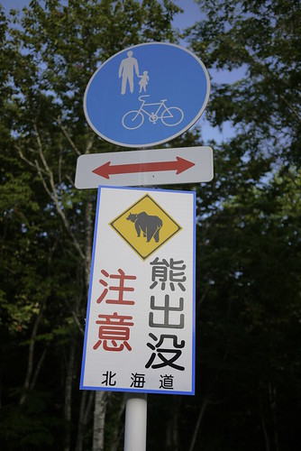
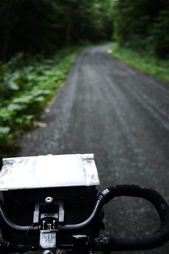
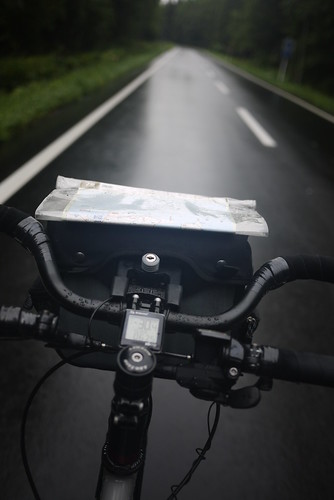
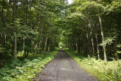
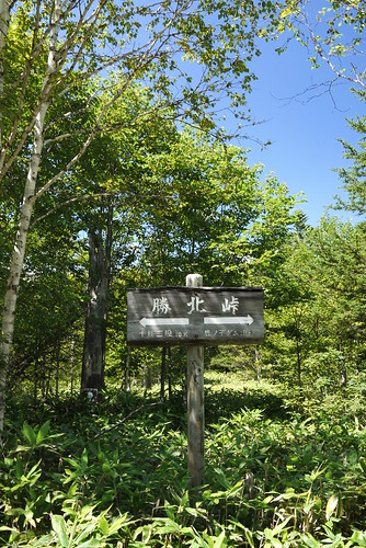
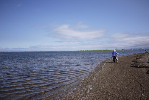
Big day and lots of climbing. That seems to summarise today quite nicely. But in reality, the first 80km or so was mostly downhill, and mostly on a beautiful cycling path following the Ishikari River. Once again I was warned of bears, but saw no sign of them. Except this sign *guffaw*.
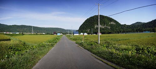
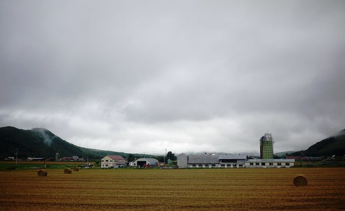
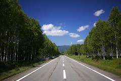
The landscape here is rugged. Mostly unrestrained.
And where it has been tamed by human intervention, the results are not at all unpleasant. It seems that north of Sounkyo, the main agricultural staple is rice.
The Ishikari River cycle path quite conveniently injected me into the guts of Asahikawa City – the second biggest city in Hokkaido. I quickly found my way out of the city, and headed towards Biei. Unfortunately, I had to spend close to an hour with bumper-to-bumper car traffic before I could sneak off into the hills again.
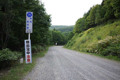
┬ĀThe hills I am talking about are those that Route 452 cuts its way through. Or at least mostly┬Ācuts its way though. Route 452 is about 150km long, but has one section that is not open to traffic. I thought this might mean that a sneaky cyclist might be able to cycle through said closed road. With that in mind, I headed towards the ‘road-closed’ sign on my map.
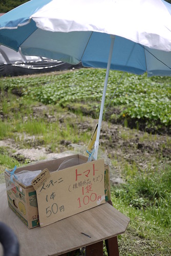
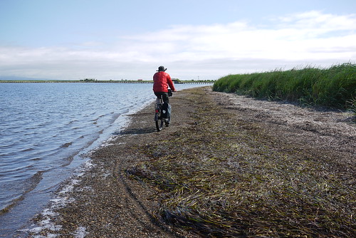
Once off the main drag, I was again in farming-land. Road-side stalls (with honestly-boxes) abounded, with tomatoes, zucchini (courgettes), and potatoes in season. I dropped in on a couple and bought some massive tomatoes, munching on them as I grinded up the uphills.
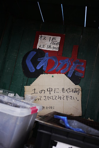
Among the stalls was also this one below. They’re selling┬Ārhinoceros beetles. Big, fat, gorgeous beetles, as big as your thumb.
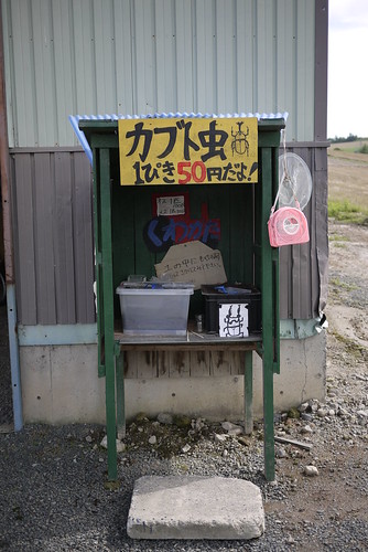
And no, they’re not for eating. They are for playing with and holding and poking and having. The lower sign in the photo below says: The beetles burrow into the dirt. Dig around and look for them.
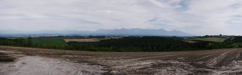
Views at the tops of the small rises in the road were Hokkaido farmland through-and-through.
Soon enough I came to the road-block on Route 452 indicated on my map. I was excited to see pavement beyond the gate, so I carried on through. To my dismay, however, the road ended completely and utterly 2km beyond the gate. There was nothing but forest. Not even a foot-track. At least the 8km or so back the way I came was downhill.
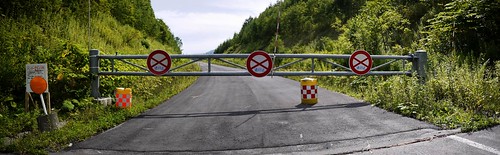
This did, however, open up the excuse to do the gravel section of Route 70, which connects Biei and Ashibetsu. The gate, by the way, is for the winter, when the road is closed due to snow.
The gravel road climbing was fine, except for the horrid horse-flies. Wikipedia tells me that there are lots of different kinds of horse-flies (http://en.wikipedia.org/wiki/Horse-fly), but I think the ones here in Hokkaido (abu – ŃéóŃā¢) are similar to ‘clegs’, in the sense that they ‘fly quietly and bite with little warning’. I have been wearing a 150-weight Icebreaker merino longsleeve top during this trip, and the flies can bite through it. This means that the horrible blighters can fly quietly onto my back as I am slowly inching up a pass, and bite me before I even know they are there. Mercifully, they don’t seem to like colder temperatures, so the higher one gets up a pass, the fewer of them there are.
The gravel on this route was a little looser than previous days, but the extra float of the wide Big Apple tyres helped to no end.
I finally arrived in Ashibetsu at around 5:30pm. I opted for the upclass Ashibetsu Kenmin Center Autocamp, because I wanted to do some laundry. I was expecting to have to pay 1,350yen, but as a cyclist, they charged me off-season daycamper rates (470yen). The only catch was that it was 8km up a hill. At least I would have a downhill to start the day tomorrow…
Route Map
Distance: 159km | Time on bike: 8h 44m | Average speed: 18.2km/h | Bears: 0
Financials: Food:┬Ā3,746yen | Accommodation:┬Ā470yen | Laundry:┬Ā700yen
August 14th, 2012 | categorizilation: all categories,Hokkaido (Japan),Japan,Post-2008,Shiretoko Tour (2012)
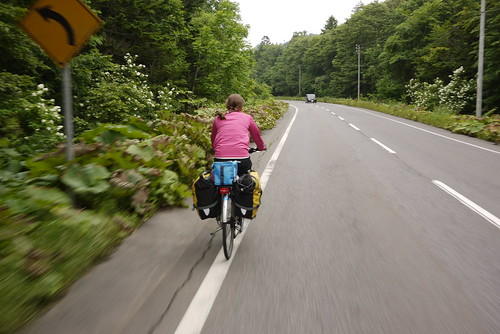
Today I felt like I was in my element. Yesterday, in Kitami, I had bought a motorcyclists’ route map book for Hokkaido, which shows in some detail the various off-road and/or dirt roads routes which criss-cross the island. I’ve always found the unpaved back roads (anywhere I’ve been in the world) to be the most fulfilling (despite the extra struggle). So right off the bat today, I got off the busy, noisy Route 39, and hopped over to the next valley over to the south.
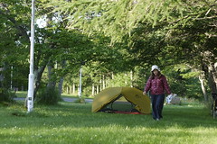
It was a stiff climb for early in the morning (I had left at 5:15am), and it was raining on and off again. I was just hoping the weather would fine up enough eventually to dry out my soggy tent which I had packed up in the rain.
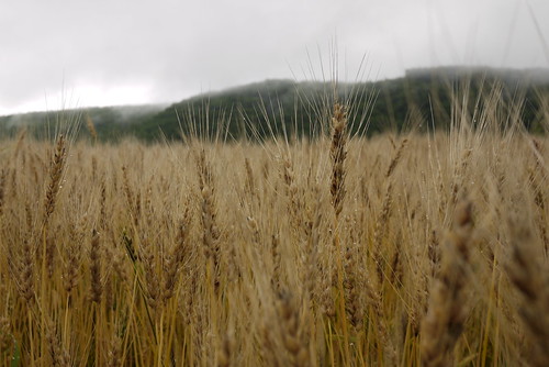
After hurtling down from the top of the Onneyu Pass, I found myself genuinely taken aback at the different world I found myself in. It was literally like I had stepped into an alternate reality. Quiet, sleepy fields of wheat. Grain silos. Mist hanging around the low hills. Just incredible. What a change this was from the bustling chaos of Route 39, just one valley across. It really is┬Āworth taking the road less travelled.
The valley I was now traveling north on, was the Oketo Valley. At the head of the valley, there was the Kanoko Dam, which holds back Lake Oketo.
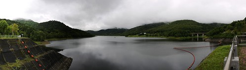
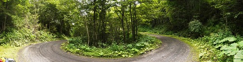
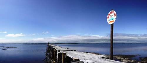
From here I followed Route 1050 to its terminus, right at the end of the lake. Here, the paved road gave way to smooth gravel, and an 11km climb up to Shoboku Pass.
About half way up, a car approached and stopped next to me. The driver mentioned that it was a long way to the top of the pass. He obviously figured it would take me all day to get there, so he handed me a bunch of four bananas. In the end, despite carrying a couple of rice balls in addition to extra snacks, I would arrive at the top with only one banana left, having devoured all the snacks I had with me.
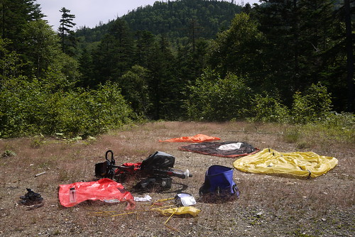
The top of the pass was met with glorious sunshine. I promptly found a clear area to spread out all of my wet gear, and spent 40 minutes basking in the sun.
From here it was only a few hundred meters to the top of the pass (972m).
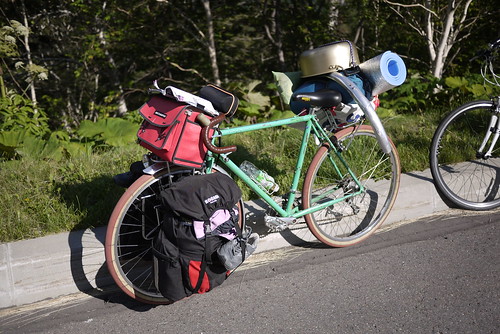
The descent was thrilling. I dropped the pressure in my balloon-like Schwalbe Big Apple 2.35 tyres, and laced to a pair of 47mm wide Kris Holm mountain rims, the 29er wheels made the gravel road feel like buttery asphalt. Loverly.
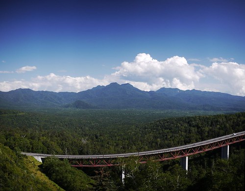
The descent spat me out onto Route 273. I knew that this route would require me to cycle up another big road pass, but I did not know at that point that it was the highest road pass in Hokkaido: the Mikuni Pass (1139m).
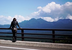
At this point, the weather was just magnificent.
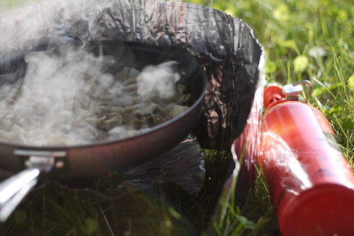
At the top of the pass was a gaggle of university cycle club members. Replete with compulsory communal cooking pot.
They told me that it was all downhill from here, down to a free campsite in Sounkyo, a small village nestled in a tight valley further down. It wasn’t entirely downhill, however, and after a good deal of climbing already today, the small ups and downs on the way to Sounkyo got a little repetitive.
Route Map
Distance: 110.6km | Time on bike: 7h 11m | Average speed: 15.7km/h | Bears: 0
Financials: Food:┬Ā3,746yen | Accommodation:┬Ā0yen
August 13th, 2012 | categorizilation: all categories,Hokkaido (Japan),Japan,Post-2008,Shiretoko Tour (2012)
What is this? The bear hunt continues? Yes, yes it does.
Haidee had pressing work to do in Sapporo, but I decided that the work I had to do could wait, so I would cycle the 350km or so back to Sapporo on my own. So after sending Haidee off on the 6:30am train, I was on the road solo.
Haidee probably had the right idea though; it rained on and off for the entire day. Accordingly, the photo below was the only one I managed to take all day.
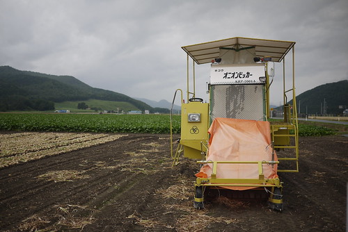
The rather endearing looking contraption is an onion picker. It picks onions. Which are in abundance along the valley between Abashiri and Kitami, and beyond.
The mission for today was to get to the free Onneyu Tsutsuji Campground. I got there just in time for an onsen and to cook dinner, before the skies opened. It rained for most of the night.
Route Map
Distance: 96.3km | Time on bike: 4h 53m | Average speed: 19.7km/h | Bears: 0
Financials: Food:┬Ā2,000yen | Accommodation:┬Ā0yen | Onsen:┬Ā600yen
August 12th, 2012 | categorizilation: all categories,Hokkaido (Japan),Japan,Post-2008,Shiretoko Tour (2012)
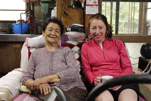
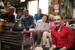
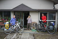
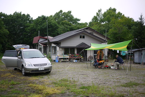
This was our last day on the road together for this bear hunt in the Shiretoko region, home to more bears per square kilometer than anywhere else in Japan. We saw not hide nor tail of one. We saw plenty of warnings of bears. But no actual bears. Not even bear poop. This was our last day to see if we could catch one.
We said our farewells to Okaasan, Leon, Ric and Matt, and got on the road, feeling very grateful for some quality time with friends and the lovely hospitality of okaasan.
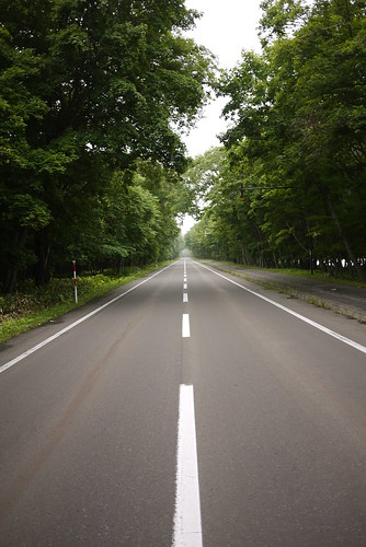
And what a sweet road it was. At 6:00 in the morning, it was free of automobile traffic, and the birds were up and singing.
Apart from one last gasping small pass, most of the day was downhill or flat.
This meant that we managed a solid 80km on our last day. Even if there were bears to be found, we probably wouldn’t have seen them.
So we rolled into Abashiri in the early afternoon, and thus ended our 12 day Bear Hunt in Shiretoko. Not a sign of bears on the roads or in campgrounds.
We checked into our accommodation for the night, and readied to depart by train back to Sapporo the next morning.
Route Map
Distance: 81.6km | Time on bikes: 4h 49m | Average speed: 16.8km/h | Bears: 0
Financials: Food:┬Ā4,821yen | Accommodation:┬Ā6,980yen
August 11th, 2012 | categorizilation: all categories,Hokkaido (Japan),Japan,Post-2008,Shiretoko Tour (2012)
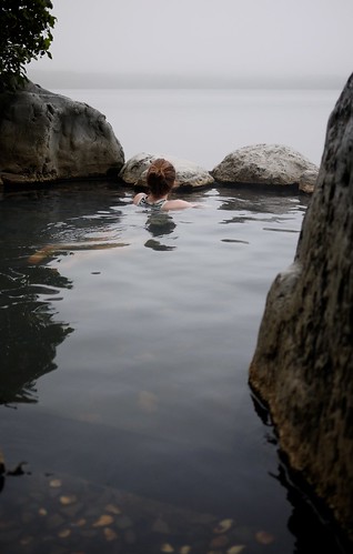
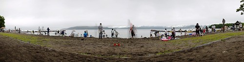
The ┬Āhiking troupe had planned for today to be a rest day, so we decided it was a great chance to take the day off too. The day began with an open-air hot spring down the road from okaasan’s┬Āplace, and only about 1m from the lake’s edge. Originally built as a private onsen by the mayor of Teshikaga, it is now open to the public.
Later in the morning we all bundled into Leon’s car and visited the well-known (evidenced by hordes of tourists) Suna-yu Onsen. Basically this is a 300m stretch of lake-side beach where anyone with a pair of hands (or┬Āpreferably┬Āa shovel) can dig into the sand and make their own hotspring pit.
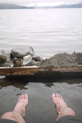
Leon, being un-intimidated by the chilly weather and chillier lake, jumped into the lake for a swim.
The next stop was a nearby sulfur-spewing mountain-side. Complete with un-roped-off steam vents, spewing ultra hot steam out of the ground. What is a man to do with such novelty but to throw his hat onto the hole to see if it will make the hat fly up into the air?
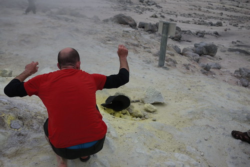
It didn’t work, evaporating my giddy curiosity into pained embarrassment when I almost burned myself retrieving the hat from the scalding hole.
August 9th, 2012 | categorizilation: all categories,Hokkaido (Japan),Japan,Post-2008,Shiretoko Tour (2012)
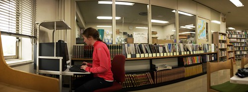
Today it rained. Like cats and dogs it rained. We waited out much of it inside the Teshikaga Public Library, where we both did some work on some distance study we are doing at the moment.
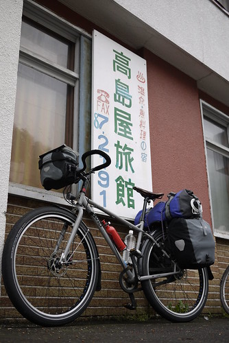
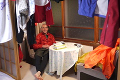
When we left the library, it started raining again. Not that that is all together bad. Cycling in the rain is actually quite a lot of fun, in a strangely sadistic way. It is the camping in the rain (with no guarantee of drying the tent out before leaving the next day) that tends to be tough work, and something I generally try to avoid where ever possible. In this case, we managed to avoid camping in the rain by availing ourselves of the services of a “Rider’s House”. Riders’ houses are small, cheap┬Āaccommodations, at the most charging 1,000yen per person for a night, and are specifically aimed at non-automobile travelers (motorcyclists,┬Ābicyclists,┬Ā walkers etc). Some are even free. Ours was 1000yen, and included a free drive to the local onsen, and cheap meals. We even got our own room to ourselves (usually you’re sharing a room with multiple others).
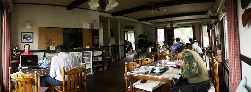
They are a great place to meet interesting characters. One guy was traveling around taking photos. He spent about 45 minutes showing us his photos. They were actually very good.
Route Map
Distance: 44.2km | Time on bikes: 2h 47m | Average speed: 15.8km/h | Bears: 0
Financials: Food:┬Ā6,231yen | Accommodation:┬Ā2,000yen | Onsen: 400yen
August 8th, 2012 | categorizilation: all categories,Hokkaido (Japan),Japan,Post-2008,Shiretoko Tour (2012)
Odaito is well known for its sunrises. This was the best this morning’s one could muster.
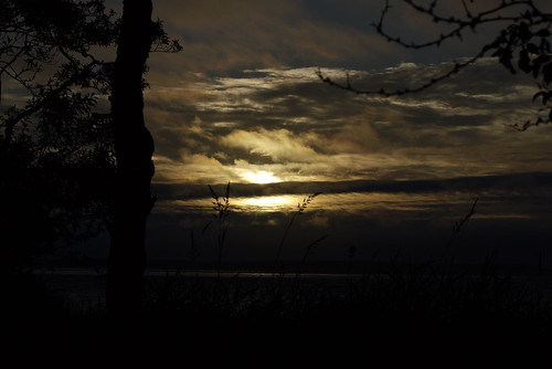
It is worth noting that the sun rises at 4am at this time of the year. Which means that for cycling, we’re on the road by around 5:30am. So that means breakfast at 5am, second breakfast at 9am, lunch at noon, and dinner at 5pm, with bedtime at around 7:30pm.
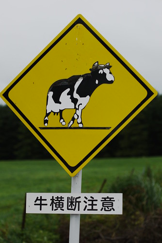
In any case, much of today’s scenery reminded us a lot of the Taranaki region in the North Island of New Zealand. Lots of dairy farms. And, with so much of the year shrouded in winter, this time of year is prime grass-growing time.
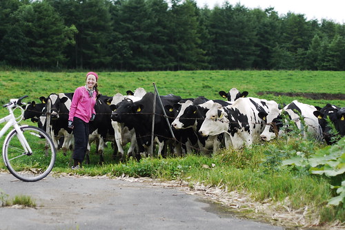
And while we didn’t see any cows on the road, signs warned us to keep an eye out.
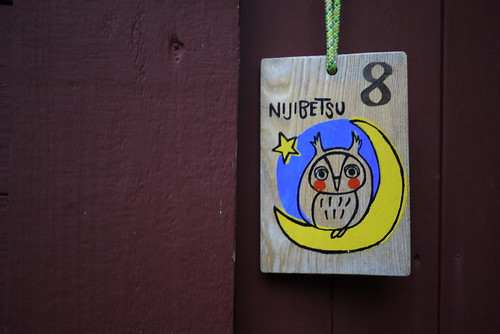
Our campsite for tonight was the very well appointed Nijibetsu Auto Camp. The plan was to camp. But it was raining. So we got a bungalo instead.┬ĀWe felt all very colonial.

Dinner was a little different this time. Vegetarian curry. It was my turn to cook. And to try to look staunch whilst doing so.
Route Map
Distance: 61km | Time on bikes: 4h 00m | Average speed: 15.2km/h | Bears: 0
Financials: Food:┬Ā5,676yen | Accommodation:┬Ā3,150yen | Laundry: 400yen
August 7th, 2012 | categorizilation: all categories,Hokkaido (Japan),Japan,Post-2008,Shiretoko Tour (2012)
Another of our ‘rest’ days. This time we got an early ferry to Notsuke Peninsula, and cycled back around to Odaito.

We were the only passengers on the ferry, so we had our very own personal guide. The ferry ride takes 30 minutes, but that includes a 5 minute stop half way, to have a gander at spotted seals. They were indeed there today. Spots and all.
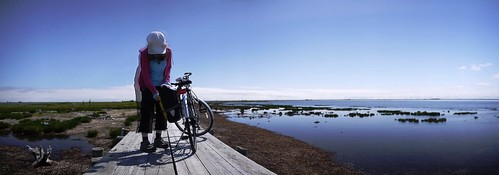
Once at the peninsula (or, rather, gigantic┬Āsand-spit), with my nice fat 60mm tyres, I had a wee cycle along the beach. Haidee, with her skinny 25mm tyres, walked.
The beach only lasted about 500m, after which there was boardwalk. Today’s beautiful blue skies made up somewhat for the rainy and cloudy weather of previous days.
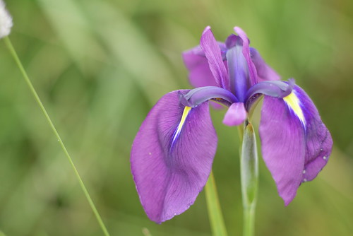
Wild flowers are the name of the game here. In particular, Irises seemed to be in full bloom at this time of year.
Notsuke Peninsula also happens to be a perfect vantage to gaze upon the long-lost Kuril Islands, or at least the southern-most of the islands, Kunashiri Island (Kunashir in Russian). Basically, the islands, which were originally Japanese, but were occupied by Soviet forces at the end of World War II, are presently claimed by Russia. The Japanese government disputes this claim. More on Wikipedia here:┬Āhttp://en.wikipedia.org/wiki/Kuril_Islands_dispute.
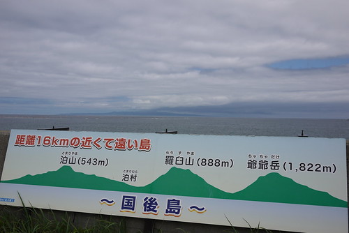
Sentiment in Hokkaido in general and in this area in particular seems quite strong that the islands should be returned to Japan. The text in red in the sign above says “Islands 16km away; so close yet so far”.
The wind was at our backs as we pedaled our way back to our campsite. Dinner was a fairly standard fare of fried onion, garlic, and mushrooms mixed with a tomato pasta sauce to make some nice vegetarian pasta.
The nearby Seaview Hotel has an onsen for 500yen per person, so, like last night, we dropped by later on for a soak.
Route Map
Distance: 35.8km | Time on bikes: 2h 34m | Average speed: 13.9km/h | Bears: 0
Financials: Food:┬Ā3,809yen | Accommodation:┬Ā700yen | Onsen (hotspring):┬Ā1,000yen | Ferry ride: 3,200yen
August 6th, 2012 | categorizilation: all categories,Hokkaido (Japan),Japan,Post-2008,Shiretoko Tour (2012)
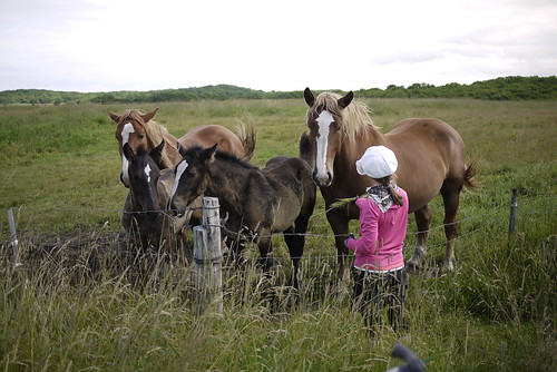
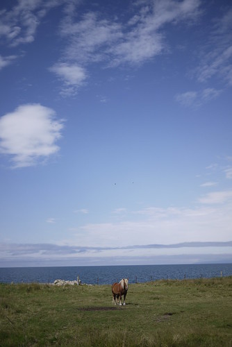
They have some very large horses in this part of Hokkaido. They are shorter than┬ĀClydesdales, but have hooves about the same size.
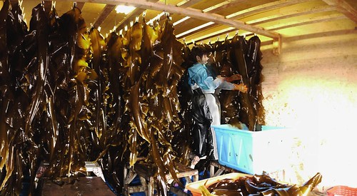
Kelp seems to be a large part of the economy here. Huge sheets of it are harvested by chaps on boats, and then hung to dry in large forced-air drying sheds. The guy below said that the dried kelp is sold all over Japan. Kelp of this thickness is used mostly for soup and sauce stock in Japan. It sort of acts like MSG; brings out the flavor of foods more.
For lunches on this trip, we were mostly eating out. Most meals are below 1,000yen, but for a large bowl of ‘kaisen-don’ (a bowl of rice topped with raw fish) at this nice place, they were charging 1,250yen. You’d easily pay 2,000yen for something equivalent in big-city Sapporo. I would have taken a photo of it, but alas my appetite had other ideas.
Despite an interesting start to the day, much of the cycling approaching our campsite (the Fureai Campsite in Odaito) was quite dull, in my opinion. The campsite made up for it though. Right on the seafront, it was.
Route Map
Distance: 59.8km | Time on bikes: 4h 02m | Average speed: 14.7km/h | Bears: 0
Financials: Food:┬Ā6,039yen | Accommodation:┬Ā700yen | Onsen (hotspring):┬Ā1,000yen | Laundry: 400yen
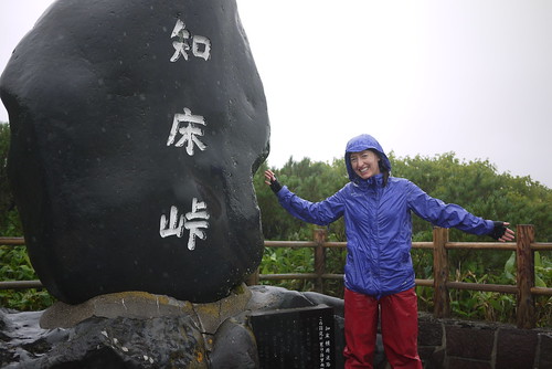
August 5th, 2012 | categorizilation: all categories,Hokkaido (Japan),Japan,Post-2008,Shiretoko Tour (2012)
Today it was raining when we got up.
It was still raining after about a 2 hour climb up Shiretoko Pass (739m, starting at sea level).
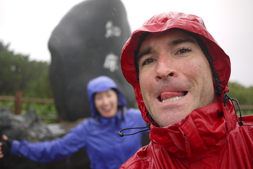
Incredulously, Haidee seemed still in a decent mood.
Although, this may have had something to do with the promise of a dry room when we arrived in Rausu, rather than a soggy campsite (as was the original plan…well, at least, the original plan was for a nice dry campsite opposite a free onsen…but sometimes the weather plays foul).
After a very chilly descent back down to sea level, we ended up at a dingy old ryokan (an old-style Japanese inn) for the night. They did a special deal for us: 7,000yen for the room. The only redeeming feature of the place was the attached natural onsen. Which was dilapidated (like the rest of the ryokan), but hot and good for tired muscles and frazzled nerves.
Route map
Distance: 33.6km | Time on bikes: 2h 59m | Average speed: 11.2km/h | Bears: 0
Financials: Food:┬Ā4,600yen | Accommodation:┬Ā7,000yen | Onsen (hotspring):┬Ā0yen
