Distance sailed today:17 NM
Total distance sailed: 17 NM
Midnight GPS position: N 24.59 W077.10
Wind: E Wind Force 2
Sea state: Calm
The marina at Marsh Harbour consists of lots of poles sticking up out of the water. If you want to moor up, you go along side the poles and tie up. The only problem is that once tied up, it is rather difficult to get the ropes off the high poles. We had our fair share of manouvering and re-manouvering to get out of the marina, however the boat’s bow thruster helped to no end. One push of a button and the bow of the boat would come swinging around in the direction that Steve wanted it. A great piece of engineering.
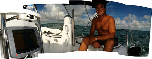
In fact, the whole boat is a marvel of engineering. Technology engineering that is. The main computer display near the helm of the boat shows all sorts of handy goodies. Radar, charts including GPS waypoints and recommended routes, live satelite weather maps, bow video feed…everything you could want. A great navigational aid.
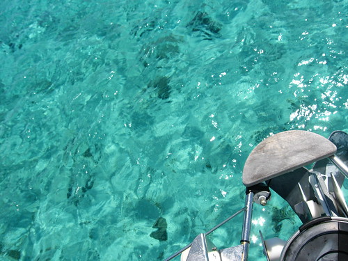
Coming away from Marsh Harbour and Abacos Island, we were in very shallow water. With only 1.5 metres of water below the keel of the boat, it was a bit too exciting. Once clear of the islands however, the depth quickly dropped to over 3,000 metres.
My first impressions of being on the Jeanneau 42DS mono hull sailboat are that it is fast, wobbly, and very luxurious. The beds are super comfy, and you need them to be so; a mono hull rocks back and forth much more than the catamaran. I doubt I will be able to cook anything as fancy as the cooking I did on the catamaran.
How are you going to cope with sleeping on the ground again after such luxurious beds?